
-
 13323 Hits
-
 73.06% Score
-
 3 Votes
|
|
Route |
|---|---|
|
|
52.36600°N / 8.178°W |
|
|
Hiking |
|
|
Spring, Summer, Fall, Winter |
|
|
Half a day |
|
|
Overview
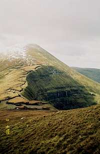
This route is a nice way to bag the summit of Galtymore while seeing most of what the range has to offer. Throughout this walk you'll have views in all directions, weather permitting. The negative of this route is the boggy cols on either side of Galtymore. Bring sturdy waterproof boots!Distance: 13.4 km (8.3 miles)
Elevation gain: 1110 meters (3640 feet)
Getting There
From the main Galtymore page:From Mitchelstown, take R513 north about 6.5 km to a turnoff towards Anglesborough. Go through this town (blink and miss it), following the country road 5 km to the Barna Cross Roads. Turn right here, and proceed about 5.5 km to the Clydagh bridge, where you’ll see signs for the Galtymore climb. Park here. There’s a bit of information on a plaque there, as well as a sign requesting that no dogs be taken on the mountains to avoid disturbing livestock.
Route Description
From the parking area, walk along a rather obvious trail at the forest edge, then head southeast up Knockmoyle, then up a spur and take a steep climb up Cush. Depending on the weather you may begin to need your compass here. Congrats! Half of your elevation gain is behind you.Head SSE to Cush's southern summit, then bear 192 degrees to the Cush/Galtybeg summit. This will be your first real encounter with boggy terrain. Enjoy the views of Borheen Lough. Find and ascend the spur heading SW up to the Galtybeg summit.
From here, bear 260 degrees to the Galtymore/Galtybeg col. Be careful in poor visibility; there are dropoffs of at least 900 feet over the northern cliffs. The col is the worst terrain of the route, and you will probably have to pick your way carefully among the peat hags.
From here, continue to bear 260 degrees to the summit of Galtymore. There is a large metal cross placed here years ago, but is not the true summit.
From the top, bear 257 degrees to the col west of Galtymore. Routefinding becomes much easier here in foul weather as there is a stone wall built just along the route you want. After about 20 minutes, bear NNE to the flat summit of Slievecushnabinnia, then from there bear 22 degrees to an elbow in a faint track. You will encounter a stone cairn along the way, and when you meet the path you'll happen upon a very well preserved Celtic stone circle. Follow this path until a turnoff east, then find your way back to your car.