
-
 8094 Hits
-
 81.84% Score
-
 14 Votes
|
|
Canyon |
|---|---|
|
|
35.44060°N / 24.10409°E |
|
|
Hiking |
|
|
Spring, Summer, Fall, Winter |
|
|
Overview
 Diktanos Gorge Diktanos Gorge |
The island of Crete is probably the place in Europe where you can find most canyons, gorges and ravines. There are places on the Balkans and on other islands (like Sardinia) which might compete for second place but there is no question about the number one. Europe's longest gorges, the Samaria and Aradena can be found here but the karst-like structure of the mountain ranges ensure that almost all valleys are profound with near vertical walls. While most of the gorges are rather wide and can easily be hiked - often mule trails connect mountain villages through the gorges - there are some wild canyons which are filled with huge boulders over which more or less difficult paths lead.
The Diktanos Gorge (Δψκτανο Φαραγη in Greek) is one of these more difficult gorges. It runs from east to west, which in itself already is an exception of the rule. It lies between the villages of Kathori (west) and Stilos (east) and is some 6km long. If you stretch the boundaries a bit you can say that it belongs to the northern outskirts of the Levka Ori Range, Crete's White Mountains. The gorge - apart from being filled with boulders - is also fille which ancient (and giant) maple and sycamore trees, which makes it a perfect place in Crete's summer heat.
Still the gorge is very dry. Like many of the Cretan canyons, the Diktanos Gorge carries water only in its upper part. A little creek, which comes down from the Levka Ori enters the gorge but after several hundred metres it vanishes beneath the ground. The old trees with their deep roots are able to get at this water which ensures a dense canopy above the canyon floor. However, taking pictures of the canyon thus is made very difficult.
Unlike other canyons the boulders in the Diktanos Gorge are not polished so that - while still pretty strenuous - scrambling through the gorge dosn't pose any major difficulties. Orientation can be tricky though in some places there are marks for the path. Especially among the shady trees the marks are missing and you can be sure to not find any in the climbing sections. The Diktanos Gorge is a short scramble of about 2-3h one way.
|


Getting There
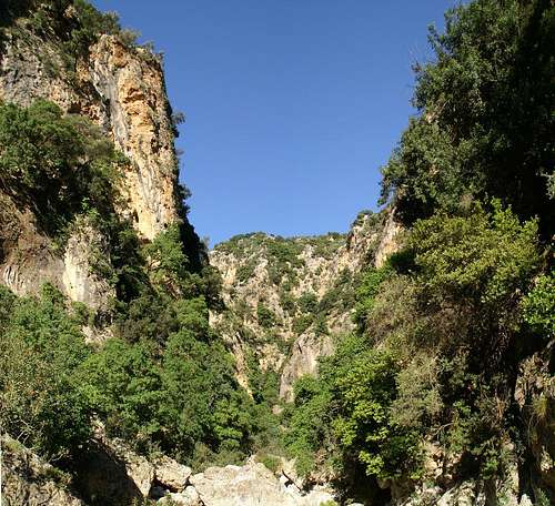
 Sun, Shade and Limestone Rock
Though there are two trailheads at Katohori and at Stilos I will only describe how to get to the latter. We tried getting to (or through) Katohori on our way to Kambi but we were completeley lost among the many narrow mountain roads in the north of the Levka Ori. Reaching Stilos, however, is fairly easy in comparison:
- Take the northern motorway E75 from either Chania (eastwards) or Heraklion (westwards).
- At the exit Kalifes turn off and drive in direction Armeni
- Drive through Armeni and Neo Chorio to Stilos
- Drive through Stilos - shortly after the village there is a bridge over a dry creek. This is the trailhead for the gorge
|


Red Tape
 Diktanos Kid
I'm not aware of any red tape here. In its eastern part there are houses and a small village in the gorge. Also, you can find several fields. Keep close to the dry creek and you won't walk on private property. There are gates and fences at the beginning and end of the gorge. Within the gorge you find flocks of goats so keep the gates closed.
Accommodation
 Boulders Bar the Way
You can quite easily find hotel rooms and apartments everywhere on the coasts. All European travel companies offer accommodation so a visit to your nearest travel office will find you some. The closest reasonable accommodation can be found at Kalives on the north coast but the villages Kaohori and Stilos also have inns.
Weather Conditions
The weather sites on the web only carry information for the cities on the north coast, which should be accurate enough for the Diktanos Gorge which is only about 5km inlands from the Souda Bay. The enarest weather link is from Souda near Chania on the north coast of the island:Maps & Books
There are quite a number of maps and books out there, which deal with the island of Crete and naturally I don’t know them all. This is the list of maps and books which I used and I appreciate it very much if you can add to itMaps
Unfortunately there are no topographic maps of Crete. The best maps I could find are scaled 1:100000 and contain the main hiking routes on the island. In one case the map showed wrong paths and roads (exchanged them) but in general they were quite useful.
- Kreta / Crete / ΚΡΗΤΗ Western Part
Touring Map
1:100000
Harms Verlag
ISBN: 3-927468-16-9
Books
Since there are no good topographical maps of Crete you should take care to get a good guidebook. The ones I used have good tour suggestions though the descriptions often are somewhat shortish. In one case the maps were wrong but since the above map also showed wrong paths (as well as other maps I saw later) I attribute this to a general problem with the cartography of this specific area. Moreover, the books were issued in 2002 and thus paths might have changed meanwhile. The books are available in German and English. The description for the Diktanos Gorge was adaequate, however. The route is described starting from Katohori.
- Kreta West / Crete West
Gert Hirner / Jakob Murböck (translation: Gill Round)
Rother Verlag
ISBN:
3-7633-4221-4 (German)
3-7633-4803-9 (English)