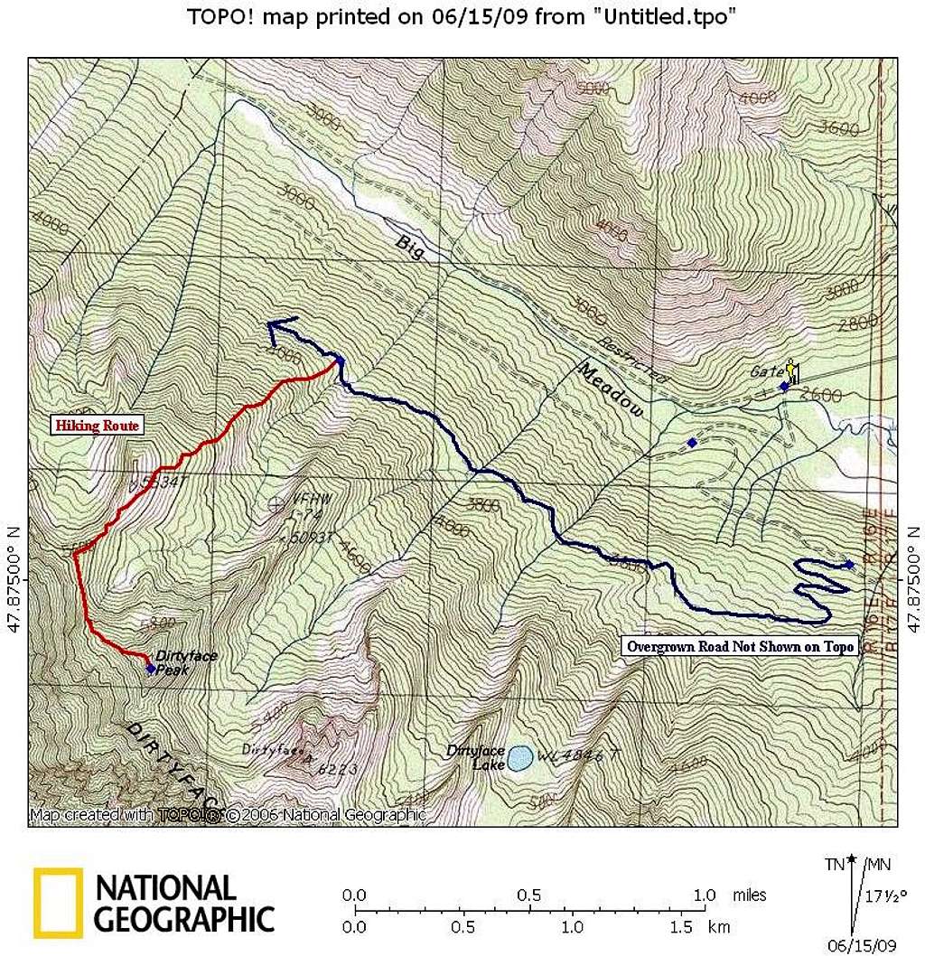
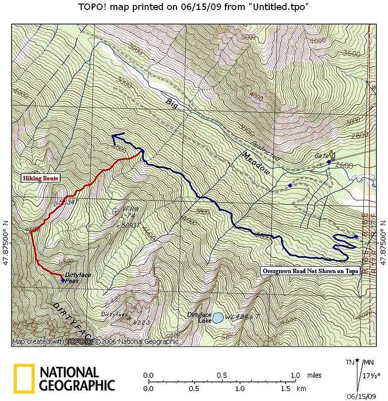
This is a variation on Klenke's NE route on Dirtyface. I believe that our route above 3800' or so is more or less the same as his. But we took a slightly different approach to get there. After reading his comment about crossing a second upper logging road we found this on the aerial photos and decided to use this to approach the peak.
Park in the same place near the gate. Instead of walking the gated road, take a trail that heads off to the left which is an old somewhat overgrown road. You'll quickly cross a bridge and then come upon a faint junction at 2760'. Go left. It looks overgrown but it's not that bad. After a little bit you'll come to a faint junction where the mapped road heads straight ahead [SE] and stays flat. The option you want is slightly uphill and to the right. Continue on and from this point there are no other road junctions or spurs. Simple head up through a series of switchbacks and then you'll do a long flat traverse to get to the preferred ridgeline.
At times the road teases with an appearance of encroaching brush but in every case there is a path of some sort beaten in and it isn't really bushwhacking at any point. I would recommend against a bike because I do think that there are enough impediments that you wouldn't save any time or energy with a bike. My guess is that there is a bit more distance on this route, maybe a 1/2 mile or 3/4 more than Klenke's route but the travel is all on a road and thus a little bit easier.


Comments
Post a Comment