
-
 2252 Hits
-
 75.81% Score
-
 6 Votes
|
|
Route |
|---|---|
|
|
44.05965°N / 114.9833°W |
|
|
Mountaineering |
|
|
Spring, Summer, Fall |
|
|
Most of a day |
|
|
5.0 (YDS) |
|
|
Moderate |
|
|
Overview
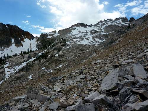
 This is a good reason to start from Saddle Back Lakes. | 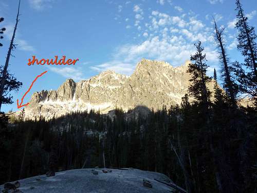 This shoulder at the base of the SE ridge curls around to the SW slopes of the peak, avoiding even simple technical climbing until very near the summit. | 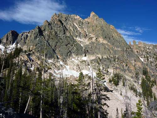 Looking up at Chipmunk, Goat, and Eagle Perches. Hard to tell which is which, but follow this route and you'll eventually find at the highest point with a great view. |
With a cool name like "Dizzy Magellan", this sounds like a technical route, but it is really just a circuitous way to do a scramble climb of the Goat Perch from Saddle Back Lakes rather than from Chockstone Basin, which unlike the Saddlebacks of the Shangri La Basin, has no trail and is far more stark. The route is 3rd class up to a shoulder which leads onto the SW slopes of the mountain, also 3rd class and feeding into 4th class. There is some easy but exposed climbing near the summit which is either challenging 4th class or easy 5th. It is quite likely you will either have to do at least a few 5th class "bouldering" moves or else be content to slap at the summit. This approach could lead to any number of technical climbing variations along the SE ridge of the mountain.
I am unfamiliar with Sawtooth Guide Books and this route probably has more sensible and less romantic names if mentioned in any of them, but since I found no cairns or signs of man, and only a few goat hoof prints in a full day of travel, and since I am taking the time to write up a page for it, and for all I know invented this route, the name is "Dizzy Magellan" here. Magellan, remember from school, was the first captain to pilot a ship around the world (that we know of- its probable the Chinese did it too and maybe earlier). By the end of this route, you will know why I picked that little name. This adventure will take most of a day, offers options to explore the Chockstone Basin from above, visit several unnamed lakes, complete any of several loops, and provides a great non-technical route to those who wish for further hiking from the Saddle Back Lakes (and if you can and will go up that climber's trail, why wouldn't you want to do more hiking and exploring?).
There is a scramble to the top of the Elephant Perch, but it could hardly be called a tremendous thrill to go up and then down it. Goat Perch is a much larger mountain and offers a finer view, and this route is quite fun with a mix of terrains and plenty of open air, so for those not honing their 5th class skills, it is the choice destination from Saddle Back Lakes. Another perk of this route is that by "sneaking" around to the back of a seemingly technical and fierce-looking mountain that towers and dwarfs the whole valley, you will earn a lot of "cliff cred" with the tent city upon your return. I pointed to the Goat Perch summit when asked if I'd done anything by a group who had done the Elephant Perch, and all of them were impressed with me, and eager with questions. So I am posting the basics here.
Getting There
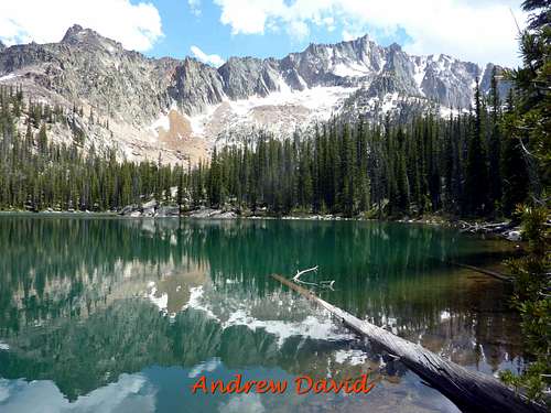
Hike 5 miles around Redfish Lake, or take the shuttle from Redfish Lodge. Look below in external links for information on that shuttle, including up-to-date pricing and schedule. The boat may at one time have been unreliable, but that is no longer the case in my experience, and the ride is fast, fun, and fairly priced. The hiking option goes through a pine-beetle marred forest that has lost some beauty, but is not exactly grotesque to walk.From the head of Redfish Lake, follow the trail until the first view of Redfish Creek on your left (the South). Look for log bridges and hope they are there. Carefully cross and follow obvious climber's trails, some marked with cairns, others merely well-trod, keeping in mind if confused that the trail stays near Elephant's Perch and excellent established campsites are very close to that wall. This climber's trail is steep, hot, and hard, but short and direct, and certainly better than bushwhacking up a valley without a trail. Total distance from head of Redfish Lake to camping areas near the Elephant's Perch will be 3.5 or so miles. There are 3 Saddle Back Lakes and any of these works for a base camp. The third is rarely visited and would offer most privacy, but also requires an extra few miles with gear.
Route Description
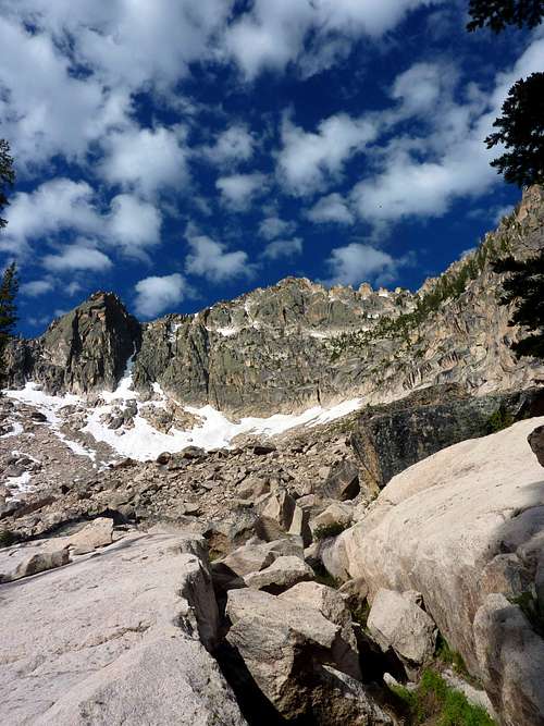
Head East from the second of the Saddle Back Lakes, picking your way up rock mounds and toward the talus field East of the Eagle and Goat Perches. Spot a shoulder (see photo) on the SE ridge and work your way up to it. There will be small water crossings, and little hidden tarns and ponds you may come across, as well as possible flowers. The view behind keeps getting grander, so take time to turn around. Water will not be available once you reach the shoulder (until most of the elevation is descended), so keep that in mind. Early season (before mid June) this talus field might be a snowfield.At the shoulder, a view of Decker Peak to the South and a little West opens up. Head almost due West and keep on the shoulder which runs for nearly a mile with virtually no elevation change. The route is reminiscent of Glacier National Park climbing as you are likely on a goat highway for the next hour, with cliffs and rock on your right hand and air and steep slopes on your left. Goats are much more likely to greet you than fellow humans anyway (unless this page sparks a lot more interest up there than I anticipate). Immediately coulours and gullies will tempt you with potential breaks and ways onto the ridge above. Keep patient and trust the shoulder. It will curl around to the West of the mountain. Do not start going up unless 5th class climbing is your goal. I tried a handful of options and all fizzled out for a soloist or those not equipped with protective gear. This burned up both hours, and my legs. The third opening (from the Eastern start of the shoulder) is passable up to an excellent shaded spot beneath a cave formed by "balanced" rocks, with flawless views of Mount Heyburn and the Elephant's Perch. I recommend that as a diversion which will take 30 minutes round-trip, unless you break to eat.
 Looking up the talus field from where I filtered my last water of the ascent. | 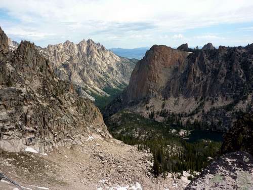 View back to Saddle Back Lakes from near start of the shoulder section. | 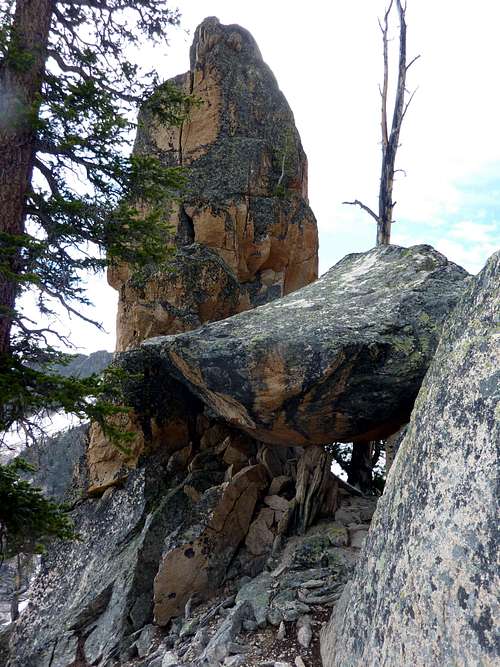 Good spot for lunch. |
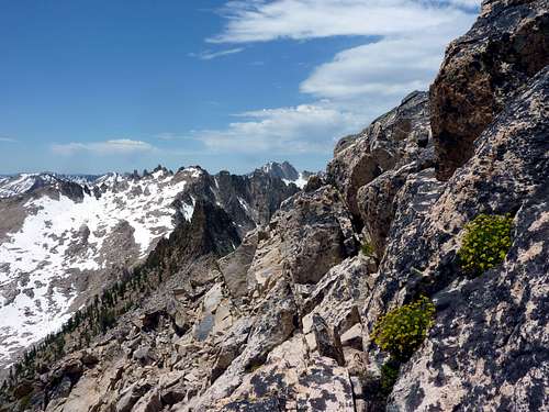
 Ascending to the ridge at a convenient place. | 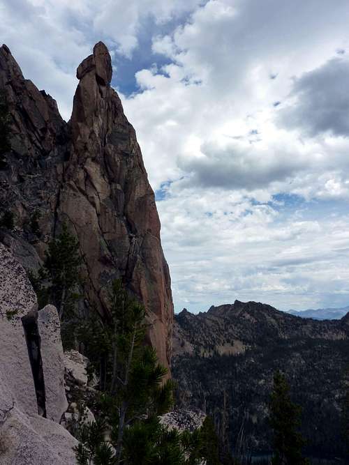 Gendarme viewed from shoulder. | 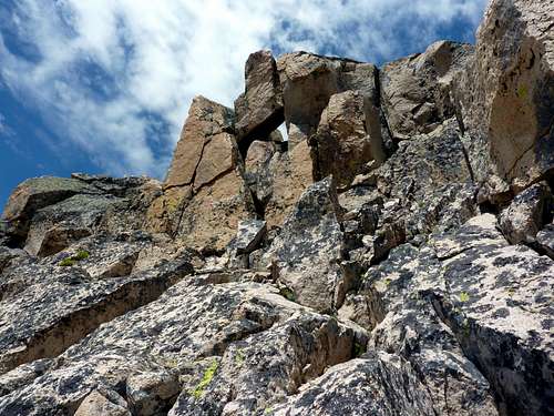 About typical of the toughest terrain you will see. 4th or 5th Class? |
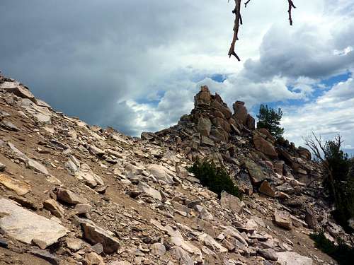
How far to take the shoulder is a matter of choice and comfort. As you work your way onto the "back" of the perches, you will find the cliffs give way to talus and boulders, solidly balanced and pleasant Class 3. My suggestion is to wait until Decker Peak's summit is directly South of you, and then to find a line up that you like once West of the summit, and once you are certain you are looking at the actual summit! The view from the summit is an inspiring 360 degree panorama taking in Monte Verita, Elk Peak, Braxon Peak, Heyburn Mountain, Grand Mogul, Elephant Perch, Decker Peak, and many more.
Descent can be done the same way, or if you have time and energy, work your way down to some lakes below and to the West, or take a new path through the basin directly North of Decker Peak which follows melt flow to the third of the Saddle Back Lakes, which is green, still, and lonely. This is the descent I took to make a loop and did require some route-finding. There are tarns and unmarked ponds, and at times, the ground can be swampy as you enter the forest, so watch your step. Faint trails do lead between all of the Saddleback Lakes, but the one for the third and southernmost of the lakes is overgrown and blocked by a handful of fallen trees.
There is only one tricky spot coming down from Goat Perch directly south. A section of terrible sandy scree begins to give way if you pick the wrong way, and below that, some difficult cliffs block progress. Look for an obvious notch that allows for a gentle walk through or move West when in doubt or if you cannot find this. Below that fine shoulder that brought you in, there are hundreds of feet worth of elevation that you do not want to tangle with. I hope the pictures will help. It is difficult to describe a route that follows all unnamed features. I had a hard time just determining which peak I had climbed, as it was not named on my map. If nothing else, you know the route is here, and if bushwhacking or the unknown are not your thing, just go back along the shoulder as it is hard to miss, especially after having walked it for an hour!
I hope the above is not completely incoherent and this page is valuable to somebody out there. It really is a fine route, and part of the fun is getting a bit lost and seeing what you find while being so.
 Near summit. | 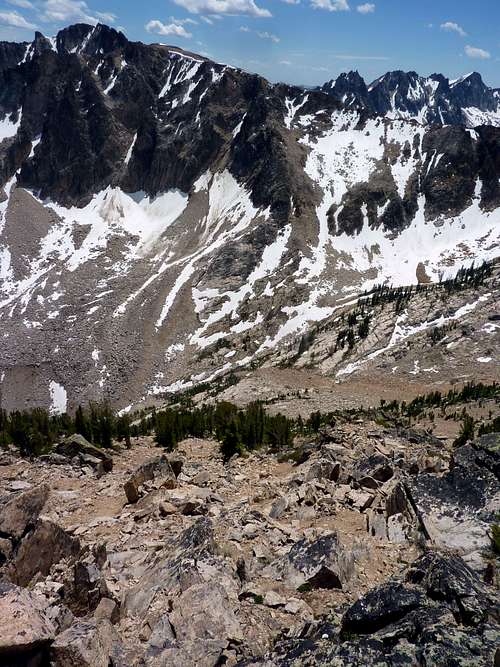 Looking south towards Decker Peak, some alternative descents rather than retracing the whole route as taken to the summit. | 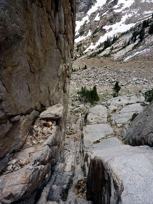 Notch descent through the cliffs. |
 SW slopes of the Perches, below the elevation of the shoulder and nearing water. | 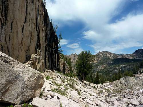 Alternative descent to the third Saddle Back Lake with "burned" cliffs on the left. | 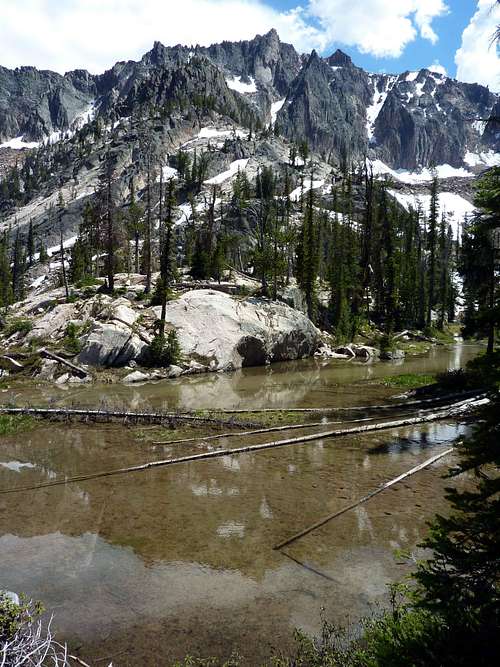 Decker Peak near an unnamed pond where the ground will get swampy as you leave talus behind. |
Look for easy gaps through the rock mounds once in the pine forests again that lead directly to the most southern of the Saddleback Lakes.
The reward of a good day is this view from the very green and lonely third Saddle Back Lake. After hours without a trail, you should find one from this spot back to the area of camp.
Summit Views
I have a video that is more impressive and inspiring to go up this peak, but I need to refresh my HTML skills before I can attach it here.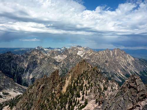 Looking North. Braxon and Heyburn impressive near center and right, respectively. | 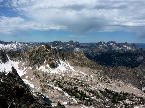 View Northeast. Monte Verita group is on the right. | 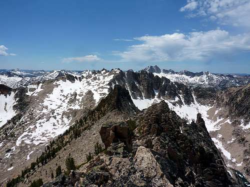 View West. |
Essential Gear
No technical gear is required. I carried an alpine axe because I always do. On this route, it might come in handy should you run into any goats who get aggressive (or other animals). Water is available on the approach from the East up to a few hundred vertical feet of the shoulder, depending on season, and snow is likely up to the summit which can be melted or used to moisten the mouth and throat. There is an obvious stream South of the mountain on one possible descent line, as well as at least one lake not much out of your way. Bring a lunch, plenty of sun screen, and your camera. Approach or hiking shoes will work but high boots that cover the ankle will be best on scree sections to protect against rolls and sprains.I took the Earthwork Press map of the whole Sawtooths, and it is of limited help for this particular trip. I suggest the USGS Quads if you want any precise idea of where you are at any time.