
-
 17885 Hits
-
 89.01% Score
-
 28 Votes
|
|
Mountain/Rock |
|---|---|
|
|
35.61070°N / 83.59935°W |
|
|
Hiking |
|
|
Spring, Summer, Fall, Winter |
|
|
4801 ft / 1463 m |
|
|
Overview
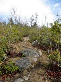
This is a peak in the Great Smoky Mountains of no particular note. The views from the top are obstructed by trees, as is true of many views in the Smokies. However, there are some very nice views from the trails that get you there. Here as in much of life, the journey is more important than the destination. View from near summit--a jumbled mess
The Dripping Spring summit is a simple bushwhack from the Miry Ridge Trail, so it’s an easy peak to bag if you are in the neighborhood. You can reach it as a side trip from the Appalachian Trail, a day loop out of the Tremont or Elkmont trailheads, or make it an overnight with the nearby campsite.
Campsite 26 is about a half-mile from the summit of Dripping Spring Mountain. There’s a dripping spring there, which may or may not be associated with the mountain.
Getting There
 Jakes Gap
For the Tremont and Elkmont trailheads, you want to enter the Smokies from either Gatlinburg or Townsend, on the road between them.
From this road -- which is officially the Little River Road, though I've never seen a sign to that effect -- take the appropriate side road to the south (left from Gatlinburg, right from Townsend).
I won't provide directions to the AT, take your pick of approaches.
 View of Davis Ridge from Trail
The Tremont and Elkmont approaches meet at Jakes Gap (4055 feet elevation). From Elkmont (about 2600 feet elevation), take the Jakes Creek Trail 3.3 miles to Jakes Gap. From Tremont (about 1250 feet), it’s about 4 miles from the gate, half of which follows the closed section of the Tremont road. At Jakes Gap, take the Miry Ridge Trail toward the AT. (From the AT, take the Miry Ridge Trail toward Jakes Gap; the trail is about halfway between the Derrick Knob and Silers Bald shelters.)
From the AT direction, the trail climbs for about a half mile before leveling out. Go a hundred yards or so and find a likely spot to bushwhack up the slope. It’s 50-100 yards through rhododendron forests to the top, a relatively flat, bush-covered summit. It’s probably a B2 bushwhack on vancouverislander’s bush scale but that scale does not take into account ducking under overhanging rhododendrons.
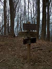
 Manway to Summit
From the Elkmont/Tremont direction, start to pay attention to your map after going around a hairpin curve. You'll parallel the summit ridge for more than a half mile, and sometimes be able to see over the ridge at low points. There's a tunnel of laurel trees and then a tunnel of rhododendrons. After this, keep an eye on the left for a manway to the left (see Bob Smith's trip report). If you start to descend to Campsite 26, you've gone too far.
The total distance is a little less than 5 miles from Elkmont, less than 6 miles from Tremont, less than 4 miles from the AT, all one-way.
Red Tape
 Daffodils in Spring
Dripping Springs Mountain is located in Great Smoky Mountain National Park (GSMNP). By statute, GSMNP cannot levy fees. As a result, there are no entrance stations, and you have to pick up a map at a business or welcome station outside the park.
The "no fee" rule also applies to camping, but you do need a permit. There are backcountry permit offices, including self-registration offices, all over the park. The nearest one to Dripping Springs Mountain is at the Sugarlands visitor center.
Camping
Backcountry Campsite 26 next to the mountain requires a permit (see above) but does not fill up. There are two bear cables and enough room for 8-10 camping parties. That sounds awful, but in fact we didn't see anyone the whole trip (in March).In the front country, the nearest campground is Elkmont, about half a mile from the trailhead on the same road.
Links
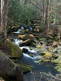 Jakes Creek
The Great Smoky Mountains National Park website has general information and some maps.
Trails Illustrated has a map showing the entire park at a very large scale. It's sufficient for Dripping Stream Mountain but doesn't have the detail you'd want for other purposes.
Relevant Forums on SP
Climbing in GSMNP.
Day hikes in GSMNP.
Good Smokies Loop?
CheesySciFi - Jul 15, 2010 2:54 pm - Voted 10/10
Update on Jakes Creek TrailA few days ago, the rangers told me that the Jakes Creek Trail is not accessible because of road construction. I'm not sure how long this will last.
Arthur Digbee - Jul 15, 2010 5:02 pm - Hasn't voted
Re: Update on Jakes Creek TrailRight, the upper parking lot is being redone. When I was there again in April, the plan would keep the Elkmont Campground open, however -- adding a mile or so of hiking to the TH, if I understand the project right. Anyway, if anyone out there in Internet land reads this page, call the park for construction info in summer 2010.