The latitude and longitude are for where the photo was taken, July 11, 2009 (2009.07.11).
I was very surprised to see that there were so few photos tagged with the name of this basin on SP, because there were fantastic sunsets both nights that members of our party stayed there in early July.
Perhaps the mosquitoes drove away the other would be photographers. I was able to kill five with a single blow, and my companion refused to leave the tent.
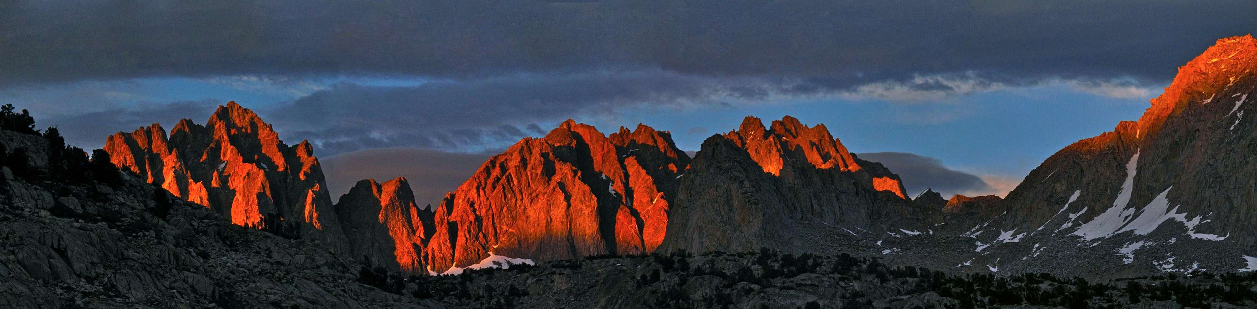
Or, perhaps, everyone is focused on the mountains the ring Dusy. In this photo are Mount Winchell and Thunderbolt Peak. I think that Isosceles Peak is in shadow in the foreground and Columbine Peak is on the far right, but the labels in Google Maps are misplaced, so I'm not sure.
Mount Agassiz is just off the frame to the left.


Comments
Post a Comment