
|
|
Route |
|---|---|
|
|
39.66800°N / 105.858°W |
|
|
Hiking, Mountaineering, Scrambling |
|
|
Spring, Summer, Fall, Winter |
|
|
Less than two hours |
|
|
class 2 |
|
|
II |
|
|
Getting There
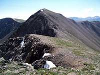
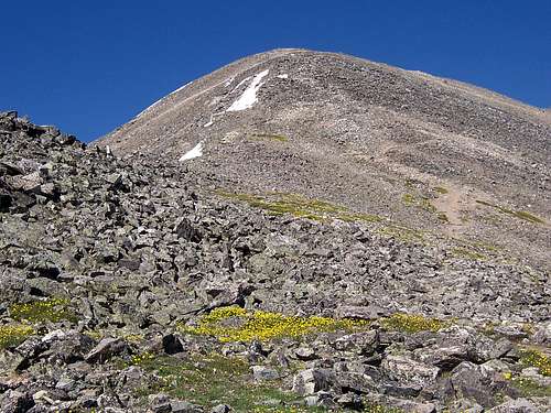 Looking up towards Gray's Peak from its' East Ridge.
The East Ridge on Gray's Peak can be accessed from two different directions with a creative third option.
To actually access Gray's Peak proper, the first approach would be to park at the Waldorf Mine or further up at the Santiago Mine. Ascend the easy class-1 eastern slopes of Mt. Edwards (A centennial 13er) then drop down onto the eastern connecting ridge as it undulates up towards Gray's Peak.
To access this first approach, Leave the small mountain town of Georgetown located directly off of I-70. From Georgetown, head up into the narrow canyon directly south on Guanella Pass Road. This is also Road #381. After a short 2.6 miles of driving, leave Road #381 at the Waldorf Mine Junction (located on the right side). There is enough room here to park passanger cars. The road past this junction as it winds into Leavenworth Gulch becomes rough and narrow and IS NOT recommended for low-clearence cars. Trucks and 4-wd vehicles can navigate the remaining 6.2 miles to the Waldorf Mine (11,580ft.) or an additional .4 miles to the Santiago Mine (11,823ft.). From this vantage, the concave eastern slopes of Edwards will be quite apparent. Once on Edwards' summit, Gray's Peak eastern ridge is immediately in front of you.
STEVEN'S GULCH
This is without doubt, the most frequented trailhead for Gray's Peak and among the busiest on any Colorado 14er. From the Bakersville exit on I-70 (exit #221), it is a short but rough 3.4 miles to the parking area. Passanger cars can drive this road with careful manuerving and experience. This trailhead is large and parking is ample. The trail, as it starts out is very well maintained and on busy weekends becomes a veritable highway. Gray's Peak eastern ridge dominates the view south into Stevens Gulch. The catch from utilizing this particular trailhead, is that to ascend Gray's Peak without benefit of using the standard class-1 walk up, a centrally located, rubble-strewn gully must be scrambled to attain the eastern ridge. From here however, it becomes a much more interesting class-2 traverse west to Gray's Peak or east to Mt. Edwards. By staying directly on the ridge crest, an occasional class-3 move is required on delightfully solid rock. Quite unlike the rock that's found on "The Remarkables" on McClellan Mountian.
CREATIVE OPTION
If one is off-roading up into Horseshoe Basin, Peru Creek can be followed up onto the ridge closer to the Mt. Edwards side of this traverse. Due to the high elevation here, this would actually be a convienent location to ascend Gray's Peak and Mt. Edwards with a possible side trip to Ruby Mountian located just southeast of Gray's Peak.
The Traverse/Route
From the summit of Mt. Edwards (13,850ft.), continue to head west on the narrowing summit ridge until it starts to drop away and looses elevation quickly on class-2 rock. From the summit of Mt. Edwards to the first saddle, 13,617ft. (39º 38.187 N, -105º 47. 877 W), you will lose about 233ft. Continue traversing west staying on the ridge crest when ever you can as this tends to be the easiest path albeit more actual scrambling.
There are three highpoints/false summits/rises, whatever you want to call them, along this traverse. By the time the second one is reached, they start to become a pain.
From the first saddle, start to gain elevation quickly again as you ascend the first of these three highpoints. The summit of the first rise is about 13,731ft. Keeping to the ridge crest, scramble down the class-2 and mixed class-3 rock until the second saddle is reached at 13,602ft. The exposure off to the north side is negliable and the south side is nothing more than grassy and scree slopes.
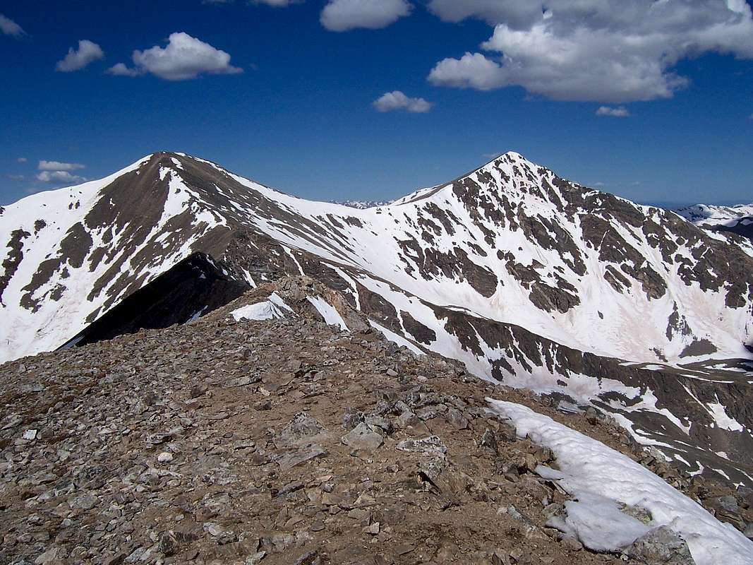
 Looking east at the second saddle.
Continue to follow the gentle slopes of this second saddle west towards the second false summit which is probably the hardest of the three, although that isn't saying much. It will top out at 13,747ft. As you descend off this rise, a small obstacle that I call the "Gray Steps" (39º 38.127 N, -105º 48.209 W) will beg for a short scramble down.
A few meters past this point, towards Gray's Peak is a convienent scree gully. This particular gully, among the many that come off this ridge to the north would make for the safest escape exit in case inclement weather moves in. There are no "surprises" or cliff bands to ford, only a mild scree slope to re-attain the head of Stevens Gulch. This would also make for a convienent ascent route to attain the eastern ridge, thus a nice alternative to the heavily traveled standard route on Gray's.
From here on-out, the remaining traverse stays at class-2 and class-1 (primitive hiker's trail). At this point, whether one stays to the ridge crest or just to the south doesn't really matter. The exposure completely dissapears. The remaining third highpoint (13,680ft.) is probably the easiest and mellowest, just simple hiking to the top with no scrambling. The other side or the third saddle you'll descend to before the final push for Gray's Peak bottoms out at 13,451ft. (39º 38.114 N, -105º 48.469 W).
From here, simply hike up the remaining 838ft. to the summit of Gray's Peak! This traverse from the summit of Mt. Edwards to the summit of Gray's Peak is roughly a mile and a quarter long.
Essential gear
The only essential gear I can realistically think of is a sturdy pair of shoes/boots. A pair or trekking poles would probably come in handy as well. Other than that, just your common faire.Situatated as the ridge is, observing weather coming in from the west is easy.