
|
|
Mountain/Rock |
|---|---|
|
|
40.92892°N / 115.84438°W |
|
|
Elko |
|
|
7475 ft / 2278 m |
|
|
Overview


East Twin Benchmark has an elevation of 7,475 feet and prominence of 605 feet, and is located seven miles northwest of Elko in northeastern Nevada. This summit lies in the Adobe Range, a minor mountain range of typical sagebrush steppe vegetation, trending in a general north-south direction. Most of the Adobes are a checkerboard of public (Bureau of Land Management) and private ownership, with the actual summit of East Twin being situated on BLM land. This pattern is attributed to the Pacific Railway Act of 1862, where the federal government gave railroad companies free land in alternating sections as an incentive and a means to finance the overwhelming task of linking east with west by rail.
There are a couple of radio towers and maintenance buildings near the summit, where an access road terminates. The summit offers some very good views of the Elko area and beyond. Visible from the top are countless mountain ranges, near and far, in every direction. The Adobe Range is home to one of the largest wintering antelope herds in the state, so there is a very good possibility of seeing antelope here if you come before the vegetation dries in the summer heat and the antelope migrate north. This area is also habitat for mule deer and other species of wildlife.

 Summit view to NW. Summit view to NW. |
 Summit view to NE. Summit view to NE. |
 Summit view to E. Summit view to E. |
Here are some photos of wildlife encountered in the Adobes:
 Common sagebrush lizard. Common sagebrush lizard. |
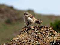 Dancing bird. Dancing bird. |
 Mule deer. Mule deer. |
 Chukar. Chukar. |
 Western fence lizard. Western fence lizard. |
 Greater short-horned lizard. Greater short-horned lizard. |
Getting There
There are multiple accesses to East Twin, the easiest being an access road from the west off of Mountain City Highway (NV-225) that leads to the summit. The access discussed on this page is the one that I used, from the south.From Idaho Street in the small city of Elko (along Interstate 80 in northeastern Nevada), proceed northwest on Fifth Street for about six miles (about two miles after making the turn onto Fifth Street, it turns from pavement to gravel as it leaves Elko and continues into the Adobe Range). Turn left onto the gravel road marked with a large rock with a white arrow and “Snobowl” painted on it and proceed northwest for about two miles, where the road will terminate at the Elko Snobowl. Please note that the Snobowl turnoff (40.89191, -115.82948) does not appear on the topo map, though the road is indeed there. You can reach the Snobowl in a 2WD passenger car. At this point, I took the 4WD road up the slope north of the ski lift to the top of the ridge, where it intersected another dirt road that runs along the ridge. I decided to park here and begin the hike, but you could drive north along the ridge toward Point 7,472 to shorten the route even further.

Route
You can begin the hike to East Twin at the Snobowl or you can opt to take the 4WD road that tops out on the ridge about 0.4 miles north of the ski lift. The route is very simple and obvious: up the south ridge of Point 7,472 (“West Twin”), then down the north side and up to East Twin, whose summit lies just a half mile to the northeast of West Twin.This is a Class 1/2 route that takes you over sagebrush and grasslands. There is a rock formation on the south slope of West Twin that you can easily navigate either side of, just a matter of preference.
As I mentioned earlier, there is a maintenance road that leads to East Twin, and West Twin as well. You can integrate the road as part of your route up the slope to East Twin, however, I felt it was better to take the direct route off the road.
This route has a round-trip distance 3.6 miles with a net elevation gain of 705 feet. The gross elevation gain on the ascent is 1,002 feet; gross elevation gain on the descent is 297 feet; total gross elevation gain is 1,299 feet.

 Route view 1. Route view 1. |
 Route view 2. Route view 2. |
 Route view 3. Route view 3. |