The Planning Begins...
Gimpilator Adam and I both had Thursday, July 2, off from work, so we tried organizing a hiking trip together. Adam's initial objective was Mount Aix, but considering I had plans for a major hiking trip on Friday and he had plans for a major hiking trip on Saturday we decided to take things a little easier on ourselves for hiking on Thursday. After several ideas were discussed, Mount Ellinor in the Olympic Mountains was mentioned. Adam had been wanting to summit that mountain for several years, and its short ascent distance was enticing to both of us. Then, the night before we went, Adam mentioned an additional possibility of traversing the ridgeline connecting Mount Ellinor to Mount Washington if conditions were in our favor. I said it was worth looking into, and our plans were set.
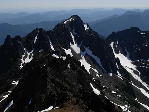
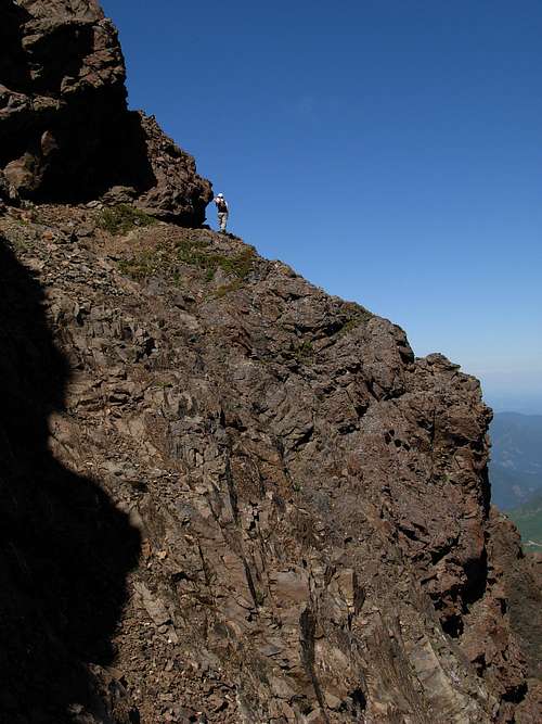
![Mount Ellinor From Mount Washington]() Mount Ellinor
Mount EllinorThe Primary Goal: Mount Ellinor
![Mountain Goats On Mount Ellinor]() Mountain Goats
Mountain Goats
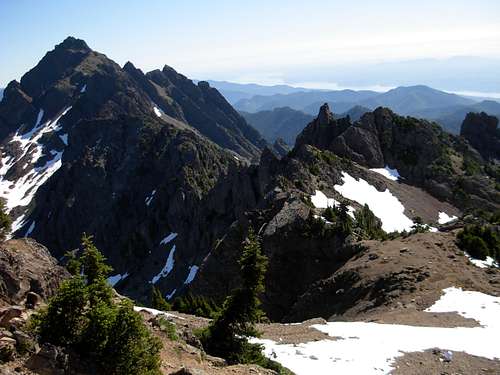
I met Adam shortly after 5:00 AM on Thursday morning. We drove south around Puget Sound to Hoodsport, and then to the upper trailhead of Mount Ellinor. We had a slight delay in the town of Potlatch, where police officers delayed and detoured vehicles around where it appeared a fireworks stand and nearby house both burned down. At the upper trailhead, one truck was already there and one car arrived shortly behind us. We began our hike at 8:20 AM, with a beautiful sky above and warm temperatures (mid-70s) already occurring. Approximately halfway up the route we encountered a small herd of mountain goats: one adult, two "teenagers", and one baby. After stopping for a few minutes to take multiple photos, we continued our journey. As we approached the final summit slope, we looked north at a snowbank where at least seven mountain goats were resting. Further north, on a rocky slope along the ridgeline, four more mountain goats could be seen. We arrived at the summit at 9:50 AM, only 90 minutes after we began, which include multiple stops for photos. By virtue of Mount Ellinor being a goal of his for a while, Adam had the honor of being first on the highest summit block. After several photos of him, it was my turn. For some odd reason, I felt compelled to do the Ralph Macchio "crane" pose on the summit. A couple of men reached the summit while we enjoyed the views, and we found out some valuable information regarding climbs of Mount Washington. Essentially, one man said it was easy to get off-route and the other man said his mistake was continuing to the right on the upper half of the trail when he later discovered he should have continued to the left. Looking over at Mount Washington and the ridgeline connecting the peak to Mount Ellinor, the traverse currently looked too dangerous to attempt but we realized we still had plenty of time to at least check out the "standard" southern route of Mount Washington.
![Posing On Mount Ellinor Summit]() "Crane" Pose At Mount Ellinor Summit
"Crane" Pose At Mount Ellinor SummitFinding A New Goal: Mount Washington
![Mount Washington]() Mount Washington, As Seen From Mount Ellinor
Mount Washington, As Seen From Mount Ellinor
We found the rugged trailhead for the southern route of Mount Washington and prepared for our climb. I decided to go "minimalist" style by only taking the day-pack portion (containing water bottles, food, several other small items) of my hiking backpack, a helmet, and an ice axe. Adam took his small Camelbak pack, a helmet, an ice axe, and one trekking pole. Just as we were about to begin the trek, one of the men we met at the Mount Ellinor summit drove up and talked with us. According to him, the route he took began much further down the forest road. However, we showed him our limited information and it suggested the starting point we were at. We initially thought he was going to join us, but he apparently had other plans and had to go. Adam and I began our trek at 12:15 PM.
![Ravine]() Climbing Ravine Towards Snowmelt Stream
Climbing Ravine Towards Snowmelt Stream
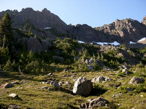
The route ascends an astounding 3200' elevation gain in only two miles. The reports we read about the route said to allow 4-6 hours just to reach the summit, so we just wanted to maintain a pace to fall within that timeframe. We intended to take plenty of breaks, and we certainly would. Although the trail initially looked good, Adam and I both expected a bushwhack with steep terrain. To our surprise, the route was fairly easy to follow in the lower forests. However, the terrain was STEEP. Unfortunately, as steep as that was, the lower portion is not near as steep as the upper portions of the route. When we left the forest we entered a steep slope containing loose scree, which led to a tight gully containing a tiny snowmelt stream. Taking a break at that location, with the sun's heat blazing down on us, Adam removed his shirt and dunked it into the stream. He said the ice-cold dampness made him feel a lot cooler and better, so I followed suit. I nearly shrieked when I put my shirt back on, as it felt like my body was being submerged into a barrel of ice water. However, after about 30 seconds, my body adjusted and felt much better. We also each grabbed some snow and filled our hats with it to keep cool; it also helped keep us from getting thirsty. We noticed a very steep trail along the right side of the stream (as the left side of the stream was a tall rock wall). Following that "trail", it led us to the snowbank where the stream originated. We then had to ascend a steep embankment that led atop the rock wall to our left side. Shortly thereafter, we entered a fairly level meadow basin.
![Mount Washington]() Upper Meadow Basin
Upper Meadow Basin
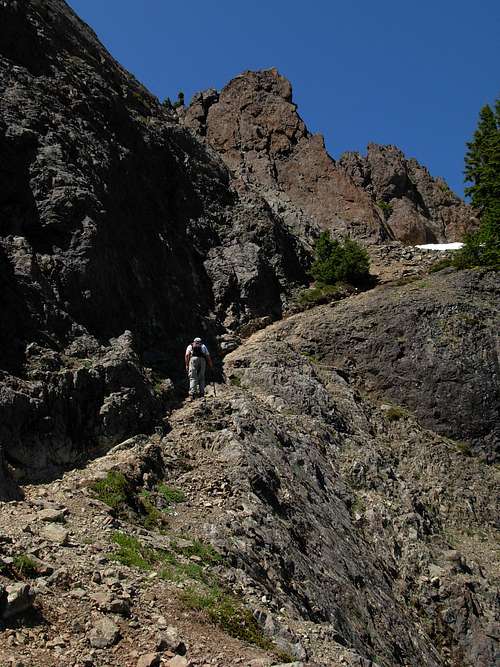
As the basin, there were three apparent "trails" present: one to the left, one in the middle, and one to the right. Analyzing the terrain, the middle route appeared to be the correct route, but remembering the conversation with the man who had advised to "stay to the left" Adam briefly checked the left path. Although it appeared it might lead in the general direction we wanted to go (i.e. "up"), the left path also appeared to disappear shortly after it began. Hence, we decided on the middle route. We steeply ascended the well-trodden path up to a large snowbank. Adam lost sight of the trail, but I could see an obvious opening ahead of us on the other side of the snowbank. It was the trail, and we continued. There were two very large boulder-cliffs ahead of us, and we speculated the trail might circle around the backside of them while climbing up a large rocky gully. Fortunately, we were correct with that assessment. Unfortunately, we then had to climb up a steep ledge using tree roots and what few natural handholds/ footholds we could find. The path then seemed to disappear, but Adam looked through some gnarly mangled trees and retraced the path on the other side.
![Mount Washington]() Gimpilator Ascending Along Steep Rocky Gully
Gimpilator Ascending Along Steep Rocky Gully
After that point, we began ascending a steep rocky path along a cliff located on the upper left side of the large gully. We found a snowbank to refill our hats with snow, and continued our journey. When we finally reached the ridgeline connecting Mount Washington to Mount Ellinor, seeing the Mount Washington summit block looming high above us, we finally started to feel very confident that our summit attempt might be successful. However, after all we had gone through just to get to that point, we figured the mountain would not let us reach our goal very easily. The path traversed around the east side of the summit block. At one point, we noticed a branch-path heading steeply up loose soil and rock as an apparent direct route to the summit block. However, it also appeared to be too dangerous, so we continued on the main path. At multiple places along the path, there was only enough room for one person's feet... if even that much... at a time. One small slip would likely be fatal. The path then suddenly ended at the large blocks on the upper ridgeline just north of the summit. I heard a large "kaboom" noise as if a boulder near the summit fell down, and Adam speculated it might be a mountain goat leaving upon hearing our approach. We climbed onto the rocky blocks and walked south along the ridgeline, and then finally climbed up to the summit. We reached the summit at 3:30 PM, until 3h15m from the trailhead!!! We were ecstatic at what we thought was great hiking time, especially considering with all the breaks we took and because we were told to allow 4-6 hours for the ascent. Mount Washington is not a climb for the faint-at-heart, and hikers/climbers must be very comfortable with all levels of YDS Class III scrambling even on the easiest routes. Mount Washington was definitely a high risk, high reward peak for both Adam and I.
![Mount Washington]() Gimpilator Ascending One Of Final Slopes
Gimpilator Ascending One Of Final Slopes
There was metal summit register container. We signed the summit register and I noticed a small bottle of Merlot wine in the container. Adam gave me an Armenian pastry, which I ate as I took a small sip from the wine bottle. I then placed the wine bottle back (still containing some wine in it) for others to enjoy in the future. After spending nearly 45 minutes at the summit, resting, eating, and enjoying the views, we began our descent at 4:15 PM. We anticipated the descent would take longer than our ascent, because of the steep and loose terrain for much of the route, but we were still on-pace to arrive back at the car before sunset. We took our time climbing back down to the Ellinor-Washington ridgeline, as it was the most dangerous section, but then regained our hiking pace as we descended southeast down the mountain. At one point, Adam ventured ahead just so he could take a video of me descending a steep rocky section of the path. This made me nervous that I might do something dumb on film, and I did not disappoint. As he filmed me, one of the rock I stepped on loosened and went tumbling down the path ahead of me, then down the steep rocky slope to my left, and then into the gully below. A large splash came up from the gully, then I could see the rock bouncing out and down the gully, making large "boom" noises echoing during its descent. Adam loved the footage, as it demonstrated just how steep and rugged the terrain really was. When we reached the steep rock wall/ small stream area located below the meadow basin, we noticed a trail heading down the top of the rock wall (rather than down into the stream area that we had originally ascended). We followed this route down and it rejoined our original route, although it was fairly hidden from the main route for any ascending hikers (i.e. like us) not knowing where to look for it.
![Redwic on the North Ridge]() Crossing North Ridgetop Towards Summit
Crossing North Ridgetop Towards Summit
When we reached the thick forested terrain again, we took a break on a log. As we sat, a man came hiking up the trail. We briefly talked with him, but although we figured he could possibly reach the summit by sunset he would almost certainly be descending the dangerous terrain of the route during nightfall unless he planned to bivy in one of the upper areas of the mountain. When we told him that we had summited Mount Ellinor, then returned to the upper trailhead before heading up from the trailhead for Mount Washington, rather than taking the ridgeline traverse between the two peaks, he said called us "maniacs" as a compliment to the acheivement. He also added that the traverse would have been too difficult without snow covering its ridgetop. We continued our descent, and eventually reached the car at 7:05 PM, only 2h50m from the summit. We were ecstatic with our hiking time, especially considering we had also climbed Mount Ellinor earlier that day and had a total of 5700' elevation gain for the day. After taking a break to load our gear and change our clothes, we headed out. We stopped at a small restaurant in Hoodsport and had dinner, then a small gasoline station south of Potlatch, and then headed home. We arrived back to Snohomish County at 11:00 PM.
![Mount Washington Summit]() Atop Summit Of Mount Washington
Atop Summit Of Mount WashingtonEpilogue
Overall, this was a great day. Individually, either of us could have summited Mount Ellinor. However, we both agreed there were multiple occasions during the Mount Washington route we might have turned around out of concern for safety if going solo. We worked well as a team, summited two Olympic Mountains, and each will have great memories of the trip for many years to come. For me, personally, the Mount Washington summit climb is one of my all-time favorite summits attained in Washington State, and I suspect it will remain that way for quite a while.


Comments
Post a Comment