


-
 5523 Hits
-
 82.48% Score
-
 15 Votes
|
|
Area/Range |
|---|---|
|
|
45.78950°N / 7.75784°E |
|
|
Hiking, Mountaineering |
|
|
Spring, Summer, Fall, Winter |
|
|
Note
La montagna chiama i suoi figli, ed essi rispondono fedelmente al suo appello… Osvaldo Cardellina, Diario alpinistico, 1964-65 Page texts: @ OsvaldoCardellina "Osva", passed away on May 2, 2022. Page owners: Christian Cardellina e Osvaldo Cardellina. Any updates from September 12, 2022: Antonio Giani, page administrator, friend and climbing companion. Testi della pagina: @ OsvaldoCardellina "Osva", scomparso il 2 maggio 2022. Proprietari pagina: Christian Cardellina e Osvaldo Cardellina. Eventuali aggiornamenti dal 12 settembre 2022: Antonio Giani, amministratore della pagina, amico e compagno di salite. |
Ayas/Brusson/Estoul Overview
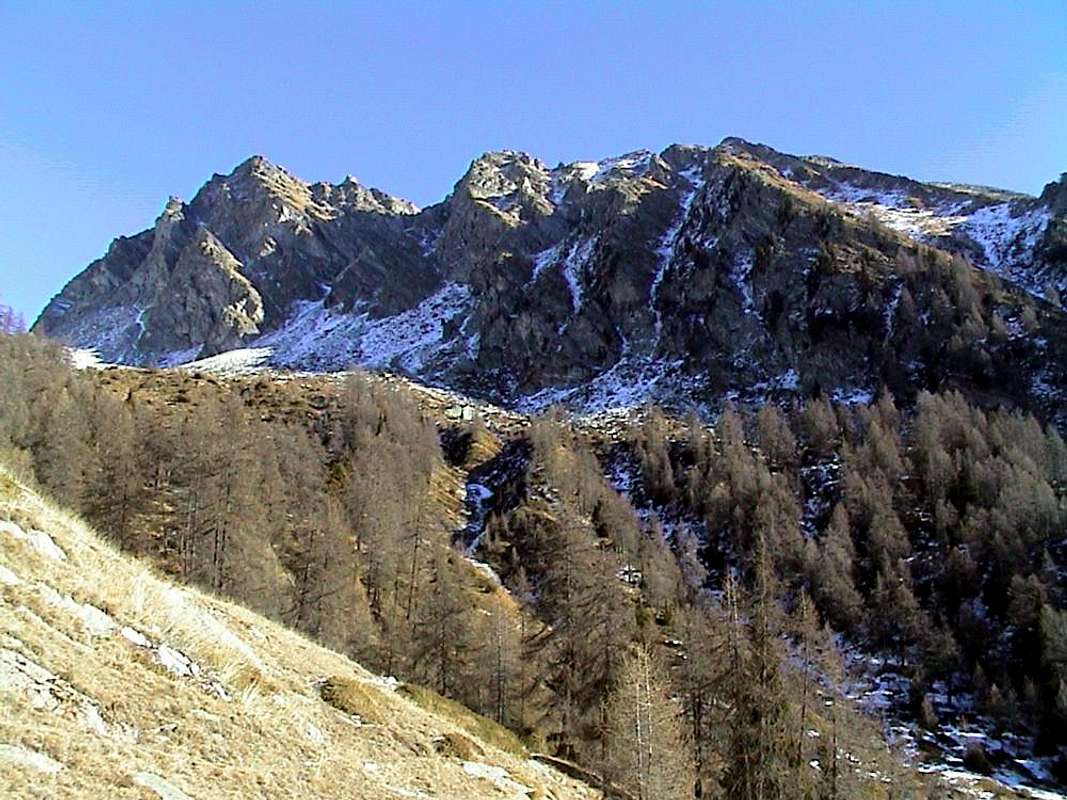
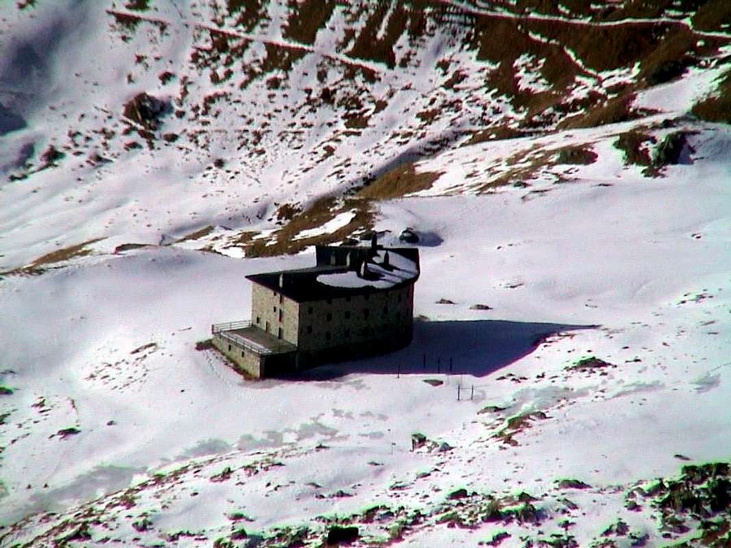
The Ayas Valley is the second, after coming from Piedmont to Gressoney that from Pont Saint Martin Commune rises to the North to Mount Rosa, the valleys that descend from the Swiss border to the South in the Central Valley perpendicular to the River flowing at Dora Baltea near the Municipality of Verrès. Going from that to the North, logically speaking diametrically opposite, we reach the important Tourist Center of Brusson Commune (artificial lake and international cross-country skiing) at the foot of Testa (Head) Comagna to the West (ancient Roman mines of gold) and the Punta della Guà in the East (above the beautiful Lake Bringuez). Just this last direction leads to a splendid Regional Road asphalt that reaches the Fraction of Estoul, at the base of a large Basin you open fan-shaped reaching toward the East Hill of Ranzola. Center is not particularly well known and popular, offering small downhill ski runs and an impressive range of possibilities for the practice of hiking or, more simply, for walks to do. Due to the poor quality of the rock, little is allocated to mountain climbing even on the Spur South-southwest of Punta della Guà has been traced a valid route of 300 meters in March 18th, 1973 by Guido Botto, Edward Ferrero and Paolo Moretti; interestingly the complete traverse of the three Mont Ciosé, also for the inhabitants Chose, from South/North accomplished solo ascent by Alessandro Gogna August 14th, 1982. During the winter the same was climbed for the North Wall by Pier Luigi Ferrero, always alone, 21th February 1988, but this wall is facing the Gressoney Valley; achieved even in the winter from Col Ranzola on crest by Osvaldo Cardellina and Emilio Bertona January 3th, 2002. During this season the area lends itself very well to the practice of Ski-Mountaineering and that of Snowshoes, for this last even with short and easy walks suitable for beginners as well as in this fascinating and a little "mysterious" discipline, rediscovered not long ago and in a short time has made many converts among mountain lovers. Now "classic", however, the practice of recording a Ski-Mountaineering remarkable turnout, especially after the construction of the shelter; remains, besides, the possibility of day trips departing directly from the parking of Estoul Hamlet, in view of the "quiet" approach exists. The existing farm roads, even if not passable without special permission, make it easier route in the early parts or along the bottom of the walloons themselves. However, it remains always the ancient paths that, unfortunately after the construction of private roads, ranging in progressive degradation.
NOTE: in this regard we refer to the various published works on SP about itineraries chosen and recommended, remarks, tools and new technique on Snow Rackets. By analyzing this area, we can divide it, starting from the West and to East, into three distinct areas with each offering different characteristics and particular features.
a) - Conca Palasina or Palasinaz located to the West and to the North and East by the watershed ridge limited to that from Punta Valfredda also Freidòhòre down in South to the Tip Valnera and to Mont Bieteron and his great shoulder or called Mont Palòn. This, in addition to numerous pastures and alpages, also includes the Refuge de l'Arp, positioned at the base of the Western slopes Valfredda/Valnera Summits and before the three homonym small Lakes, located in their turn immediately to the North under the Hill Valfredda.
b) - from the Valnera Hill or Valdònierfòrkò down towards the South, dividing the Gressoney Valley, up to the important Hill Ranzola. It contains the two beautiful Lakes Estoul.
c) - last area of lower elevation, which rises from the Hill of Ranzola first at the Punta della Regina finally to decline significantly on the watershed to the West with the parallel Vallon of Frudiera up to the top 'inhabited Graines with its magnificent castle with tower. Three distinct zones separated and otherwise characterized in the same extended area.
 |
La Valle di Ayas é la seconda, arrivando dal Piemonte dopo quella di Gressoney che da Pont Saint Martin risale a Settentrione verso la Catena del Monte Rosa, delle valli che dai confini con la Svizzera discendono a Mezzogiorno in perpendicolare alla Valle Centrale del Fiume Dora Baltea sfociando presso il Comune di Verrès. Salendo da questo verso Nord, logicamente in senso diametralmente opposto, si raggiunge l'importante Centro Turistico di Brusson (lago artificiale e pista internazionale di sci di fondo) ai piedi della Testa Comagna ad Ovest (antiche miniere romane di oro) e della Punta della Guà ad Oriente (sopra lo splendido Lago di Bringuez). Proprio verso quest'ultima direzione si snoda una splendida Strada Regionale in asfalto raggiungente la Frazione di Estoul, posta alla base d'una grande Conca che si apre a forma di ventaglio raggiungendo verso Est il Colle della Ranzola. Centro non particolarmente conosciuto e frequentato, offre piccole piste da sci di discesa ed una gamma impressionante di possibilità per la pratica dell'Escursionismo o, più semplicemente, anche per passeggiate turistiche. Causa la cattiva qualità della roccia, poco vien concesso all'Alpinismo anche se sullo Sperone Sud-sudovest della Punta della Guà é stato tracciato un valido itinerario di 300 metri nell'inverno del 1973 da parte di Guido Botto, Edoardo Ferrero e Paolo Moretti, il 18 di Marzo; interessante la traversata completa dei tre Mont Ciosé, oppure in loco Chose, da Sud verso Nord compiuta in solitaria ascensione da parte di Alessandro Gogna il 14 Agosto 1982. In inverno il medesimo é stato scalato per la Parete Nord da parte di Pier Luigi Ferrero, sempre da solo, il 21 Febbraio 1988, ma questa parete é rivolta verso la Valle di Gressoney; raggiunto ancora in pieno inverno dal Colle della Ranzola per cresta da parte di Osvaldo Cardellina ed Emilio Bertona il 3 Gennaio 2002. In stagione la zona si presta alquanto anche alla pratica dello Sci-Alpinismo ed a quella delle Racchette da neve, per quest'ultima anche con passeggiate semplici, facili e brevi nonché idonee ai debuttanti in codesta giovane e fascinosa disciplina. "Classica", invece, la pratica dello Sci-Alpinismo, soprattutto dopo la costruzione del rifugio; permane, comunque, la possibilità d'effettuar le gite in giornata da Estoul.
NOTA: inoltre dar un'occhiatina, sempre su SP, ai lavori varii al riguardo dell'attrezzatura, tecnica, raccomandazioni ed itinerari scelti ed indicati a riguardo della suddetta pratica. Analizzando quest'area, possiamo suddividerla, partendo da Ovest e verso Est, in tre zone ben distinte con ognuna offerente caratteristiche e peculiarietà altresì differenziate.
a) - Conca di Palasinaz situata ad Ovest ed a Nord e limitata ad Oriente dalla cresta spartiacque che dalla Punta di Valfredda scende a Sud alla Punta di Valnera o Valdònierhòre ed insino al Mont Bieteron nonché al suo spallone o Mont Palon. Essa, oltre a numerose alpi, comprende anche il nuovo Rifugio de l'Arp, posizionato alla base dei Versanti Occidentali delle Punte di Valfredda e di Valnera ed anticipante di modesta distanza i tre Laghi di Valfredda, situati a loro volta subito verso Settentrione sotto il Colle di Valfredda o Freidecoll.
b) - zona che dal Colle di Valnera scende verso Sud, divisoria con la Valle di Gressoney, fino all'importante Colle della Ranzola. Essa contiene i due bei e viciniori Laghi d'Estoul.
c) - un'ultima area, di minor elevazione, che dal Colle della Ranzola sale dapprima alla Punta della Regina per indi declinare decisamente verso Ovest sullo spartiacque con il parallelo Vallone di Frudiera fin sopra l'abitato di Graines col suo magnifico castello con torre. Tre zone ben contraddistinte componenti l'identico sì largo ed esteso comprensorio.
 |
 |
 |
 |
Getting There
BY CAR:
- From TORINO, MILANO, etc: Motorway A5. Exit at IVREA or Quincinetto (PIEDMONT) From IVREA Town: in West (Southern side) to Pont Saint Martin, Verrès Municipalities in East from Aosta Town. From Courmayeur Resort: in East-southeast to Aosta, Nus, Chatillon, Saint Vincent, Verrès Municipalities.
- From Verrès to Val d'Ayas Valley From Verrès (549m), with Regional Road, to Challant Saint Victor (765m), Challant Saint Anselme (1.060m), Brusson (1.332m) Municipalities; wanting, continuing to Northwest to Antagnod-Ayas (1.709m) Commune, below Mounts Tantané and Zerbion also in North towards Champoluc (1.570m) and Saint Jacques(1.670m) Communes at the end of Evançon or Ayas Valley and under the Western side of Monte Rosa (Rollin Hump, Breithorns, Pollux and Castor).
- From FRANCE: through the Mont Blanc Tunnel to Entrèves/Courmayeur. By Little Saint Bernard Pass, closed since November until half May to La Thuile Valley - Pré Saint Didier - Aosta - Verrès Municipalities. It is not necessary to take Motorway A5: you can drive on SS.26, in the direction of AOSTA - IVREA - TURIN.
BY PLANE:
- Aeroporto "Corrado Gex" Saint Christophe (Aosta).
The Summits
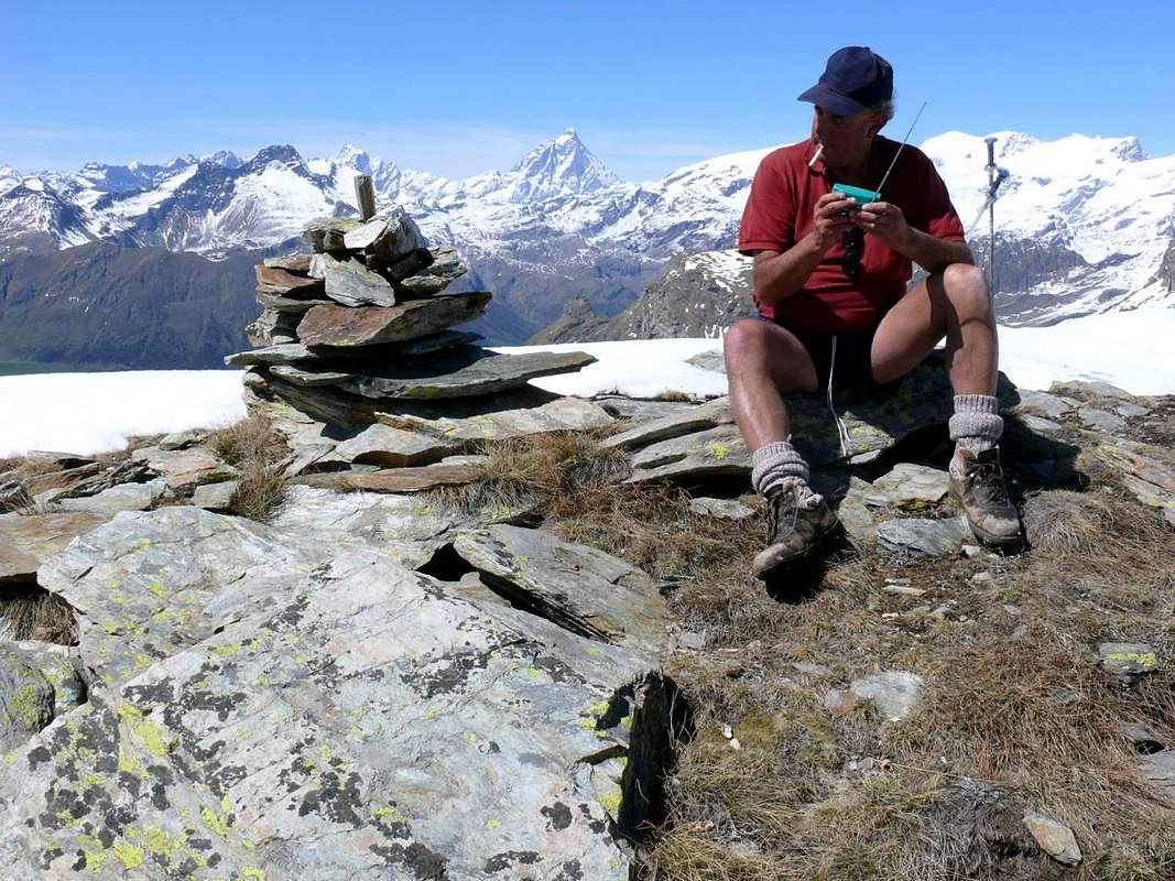
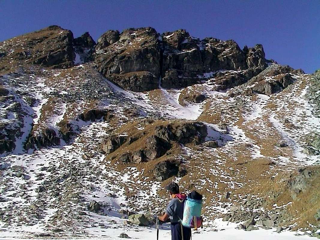
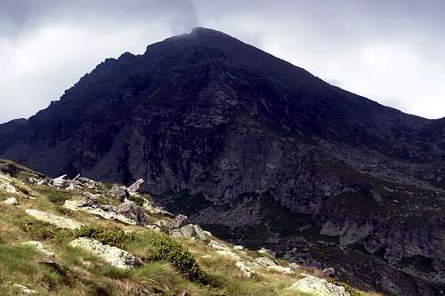
This first district of mountains above the Basin Estoul is aimed at the most in the West, or from the top, first of all, the Punta della Guà above the Municipality of Brusson.It up to the Corno Bussola (Horn Compass) on the watershed from South to North; from the same a second branch is directed towards the Levant, for separating the Vallon of Mascognaz to the North by the Palasinaz (after the Punta del Lago, the Pass and the Top of Palasina), reaching the Tip Valfredda, whence a third and final descends towards Southeast. This, after the passage of the same name, stands up to the Top Valnera where it bifurcates: one branch goes to the South-southwest, and after a series of altitudes unnamed, form the Mont Bieteron his Southern shoulder, known as Mont Palòn (inscriptions on rocks of the Summit, not to be confused with the other with same name just North of Tip of the Guà); a second branch descends farther South, adapted to contain the Basin real Estoul, forming in its descent the "Bocchetta" (small step in the manner of a notch) of Eclou, a series of teeth which precede the three Summit of Mont Ciosé or, "in loco", Chose to conclude to the Ranzola Hill. From this point on the watershed between Ayas and Gressoney continues in the direction of several top above the beautiful pyramid of Mont Nery (3.075m), the highest mountain of this long stretch after the partition of the Testa Grigia (Gray Head; (3.313m). But now we are in the Walloon of Frudiera or Frudière with its beautiful lakes; but the second branch (Estoul) that this will be part of future studies. To us, for the moment, only interested in the first sector, ie to Palasina that from the Guà Summit, with a large semi-circular turn, reaches the Mount Bieteron his shoulder and ending above Lake Literan and the whole series of the Alps that Northwest wind above Brusson and Estoul. This sector has expanded twenty top among which ten have a name well-defined and reported by the Maps. Furthermore, it is the starting point for the ascent of Corno Vitello (+; 3.057m) via the small saddle (2.778m) on an extension to the North of the dividing ridge; but this belongs to the top of the Mascognaz Vallon, immediately North than Palasinaz and bordering those of Freida/Loaoche-Pénte in Gressoney Valley. These Summit develop with two small parallel and semicircular mountain ranges, where the nodes are identified in the basic topographic Tip of Guà, Bussola Horn, Top Valfredda and Bieteron for the first area, and always starting again Bieteron to Tip Valnera and from this to Ciosé or Stallerhorn for the second.
Questo primo circondario di montagne soprastanti il Bacino di Estoul é rivolto alla parte più ad Occidente, ovvero dalle sommità, prima tra tutte la Punta della Guà, sopra il Comune di Brusson fino al Corno Bussola sullo spartiacque da Sud verso Nord; dal medesimo un secondo ramo s'indirizza verso Levante, atto a separare il Vallone di Mascognaz a Settentrione da quello di Palasinaz (dopo la Punta del Lago, il Passo e la Punta di Palasina), raggiungendo la Punta di Valfredda, donde un terzo ed ultimo scende verso Sudest. Questi, dopo l'omonimo passo, si rialza alla Punta di Valnera ove si biforca: uno scende verso Sud-sudovest e, dopo una serie di quote innominate, forma il Mont Bieteron e la sua spalla Meridionale conosciuta altresì come Mont Palon (iscrizioni sulle rocce della sommità; da non confondere con l'altro Mont Palon subito a Nord della Guà); un secondo ramo scende più a Sud, atto a contenere il Bacino vero e proprio di Estoul, formando nella sua discesa la Bocchetta (piccolo passo a guisa di intaglio) d'Eclou, una serie di elevazioni dentellate precedenti le tre Sommità del Mont Ciosé o, in loco, Chose per concludere al Colle della Ranzola. Qui, lo spartiacque tra Ayas e Gressoney continua in direzione di varie sommità che precedono la bella piramide del Mont Nery (3.075 m), la montagna più elevata di questo lungo tratto divisorio dopo la Testa Grigia (3.313 m). Ma ormai siamo nel Vallone di Frudiera o Frudière coi suoi bei laghi; sia il secondo ramo (d'Estoul) che questo faranno parte di studi successivi. A noi, pel momento, interessa soltanto il primo settore, cioé quello di Palasina che dalla Punta della Guà, con un largo giro semicircolare, raggiunge il Bieteron e la sua spalla terminando al di sopra del Lago Literan e di tutta quella serie di alpeggi snodantisi sopra Brusson ed a Nordovest di Estoul. Quest'esteso settore presenta una ventina di sommità tra le quali dieci possiedono un nome ben definito e riportato dalle Carte. Inoltre risulta punto di partenza per l'ascensione al Corno Vitello (+; 3.057 m) tramite la selletta (2.778 m) sul prolungamento verso Nord della cresta spartiacque; questa sommità però appartiene di già al Vallone di Mascognaz, subito a Settentrione rispetto a quello di Palasinaz e confinante con quelli di Freide/Loaoche-Pénte in Valle di Gressoney. Queste Sommità si sviluppano con due piccole catene montuose parallele e semicircolari, dove i nodi topografici basilari si individuano nella Punta della Guà, Corno Bussola, Punta di Valfredda e Bieteron per il primo settore e, sempre ripartendo dal Bieteron, alla Punta di Valnera indi al Mont Ciosé per il secondo.
Starting from Estoul you have only the embarrassment of choice. (For the approaches see "The Lakes" & "Where do we go fishing?")
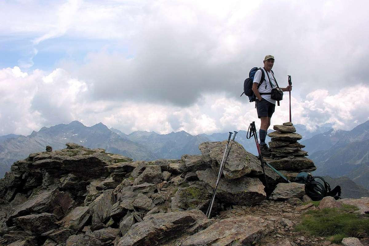
A Summit which you want to go?
In addition to briefly describe each of the ten top with a name, adding to these the Chalberhòre or Corno Vitello (Vealhorn) quite easily accessible from this side, and some other intended for lovers of exploration, we give some indication of the ways forward also highlighting some quirks that you encounter on the same; almost all of them are aimed at Walkers/Hikers (E) and in some cases to Expert Hikers (EE) and in rare Expert Hikers to Mountaineers (EE/A). We must not forget, however, besides the fact that the rock is always rotten, crumbled, grassy and of very poor quality, the snow conditions completely subvert the factors of difficulty and where in summer you can pass easily in the presence of snow, especially if fresh or high and has not been processed, you should be more cautious. Despite the fact that almost all the ascents possess a path or a track indicative more or less evident and despite numerous reports exist it must be remembered that the presence of this element restricts or completely erase these valuable aid. By contrast, the presence of snow trips offer sensations and emotions more completely changing the "pitch", and the views can be enjoyed and from most definitely unusual. In any case, learning how to suitably evaluate the various existing situations, without neglecting those that require caution ...
 |
 |
 |
 |
 |
a) - to go directly to the small saddle 2.733 meters at Pointe Palòn and continue along the easy Northern Crest;
b) - diagonally across the Northeast Slope of scattered traces reaching the big Cross Summit (E/F; 0h'45/1h'00 from the loch; 3h'30/3h'45 from Estoul; 4h'45/5h15 from Brusson).
2) - Pointe Palon (2.779m); East Slope and South Crest in final part from Bringuez Lake or with traverse from Punta of Guà through saddle 2.733 meters. This Summit is often confused with the nearby Guà Summit, from which in reality is independent. From the small saddle, leaving South the track towards the Guà, go up the short Crest South with a small rocky stretch in the terminal part (E/F; 0h'20/0h'30 from the the little saddle).
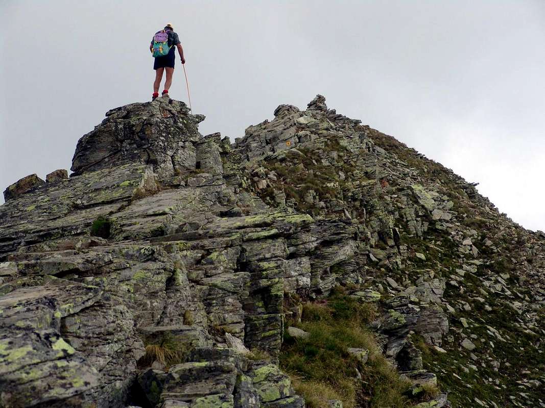
3) - Unnamed Quotas (2.759, 2.855, 2.859, 2.899 meters); traverse South/North from Pointe Palon also vice versa from Bussola Pass on crest. Of this enough important and long watershed, designed to enclose the small Basin Bringuez separating it from the Fornoilles Walloon above the Village Extrepierre (1.389m; just on Regional Road to the Northwest of Brusson), has not been reported in any mountain publication. Formed by, starting from South or from Pointe Palon, two separate quotas from as many notches reaches the altitude of 2.840 meters where it splits: one branch goes to the East-southeast over the Hill Bringuez, locally called "The Bocchet"(2.661m), to finally go back to the Mont Quiappa; a second continues Northward reaching the Quota 2.899 meters before falling precipitously over the Bussola Pass. This last, the highest among the Guà Summit Corno Bussola has been uphill, beginning on the same hill, by Osvaldo Cardellina July 7th, 2002 after solo complete traverse from Corno Vitello/Tops Palasina/Punta del Lago Lungo/Bussola Horn with up and down through the short but steep North Slope (EE/A; AD-; II°/II°+, a passage of III°- about a band, however avoidable left; difficulty in finding the path with the danger of falling rocks. (In total 1h'30/1h'45 round trip from pass). Regarding the traverse to the Palòn or vice versa there is no news, but not easy to predict climbing and exposed in several sections. Quote this last might be called Pointe Fornoilles of being at the top of the homonym vallon; in any case, this part is still waiting for a complete scan; this is not sufficient to make an analysis from the bottom, but you have to take the whole of crest in one direction or the other.
4) - Monte Chiappa or Mont Quiappa (2.683m); Northern Slope from two Lakes of the Battle. To climb the enough steep grassy slopes gradually moving to the right until you reach a slightly marked ridge along which you will reach the Summit cairn (E/F; 1h'00/1h'15 from both the lochs).
5) - Corno Bussola or Mont de Boussolaz (+; 3.023m). From Long Lake through good path on rocky promontory reach the Bussola Pass. From this
a) - Southeast Crest, with, just after the same, a short rocky wall equipped with chaines that leads to the upper part of the path; flexing Northwest to Summit (EE/F+; 0h'45/1h'00 from pass; 2h'15/2h'30 from Palasinaz Alpage; 4h'30/5h'00, Estoul; 5h'30/6h'00, Brusson). Also
b) - by long traverse from little saddle 2.697 meters crossing the two Palasina Summits and Top Long Lake (a smallwall exposed immediately downhill from the same (6/7 metres; I°+/II°-) just and, after the altitudes 2.942, 2.975 meters, a passage steep and exposed in the final part of the rock is not good, however, to circumvent the final stretch through a small track to South joining up with the "Normal" just below the Summit (EE/A; 1h'45/2h'00 from hill; combined but very long traverse coming from Chalberhòre EE/A; 7h'00/8h'00 from Estoul parking, round/trip).
6) - Punta del Lago Lungo or Pointe du Lac Long (2.816m); easy traverse on East Ridge from Palasina Hill (2.661m; E/F; 0h'20/0h'30).
7) - Palasina(z) Summits (2.740, 2.783 meters); South Slopes or traverse on crest from saddle from East to West (2.697m; EE; F+; 0h'30).
8) - Corno Vitello or Chalberhòre or Kalberhorn (+; 3.057m); Southwest Crest from little saddle 2697 meters, through two South Shoulders (2.921, 2.923 meters). This ascent takes place, after arriving from the South to the saddle 2.697 meters and another short distance to the quotas 2.705, 2.823 meters, on the ridge dividing the Vallon of Mascognaz (West) by one of Alpenzu in the Gressoney Valley. Typically the path is yellow marked, but in the case of snow, the reports tend to disappear, making the search for the way more complicated but interesting. You can follow the ridge (just more difficult with a bypass to the left) or to remain below the same on the Western Slope (Mascognaz; F/F+; 1h'45/2h'15). Variant: from Third Lake Valfredda, reached from Refuge l'Arp and with path towards the first two lochs, through steep moraines in East to climb to the eponymous pass or Freidecoll (2.857m); from this with a small path diagonally Northwest to the quota 2.823 meters going back to the previous way (also further to the right on the watershed (more challenging) to Quota 2.921 meters more or less the same difficulties, same time).
 |
 |
 |
 |
 |
9) - Valfredda Summit or Freidòhòre also, by Brusson inhabitants or those of Gressoney, Punta Lavassey or Corno di Valnera (+; 2.947m).
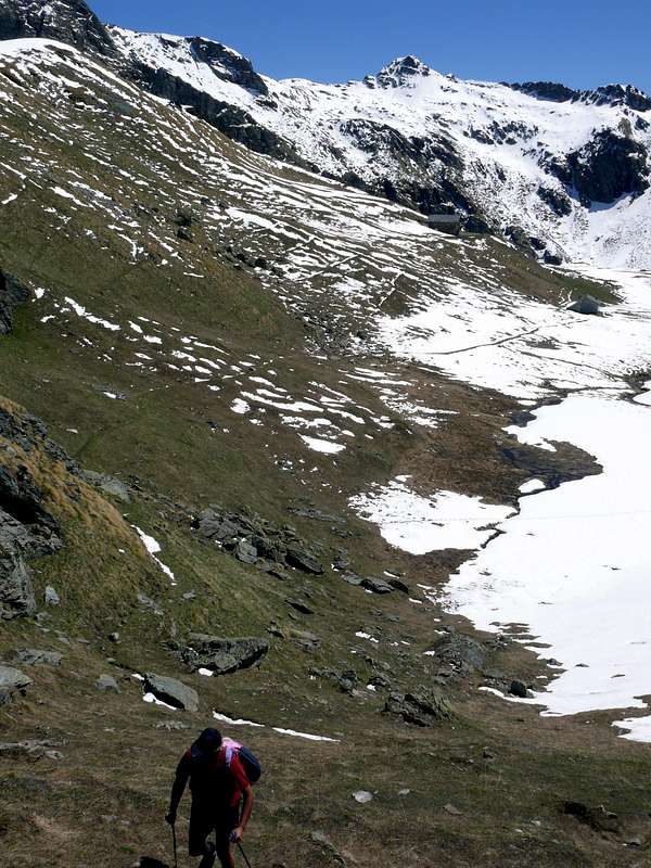
a) - Through the Western Slope under the hill and Southeast Crest from Valnera Pass or Valdònierfòrkò (2.676m), reached from l'Arp Shelter. Continue with path in Southeast neighbor and up to the source 2.661 meters; from this, lesspath and through moraines or grassy slope to pond 2.674 meters just under the pass. From this last by the easy Southeast Crest with yellow signs, just below the same or entirely and integrally on thread, to Summit Cross (yellow signals E/F; 1h'30/2h'00 from the Shelter 2.446m).
b) - Or through the more steep and challenging South-southwest Crest from fork just before the refuge to point 2.597 meters; from this through rotten, broken, easy rocks reach the Summit (EE/A; F+; 1h'45/2h'00).
c) - Directly from refuge first on the path to the first Lake Valfredda and then through steep stony slope up to the base of West-northwest Face with climb into a greyish rocky gully with gravels and a small rocky wall in the terminal part (A/F+/PD-/PD+; 2h'00/2h'30 from l'Arp Shelter.
d) - Also, always departing from refuge but in North towards three Valfredda Lakes and Pass by the North-northwest Ridge passing on altitude 2.869 meters, carving 2811 metres and following quotas 2.919, 2.911 meters, just below the Summit (surely a crest very rarely traveled and certainly more difficult and more challenging; F+/PD-; 2h'00/2h '30 from l'Arp Refuge.
10) - Valnera Summit or Valdònierhòre (+; 2.754/6m). Through the
a) - Southwest short Crest from little saddle 2.681 meters, reached with oblique path-traces in Southeast, about 200 meters below the Western Face, from l'Arp Refuge (F/F+; 1h'30/1h'45 from the shelter 1h'15/1h'30 or going up directly on grassy slopes from winding road 2.319 meters before the same). Also through the
b) - Northern Crest from Valdònierfòrkò (2.676m; via integral very rarely frequented. Not difficult, but a little exposed; should bypass some steps right immediately under the ridge and through the Western Face; to be undertaken with caution in the presence of fresh snow F+/PD-; 1h'20/1h'35). Or
c) - directly through little rocky Western Face on a small spur, which divides the same into two sectors (Osvaldo Cardellina and Emilio Bertona July 09th, 2006. PD-PD; 2h'15/2h'30 from Refuge). Besides
d) - can be reached with an "acrobatic", complete crossing in descent from Bieteron (see Jags; 1h'00/1h'30), probably traveled only once, but for which there is a relationship. Surely this small hilltop, but important node topography, it is more easily accessible route the opposite side, ie from the Lakes Estoul, but these belong to the homonymous vallon that will be examined in the next job.
11) - Mont Bieteron Jags (2.662, 2.708 meters); traverse from saddle 2.681 meters (exposed, difficult and still to this day most likely scarcely explored). However, in "Monte Rosa" by Gino Buscaini 1971, page 297, there is a report about the climb to the crest of the Southwestern Summit of Valnera which can be summarized thus: from the Summit of Bieteron down a wall with small ledges (15 meters, II°-) surpassing the next small gendarme (II°, follows a little tower that salt on its right by means of a dihedral (4 meters, III°+) and obliquely on ledges recovers the ridge. After you get off the mound with a roughness on the right reaching the minuscule Collar Bieteron (2.619m), and then there is "grafted" on the Southwest Ridge of Valnera and, after a passage exposed (II°) to reach the "Normal Route" in final part. (PD/PD+; 1h'00/1h'30 downhill from Bieteron.
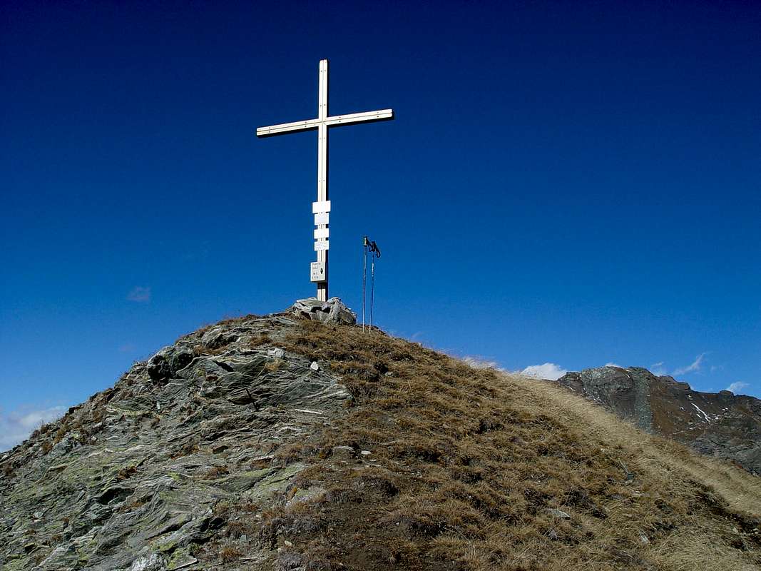
12) - Mont Bieteron (+; 2.763m). Through Southwest Slope of Mont Palòn from Literan Lake and crossing through South-southwestern Slopes. From big shoulder down through the rocks easy but exposed a short distance; then continue by flexing just to the North-northeast and through a small track, which often gets lost between the grassy slopes, with some small rock (sometimes delicate passages of I°, moreover not forced and thus easily bypassed on both sides) to reach the Summit Cross (EE/F+; 2h'50/3h'10 from the lake or, more in bottom, from private dirt road).
Note: you absolutely can not crossing down the grassy slopes of the East-Northeast Slope to the Lakes Estoul and Chamen, because really treacherous and dangerous, even in the absence of snow but covered grass as "Olline", very slippery. It should go down again, and then navigate.
13) - Mont Palon (2.594m); various paths on South-southwestern Slopes from Lake Literan. Ascent through boring grassy slopes with short crossing on small rocks which require a final bit of caution when wet or in snow (E/F; 1h'45/2h'00 from the loch or, lower, from dirt road).
Oltre a descriverne in breve tutte le dieci sommità con un nome, aggiungendovi lo Chalberhòre o Corno Vitello da questo versante abbastanza agevolmente raggiungibile ed alcun'altre destinate agli amanti delle esplorazioni, diamo qualche indicazione sulle vie da percorrersi segnalando alcune peculiarità che si incontrano sulle medesime; quasi tutte son rivolte agli Escursionisti (E) ed in alcuni casi ad Escursionisti Esperti (EE) ed in rari ad Escursionisti/Alpinisti (EE/A). Non devesi dimenticare però, oltre al fatto che la roccia risulti sempre "erbosa", sgretolata e di cattiva qualità, che le condizioni di innevamento sovvertono completamente i fattori di difficoltà e là dove nella bella stagione si passa agevolmente, in presenza di neve, soprattutto se fresca o alta e non trasformata, si deve usar maggior prudenza. Anche se quasi tutte le salite posseggano un sentiero o traccia indicativa più o meno evidente e nonostante le numerose segnalazioni si deve ricordare che la presenza dell'elemento limita o cancella completamente questi validi aiuti; per contro, le gite in presenza di neve offrono sensazioni ed emozioni maggiori cambiando completamente il "terreno di gioco" ed i panorami da gustare sicuramente più inusuali. In ogni caso imparar a valutar congruamente le varie situazioni in essere, senza mai trascurare quelle che richiedono cautela ...
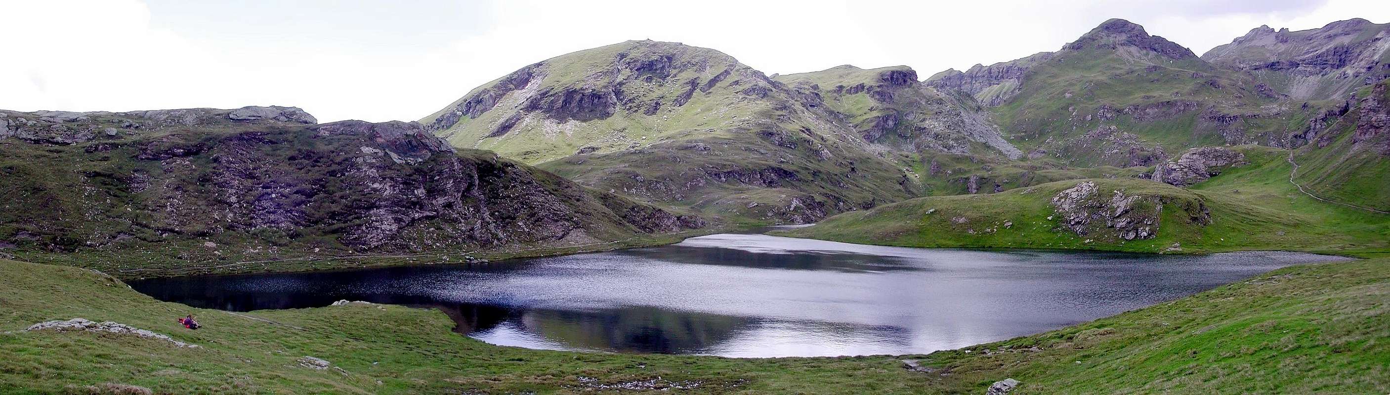
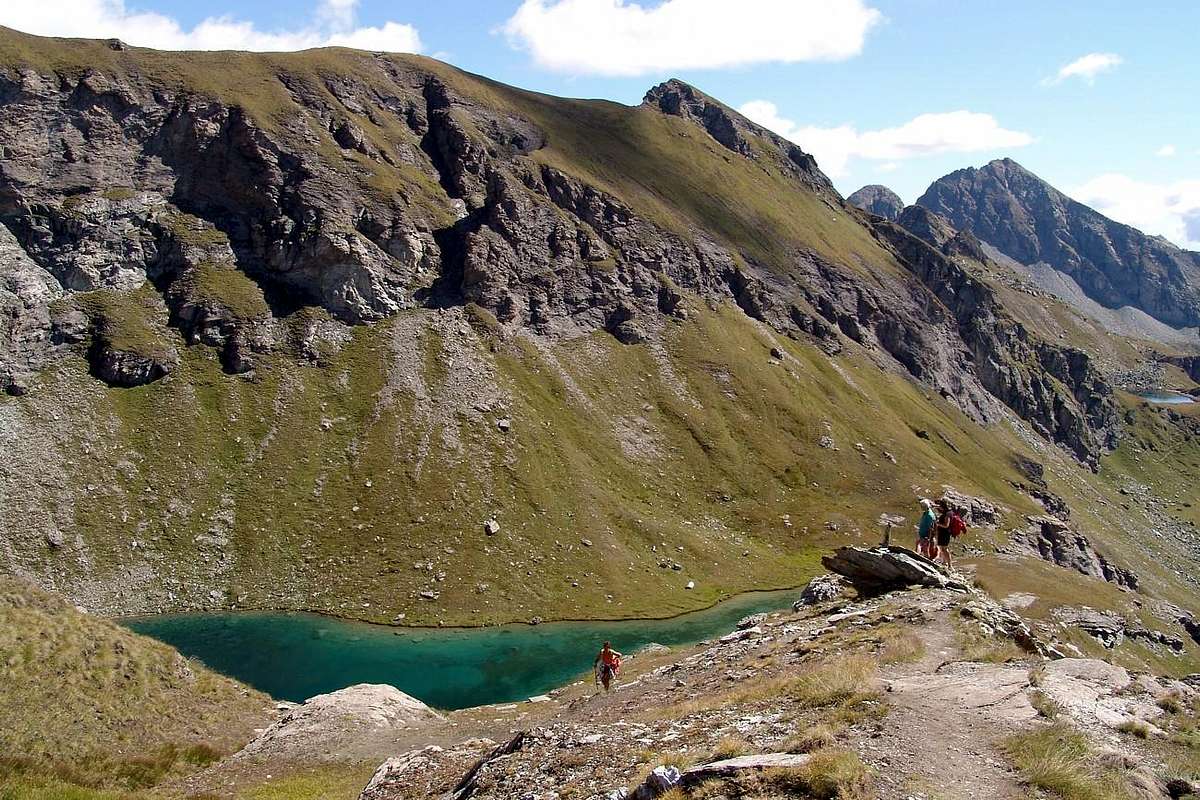
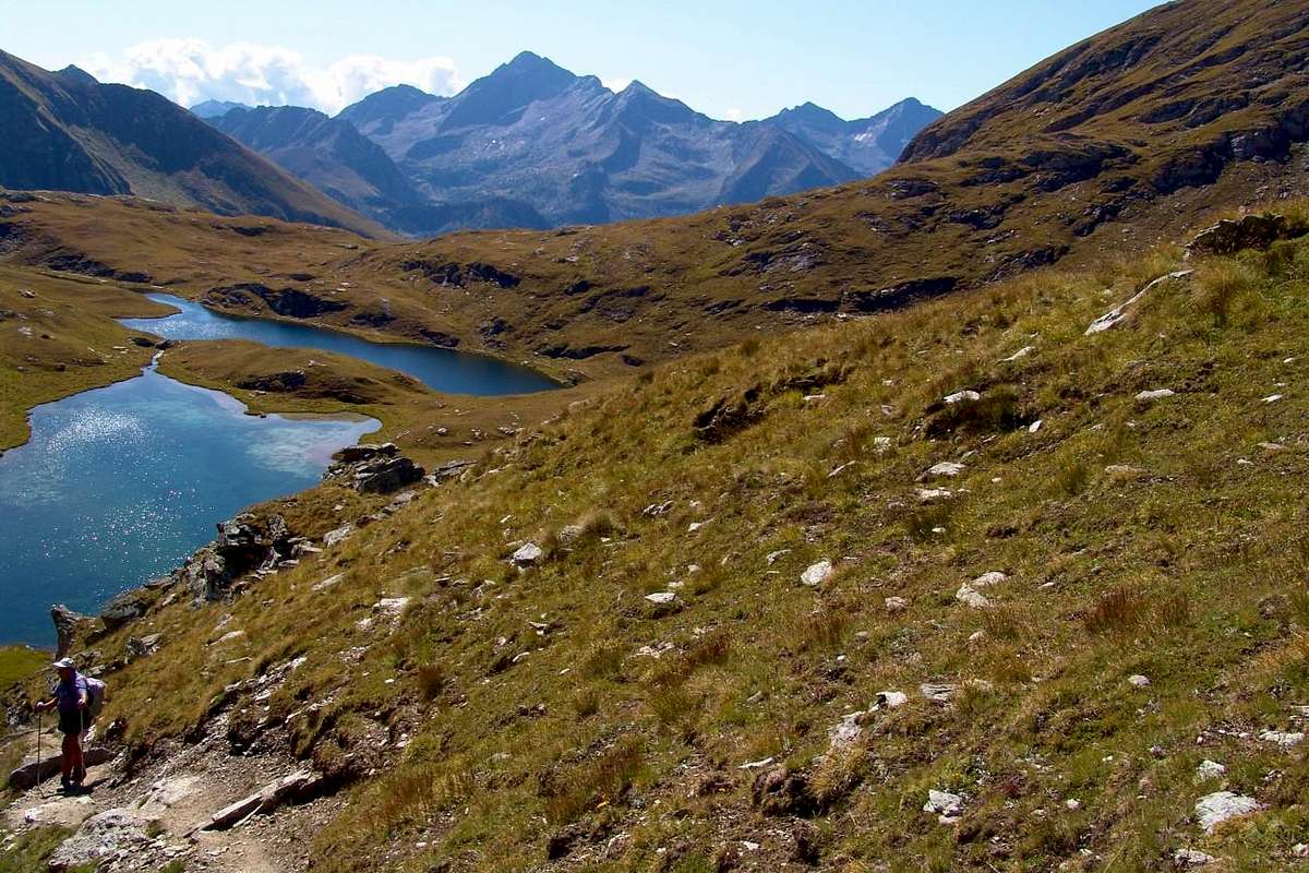
The Lakes
 |
 |
 |
 |
 |
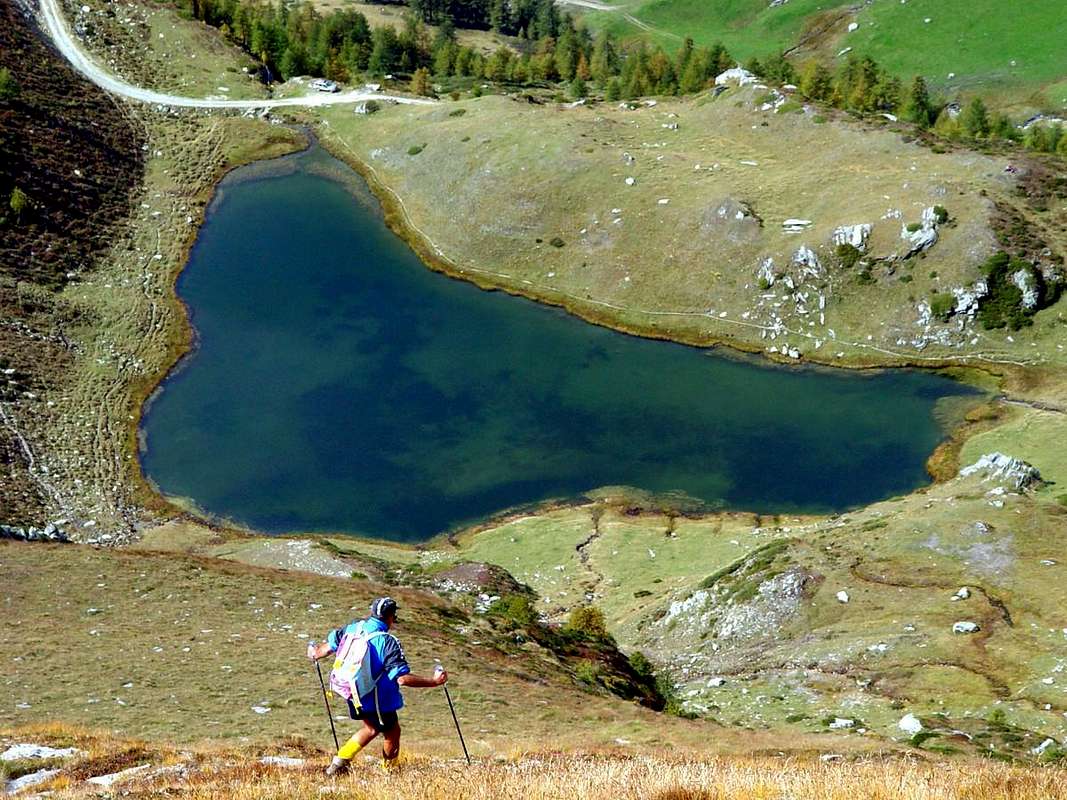
But even more than its mountains, not for the truth of lofty stature, and also poorly known and popular except for a few rarities such as the Corno Bussola, the Basin Estoul is highlighted by a series of beautiful lakes and ponds that "spreads" especially Comba Palasina. Here, starting from the Southwest to Northeast will rely increasingly heading towards ten or eleven o'clock by including the Literan at the entrance of the vallon, like the tops that have the names: Lake Bringuez, ever-changing hues from emerald green to blue and the almost violet, Long Lake, which, as its name says, it "lies" in the highest part of the vallon floor, the Lakes Pocia and Vert with the above Lac du Couloir, just below the Hill of Palasina, and finally the two Lakes of the Battle connected in a "deadly embrace" at the top of the highest vallon. The other three lakes are located more to the East, homonyms and below the Pass and Tip of Valfredda and immediately behind the Refuge de l'Arp. Two lakes, Chamen and Estoul than that of Literan the Western slopes of the Bieteron, are beyond the partition but no longer part of basin; the last of the three sectors namely starting of Ranzola Hill and towards the South and West, however, there are lakes and find you have to "go downhill" the little saddle 2.163 meters, between the Tip of the Regina (Queen) and that of Garda reaching the two Frudière Lochs into homonymous and parallel valley. Even these we'll talk in the next two work involving the successive sectors which, as already said with regard to the tops, concern in the strict sense of Estoul Walloon and zones "more Southern".
Ma ancor più rispetto alle sue montagne, per la verità di non eccelsa levatura ed inoltre scarsamente conosciute e frequentate tranne qualche rarità come il Corno Bussola, la Conca di Estoul s'evidenzia per tutta una serie di splendidi laghi e laghetti che "sparge" soprattutto nella Comba di Palasina. Qui, partendo da Sudovest e dirigendoci verso Nordest ne contiamo sempre dieci oppure undici inserendo anche il Literan all'ingresso del vallone , come per le sommità che han nome: il Lago di Bringuez, dai riflessi sempre cangianti dal verde smeraldo all'azzurro ed al quasi violetto, il Lago Lungo che, come dice il suo nome, s'"adagia" nella parte più elevata del vallone, i Laghi Pocia e Vert con il soprastante Lac du Couloir, subito sotto il Col Palasina, ed infine i due Laghi della Battaglia collegati in un "abbraccio mortale" all'ingresso del vallone superiore. Altri tre laghetti si trovano più ad Oriente, omonimi e sottostanti Passo e Punta di Valfredda e subito alle spalle del Rifugio de l'Arp. Due laghi, di Chamen e di Estoul oltre a quello di Literan alle pendici Occidentali del Bieteron, stanno oltre il divisorio ma non fan più parte di questa conca; nell'ultimo dei tre settori ovvero a partire del Colle della Ranzola e verso dapprima Sud e poi Ovest, invece, non esiston laghi e per trovarne bisogna "scollinare" la selletta 2.163 metri tra le Punte della Regina e della Garda raggiungendo i due di Frudière nell'omonimo e parallelo vallone. Anche di questi discorreremo nei prossimi due lavori implicanti i successivi settori che, come già detto per quanto concerne le sommità, riguardano il Vallone ristretto d'Estoul e le zone "maggiormente Meridionali".
Said that it is not abssssolutely necessary to reach a Summit, unless you do not have a Family Doctor prescribed. You can also more or less easily or with difficulty sit here and go to a lake to fish in peace! But to give you some advice, here I need to consult an Expert, because I'm not a Fisherman. Repudiation hunting Animals, but I accept Fishing Fish: glaring contradictions of Life, as they are also of the Living. Perhaps because of an Education Traditional Catholic: the fish OK, the lamb no. But to tell you where you can fish and where not I see him Antonio, who is a Fisherman. Is an Expert "Pescador". We feel that we report the "fishiness". Awarded the answer to the question we now know that they are all full "of fish and fishable", with a reserve to the Literan Lake that was once a Reserve Fishing. So let's go for a walk in these beautiful Lakes waves Palasina know them a little better. Because when you only think about running in the Mountains do not see anything! Oh, remember, if it is the bad weather, to ward off the line, especially if it's Carbon Fibre ... Otherwise fry with her.
1) - Bringuez or Brenguez Lake (2.529m); is placed in a narrow basin between the Tips of the Guà and Palòn to the West and Mount Chiappa East. It can be reached directly a) - from Brusson Municipality with a path to the North that reaches through the Bois (Forest) Brenguez or Bringuez and in succession the Alps Brenguez (+, 1.888m), Chavannes (1.997m; source), the Torrent de Brenguez and the fork 2.352 meters at the entrance of the small "conca". Otherwise, always starting Northeast (E; 3h'30/4h'00). Also
b) - from Brusson towards West the Torrent Messuère, the "Hole of the Fairies" and subsequent Alpages Mandaz, Raccard, Lavassey where, turning in opposite to the Northwest, you come to Quiappa Alp (2.245m) and the junction with 2.352 meters the previous path (E; 3h'30/4h'00). Or with the private dirt farms road that reaches c)-: from Estoul-Fenillettaz tiny Village (1.840m; sign ban on driving to the next junction 1.882 meters; source) and, after Fontaine, Chanlochère, Chavanne Pastures and fording the Ru (Brook/Torrent) Dialley, reaches beyond the Vallon Lavassey Alp (1.996m; spring; (E; 3h'00/3h'20), and after the previous routes from valley floor. In our humble opinion, this is the ultimate way to be preferred, even if it involves a small loss of altitude in the crossing of the gorge-walloon; in each case the other two routes offer beautiful walks in unspoilt nature and little known to the masses.
2) - Lac Long (2.632m). Is enclosed in a deep inlet mail with axis West/East at the foot of the Bussola Pass (2.807m) lies between the stands to the South of a secondary spur that descends from the Quota 2.859 meters (on the same pass the "Normal Route" for the Bussola Horn) and to the North of the long East Crest of Summit that reaches the Tip of Long Lake; his emissary down towards East-southeast at Lake Pocia. Accessible from the latter through the path that goes between moraines towards Northwest (EE; 1h'00/1h'15 from Bringuez Lake; EE; 2h'15/2h'30 from Brusson to Bringuez Lake and crossing "The Bocchet" (narrowing); E; 0h'45/1h'00 from the First Battle Lake; E; 3h'15/4h'00 from Estoul).
3) - Lac Pocia (2.518m). Cuboid irregular, is located between Long Lake and the Second Battle Lake; it can be reached from the latter by means always the same path coming from the junction between the First Battle Lake and the just above Lac Vert (Green Lake; E; 0h'30 from the First).
4) - Lac Vert (about 2.500m). Pond in the shape of an isosceles triangle with the vertex to the West, you reach in a short time through the path, starting from the "Baita Dino" (2.435m), reaches the first lake then along its Northern shore to the Northwest E; 0h'15 from the First Lake.
5) - Lac du Couloir (2.607m); tiny lake rounded immediately below the Hill Palasina (2.661m). It can be reached with the path that leads to this, first toward the Northwest and then decisively to the North; or a next alternative via a secondary pathway that connects to the previous at the junction 2.556 meters (E; 0h'25/0h'35 from the first lake; E; 1h'20/1h'40 from Refuge l'Arp 2.446m; E; 3h'15/3h'30 from thr Estoul parking).
 |
 |
 |
 |
6) - Primo Lago della Battaglia (2.484m); can be considered as the basis for the entire route of this first series of lakes, in the strict sense said Palasina or for the local inhabitants Palasinaz. Departing from Estoul follow the same farm dirt road to Lake Bringuez with the previous point 1/c) -. Where this with a variation down to the Ru Dialley, leave this bifurcation on the left continuing, however, on the main branch and, on the right, leaving the Lake Literan reach the next fork in altitude 2.231 meters; discarding, this time on the right, the same that goes to the Refuge de l'Arp, cross the Grand Torrent and, with direction to the Northwest, reaching in progression Chavanne (2.347m) and Palasinaz (2.402m) Pastures. From this last, still leaving to the right (Northeast) a detour that leads to the shelter, continue in the same direction and, after a short stretch of farms dirt private road followed by the path, reaching the "Baita Dino" (2.435m; with no name on Maps) , in a grassy area at the edge of the effluent of the First Lake of Battle; following the path to the South of the same in a narrow gorge in a short time reach the loch (E; 2h'45/3h'00, parking).
7) - Second Loch of the Battle (2.484,5m); of more rounded shape compared to the Prime like a triangle with the apex to the North, the Second is the continuation of the first, or, if we want to better the other way around. In fact, a quick connection of a few hundred meters unites them with little difference in level between the one and the other and through a path that touches their Southern shores. Continuing with the same, and bowing more to the West, you reach the Bringuez Pass (2.661m), from which with fairly steep descent to the South we reach the eponymous lake. Continuing with the path instead of the right of the First are reached earlier lakes above (E; 0h'10 from the First; E; 3h'00/3h'10, Estoul).
8) - First Lake of Valfredda (2.544/6m); from the junction 2.231 meters on the contrary this time leave the intersection to the Northwest to direct Chavanne Pasture and continue to the right, with wide turn first to the Northeast and then Northwest crossing several small secondaries torrents below Valdònierhòre, reached by a final ramp steeper the de l'Arp Refuge. From this a path with the same development in a short time reached the First Lake Valfredda under the Western Face of homonymous Summit. (E; 0h'20/0h'30 from l'Arp Refuge; E; 2h'30/3h'00, Estoul). First Note: from the change of direction of the private farm dirt road before you can continue to l'Arp Shelter the Northeast on grassy knolls and debris along a secondary small torrent until you reach the path that leads to Valdònierfòrkò (2.676m) from the refuge; from the pass by a long descent leads to the "Boulders Zone" at Gressoney St. Jean (1.388m), below Monte Rosa Chain and in the splendid valley with the same name.
9) - Second Valfredda Lake (2.575m). Prime Lake continue same path, towards the North, and left to port a source, in just a short time to reach the Second place just under the saddle 2.697 meters, that allows the passage to the next Mascognaz Vallon (E; 0h'10 from the First).
10) - Third Lake of Valfredda (2.589m). Third, even smaller, is located under the same saddle 2.697 meters and immediately to the West of Freidecoll or Valfredda Pass; through a thin track, below the continuation of the path to the same saddle, on the bottom of the walloon is reached in the midst of great casting the fairly steep moraines (EE; 0h'10 from the Second; E; 0h'45/1h'00 from refuge; E; 3h'00/3h'15 from Estoul). Second Note: Through a steep, strenuous climb of these you can get up and go down to the Alpenzu Hut, Onder Perletoa always in Gressoney.
11) - Literan Lake (2.226m); Returning back to base in the itinerary that salt Estoul-Fenilliettaz the entire vallon, we reach the second junction after Chavanne (2.209m); leave the main road, by means of three hairpin bends and a small diagonal on dirt is reached the lake just below a beautiful new barn (2.276m) and at the Southwestern foot of Palon, large grassy-rocky shoulder of the upper Bieteron E; 1h'00/1h'15, Estoul).
Non sia detto che bisogna raggiunger assssolutamente 'na Sommità o un cocuzzolo, a men che non ve l'abbia prescritto il Medico di Famiglia ol Dotòr. Potete anche più o men tranquillamente o faticosamente raggiunger un lago e qui "assiettarvi" a pescar in santa pace! Meglio senza "rompiscatole" d'attorno. Ma per dar Voi qualche consiglio, qui ho necessità d'interpellar n'Esperto, ch'io Pescator non son. Ripudio sta caccia agli Animali, ma accetto la Pesca: contraddizioni lampanti della Vita, poichè anche lor son Viventi. I pesci si, l'agnello NO. Educasciòn Catolica? Ma per dir ove si può pescar e dove no devo consultar l'Antonio, che Pescador l'é. Esperto. All'uopo sentiam cosa ci riferisca della "pescosità" dei medesimi. Ottenuta dall'Antonio sta soddisfasciòn al riguardo del quesito, ora sappiam che son tutti "pescosi e pescabili" co' 'na piccola riserva pel Literan che tempo addietro l'era Riserva. Così 'ndiam far 'na passeggiata sù pe' sti splendidi Laghi del Palasina onde conoscerli un pòchettin meglio. Perché quando in Montagna pensi solo correr sù e giù non te vedi proprio un bel tubo de gniente! Mejo péscar e vardar Panorama ... Ah, ricordatevi, se vien temporal, d'allontanar la lenza, soprattutto s'é in fibra di Carbonio ... Altrimenti friggete insieme a lei.
 |
 |
 |
 |
 |
Campings
Remember that free camping is forbidden (except for emergency reasons, over 2.500m, from darkness until dawn).
Mountain Conditions
- You can get meteo information at the official site of the Regione Valle d'Aosta:
- Valle d'Aosta Meteo
- Meteo: You can find more weather information on the website 3B Meteo:
- Meteo Brusson
Books and Maps
BOOKS:
- "Guida delle Alpi Occidentali" di Giovanni Bobba e Luigi Vaccarone C.A.I. Sezione di Torino Volume II (parte II), 25 Maggio 1896.
- "Guida dei Monti d'Italia" Alpi Pennine (Vol. 2) di Gino Buscaini - Club Alpino Italiano/Turing Club Italiano, Luglio 1970 (In Italian).
 |
 |
MAPS:
- I.G.C. Istituto Geografico Centrale Torino "IVREA-BIELLA e Bassa Valle d'Aosta" 1:50.000.
- I.G.C. Istituto Geografico Centrale Torino "Cervino e Monte Rosa" 1:50.000.
- L'Escursionista editore "Alte Valli d'Ayas e del Lys" Carta dei sentieri (8) 1:25.000.
Important Information
- REGIONE AUTONOMA VALLE D'AOSTA the official site.
- FONDAZIONE MONTAGNA SICURA Villa Cameron, località Villard de la Palud n° 1 Courmayeur (AO) Tel: 39 0165 897602 - Fax: 39 0165 897647.
- A.I.NE.VA. (Associazione Interregionale Neve e Valanghe).
Useful numbers
- Protezione Civile Valdostana località Aeroporto n° 7/A Saint Christophe (Ao) Tel. 0165-238222.
- Bollettino Meteo (weather info) Tel. 0165-44113.
- Unità Operativa di Soccorso Sanitario Tel. 118.