
-
 9454 Hits
-
 84.12% Score
-
 18 Votes
|
|
Route |
|---|---|
|
|
45.68741°N / 7.36670°E |
|
|
Trad Climbing |
|
|
ROUTES
 |
* NOTE: the described routes are listed clockwise departing from the Right Couloir, or Westerner.
* NOTA: le vie descritte vengono elencate in senso orario partendo dal Canalone di Destra, ovvero Occidentale.
|
A) - West gully or of Right. First ascension: Osvaldo Cardellina, lone, (Oct 11th, 2007); in day from Gorres-Saint Saloo Villages and through Ponteilles Alp and Waterfall and Comboé's Tableland to Morion(d) Alp. Not repeated. To begin, starting from the perimeter ruins of Moriond Pastures (1.948m) on the second couloir of unloading at the base and to the lateral right (West) of the big central drainage channel (slightly less steep than the precedent and what a form an angle in the grassy and morenic slope, or stony ground) always at the same basic face to quota 2.330/40 meters around, near a rocky small cascade, with one trickle of water. Attach the wall on the right (West), with oblique and delicate climb and by a terminal little rocky gully, final part of the great Couloir of Right, also West. Climb into the same in ascent through not good and friable rocks, even marches (from the II°+ to the III°+), holding himself on the right of the great stain of damp left by a fall of water during the breakup of the snows and in clear evidence during the rainstorms; later 80/90 meters around, to reach a great tilted ledge overhanging the basal jump or "clog". * VARIANT of DEPARTURE: instead of going up again through the clog of base the aforesaid channel of drainage of the snows or waters, rather dangerous for the discharges of stones to begin on the rocks immediately to the right, also these of not good quality, but relatively less exposed to the discharges because mostly distant from the axis of fall. (AD+; sees then). * * (Especially in the recent period, due to the warm one with landslides through separation even from the part of the top of the West Crest; one first great landslide happened Aug 21 th, 2005, among the hours 16'15s and the 16'30s and the boom of which he was heard thin from the floor valley, with separation to quota 2.680/70 meters around and unloading on the basal slant of right (West) leaving a great whitish trace on the gully and nearby prairie. The second in the same day and month of 2010 with beginning under the West Crest to quota 3.060/50 meters around, longer but of small entity, seen the thin furrow engraved in the couloir. Also the base of the gully rather results precarious with a crack in the ground, overhanging the 2000 great landslide separation, by now long almost 250 meters and wide also over 3; the same one in the slope of July '66 (during note a first approach on the right of the wall, with renouncement for the bad quality of the rock) it was longer than 20 meters and wide as a small gutter. Besides he was already known by the shepherds of beginning the twentieth century, that called it to her "Raye (Crevice) du Morion(d); surely, as from had private informations, it was of small entity and dimension in comparison to the 1966 sighting. The whole zone is to the actual state under continuous monitoring from the Civil Protection."). To mostly support on the right (West) to slightly go up still through a great plate to form of dihedral on scarcely more best rock but anyhow always friable, broken and with very delicate and exposed climb , certainly less and less exposed to falling blocks (III°/III°+, a brief passage of IV°-, delicate). Arrived in about half of this ramp-dihedral, which continues in the upper right toward a secondary edge, abandon to cross left West) in the direction of a wide ledge; going out to the right border of the superior horizontal ledge of rotten rocks; with a crossing relatively more safe, as soon as longer toward left (East), to connect easily him to the precedent itinerary, reaching the inside of Western Couloir, here more large, hardly over his half. Therefore, to almost entirely cross it bringing himself toward left (always East), with about 40 metres through broken rocks and even too much steep but easy and enough safe, or through a snowfield until almost the end of the month of June, thus entering the Western Gully real, more specifically, in this second case, reach the "rigola" or drain and climb along side on the right. Achieving such a small rocky strip that easily exceeds coming to a small snowfield shaped little spider, place right at the base of the couloir that from here salt funnel shaped. First with a very narrow stretch vertically and then turning left (East), to go up again it with sinuous course, leaving at first on the left a wall of vertical rock of about forty meters around; for then to, side by side, continue and, underlying to the Spur of right of the face becoming rather, the narrow couloir and with evident traces of showy and rocky recent landslides, up to reach a second ledge tilted with possibility, in beginning season and up to half summer, to find snowy again it. Go up some more it through a not difficult, but delicate, course in diagonal, from the left toward the right for scarce hundred meters, reaching a second rocky jump of 50 meters around fifty-fifty of the wall; to revolve, doubling it to it on the right (West through a little gully to arc that tilts it toward left (East), overcoming in progression four small constituent rocky "banconate" (bands) the layers of the same rocky jump (II°/II°+; not difficult but delicate climb, raison the remarkable suspended rocky material). Reach a third ledge-plateau tilted and with the same characteristics of the preceding one. To cross it in opposite sense (from West verse East and then in zigzag, with other two changes of direction among the small same bands and a more accented rocky band to West) going beyond two narrow and small again rocky bands; to climb on the first oblique and into the horizontal second, bringing himself so until almost against the E'peron of right or West, in the proximities of a minuscule promontory. Before joining himself with this last, with brief climb in vertical, to reach a further small wall of more broken and less steep rocks (II°, brief lines of II°+; notable possibility of stonesfalls, so much that the landslides verified him in these last years have drawn origin all from this point), that brings, through a narrow passage, toward a fourth grade ledge or tilted snowfield. Edged on the left a second little rocky promontory, the last underlying rocks they are reached the Western Crest. Before joining himself with this last, by brief slope in vertical, to reach a further small wall of more broken and less steep rocks (II°, brief lines of II°+; notable possibility of fall of stones, so much that the landslides verified him in these last years have drawn origin all from this point), that brings to a fourth grade ledge or tilted snowfield. Edged on the left a small rocky promontory, the last underlying rocks they are reached the Western Ridge in quota 3.070/80m around;, going out nearby and in parallel to the route of the spur on the same one and to about fifty meters from the Peak. Through this, with passages of I°+ or II°-, if crossed on the thread (possible avoidances to the right or on adjacent West-southwestern Slope), in the last 100 meters to reach the Peak (AD+; rock nails also pitons n° 5 utilized; a lot of statement to the stones fall and very delicate slope; surely climbed by to dissuade every case; 4h'30/5h'00). With a general consideration, this is not a recommended route, which however could become an interesting climb in the presence of ice as well as with hard and transformed snow, but in this case completely changing the type of climb that from rock climbing would turn into a glacial climb requiring the relative ones. tools and clothing, namely helmets, gloves, gaiters, duvets, sunglasses as well as rope, ice ax, crampons.
A) - Canalone Ovest o di destra. Prima ascensione: Osvaldo Cardellina, solo, (11 Ottobre, 2007); in giornata dai Villaggi di Gorres-Saint Saloo passando dall'Alpe di Ponteilles e Cascata, il "Basso" Comboé ed i resti dell'Alpe Morion(d). Itinerario attualmente ancora non ripetuto. Iniziare, dopo la risalita, partendo dai miseri ruderi dell'Alpe del Moriond (1.948 metri ed ormai ridotto a misere rovine perimetrali), sul secondo canale di scarico laterale sulla destra (Ovest) del gran Canalone Centrale (leggermente meno ripido del precedente e formante un angolo nella salita) alla base del pendio erboso-morenico della parete stessa a quota 2.330/40 metri circa , con possibilità di trovare ancora i residui di un nevato, di solito inarcuato in basso, oppure sommersa pietraia. Attaccare la parete sulla destra (sempre Ovest), con salita obliqua, lungo lo stesso canalino roccioso di scolo, parte terminale del grande Canalone di Destra od Ovest, nella base della medesima. Arrampicarlo salendo tramite rocce sempre non buone ed alquanto friabili, se non addirittura marce nonché da arrampicarsi con grande prudenza (dal II°+ al III°+; delicato), tenendosi sulla destra della grande macchia di umidità lasciata da una cascatella di acqua durante lo scioglimento delle nevi, in buona evidenza durante i temporali. Dopo 80/90 metri circa raggiungere una grande ed evidente cengia orizzontale, ma inclinata nonché soprastante il salto roccioso basale. * VARIANTE di ATTACCO: invece di risalire lo roccolo di base per mezzo del suddetto canalino di scolo delle nevi o acque, alquanto pericoloso per le scariche di sassi, iniziare la salita lungo le rocce immediatamente sulla destra, anche queste di non buona qualità, ma relativamente meno esposte alle scariche perchè maggiormente distanti dall'asse di caduta (AD+; vedi dopo). * * (Eventi verificatisi soprattutto nel recente periodo, dovuto al caldo con frane tramite distacco addirittura dalla parte sommitale della Cresta Ovest; una prima grande frana avvenne il 21 Agosto 2005, tra le ore 16'15 e le 16'30 ed il boato della quale venne udito fino dal fondovalle, con distacco a quota 2.680/70 metri circa e scaricamento sul pendio basale di destra (Ovest). Il materiale precipitò, saltando la cascatella nello zoccolo basale, lasciando una grande traccia biancastra nel canalone e nell'attigua prateria. La seconda analoga, nello stesso giorno e mese del 2010, con inizio sotto la Cresta Occidentale a quota 3.060/50 metri circa, più lunga ma di minore entità, visto il sottile solco impresso e rimasto nel canale; la medesima striscia risulta osservabile ancor oggi, anche da grande lontananza. Anche la base del canalone é da considerarsi alquanto pericolante con una crepa nel terreno, soprastante il distacco della grande frana del 2000, ormai lunga quasi 250 metri e larga anche oltre 3 metri; la stessa, osservata nella salita del luglio '66 (durante appunto un primo approccio sulla destra della parete, con rinuncia per la cattiva qualità della roccia, per poi proseguire nel lato opposto) era non più lunga di 20 metri e larga come un piccolo tombino. Inoltre era già conosciuta, ma di minor entità, dai pastori in loco di inizio '900, che la chiamavano la "Raye du Morion", ovvero La Crepa o Crepaccia del Morion(d)). Appoggiare più verso destra (Ovest) per risalire per mezzo di una grande placca, a forma di diedro inclinato dalla sinistra alla destra, su roccia leggermente migliore, ma sempre friabile, e sicuramente meno esposta alla caduta di pietre (III°/III°+, un passaggio breve di IV°-; delicato). Arrivati a circa la metà di questa rampa-diedro, che prosegue in alto a destra verso uno spigolo secondario, abbandonarla per attraversare verso sinistra (Est) in direzione di una larga cengia; uscir fuori al margine destro della cengia superiore. Con una traversata orizzontale, appena più lunga ma non difficile e relativamente abbastanza sicura, verso sinistra (sempre Est), ricollegarsi con facilità al precedente itinerario, raggiungendo l'interno del canalone, appena oltre la sua metà. Quindi, attraversarla quasi completamente portandosi verso sinistra, tramite una quarantina di metri circa su rocce rottette e neppure troppo ripide con detriti o tramite un nevaio persistente sin quasi alla fine del mese di Giugno, entrando così nel Canalone Occidentale vero e proprio; più. Precisamente, in questo secondo caso, raggiungere la rigola o canale di scolo e salire affiancandola sulla destra. Raggiungere così una fascetta rocciosa che si supera agevolmente arrivando ad un nevaietto a forma di piccolo ragno, posto proprio alla base del canale che da qui sale a forma di imbuto. Dapprima con un tratto in verticale molto stretto e poi piegando a sinistra (Est), risalirlo tramite andamento sinuoso, lasciando dapprima sulla sinistra un muro di roccia verticale di una quarantina di metri circa, per poi continuare, parallelamente e sottostantemente allo Sperone di destra od Ovest della parete, diventando il canale alquanto ristretto e con evidenti tracce di vistose e biancastre frane recenti, fino a raggiungere una seconda cengia inclinata con possibilità, in inizio stagione e fino a metà estate, di trovarla ancora innevata. Risalirla con andamento in diagonale, dalla sinistra verso la destra per un centinaio di metri scarsi, raggiungendo un secondo salto roccioso di 50 metri circa, nel bel mezzo della parete; aggirarlo doppiandolo sulla destra (Ovest) per mezzo di un canalino arcuato, che si inclina verso sinistra (Est). Superare in progressione quattro piccole fasce rocciose costituenti le propaggini estreme e laterali destre del salto roccioso medesimo (II°/II°+; salita delicata, causa il meteriale sospeso), raggiungendo una terza cengia-plateau inclinata e con le stesse caratteristiche della precedente. Attraversarla in senso opposto (da Ovest verso Est e poi in zig zag, con altri due cambi di direzione tra le fascette medesime ed una più accentuata banconata rocciosa ad Ovest) oltrepassandone ancora altre due, sempre rocciose. Salire la prima obliqua e la seconda quasi orizzontale, portandosi così fino quasi contro lo Sperone di destra nelle vicinanze di un minuscolo promontorio, non molto evidente salendo. Prima di congiungersi con questo ultimo, con breve salita in verticale, raggiungere un'ulteriore muretto di roccette più rotte e meno ripide (II°, brevi tratti di II°+; notevole possibilità di caduta di pietre, tanto che le frane verificatesi in questi ultimi anni hanno tratto origine quasi tutte da questo punto), che porta, per mezzo di una strettoia, verso una quarta cengia o nevaio inclinato. Contornato sulla sinistra un secondo piccolo promontorio roccioso, si raggiungono le ultime rocce immediatamente sottostanti la Cresta Occidentale in quota 3.070/80 metri circa, uscendo quasi vicino ed in parallelo alla via dello Sperone Occidentale, nonché sulla medesima ed a circa una cinquantina di metri dalla Cima. Per mezzo di questa con passaggi di I°+ o II°-, se percorsa sul filo (aggiramenti possibili a destra o Sud), negli ultimi 100 metri raggiungere la Vetta (AD+; chiodi da roccia utilizzati: n° 0; molto esposto alla caduta di pietre e salita alquanto delicata, nonché pericolosa; sicuramente salita da sconsigliare in ogni caso a causa dell'elevata pericolosità; 4h'30/5h'00). Come considerazione generale, si tratta di via sconsigliabile, che però potrebbe diventare salita interessante in presenza di ghiaccio nonché con neve dura e trasformata, ma in questo caso completamente cambiando la tipologia di scalata che da ascensione su roccia si tramuterebbe in salita glaciale richiedendone i relativi attrezzi e vestiari, ovvero consistenti elmetto, guanti, ghette, duvet, occhiali da sole nonché in corda, piccozza, ramponi.
|


|
B) - Right Side of the wall or Western Spur. First ascent: Adolfo Giulio "Dulo" Ourlaz, First Lone, (Summer 1940); in day from Pila Alp, Plan Fenêtre Pass, Comboé's Lower Tableland and ancient Morion(d) Pasture (perimeter ruines). * First repetition and second lonely ascent: Renato Quendoz, (Summer 1964); in day from Pila Touristic Village, through the Plan Fenêtre Hill to Ancient of Morion(d) Alp (ruins). ** Second replay also third ascent and third lonely climbing: Osvaldo Cardellina, lone, (March 20th, 2007), in day from Pila, Colle Plan Fenêtre, Morion Alp; in descent to Col Carrel, Federigo Zullo Bivouac, Comboé, Colle Plan Fenêtre, Pila. ***Third repetition and fourth ascent Marco Gaida and Claudio Curtaz, (Oct 19th, 2008); approach like above and in day **** Fourth replay or fifth ascent, as well as fourth lonely: Marco Gaida, (Aug 05th, 2009). ***** First descent, by snowboard, Davide Capozzi and Julien Herry, after the ascent through the same route; (May 31th, 2013). Approach sees over. * * * It, it leans on us to the relationships of says Adolfo Giulio Ourlaz "Dulo" and Renato Quendoz, Aosta Town mountain guide and climber, in Summer/Autumn 1978 both and you publish in "Guide of the Emilius Mountain", page 151 and itinerary "63cc) Via dello sperone di destra - ..." or "63cc) Right Spur Route - ..." ; December 1978, by Osvaldo Cardellina and of same Editor: "… it doesn't follow a precise itinerary, being you a lot of liberty of run; the attack is worthwhile to effect it after having been climbed for brief line in the central channel and supporting to the right on steep rocks but not difficult. It is possible to also climb directly the constituent wall the basal clog, with steep rocks and not a lot of good person, but it is unadvisable really because of the rotten rock…"; this remains the only bibliographical, as well as literary available source in existence. Subsequently the same one has been taken back in Guide of the Mountains of Italy of the C.A.I., Edition of March 2005, " Emilius Rosa dei Banchi Parco del M.Avic", itinerary 58d): ... " for the great crest of right (W) of the wall NNW". ... "Over, the wall decreases of inclination and introduces smaller smaller difficulties, with an oblique run slightly to the left." ... , page 132 to work of Giulio Berutto and Lino Fornelli. But, from recent informations, gotten in the years 2010 and 2011 from the mountain climber of Pont Saint Martin Mark Gaida, that he has crossed twice her of which one in solitary, it confirms the judgment slightly lowering the level of technical difficulty, as from us published to the beginning of the present job and currently of already retouched. Begin to right 50/60 meters (West) of the Central Gully or "Great Couloir", to quota or altitude 2.330/40 meters around, bringing himself from the central throat toward right on a summer residue of extant double snowfield to form of arc, or on stony ground or, in patois language, "clapeys" (great boulders) and also a lot of debris with earth; through a small gully, with steep rocks, always friable and sometimes marches (III°/III°+), climb up a small thin round rocky promontory (he can also be reached it beginning from right to left on a mini gully), to almost meet an almost horizontal ledge. From this to exploit an oblique ramp of 150 meters around with diagonal tall toward right (with not forced route). * * * * VARIATION of BEGINNING: also and again with a different attack but nearby, to mostly hold him on the right (always to the West) following a ramp underlying, parallel but briefer; the same route, after having reached the same small rocky promontory (sees above), it goes beyond it and, crossed a channel of unloading "broken" coming from a small yellowish wall overhanging, brings him on a small crest to the Oriental borders of the Western Couloir, above the first big ledge of this last. Old consecutive two rocky prominences, followed by to series of small ledges, also grassy, overlapped, to go up again it on the thin thread against the border of the aforesaid vertical rocky jump, here more dark color. To double to the left it on his oriental edge facing to small rocky edge of abundant about fifty meters, constituent the weak point of the small wall divided in two separate sides. To overcome it on his small edge reaching a less steep slant constituted by rocks with grass and connect him more aloft with the preceding itinerary (from AD- to AD+; probably with passages from the II° to the III°; same time). Going out of this continue in the same direction with slope, still in diagonal before through a brief stretch, and then vertically and with "ondulated" course on the thread of spur, that begins here to mostly delineate it, along other 200/20 meters around. To often climb on the rock mixed to lines by now grassy (great sights both on the below horrid Central Gully and on that of right). After a diagonal crossing up a great debris ledge, climb on the spur that here has again rather tightly sinuous course, accompanied to West by the lines of the Western Gully; to quota 2.730/40 meters around to gradually go at first himself on the edge of the great crest verse East, through rocks broken with deposits and you shatter, then for 60 meters around rather toward West, with the same characteristics. Re-enter returning toward East and finish, with direct climb in vertical, out going out on a small shoulder hemi level of the West Crest, to quota 3.080/3.085 meters around, meeting some more binding passage in the final part under the same, more for the composition of the rock, mingled with soil, that not for excessive technical difficulties (II°/III°- on the thread). Through this conclude, same remarks, as in preceding itinerary (From AD to AD+; rock nails or pitons n° ? used, nearly surely anybody with the same notes-remarks-considerations of the Route E)- and for the knowledge of the bravery and the technical abilities of the mountain climbers in matter; climbed rather delicate, above all for the poor quality of the rock in the broken and rotten rocky "clog" of base of the wall; 4h'30/5h'30; for exemple; in the last lonely ascent, by the mountaineer Marco Gaida, start from Pila Resort hours 5h'30 and Summit 12h'00 about). Western SPUR into the Right Side (1940): views on Right E'peron, Exit out to Summit of Nona Becca and pano to Aosta Town. It is certainly the easiest and safest way, so much so that it was also used by the two mountaineers for the first descent by snowboard on May 31th, 2013.
B) - Lato destro della parete o Sperone Ovest. Prima salita: Adolfo Giulio "Dulo" Ourlaz, solo, (Estate del 1940); in giornata dal'Alpe di Pila, Colle Plan Fenetre, la Bassa di Comboé e l'Antico Alpeggio del Morion(d). * Prima ripetizione e seconda solitaria: Renato Quendoz, (Estate del 1964); in giornata dal Villaggio Turistico di Pila ed identico itinerario. ** Seconda ripetizione e terza salita ed anche solitaria : Osvaldo Cardellina, solo, (20 Marzo, 2007), in giornata da Pila, Colle Plan Fenêtre, Alpe del Morion; in discesa al Col Carrel, Bivacco Federigo Zullo, Comboé, Colle Plan Fenêtre, Pila. *** Terza ripetizione e quarta salita: Marco Gaida e Claudio Curtaz, (19 Ottobre, 2008); via di avvicinamento uguale ed in giornata da Pila **** Quarto replay o quinta ascensione, nonché quarta solitaria: Marco Gaida, (5 Agosto, 2009). ***** Prima discesa, tramite snowboard, Davide Capozzi e Julien Herry, dopo la salita lungo la medesima via; (May 31th, 2013). Via di avvicinamento sempre da Pila in giornata * * *Ci si appoggia alle relazioni della Guida Alpina di Aosta Adolfo Giulio Ourlaz detto "Dulo" e dell'alpinista aostano Renato Quendoz, entrambe del'Estate/Autunno del 1978 e pubblicate in "Guida del Monte Emilius", pagina 151 ed itinerario "63cc) Via dello sperone di destra - ..."; Dicembre 1978, di Osvaldo Cardellina, anche Editore della medesima: "… non segue un itinerario preciso, essendovi molta libertà di percorso; l'attacco conviene effettuarlo dopo essere saliti per breve tratto nel canale centrale e appoggiando a destra su rocce ripide, ma non difficili. E' possibile salire direttamente anche la parete costituente lo zoccolo basale, con rocce ripide e non molto buone, ma è sconsigliabile proprio a causa della roccia marcia …"; questa permane l'unica fonte esistente di informazione bibliografica, nonché letteraria. Successivamente la stessa é stata ripresa in Guida dei Monti d'Italia del C.A.I., Edizione del Marzo 2005, "Emilius Rosa dei Banchi Parco del M.Avic", itinerario 58d): ... "per il crestone di destra (W) della parete NNW." ... "Oltre, la parete diminuisce d'inclinazione e presenta minori difficoltà minori, con un percorso leggermente obliquo a sinistra." ... , pagina 132 ad opera di Giulio Berutto e Lino Fornelli. Ma, da recenti informazioni, ottenute negli anni 2010 e 2011 dall'alpinista di Pont Saint Martin Marco Gaida che ha percorso due volte la parete, delle quali una in solitaria, se ne conferma il giudizio abbassando leggermente il livello di difficoltà tecnica, come da noi pubblicato all'inizio del presente lavoro ed attualmente di già ritoccato. Attaccare iniziando 50/60 metri a destra (Ovest) del Canalone Centrale a quota 2330/40 metri circa portandosi dalla gola centrale verso destra (Ovest) su di un residuo di duplice nevaio arcuato, esistente sino a metà estate, od altrimenti su terreno morenico disseminato di "clapeys" ed anche abbondante detrito con terra. Tramite un canalino di rocce ripide, rotte, friabili e talvolta marce (III°/III°+) salire sopra un piccolo promontorio tondeggiante (altrimenti lo si puà raggiungere iniziando più a destra per mezzo di una canaletta, che sale da destra a sinistra, ovvero da Ovest in direzione Est), fino ad incontrare una cengia pressocché orizzontale. Donde sfruttare una rampa rocciosa ed obliqua di circa 150 metri, interotta da un beve tratto erboso, con diagonale alto verso destra (con percorso sicuramente non obbligato). * * * * VARIANTE di INIZIO: oppure ed ancora con un attacco diversificato, ma viciniore, tenersi maggiormente sulla destra (sempre verso Occidente) seguendo una rampa sottostante, parallela ma più breve; la stessa via, dopo aver raggiunto il piccolo promontorio roccioso suddetto, lo oltrepassa ed, attraversato un canale di scarico "spezzato" proveniente da una paretina giallognola soprastante, si porta su di una crestina ai margini orientali del Canalone Ovest, sopra la prima grossa cengia di questo ultimo. Superati due risalti rocciosi consecutivi, seguiti da una serie di cengette, anche erbose, sovrapposte, risalirla sul filo fino contro il margine del sovracitato salto roccioso verticale, qui più scuro. Doppiarlo a sinistra sul suo bordo Orientale affrontando uno spigoletto roccioso di una cinquantina abbondante di metri, costituente il punto debole della piccola parete suddivisa in due distinti lati. Superarlo sul suo piccolo orlo raggiungendo un pendio meno ripido, costituito da rocce ricoperte anche da erba, ricollegandosi più in alto con il precedente itinerario (da AD- ad AD+; probabilmente con passaggi dal II° al III°; stesso tempo). Uscendo da questa continuare sempre nella medesima direzione (Ovest) con salita, sempre in diagonale per breve tratto prima, e poi verticalmente con andamento "ondulatorio" sul filo dello sperone, che qui incomincia a delinearsi maggiormente, lungo altri 200/20 metri circa. Arrampicare su roccia spesso frammista a tratti ormai erbosi (grande viste sia sull'orrido Canalone Centrale che su quello di destra od Occidentale). Dopo un'attraversata verso sinistra su una grande cengia detritica, salire sullo sperone, che qui ha andamento piuttosto strettamente sinuoso, assecondato ad Occidente dalle linee del canalone di destra; a quota 2.730/40 metri circa portarsi sul filo della grande cresta dapprima gradualmente verso Est, tramite rocce rotte con detriti e frantumate, poi per 60 metri circa più verso Ovest con le stesse caratteristiche. Rientrare tornando verso Est e concludere, con salita diretta in verticale, fuori uscendo su di una piccola spalla semi-pianeggiante della Cresta Ovest, a quota 3.080/3.085 metri circa, incontrando qualche passaggio più impegnativo nella parte finale sotto la stessa, più per la composizione della roccia, frammista a terriccio, che non per eccessive difficoltà tecniche (II°/III°- sul filo). Tramite questa concludere, stesse osservazioni effettuate nell'itinerario precedente (Da AD ad AD+; chiodi utilizzati? Per quanto dato a sapersi, quasi certamente nessuno, per le stesse note e considerazioni della Via E)- , nonché per la conoscenza del valore e delle capacità tecniche degli alpinisti in questione; salita piuttosto delicata soprattutto per la scadente qualità della roccia nello zoccolo di base della parete; 4h'30/5h'30; come esemplificazione nella solitaria di Marco Gaida: da Pila alle 5h'30 e Vetta alle 12h'00 circa). Sicuramente la via più facile e sicura, tanto che é stata utilizzata per la prima discesa in snowboard.
|


|
C) - Great Central Couloir. First ascent: Central Couloir: Osvaldo Cardellina, lone, (Jun 27th, 1999); with climbing in day from Pila-Resort, Plan Fenêtre Pass, "Lower" Comboé and Morion(d)'s Alp. Currently not repeated. * * * * * In Guides of the Mountains of Italy of the Italian Club Alpine., Edition of March 2005, "Emilius Rosa dei Banchi Parco del M.Avic", itinerary 58e):... "for the central gully of the wall NNW." ... "The first part of the gully is in steep snow for a 200 meters, since against a steep rocky jump where the couloir is strangled";... , page 132 to work of Giulio Berutto and Lino Fornelli. From the miserable rests (perimeter ruins) of the Alp demolished of the Morion or Moriond (1.948m) to climb on the right edge (West) of the gravelly and earthy main "rigola" (couloir floor) of the by now dried Stream of the Morion, that goes down from the Central Couloir of the Northern Wall; with fatiguing run on terrestrial hard and steep (to pay attention in the first hours of the morning, because you could present frozen) bringing himself to the entrance of the gully at the base of the wall to quota about 2.290m, whereas the same gully mostly goes widening itself becoming among the two Eastern Sides and Western of the face dividing, for then to descend gradually toward the channel of drainage of the waters and the snows in direction of the Morion ancient Pasture. To generally go up again the steep initial part on hard snow with the 1920 Route, for 70/5 meters around; when this turns to the left at the great N-NE Ridge (East) forwarding himself on a tilted ramp, to abandon continuing it into the center of the couloir, here from the aspect of dismal and repulsive throat. To reach with a about 140/50 meters a notable rocky jump, that blocks the access to the superior part; to face it on steep rocks, routs and with gravels, attaching at first it toward left and bringing himselff after about eighty meters toward a second ramp, always verse East, that he goes up again for a scarce draught of rope (III°/III°+, a delicate passage of IV°-). You comes so on a small hanging snowfield at the base of a second rocky band, marked by the black of the damp of i drain it some waters (II°/III°/III°+; sector a lot of statement to the fall of slavine in case of abundant snow in the superior sector or in the hours where the sun reaches it; all the sighted slavines are occurred among the hours four and you are of the afternoon, schedule where he is of already transited for a long time). From this to move more quickly traverse himself the possible in diagonal toward right (West) and with another ramp formed by ledges with soil and gravel (II°/II°+) and, through a steep small wall (130/40 meters around; III°/III°+; very delicate), to reach a second and greater "nevaio" (snowfield), site in the center of the wall. To overcome him with a diagonal toward left (also 40/5°) and to face a brief rocky band (20/5 meters; II°/II°+) vertically reaching a third situated "nevaio"; to go out through aloft toward right of it a small gully of 30/40 meters around, for then, with as many in opposite direction, to reenter in the principal channel bringing himself against a snowy ramp that diagonally climbs verse East in direction of the Spur of Left of the wall (altogether few more than hundred meters). To follow her for around halves her run, for then to go up again in vertical toward the peak through a small rocky couloir with gravels of 70/80 meters around, through a small secondary rocky rib coming from the superior part of West Spur (I°/II°/II°+; or to follow the course of the principal channel, with difficulty as soon as superior, at first with a diagonal ascendancy on the right and subsequently with a handle in opposite sense), reaching the terminal part of the gully, that widens here to fan. Through rocks shattered with soil or even mud (in beginning of season hard snow to 40° with sticks of "verglass" on the rocks) to flank four emergent rocky blocks and to double on the right a band of oblique rocks, coming from a kind of thumb on the great N-NE "Crestone" or Ridge, reaching with the same characteristics the final part; to cross slightly folding up her toward left, for then to go him to insert in a narrow small gully that goes out really to the feet of the statue of Madonna on the Summit (D+; nails or pitons used n° 0; very delicate and statement to fall of stones/ice and ascension to be done only with good snow, hard and well arranged, as him verified generally from the second halves the month of June to the first two weeks of days of that of Jul; from 5h'30 to 7h'00, according to the conditions of snowy).
* VARIANT into the COULOIR in the LOWER/MIDDLE PART: You can, if you wish, go up in the center of the couloir and continue straight and vertical edge on the bottom of the same difficulties with slightly higher of course, yet with greater exposure to falling rocks and ice. In this case, avoid turning on the left (East) going up to fifty meters the bottom of the gully until you reach the small snowfield-ledge of the previous route and, if desired, continue with the same always up to the largest snowfield above. But, not recommended, since the ascent of the great Central Canal already has very significant exposure to objective difficulties and does not need to look further danger. Predict difficulties little higher and, however, the terminal part through few metres of the great couloir, more and more in the shape of narrow, must be addressed in order to access to the upper and more large snowfield. Great Central COULOIR (1999): views from the midst hill of Saint Christophe Village, from La Mare locality, near Comboé Torrent, and exit in the final line under the Peak. In any case, we never tire of repeating it, make sure of the type of snow, which must be safe and hard because well transformed.
C) - Gran Canale Centrale. Prima Ascensione: Osvaldo Cardellina, solo, (27 Giugno, 1999); in giornata da Pila, Colle Plan Fenêtre, Comboé ed Alpe del Morion(d). Via non ripetuta. * * * * * In Guida dei Monti d'Italia del C.A.I., Edizione del Marzo 2005, "Emilius Rosa dei Banchi Parco del M.Avic", itinerario 58e): ... "per il canalone centrale della parete NNW." ... "La prima parte del canale é in neve ripida per un 200 metri, sin contro un ripido salto roccioso dove il canale si strozza;" ... , pagina 132 ad opera di Giulio Berutto e Lino Fornelli. Dai miseri resti dell'Alpeggio diroccato del Morion o Moriond (1.948 m) salire sul bordo destro (Ovest) della rigola ghiaiosa e terrosa dell'ormai essiccato nonché scomparso Torrente del Morion, che scende dal Canale Centrale della parete Nord; con percorso faticoso su terreno duro e ripido (prestare attenzione nelle prime ore del mattino, perché potrebbe presentarsi gelato) portandosi all'imbocco del canale alla base della parete a quota 2.290 metri circa. Risalire la ripida parte iniziale su neve, in genere dura e con la Via del 1920, per 70/5 metri circa; quando questa gira a sinistra (Est) sopra su di una rampa a guisa di cengia erbosa ed inclinata, inoltrandosi verso Oriente, abbandonarla continuando nel centro del canale, qui dall'aspetto di gola tetra e repulsiva. Raggiungere con un 140/50 metri circa un notevole salto roccioso, che sbarra l'accesso alla parte superiore; affrontarlo su rocce ripide, rotte e con ghiaie, attaccandolo dapprima verso sinistra e portandosi, dopo una ottantina di metri, verso una seconda rampa, sempre verso E, risalendo per un tiro scarso di corda (III°/III°+, un passaggio di IV°-). Si giunge così su di un nevaietto pensile alla base di una seconda fascia rocciosa, segnata dal nero dell'umidità provocato dallo scolo delle acque (II°/III°/III°+; settore molto esposto alla caduta di slavine in caso di neve abbondante nel settore superiore o nelle ore dove il sole lo raggiunge; tutte le slavine avvistate si sono verificate tra le ore quattro e sei del pomeriggio, orario dove si è di già transitati da tempo). Da questo, spostarsi il più rapidamente possibile in diagonale a destra (Ovest) e, con un'altra rampa formata da cengie con terriccio e ghiaia (II°/II°+), tramite una ripida paretina (130/40 metri circa; III°/III°+; molto delicato), raggiungerne un secondo e più grande, sito nel centro della parete. Superarlo con un diagonale verso sinistra (anche 40/5°) ed affrontare una breve fascia rocciosa (20/5 metri, II°/II°+), raggiungendo un terzo nevaio situato verticalmente; uscirne in alto a destra per mezzo di un canalino di 30/40 metri circa, per poi, con altrettanti in direzione opposta, rientrare in quello principale portandosi contro una rampa nevosa, risalente diagonalmente verso E in direzione dello sperone di sinistra della parete (complessivamente poco più di un centinaio di metri). Seguirla per circa la metà del suo percorso, per poi puntare in verticale verso la vetta, tramite un canalino roccioso con ghiaie di 70/80 metri circa, tramite una piccolo costola rocciosa secondaria originantesi sullo Sperone O (I°/II°/II°+; oppure seguire il corso del canale principale, con difficoltà appena superiori, dapprima con un diagonale ascendente sulla destra ed in seguito con un'ansa in senso opposto), raggiungendo la parte terminale del canale, che qui si allarga a ventaglio. Per mezzo di rocce frantumate con terriccio, o addirittura fanghiglia (in inizio di stagione neve dura a 40° con candelotti di "verglass" sulle rocce), fiancheggiare quattro blocchi rocciosi emergenti; poi doppiare sulla destra una fascia di rocce oblique, proveniente da una specie di pollice sulla grande Cresta N-NE, raggiungendo, con le stesse caratteristiche, la parte finale. Percorrerla piegando leggermente verso sinistra, per poi andarsi ad infilare in un angusto strettissimo canalino, che esce proprio ai piedi della Madonna di Vetta (D+; chiodi da roccia utilizzati: n° 0; molto delicato ed esposto a caduta di pietre e ghiaccio; da 5h'30 a 7h'00, secondo le condizioni di innevamento). * VARIANTE nel COULOIR nella parte PARTE MEDIO/BASSA: Si può, volendo, salire in centro del canale e proseguire direttamente ed in verticale di salita sul fondo dello stesso con difficoltà di poco superiori ma, sicuramente, con maggior esposizione alla caduta di sassi e ghiaccio. In questo caso evitare di girare a sinistra (Est) progredendo per una cinquantina di metri il fondo del canaletto fino a raggiungere il piccolo nevaio-cengia del precedente itinerario e, volendo, proseguire sempre con il medesimo sino al più grande nevaio superiore. Ma, non consigliabile, poiché la salita del grande Canale Centrale presenta già notevoli esposizioni a difficoltà oggettive e non necessita di cercarne ulteriori pericoli. Prevedere difficoltà di poco più elevate e, comunque, la parte terminale di pochi metri del canale, sempre di più in forma di strettoia, deve essere affrontata per potere accedere al maggiormente esteso nevaio soprastante. In ogni caso, non ci stanchiamo di ripeterlo, assicurarsi della tipologia della neve, che deve risultare sicura e dura perchè ben trasformata.
|


|
D) – Right or West Side of the East Spur. First ascension: Osvaldo Cardellina, Giuseppe Lamazzi and Ines Alasonatti, (Jul 12th, 1996); in day from under Ponteilles Pasture and directly through the rocky couloir (almost impracticable after the great landslide following the flood of the year 2000). Not repeated. * * * * * * This street is not inserted in "Guide of the Emilius Mountain", since realized later (1996) and so much less in "Emilius Rosa of the Banchi Park of the M.Avic", even if in advance effected to the publication of the same one (2005), because held variant of the 1920 Route, or of the first climbers. In reality that of 1996 is an itinerary completely to if autonomous and surely of greater appointment and difficulty, according to alone to that of the Central Couloir, but more challenging to respect all other routes. Besides, together with that of the West Spur or of Right, the surest can be considered on the whole wall, also because very less statement to the falls of stones and on compact rock mostly and therefore safe. Nevertheless remain difficulty to plunge the pitons, since the rock has the tendency to break himself. Interesting it would be "to correct" the route also facing the big wall of over one hundred East meters of the appendix, tracing so a run more high-level. To begin, after the identical approach to the preceding route, as well as with the first part of the Route 1999 of the great Central Couloir, up to where this is undoubled with the Street 1920; the same goes toward the great rocky-grassy ramp/ledge it is long and in diagonal slope, on the left (East or at and counter the N-NE great Ridge) of the same flanking his oriental bank of it. Instead to attach on a rocky, underlying and incorporated appendix to a big vertical jump of over hundred meters; to continue climbing on very steep rocks and routs (II°+/III°/III°+, a passage IV°-; 2 nails), among the same one and the same jump, through a series of small overlapped ledges, (also grassy and prepared to semicircle and inside a narrow wall, delimited on the right by a goal edge, such to separate it from the big Couloir), as well as underlying a notable black stain, due to the damp. With oblique climb to the right to reach a second of it, for then to vertically climb to side of another dark stain, always due to the dampness (III°+; 1 piton). Reached one not great horizontal ledge (in beginning season snow or also ice), continue for other 40 meters around on the thread of a slender edge, rather a little accented; continue bringing himself to the great underlying horizontal ledge the wall and the small gully below the triangular "nevaio" (snowfield), over which the East Spur is delineated (mostly II°), to quota 2.580 meters around. From this follow at first for brief line the thread of the same spur (I°+/II°-; the first climbers effected a temporary digression toward left (East) to the search of water, for then to reenter toward the thread of the East Spur; on the ledge danger of stones and ice discharges; you see various photo), progressively moving then himself toward right on the Western Side of the same one and finding some rock of good qualities, even if an a little more binding (II°+, after III°-). After a ledge grassy-rocky tilted on the right and gone beyond a mini and forked rocky pulpit, to form of parallel arrows (in clear evidence in the photo of om and by Antonio with winter outline, you see Overview), doubling left it (East), it is overcome therefore a series of small oblique rocky slabs and you tilt to the right downward, or toward the Central. Crossing her same, that forms in their whole to great plate, toward right (West; 1 nail) to reach to small rocky balcony, correct before the conjunction of two small gullies coming from the East Spur (2.800m and 2.820 meters around) that they as down in diagonal toward the big Central Channel, giving life to small almost perennial snowfield in the center of the same and really in the center of the very wall, above the great rocky jump of the couloir. On more compact rock and from the brownish color, to continue along that of right, folding up with slope in vertical and leaning to the left slightly (at first following it same with course "undulated" and then, nell his half, abandoning it on East to continue on the thread of a small "quick" edge that vertically climbs), and to reach a double rocky promontory, what it is gone beyond climbing over his two minuscule points really in the beautiful mean (2.900/10 meters around; from the II° to the III, also III°-; 1 piton). You so almost reaches the superior border of the big snowfield suspended on the opposite side of the spur, passing about thirty meters of it around on the right (West). It rises us with diagonal slope toward right reaching so a sector of minced rocks, routs and easier, over which the climb becomes less binding, on rock always broken and often covered by grassy lines and tilted toward right. After a small band of horizontal rocks, another similar and debris it is gone beyond, but more slender, rocky "banconata", to which it follows a line of rotten rocks with soil and, at times, mud (I°+/II°-). Overcoming a last of it, mostly in evidence and of greater consistence and where this form an angle among a yellowish triangular small wall and another darker (3.020/45 meters around), he reaches the line of underlying wall the peak; these it is formed from crumbled rocks and you shatter, as well as wet for the drainage of snowcapped residues (often "verglass" and danger of fall of icy sticks and ice). The he goes up again not directly with difficult, but enough boring climb, reaching to the brief underlying rocky jump the peak and going out as of it in the precedent itinerary (AD+/D-; almost always delicate climb; used rock nails or pitons n° 5, above all for the "whims" of Ines; 7h'00 for the first mountaineers). As a general consideration, it should be noted that this route, more solid, can be convenient in case of snow or finding a wet rather than only humid rock. East SPUR through West Side (1996): climbing from the great ledge on the West Side of the Spur of Left, deserved small vices of peak and pacific return to the Fall of Ponteilles.
D) - Lato destro od Ovest dello Sperone Est. Prima salita: Osvaldo Cardellina, Giuseppe Lamazzi and Ines Alasonatti, (12 Luglio, 1996); in giornata dal canalone roccioso sottostante l'Alpeggio di Ponteilles (quasi impraticabile, dopo la grande frana a seguito dell'alluvione dell'anno 2000). Via non ripetuta. * * * * * * Questa via non è inserita in "Guida del Monte Emilius", poiché realizzata dopo (1996) e tantodimeno in "Emilius Rosa dei Banchi Parco del M. Avic", anche se effettuata anticipatamente alla pubblicazione della stessa (2005), perché ritenuta variante della Via del 1920 o dei primi salitori. In realtà quello del 1996 è un itinerario completamente a sé stante e sicuramente di maggior impegno e difficoltà, secondo solo a quello del gran Canale Centrale, ma più impegnativo rispetto a tutti gli altri percorsi. Inoltre, insieme a quello dello Sperone Ovest o di destra, può essere considerato il più sicuro sull'intera parete, anche perché molto meno esposto alle cadute di pietre e su roccia maggiormente compatta e quindi sicura. Ciononostante rimangono difficoltà per infiggere i chiodi, poiché la roccia tende a spaccarsi. Interessante sarebbe "correggere" la via affrontando pure il gran muro di oltre cento metri ad Est dell'appendice, tracciando così un percorso di più alto livello. Iniziare, dopo l'avvicinamento identico alla precedente via, nonché con la prima parte della Via 1999 del Canale Centrale, fino a dove questa si sdoppia con la Via 1920; la stessa sale verso E lungo la grande rampa/cengia roccioso-erbosa ed in salita diagonale, sulla sinistra (E) dello stesso fiancheggiandone la sponda orientale. Attaccare invece su di un'appendice rocciosa, sottostante ed incorporata ad un gran salto verticale di oltre un centinaio di metri; proseguire arrampicando su rocce molto ripide e rotte (II°+/III°/III°+, un passaggio IV°-; 2 chiodi), tra la medesima ed il salto stesso, per mezzo di una serie di cengette sovrapposte, (anche erbose, disposte a semicerchio ed all'interno di una ristretta parete, delimitata sulla destra da un fine spigolo, tale da separarla dal gran Canalone), nonché sottostanti una notevole macchia nera, dovuta all'umidità. Con arrampicata obliqua a destra raggiungerne una seconda, per poi salire verticalmente a lato di un'altra scura, sempre dovuta all'umido (III°+; 1 chiodo). Raggiunta una non grande cengia orizzontale (in inizio stagione neve od anche ghiaccio), continuare per altri 40 metri circa sul filo di uno spigoletto, alquanto poco accentuato; proseguire portandosi alla grande cengia orizzontale sottostante la parete ed il canalino sotto il nevaio triangolare, oltre la quale si delinea maggiormente lo Sperone Est (II°), a quota 2.580 metri circa. Da questa seguire, dapprima per breve, tratto il filo dello sperone stesso (I°+/II°-; i primi salitori effettuarono una divagazione temporanea verso sinistra (E) alla ricerca di acqua, per poi rientrare verso il filo dello Sperone Est; sulla cengia pericolo di scariche; vedi foto varie), spostandosi poi progressivamente verso destra sul lato occidentale e trovando della roccia di miglior qualità, anche se leggermente più impegnativa (II°+, poi III°-). Dopo una cengia erboso-rocciosa inclinata sulla destra, oltrepassato un piccolo e bifido pulpito roccioso a forma di frecce parallele (in chiara evidenza nella foto di om e di Antonio con profilo invernale, vedi Overview), doppiandolo a sinistra (E), si supera poi una serie di fascette rocciose oblique ed inclinate verso il basso a destra, ovvero verso il Canale Centrale. Attraversando le stesse, formanti nel loro insieme un "placcone", verso destra (O; 1 chiodo) raggiungere un balconcino roccioso, giusto prima della congiunzione di due canalini provenienti dallo Sperone Est (2.800 m e 2.820 metri circa), che discendono in diagonale verso il gran Canale Centrale dando vita ad un nevaietto, quasi perenne, nel centro dello stesso e proprio nel bel mezzo della parete, sopra il grande salto roccioso del medesimo. Su roccia più compatta e dal colore brunastro, proseguire lungo quello di destra dapprima con lo stesso con andamento "ondulatorio"; poi, giunti nella sua metà, lasciarlo ad E per proseguire sul filo di un svelto orletto verso l'alto per raggiungere sulla verticale un doppio promontorio roccioso, che si oltrepassa nel suo mezzo tra due puntine (2900/10 metri circa; dal II° al III, anche III°-; 1 chiodo). Si giunge così quasi al margine superiore del gran nevaio sospeso sul lato opposto dello sperone, passandone una trentina di metri circa sulla destra (O). Ci si innalza con salita diagonale progressiva verso destra raggiungendo così un settore di rocce più trite, rotte, oltre le quali l'arrampicata diventa meno impegnativa, su roccia sempre rotta e spesso ricoperta da tratti erbosi ed inclinati verso destra. Dopo una fascetta orizzontale, si oltrepassa un'altra similare e detritica, ma più esile, banconata, alla quale segue un tratto più marcio con terriccio ed, a volte, tratti di fanghiglia (I°+/II°-). Superandone un'ultima, più in evidenza e consistenza formante un angolo tra una paretina triangolare giallognola ed un'altra più scura (3.020/45 metri circa), si arriva al tratto di parete sottostante la Vetta; questi é formato da rocce sbriciolate e frantumate, nonché bagnate per lo scolo di nevati residui (spesso "verglass" e pericolo di caduta di candelotti di ghiaccio). Risalire direttamente con arrampicata non difficile, ma abbastanza noiosa, pervenendo al breve salto roccioso uscendone come nel precedente itinerario (AD+/D-; arrampicata quasi sempre delicata; chiodi utilizzati 5, soprattutto per i "capricci" di Ines; 7h'00 per i primi salitori). In generale, da osservare come questa via possa convenire in caso di innevamento o trovando a roccia, più che umida, bagnata; infatti il lato destro od interno, verso il Canalone Centrale, del Pilastro Orientale risulta più compatto.
|


|
E) - Left Side of the Wall, Eastern Spur, Central Couloir and it departs terminal of the Western Spur (Route of the first ascent of the face 1920). First ascent: Michele Baratono, Federico Chabod and Mario Schiagno, (Jul 12th, 1920); presumably, from Pila Pastures, Chamolé's Alp, Plan Fenetre Pass, Comboé's Alp to Morion(d) Old Alp. Climbing not often repeated, if not partly coinciding in some you treat with other routes of the Left Side (East) of the Wall. Instead repeated with first repetition integral and complete by Osvaldo Cardellina, lone, (Jun 07th, 2009); in day from Pila, Col Plan Fenêtre, Lower Comboé and crossing to the East towards the Morion Alpage (perimeter ruines).* * * * * * * As from relation of first climbers appeared in RM (Magazine of the Mountain Italian's Club Alpine), 1922, page 8;: "Becca di Nona. Excursion for the wall North - Without guides neither carriers (July 12 th 1920). To the hours 6,30 of July 12 th, 1920 we reached the feet of the wall North of the Nona's Becca at in the point where a wide corridor of rock about 10 meters, it contains a steep casting of snow, residual of avalanches it went down in the big central couloir. The aneroid one marks quota 2.300. We begin the slope on the hard snow and, old easily the first 100 meters. of gradient, we reach the Summit of the corridor, where the smooth and vertical rocks block us the footstep both of forehead and to the right. We turn to the left however and we abandon the channel that later it will be certain bombarded by avalanches of stones… A. the 8 is to quota 2.700 meters to the feet of the big vertical wall that it goes down from the jagged Northern Ridge. We direct to the right for bringing us toward the center of the wall and we cross fast a small channel that shows recent traces of stones. Among this couloirl and the gully that it ploughs the wall to the center there is a crest that we decide to cross. Before giving the attack, taking advantage of a vast and comfortable base, we lay down there and we open the sacks for a small refection. But a sudden and dry crash communicates us the awakening of the mountain and gives us way of throwing us in time to the shelter under the nearest rocks. In the channel from us just crossed they pass with great and roaring leaps, burdens rocks that drag to their succession, in the furious one galloped downstream, an endless and noisy team of other stones rebounded whose splinters as up to us. The gust has lasted few second. We take back the sacks and we move there toward the thread of the crest where we will have less comfort, but surer. A second discharge passes in the channel while we are salting seized to the cliffs, but by now we are out draught… Here the slope that is done as soon as steep and interesting, it becomes dangerous because great rocks in unstable balance they threaten with falling if not climbed with the maximum prudence. We slowly proceed for others few ms. and then we decide to abandon the crest that goes to unite himself to the rocks of the crest North shortly after. We go down in the big central channel crossing toward right a comfortable ledge and we bring us in the western line of the wall that seems easier scaling… we Salt on friable rock with grips ache sure: a steep plate of very hard snow forces us to cut some step. Other steep rocks more and more and you shatter the progress they make slow continually threatening with ruining down. Slowly moving us toward the center, we reach the foot of the last wall of rock that separates us from the point. They are few ms. vertical and difficult that brings us on the crest N-W to around 10 meters. from the peak that we reach at 11,30 o'clock." In descent through the usual or normal route." "Michele Baratono (CAI Torino) - Federico Chabod (CAI Torino) - Mario Schiagno (C.A.I. Aosta)." The same is taken back and elaborated again from "80 itineraries of touring mountaineering ski mountaineering in the valley of aosta", pages 101/2, of Osvaldo Cardellina, Publishing Musumeci in Aosta in June 1977, in "Guide of the Emilius Mountain" December 1978, pages 146/51 (with the relationship of the RM, further information, a generic VARIANT and two photos in B&N), of the same Author and Publisher and finally in "Emilius Rosa of the Banchi Park of the M. Avic" March 2005, pages 133/5 with variation and beautiful squirt with you trace the various routes) to work of Giulio Berutto and Lino Fornelli, with Edition C.A.I./T.C.I. To reach, as for the preceding routes, at the base of wall and to attach in the big Central Channel (40° and over) going up again him for 70/80 meters around, after whether to abandon it on the right climbing bringing himself in direction of a great ramp grassy rocky of about 150 meters and tilted toward the same; to climb him toward left (East) reaching a first small gully, that goes down from the snowfield suspended superior and from the great overhanging horizontal ledge, such a to form a great sheet in the tall part and to the left of the same one. Don't face him but, discarding below it on the left over to pass it and continue with progressive climb toward left (East) through rocks mingled with very grassy lines; always through slope in diagonal and with the same rocky characteristics to reach a third less gully accented, that it originates from the big underlying rocky wall the pinnacles of the "Crestone" N-NE (Great Crest; I°+ and breves drawn of II°-). When this last damps him against the wall, to abandon him in his terminal line and to begin, with light slope in diagonal, the crossing enough long in opposite sense; reach so the great horizontal ledge near a small channel, coming from the superior snowfield (pratically the second, formerly crossed). To quickly go beyond him and easily (elevated danger of falls of stones and ice) and continue the crossing, with possibility to find residual of hard snow, thin against the East Spur; with a passage of a dozen of meters (II°-) to grab its corner on broken rocks and "piled". Following on the thread of crest, or with light avoidances, for about 200 meters, up to that the same goes to melt itself with the great hanging snowfield (II°/II°+), to quota 2.900 meters around; climb on great rotten, broken blocks and stacked (II°/II°+; very delicate) reaching a small balcony, action to point of standstill and suspended on rocks to lead and precarious on the underlying big triangular "nevaio", (characterized by a hole with glimpse to perpendicularly leadline on the same; II°+; very delicate). To edge on the left (East) a brief vertical jump and, passing in the formed crack between the ice of the snowfield and the rock, turn back himself with precaution, through mixed ground, on the thread of ridge (II°; almost certainty to find "verglass"; delicate and enough exposed); go up again here for about 10 meters the very slender corner, crossing then, always on precarious and such rock to be asked, for continuous caution in direction of the "Great Central Couloir". With ascent in diagonal toward right (West) cross him on minced rocks and you shatter but less binding, or on hard snow, gradually bringing himself on the West E'peron or Spur of the wall to quota about 3.000/20 meters; revolve on the left a brief rocky prominence reaching a series of slabs rocks mixtures routs and harden snowy plates and, through a last rocky plate of about 5/6 meters (II°/II°+), go out on the W Crest, quota 3.120/5 meters around, and through this last, or doubling under in South, easily reach the Summit (PD/PD+ in the inferior part; from AD- to AD in the superior; nails or pitons used n° ?, almost certainly anybody, because the layout doesn't ask for him, but above all cause the motive that for the mountain climbers of the epoch to plunge a nail in the rock was always also motive for dishonor; really necessity of the use of crampons in beginning of season; 4h'30/5h'30). Together with the Western "Canalone" or Gully, this can be considered as the easiest route, even if it presents complications in the choice of the route, which is too inhomogeneous and such as to lead to "circumnavigate" the wall passing from the center to the right (East), then, after crossing the Central Canal, on the right or west spur. MIXED ROUTE of the FIRST ASCENT (july 1920): winter views of together of the complex "vagabondage" through the East Side, East Spur, crossed of the big Central Gully and gone out on the West E'peron. It still expects the first winter slope.
E) - Lato sinistro della parete, Sperone E, Canale Centrale e parte terminale dello Sperone O (Via dei primi salitori 1920). Prima Ascensione: Michele Baratono, Federico Chabod e Mario Schiagno, (12 Luglio, 1920); presumibilmente dal Villaggio-Alpeggio di Pila, Alpe di Chamolé, Colle Plan Fenetre, Alpeggio del Comboé ed Antica Alpe del Morion(d). Non ripetuta, se non in parte, collimando in alcuni tratti con altre vie del Settore Sinistro (Est) della parete. Invece ripetuta completamente con prima ripetizione integrale da parte di Osvaldo Cardellina, solo, (7 Giugno 2009); in giornata da Pila, Col Plan Fenêtre, "Basso Comboé" e successiva attraversata all'antica Alpe del Morion (rovine perimetrali).* * * * * * * Come da relazione dei primi salitori apparsa nella RM (Rivista della Montagna del Club Alpino Italiano, 1922), pagina 8;: "Becca di Nona. Escursione per la parete Nord - Senza guide né portatori (12 luglio 1920). Alle ore 6,30 del 12 luglio 1920 giungemmo ai piedi della parete Nord della Becca di Nona nel punto ove un corridoio di roccia largo circa 10 metri, racchiude una ripida colata di neve, residuo di valanghe precedenti scese nel gran canalone centrale. L'aneroide segna quota 2.300 metri. Iniziamo la salita sulla neve dura e, superati facilmente i primi 100 metri di dislivello, giungiamo alla sommità del corridoio, ove le rocce liscie e verticali ci sbarrano il passo sia di fronte che a destra. Volgiamo però a sinistra ed abbandoniamo il canale che più tardi sarà certo bersagliato da valanghe di sassi … Alle 8 siamo a quota 2.700, ai piedi del gran muro verticale che scende dalla frastagliata cresta nord. Volgiamo a destra per riportarci verso il centro della parete ed attraversiamo veloci un piccolo canale che mostra recenti tracce di sassi. Tra questo canale ed il canalone che solca la parete al centro vi è una cresta che decidiamo di percorrere. Prima di dare l'attacco, approfittando di una vasta e comoda piattaforma, ci sdraiamo ed apriamo i sacchi per una piccola refezione. Ma un improvviso e secco schianto ci comunica il risveglio del monte e ci dà modo di buttarci in tempo al riparo sotto le rocce più vicine. Nel canale da noi appena attraversato passano con grandi e fragorosi balzi, alcuni massi che trascinano al loro seguito, nella furiosa galoppata a valle, una infinita e rumorosa schiera di altri sassi rimbalzanti le cui schegge giungono fino a noi. La raffica è durata pochi secondi. Riprendiamo i sacchi e ci spostiamo verso il filo della cresta ove avremo meno comodo, ma più sicuro. Una seconda scarica passa nel canale mentre saliamo aggrappati alle rupi, ma ormai siamo fuori tiro …Qui la salita che man mano si è fatta ripida ed interessante, diventa pericolosa perché grandi massi in bilico minacciano di precipitare se non scalati con la massima prudenza. Procediamo lentamente per altri pochi metri e poi decidiamo di abbandonare la cresta che va ad unirsi poco dopo alle rocce della cresta Nord. Scendiamo nel gran canale centrale percorrendo verso destra una comoda cengia e ci portiamo nel tratto occ. della parete che pare di più facile scalata … Saliamo su roccia friabile con appigli mal sicuri: una ripida placca di neve durissima ci obbliga a tagliare qualche gradino. Altre rocce sempre più scoscese e frantumate rendono lento il procedere minacciando continuamente di rovinare giù. Spostandoci lentamente verso il centro, raggiungiamo il piede dell'ultima muraglia di roccia che ci separa dalla punta. Sono pochi metri verticali e difficili che ci portano sulla cresta N-O a circa 10 metri dalla vetta che raggiungiamo alle 11,30. Scendiamo per la via solita." "Michele Baratono (C.A.I. Torino) - Federico Chabod (C.A.I. Torino) - Mario Schiagno (CAI Aosta)." La stessa viene ripresa e rielaborata da "80 itinerari di escursionismo alpinismo sci alpinismo in valle d'aosta", pagine 101/2, di Osvaldo Cardellina, Editore Musumeci in Aosta nel Giugno 1977, in "Guida del Monte Emilius" Dicembre 1978, pagine 146/51 (con la relazione della RM, ulteriori informazioni, una VARIANTE generica e due foto in B&N), dello stesso Autore ed Editore ed infine in "Emilius Rosa dei Banchi Parco del M. Avic" Marzo 2005, pagine 133/5 con variante e bello schizzo con tracciate le varie vie) ad opera di Giulio Berutto e Lino Fornelli, con Ediz. C.A.I./T.C.I. Pervenire, come per le precedenti vie, alla base della parete ed attaccare nel gran Canale Centrale (40° ed oltre) risalendolo per 70/80 metri circa in genere su residui di neve indurita perché pressata dalle slavine del colatoio; dopo di che abbandonarlo sulla destra salendo portandosi in direzione di una grande rampa erboso-rocciosa di 150 metri circa, inclinata verso lo stesso. Salirla verso sinistra (Est) raggiungendo un secondo ma più piccolo canale, discendente dal nevaio sospeso superiore e dal cengione orizzontale soprastante; quest'ultimo tale da formare un grande lenzuolo nella parte alta ed a sinistra della stessa. Non affrontarlo ma, scartandolo sotto sulla sinistra (Est), oltrepassarlo e continuare con progressiva traversata in leggera ascesa sempre nello stesso senso, per mezzo di rocce frammiste a tratti molto erbosi; sempre con salita diagonale e con le medesime caratteristiche rocciose raggiungere un terzo canalino, meno accentuato e proveniente dal gran muro roccioso, sottostante i gendarmi del Crestone N-NE (I°+ e brevi tratti di II°-). Quando quest'ultimo si smorza contro la parete, abbandonarlo nel suo tratto terminale ed iniziare, con leggera salita diagonale, l'abbastanza lunga traversata in senso opposto; raggiungere così la grande cengia orizzontale nei pressi di un canalino sinuoso, proveniente dal nevaio superiore (il secondo, già precedentemente attraversato ed aggirato a levante). Oltrepassarlo rapidamente e facilmente (elevato pericolo di cadute di pietre e ghiaccio), continuando la traversata, con possibilità di trovare residui di neve dura, fino contro lo Sperone Est; con un passaggio di una dozzina di metri (II°-) afferrarne il tagliente su rocce rotte ed accatastate.Seguirlo sul filo, oppure con leggeri aggiramenti, per circa 200 metri, finché lo stesso va a fondersi con il grande nevaio sospeso (II°/II°+), a quota 2.900 metri circa; arrampicare su grandi blocchi rotti ed accatastati (II°/II°+; molto delicato) raggiungendo un terrazzino, atto a punto di sosta e sospeso su rocce a piombo e pericolanti sul sottostante gran nevaio (caratterizzato da un foro con vista a piombo sul medesimo; II°+; molto delicato). Contornare sulla sinistra (E) un muretto verticale e, passando nella fessura formata tra il ghiaccio del nevaio e la roccia, riportarsi con precauzione, per mezzo di terreno misto, sul filo di cresta (II°; quasi certezza di trovare "verglass"; delicato ed abbastanza eposto); risalire per 10 metri circa lo spigolo, qui molto esile, attraversando poi, sempre su roccia pericolante e tale da richiedere continua cautela, in direzione del Canale Centrale. Con salita in diagonale a destra (O) attraversarlo su rocce trite e frantumate, meno impegnative, oppure su neve dura, portandosi gradualmente sullo Sperone O della parete a quota 3.000/20 metri circa; aggirare a sinistra un breve risalto roccioso, raggiungendo una serie di lastroni misti a rocce rotte e placche nevose indurite e, tramite un'ultima rocciosa di 5/6 metri (II°/II°+), uscire sulla Cresta W a quota 3120/5 metri circa e, per mezzo di quest'ultima sul filo o sottocresta a S, agevolmente raggiungerne la Sommità (PD/PD+ nella parte inferiore; da AD- ad AD nella superiore; chiodi da roccia utilizzati: n° ?; ma quasi certamente nessuno, perché il tracciato non lo richiede, e soprattutto causa il motivo che per gli alpinisti dell'epoca infiggere un chiodo nella roccia era pur sempre motivo di disonore; necessità dell'uso di ramponi in inizio di stagione; 4h'30/5h'30). Insieme al Canalone Ovest, questa può essere considerata come la via più facile, anche se presenta delle complicazioni nella scelta del percorso, troppo disomogeneo e tale da portare a "circumnavigare" la parete passando dal centro a destra (Est), poi, attraversato il Canalone Centrale, sullo Sperone di destra od Occidentale.
|


|
F) - By Mixed and Direct on the East Side, Eastern Spur with exit on the "Crestone" N-NE after the "Pouce about 3.050 meters" and just before the Top in altitude of about 3.100 meters. First ascent: Osvaldo Cardellina and Bruno Pagliarin,(Jul 10th, 1969); in day from Pila, Chamolé Alp, Plan Fenêtre Pass, Lower Comboé and traverse to ruines of Morion(d) Alp. First repetition: Osvaldo Cardellina, solo, (Oct 23th, 2005); in day from the three Pastures of Reverier Dessus, Cretaz Nuaz, Le Champex, Ponteilles Alp, "Low" Comboé, Morion Alp. * * * * * * * * This route in the Guide of the C.A.I. / T.C.I. Mar 2005 "Emilius Rosa dei Banchi Parco del M. Avic", pages 134/5, by Giulio Berutto and Lino Fornelli, are inserted what appendix ("58fa) variant." … "In this way the most direct and logical itinerary of the wall realizes him. O. Cardellina, I. Garzotto and Pagliarin, Aug 13 th, 1967." …) to the 1920 first climbers route; in reality, perhaps for a misprint, they are amiss assembled the 1966 Route first repetition effected by Garzotto with Cardellina in Aug 1967, as well as the "mixed" slope, but almost entirely autonomous, effected by this last with Pagliarin in the Jul of 1969. In the same one it makes him cross this itinerary with 58e ("Via of the Central Couloir"), while the same one crosses 58f or Route of the first ascent, to the height of the great horizontal ledge for then to continue in parallel on the left or East and inside of left side into Eastern Spur. Also the final exit out results, for contingent verified reasons during the ascent, "particular" and it is not direct to the Summit, on the contrary at a small carving to the "Crestone" N-NE, through the same to conclude. To begin to the left ore East about 20/25 meters of the "Great Central Couloir" and immediately to the right of a black casting of wet, enough steep and challenging rock (II°+/III°-; enough good rock); overcome the first rocky terrace, he comes on a small grassy ledge tilted to right in direction of channel. Cross it always toward left (East) and along a small gully go beyond, doubling a jutting rock, the first stretch, that gives access to the great underlying oblique and with grass ramp a vertical wall of it (initial part of the Route first ascent 1920). Cut it with slope in vertical on rocks, covered by deposit and grass, contemplating to the Oriental Edge of the same wall to the extreme (I°/II°-; easy); to edge to the left subsequently it for mean, at first, of to tiny rocky edge (II°+/III°-; amusing) and subsequently with to little crest, that salt parallel to brief gneissic and grey gully immediately to the left, always East (logic and geologic continuation of that coming from the superior snowfield, interrupted by the horizontal ledge; II°-). Still climb on the same directive line meeting in succession a snowy ledge, or even in loate season with debris, a short and easy rocky band and a line of broken "roccette" (small rocks), that bring to the horizontal ledge in the center and fifty-fifty around of the wall (I°+/II°+). From this, gone beyond for a second, as well as last, time the 1920 Street that it brings him to right (West) on the thread of the East Spur, to surmount a first and short rocky jump (from III° to III°+). To vertically go up again still facing the wall overhanging, as well as below the hanging triangular snowfield, through rocks broken with debris and white-greyish very dangerous, due colour to the continuous separations of the same ones (sees under). (* ° * Variant 1: or and better, as for the itinerary H)-, to support as soon as more to left on the small one and a little delineated spur with more dark-brownish rocks of good qualities, slightly surer and less exposed, as soon as more to East; through this "diversion" he momentarily goes out of the original street getting however a best compensation in safety; II° to III°.) Climb about twenty meters holding himself under and to East of the thread of the East Spur (220/30 meters around; II°/II°+; an initial passage of III°-; delicate part, exposed to stonesfall and ice). To go out i know near to small pulpit near the balcony of the itinerary E) - or route of the first mountaineers 1920 and continue with flanking to left of this along the first 10 meters around. When this crosses toward the Central Channel, to abandon, continuing it immediately side by side the thread of the East Spur or as soon as under, and continue to the left toward the triangular snowfield; directly go up the same (II°/II°+; 60/70 meters around), at the moment crossing aloft the Route 1966 Garzotto's and Company to quota 3.040/45 meters around. (* ° * °
Variant 2: Otherwise and better and better, to hold to the right him (always West) nearby or on the thread in the tall part of this line of the spur, here constituted by great stacked blocks and precarious (from the II°- to the II°+; difficult but delicate part not); to keep in mind that mostly approaching himself to the same more elevated they are the possibilities to incur in the "verglass", it causes the transformation of the snowfield with the heat of the rock. The whole these two factors convinced the first mountaineers of the wall to abandon the Oriental Side of the same one and, gone beyond the "Great Central Couloir" through an ascending traverse to conclude on the opposite face on a small rib "broken" and parallel to West Spur.) To leave in high it on the West and to face a band tilted to the right of reddish rocks, also with gravels and suspended material (II°+/III°-), that goes up with progressive steep slope. Over this a nearly vertical line of broken rocks and a small very narrow rocky gully, with grips to appraise him with more caution and more and more circumspection (50 meters around; from the II°+ to the III°+; a passage of 5/6 meters around of IV°-; delicate) they bring around rather to a narrow carving on the big "Crestone" N-NE to about 40 meters from the Summit and with this to conclude after having overcome a brief rocky prominence, followed from other roughness less important (Variation effected in beginning of season, cause unpracticable route of the Central Couloir for a tall layer of mud owed impending to the breakup of the snowfields, such to make to sink the whole boot; AD+; nails or pitons utilized n° 0, in both cases; 5h'30). In the first repetition, on the other hand, better conditions with a "drier" route, also because it was carried out at the end of October, when the snow flow completed its cycle, making the route certainly easier and more frank. In any case it turns out to be a somewhat particular and "sought after" climb, since in normal conditions it does not have much sense. MIXED ROUTE into East SIDE and EXIT OUT to N-NE great RIDGE (1969): in lack of 1969 actions photo (too hurry to race to house from the girl), the Northern Wall and the "Crestone" N-NE from Plan Fenêtre Pass, Military Camps (by Chaberton) to the Comboé and always pleasant return to the same from the North Face. Satisfy you!
F) - Via Mista e Diretta sul Lato Est, Sperone Est con uscita sul Crestone N-NE dopo il "Pollice o Pouce" 3.050 metri circa a quota 3.100 metri circa. Primi salitori: Osvaldo Cardellina e Bruno Pagliarin (10 Luglio, 1969); in giornata da Pila, Alpe di Chamolé, Colle Plan Fenêtre, Bassa di Comboé e traversata all'Alpe del Morion(d). Prima ripetizione da parte di Osvaldo Cardellina, solo, (23 Ottobre 2005); in giornata partendo da Reverier Dessus, Cretaz Nuaz, Le Champex, Ponteilles,"Basso Comboé" e traversata ad Est verso l'Alpe diroccata del Morion * * * * * * * * Questa via nella Guida del C.A.I./T.C.I. Marzo 2005 "Emilius Rosa dei Banchi Parco del M. Avic", pagine 134/5, ad opera di Giulio Berutto e Lino Fornelli, viene inserita quale appendice ("58fa) variante." … "In questo modo si realizza l'itinerario più diretto e logico della parete. O. Cardellina, I. Garzotto e Pagliarin, il 13 Agosto 1967." …) alla via dei primi salitori del 1920. In realtà, forse per un refuso, vengono erroneamente assemblate la prima ripetizione della Via del 1966 effettuata da Garzotto con Cardellina nell'Agosto del 1967, nonché la salita "mista", ma quasi completamente autonoma, effettuata da questo ultimo con Pagliarin nel Luglio del 1969. Nella stessa si fa incrociare questo itinerario con 58e (Via del Canale Centrale), mentre la medesima incrocia 58f, o Via dei primi salitori, all'altezza della grande cengia orizzontale per poi proseguire in parallelo sulla sinistra od E ed all'interno del lato sinistro dello Sperone Est. Anche l'uscita finale risulta, per ragioni contingenti verificatesi durante l'ascensione, "particolare" e non è diretta alla Vetta bensì ad un intaglietto del Crestone N-NE, tramite il quale concludere. Iniziare un 20/25 metri circa a sinistra del gran Canale Centrale e subito a destra di una colata nera di roccia bagnata sullo zoccolo basale di sinistra (E), ripida ed impegnativa (II°+/III°-; roccia abbastanza buona); superato il primo gradone roccioso, si raggiunge una cengetta erbosa, inclinata a destra. Attraversarla in senso opposto (E) e lungo un canalino, oltrepassando uno spuntone, superare il primo tratto, che dà accesso alla grande rampa obliqua sottostante una parete verticale (collegamento tra il Canalone Centrale ed il prosieguo nella Via dei primi salitori 1920). Tagliarla in verticale, su rocce coperte da detrito ed erba, mirando all'estremo bordo orientale del muro stesso (F/F+; I°/II°-); contornarlo a sinistra dapprima su di un orletto roccioso (II°+/III°-; divertente) e, successivamente, con una crestina, che sale parallela ad un canalino gneissico, (subito a sinistra, od E, e logica continuazione di quello proveniente dal nevaio superiore, interrotto dalla cengia orizzontale; II°-). Salire sulla stessa linea direttiva, incontrando in successione una cengia nevosa o detritica, una breve facile fascia rocciosa ed un tratto di roccette rotte, adducenti alla cengia orizzontale, nel centro ed a metà circa della parete (I°+/II°+). Da questa, attraversata per una seconda, nonché ultima, volta la Via del 1920, che si dirige verso destra (O) sul filo dello Sperone Est, superare un primo corto risalto roccioso (dal III° al III°+); progredire ancora verticalmente affrontando il muro soprastante, nonché sottostante il nevaio triangolare superiore. Arrampicare per mezzo di rocce rotte, bianco-grigiastre, colore dovuto ai continui distacchi delle stesse, nonché molto pericolose (vedi sotto). (* ° Variante 1: oppure e meglio, come per l'itinerario H)- del 1978, appoggiare più verso sinistra sul piccolo e poco delineato sperone di rocce brunastre di miglior qualità, leggermente meno pericolose ed esposte, appena più ad E; tramite questa “diversione” si esce momentaneamente dalla via originale, ottenendo però una contropartita migliore in sicurezza; II°/III°). Arrampicare tenendosi una ventina di metri sotto ed ad E del filo dello Sperone Est (230 metri circa; II°/II°+; un passaggio iniziale di III°-; parte delicata, esposta alla caduta di pietre, nella quale bisogna sapersi muovere con cautela e circospezione). Uscire così presso un piccolo pulpito nelle viciniorità del terrazzo all'Itinerario E)-, ritornando per brevissimo tratto vicino alla via dei primi salitori 1920, e continuare fiancheggiando questa lungo i primi 10 metri circa; quando questa attraversa verso il Canale Centrale, abbandonarla proseguendo a lato del filo dello Sperone Est, appena sotto e a sinistra, verso il nevaio triangolare (II°/II°+; 60/70 metri circa) incrociando in alto la Via Garzotto-Ferronato-Cardellina del 1966, a quota 3.040/45 metri circa. (* ° * ° Variante 2: altrimenti ed ancor meglio, tenersi più a destra (sempre Ovest) vicino o sul filo nella parte alta di questo tratto dello sperone, qui costituito da grandi blocchi accatastati e pericolanti (dal II°- al II°+; parte non difficile ma delicata); tenere presente che maggiormente avvicinandosi al medesimo più elevate sono le possibilità di incorrere nel "verglass", causa la trasformazione del nevaio con il calore della roccia. L'insieme di questi due fattori convinse i primi salitori della parete ad abbandonare la faccia Orientale della medesima ed, oltrepassato il grande Canalone Centrale con un traversata ascendente, a concludere sull'opposto lato nella parte finale di una piccola costola "spezzata" e parallela allo Sperone Occidentale.) Lasciare la Via del 1920 sulla destra in alto (O) ed affrontare una fascia inclinata sempre a destra di rocce rossicce, anche con ghiaie e materiale sospeso, ed impegnative (II°+/III°-), che sale progressivamente in ripidezza; oltre questa un tratto ancor più esposto di roccette spezzate, piccole cenge ed un canalino roccioso molto ripido e con appigli da valutarsi attentamente e con circospezione (50 metri circa; dal II°+ al III°+; un passo di 5/6 metri circa di IV°-; delicato) portano ad un intaglio alquanto ristretto sul gran Crestone N-NE, a 40 metri circa dalla Vetta, e con questo concludere, dopo aver superato un breve risalto roccioso, seguito da altre asperità minori. Variante effettuata in inizio di stagione, per l'impercorribilità della parte finale della Via del Canalone Centrale, causa un alto strato di fanghiglia colata sulle rocce, dovuto allo scioglimento dei nevai soprastanti, tale da far sprofondare l'intero scarpone. Nella prima ripetizione invece condizioni migliori con percorso più "asciutto", anche perché effettuata a fine ottobre, quando lo scolo delle nevi ha completato il suo ciclo rendendo il percorso sicuramente più agevole e franco. In ogni caso risulta essere una scalata abbastanza particolare e "ricercata", poiché in condizioni normali non possiede un gran senso (AD+; chiodi: n° 0 in entrambe le salite; 5h'30).
|


|
G) - Left Side, Little Gully East and direct exit out. First ascent: Ilario Antonio Garzotto, Dario Franco Cardellina and Walter Ferronato, (Jul 24th, 1966); entirely in day and completely from Pian Felina Fraction (565 metres)! Along the route for the Alp of Ponteilles and Fall, Comboé "Vallon" and brief crossed toward the Morion(d) Alp; therefore direct slope through the rocky gully (that of the 2000 landslides), that brings at basic the of the wall in his side of right (West). After a fruitless attempt, crossed on the left side over the Great Central Couloir and realization of the New Route. * First Replay: Ilario Antonio Garzotto and Osvaldo Cardellina (Aug 13th, 1967); in day from Gorres Village, Ponteilles Alp and Waterfall, Comboé's small Valley and traverse to Morion(d) Old Pasture. * * * * * * * * * From the Alpine Diary 1964-69 of Ilario Antonio Garzotto (* 1947 + 1969): "Becca di Nona (3.142 m) Parete Nord (800 m) 24 Jul 1966 Cardellina D., Ferronato W., Garzotto I. We depart from Felina at 5.00 o'clock. We bring us with some work to the attack (8.30). After brief standstill we begin the slope. (9.30) dense benches of fog sometimes wind us. We climb on crestine with the purpose to avoid the fresh snow and the small snowfields. The rock is friable and needs to be careful. We overcome to nevaio enough tilted. We go down then for the normal one." And brought in Guides of the Mountains of Italy of the C.A.I., Edition of March 2005, "Emilius Rosa dei Banchi Parco del M. Avic", itinerary 58h):... "for the wall N, street of left." ... "Of here to turn to the left with diagonal slope for 30 meters until to small channel that directly comes down from the superior snowfield. To actually climb the small gully to the snowfield for thick small rocks covered of verglass (150m, difficult and delicate)." ... , page 135, by Giulio Berutto and Lino Fornelli. To begin 45/50 meters around and to the left (East; after a first try on the West Side, by the climbers, with renounce for bad quality of rock)) of the big Central Couloir with not obliged course, climbing then for rocks grass intermingled, overcoming some balconies to which they follow brief small crests, directly on the vertical one of the great horizontal ledge, that is reached on it left corner, where a small and dangerous gully flows from the superior snowfield. Departing from this, after an initial wall to take the narrow "canalino" (small gully), that goes down on his oriental extremity from the triangular suspended "nevaio" (snowfield), going up again it for 130/140 meters around through all of it length actually to the inferior border of the same snowcapped sheet (III° to the beginning). More in the detail begin on a small rocky wall, with greyish rocks on the fund of which it often flows the water, and go up again around her of 30/5 metres with thin sinuous course against the base of the triangular, vertical and dark wall of the Great Tower (2.988m). Here the small channel feathers him mostly boxing itself, with inclinations of 40°/45° on hard snow with often presence of "verglass" or in advanced season a rivulet of water; the same slightly goes up again with a diagonal to right and with a continuous line actually crossing the whole base of the same wall reach, after about seventy meters, a zone more open with rocks subject landslips and whitish on the right and a great stain of dampness on the opposite side. Doubled to the right (West) a sharp and very steep corner (what it goes down from the Grande Tour and action to separate his Wall Northwest from that of rocks clearer and sulphurous-yellowish revolt mostly toward West), the little gully, always narrow and cramped, it goes up again forming a great S at the base of this last; for then "to flow" in the superior triangular and hanging snowfield. Finally therefore in this line, through a triplex change of direction right-left-right, "emerge of it" in the superior part; crossed the same one, on rocks shattered by the ice reach the suspended "nevaio". Altogether between initial small wall and goulotte 160/170 meters around; a lot of exposed to falls of stones and ice; very delicate. Drawn to appraise him in to with passages from the II° to the III°+. Go up again him on his oriental or tall edge with diagonal slope of 50/60 meters around and with direction from the left toward the right, underlying to the wall of the "Crestone" N-NE (40°/45°: a lot of statement to the fall of stones), going out on an a little accented rocky pulpit, after having discarded on the right (West) and in the tall part one "comma" rocky . Overcoming a series of rocky bands, you tilts toward the Great Couloir Central and alternate to lines of less consistent rock, to directly aim toward the Peak (you see Itinerary D-); through a narrow "canalino" with soil in the final part (II°-), or, and more elegantly, going up again for the sharp corner of his Northern Edge (II°/II°+/III°-) to reach a "prow" near the Madonna of Summit (From PD/AD- in the inferior part to AD+/D in the superior; nails or pitons used n°0; rather delicate and dangerous; 6h'30). East GULLY and DIRECT EXIT OUT (july 1966): from the "heroic" great grind of the july '66 from the Fraction of Pian Felina, going and return, with 5.154 metres gradient to the comfortable first repetition of the year later with "alone" 3.514 meters from the small Villages of Gorres-Saint Salò on the Regional Road to Pila Resort, both round trip always in the day.
G) - Settore sinistro, Canalino Est ed uscita diretta. Primo percorso: Ilario Antonio Garzotto, Dario Franco Cardellina e Walter Ferronato, (24 Luglio, 1966); interamente in giornata e completamente dalla Frazione di Pian Felina (565 m)! Lungo la via per l'Alpe di Ponteilles e Cascata, Comboé e breve traversata verso l'Alpeggio del Morion(d); quindi salita direttatramite il canalone roccioso (quello della frana del 2000), che porta alla base della parete nel suo lato di destra. Dopo un tentativo infruttuoso, traversata sul lato sinistro oltre il Gran Canale Centrale e realizzazione della Nuova Via. * Prima Ripetizione: Ilario Antonio Garzotto ed Osvaldo Cardellina (13 Agosto, 1967); in giornata dal Villaggio di Gorres, Alpe e Cascata di Ponteilles, piccolo Vallone di Comboé e traversata al Morion(d). * * * * * * * * * Dal Diario Alpinistico 1964-69 di Ilario Antonio Garzotto (* 1947 + 1969: "BECCA DI NONA (3.142 m) PARETE NORD (800 m) 24 LUGLIO 1966 CARDELLINA D., FERRONATO W., GARZOTTO I. PARTIAMO DA FELINA ALLE 5.00. CI PORTIAMO CON UN PO' DI FATICA ALL'ATTACCO (8.30). DOPO BREVE SOSTA INIZIAMO LA SALITA. (9.30) OGNI TANTO FITTI BANCHI DI NEBBIA CI AVVOLGONO. ARRAMPICHIAMO SU CRESTINE AL FINE DI EVITARE LA NEVE FRESCA ED I PICCOLI NEVAI. LA ROCCIA E' FRIABILE E BISOGNA STARE ATTENTI. SUPERIAMO UN NEVAIO ABBASTANZA INCLINATO; SALIAMO PER ROCCIA FRIABILE E BAGNATA; INFINE USCIAMO DALLA PARETE. (16.00) SCENDIAMO POI PER LA NORMALE." In Guida dei Monti d'Italia del C.A.I., Edizione del Marzo 2005, "Emilius Rosa dei Banchi Parco del M. Avic", itinerario 58h): ... "per la parete N, via di sinistra." ... "Di qui volgere a sinistra con salita diagonale per 30 metri sino ad un esiguo canalino che discende direttamente dal nevaio superiore. Salire il canalino sino al nevaio per roccette spesso ricoperte di vetrato (150 metri, difficile e delicato)." ... , pagina 135 ad opera di Giulio Berutto e Lino Fornelli. Iniziare 45/50 metri circa ed a sinistra (Est; dopo un primo tentativo sul lato destro od Occidente, da parte dei primi salitori, al quale rinunciarono per cattiva qualità della roccia) del Canale Centrale con percorso non strettamente obbligato, salendo poi per rocce frammiste ad erba, superando alcuni balconi ai quali seguono brevi crestine, direttamente sulla verticale della cengione orizzontale, che si raggiunge sul suo bordo sinistro (Est), ove sfocia un pericoloso canalino con provenienza dall'estremo bordo sinistro od Orientale del triangolare nevaio superiore. Dalla grande cengia, dopo un muretto iniziale, prendere lo stretto canalino, che, dal nevaio triangolare e sospeso, scende sulla sua estremità orientale, risalendolo per 130/140 metri circa attraverso tutta la sua lunghezza sino al margine inferiore dello stesso lenzuolo innevato (III° all'inizio). Più nel dettaglio, incominciare su di una paretina rocciosa con rocce grigiastre sul fondo della quale spesso scorre l'acqua, e risalirla di 30/5 metri circa con andamento sinuoso fino contro la base della triangolare, verticale e scura parete della Grande Tour (2.988 m.). Qui il canalino si impenna incassandosi maggiormente, con pendenze di 40°/45° su neve dura, con spesso presenza di "verglass" o in stagione avanzata un rigagnolo di acqua; risale con un diagonale leggermente verso destra e con una linea continua percorrendo tutta la base della parete medesima sino a raggiungere, dopo una settantina di metri, una zona più aperta con rocce franose e biancastre sulla destra ed una grande macchia di umido sul lato opposto. Doppiato a destra (Ovest) un affilato e ripidissimo spigoletto (che scende dalla "Grande Torre" oppure "Gran Tour", atto a separare la sua Parete NO da quella di rocce più chiare e sulfuree-giallastre rivolta maggiormente verso Ovest), il canale, sempre stretto ed angusto, risale formando una grande S alla base di quest'ultima, per poi "sfociare" nel sospeso e triangolare nevaio sovrastante, ormai in via di estinzione. Infine quindi in questo tratto, tramite un triplice cambio di direzione destra-sinistra-destra, "sbucarne" nella parte superiore; percorsa la medesima, su rocce frantumate dal ghiaccio, raggiungere il nevaio sospeso. Complessivamente tra paretina iniziale e goulotte 160/170 metri circa; molto esposto a cadute di sassi e ghiaccio; alquanto delicato. Tratto da valutarsi in AD, con passaggi dal II° al III°+. Risalirlo sul suo bordo orientale o più alto con salita diagonale di 50/60 metri circa e con direzione dalla sinistra verso la destra, sottostante alla muraglia del Crestone N-NE (40°/45°: molto esposto alla caduta di pietre), uscendo su di uno scarsamente accentuato pulpito roccioso, dopo aver scartato sulla destra (Ovest) e nella parte più elevata una "virgola" rocciosa. Superando una serie di fasce rocciose, inclinate verso il Canalone Centrale ed alternate a tratti di roccia meno consistente, puntare direttamente verso la Vetta (vedi Itinerario D-); tramite un veramente angusto canalino con detriti e terriccio nella parte finale (II°-), oppure, e più elegantemente, risalendo per l'affilato spigolo del suo bordo settentrionale (II°/II°+/III°-) arrivare su di un balcone a forma di prua subito a NO della Madonna sulla Sommità (Da PD/AD- nella parte inferiore a AD+/D nella superiore; chiodi da roccia utilizzati: n° 0; alquanto delicato e pericoloso; 6h'30).
|


|
H) - Climbed Direct of the left sector and gone out on the "Crestone" N-NE. First ascent: Osvaldo Cardellina and Camillo Roberto Ferronato, (Sep 24th, 1978); in day from Pila, Plan Fenetre Pass, "Lower" Comboé and crossing to remains of the Old Morion(d)'s Pasture. Actually not repeated. * * * * * * * * * * In Guides of the Mountains of Italy of the Italian Club Alpine., Edition of March 2005, "Emilius Rosa dei Banchi Parco del M. Avic", itinerary 58g):... "for wall N and crest NNE."... "To directly attach the wall (200m, II/III, very delicate) finally going out on the great tilted snowfield ..." , page 135 to work of Giulio Berutto and Lino Fornelli. While in "Guide of the Emilius Mountain" 1978, by Osvaldo Cardellina, page 151 and two photos in B&W to the pages 147/150, as generic VARIANT was pointed out, concerned and regarded the tall part from the snowfield in above up to the exit out on the "Crestone" N-NE, as it already happened for the 1969 slope with final climb on the same, but even more aloft and not very distant from the Peak. To attach to the left a 90/100 meters around (East) of the big couloir climbing in parallel and, more or less, with the same characteristics of the two preceding routes actually to the great grassy ramp and tilted and to cross it (250m around; I°+/II°- with a passage in chimney of 7/8m of II°+); to go up again from quota 2580/90 meters around directly a "canalino" (= small gully) of good gneiss grayish/whitish, that, with further 120/30 meters around (II°/II°+; climbed amusing, but exposed to the fall of stones), hands to the great horizontal ledge to few less than half wall. From this to directly continue on the vertical one along the underlying wall the great snowfield, or eventually and better because surer, to lean on himself on the left on a evident rocky and sinuous brown rib with more dark rocks, such to constitute the edge Western orographic of the small descending gully from the same "nevaio" or snowfield; to face these 170/80 meters (from the II° to the III°; rather delicate) with maximum circumspection and vigilance. To go out on the hanging snowfield, immediately to the left in the very little balcony with exsposed pulpit, through rocks overlapped and more precarious than difficult. To climb the "nevaio" almost tilted in his center with light inclination from the right or West toward the left or East, reaching a little constituent wall the terminal part of a small descending rib from the "Great Crestone" N-NE (40°/45°; absolutely necessary the crampons for the frequency often of "verglass"; lately however the snowfield in advance season is destined to disappear entirely also); to overcome it with a jump of about 30/5 meters on rocks enough difficult, unsteady (also III° and III°+) and routs. The slope to continue gradually folding up toward left (East) and, through ledges very you tilt and covered by deposit alternated to steep rocky bands, climbing her in progression and in direction from the left to the right, to aim toward an evident carving at the "Crestone" N-NE, near a double rounded hump (sees always in SP). Go out around on the same one to hundred meters of the Peak, through rocks steep and enough difficult (from the II°+ to the III°+; draws delicate in presence of snow). With the same to easily conclude after having overcome in succession an easy tilted line, a sharp tower to form of thumb, a steep small wall and some less binding reliefs (from the I°+ to the II°-, a passage of III°) toward the Summit (D+; nails or pitons used n° 0; crossed very delicate that requires experience in the search for the logical succession of the passages, but above all in the choice of the exact point to exit the face on the N-NE "Crestone". 4h'00 in the first ascension, happened to end September with the practically dry wall; very varying instead according to the snowy conditions). DIRECT ASCENT of East WALL and EXIT OUT on N-NE "Crestone" or Great Ridge (1978): climbing in the little gully of grey gneiss, at the base of the small underlying spur the suspended triangular snowfield and above the same and gone out final on the big one N-NE "Crestone" to about 90 meters from the Vertex of Peak.
H) - Salita Diretta del Settore sinistro ed uscita sul Crestone N-NE. Prima Salita: Osvaldo Cardellina e Camillo Roberto Ferronato, (24 Settembre, 1978); in giornata da Pila, Colle Plan Fenetre, Basso Vallone del Comboé e traversata alle rovine dell'Alpeggio del Morion(d). Via non ancora ripetuta. * * * * * * * * * * In Guida dei Monti d'Italia del C.A.I., Edizione del Marzo 2005, "Emilius Rosa dei Banchi Parco del M. Avic", itinerario 58g): ... "per parete N e cresta NNE." ... "Attaccare direttamente la parete (200 metri, II/III, molto delicato) uscendo infine sul grande nevaio inclinato ..." ... , pagina 135 ad opera di Giulio Berutto e Lino Fornelli. Mentre in "Guida del Monte Emilius" 1978, di Osvaldo Cardellina, pagina 151 e due foto in bianconero alle pagine 147/150, veniva indicata come generica VARIANTE, concernente e riguardante la sola parte alta dal nevaio triangolare in su fino all'uscita sul Crestone N-NE, come già avvenne per la salita del 1969 con arrampicata finale sullo stesso, ma ancora più in alto e non molto distante dalla Vetta. Attaccare un 90/100 metri circa a sinistra (Est) del "Gran Canale Centrale" salendo in parallelo, e più o meno con le stesse caratteristiche delle due precedenti vie, sino alla grande rampa erbosa ed inclinata ed attraversarla (250 metri circa; I°+/II°- con un passaggio in camino di 7/8 metri di II°+); risalire da quota 2.580/90 metri circa direttamente un canalino di ottimo gneiss grigiastro che con ulteriori 120/30 metri circa (II°/II°+; arrampicata divertente, ma esposta alla caduta di pietre) porta alla grande cengia orizzontale a poco meno di metà parete. Da questa proseguire direttamente sulla verticale lungo la muraglia sottostante il grande nevaio triangtolare, oppure eventualmente e meglio perché più sicuro, appoggiarsi sulla sinistra su di una evidente e bruna costola rocciosa con andamento sinuoso su rocce più scure, tale da costituire il bordo orografico occidentale del piccolo canale discendente dal nevaio stesso; affrontare questi 170/80 metri circa (dal II° al III°; alquanto delicato) con massima circospezione e vigilanza: uscire sul soprastante nevato subito a sinistra del terrazzo con pulpito, per mezzo di rocce accatastate più pericolanti che difficili. Salire il nevaio inclinato pressocché nel suo centro con leggera inclinazione dalla destra verso la sinistra, raggiungendo così una paretina costituente la parte terminale di una piccola costola discendente dal Crestone N-NE (40°/45°; assolutamente necessari i ramponi per la frequenza spesso di "verglass"; ultimamente comunque il nevaio in avanzata stagione è destinato a scomparire anche del tutto); superarla con un salto di 30/5 metri circa su rocce abbastanza difficili, instabili (anche III° e III°+) e rotte. Continuare la salita piegando gradualmente verso sinistra (E) e per mezzo di cenge molto inclinate con detrito alternate a ripide fasce rocciose puntare, salendole in progressione ed in direzione dalla sinistra alla destra, verso un evidente intaglio sul Crestone N-NE, presso una duplice gobba arrotondata (vedere sempre in SP). Fuoruscire sul medesimo ad un centinaio di metri circa dalla Vetta, tramite rocce ripide ed abbastanza difficili (dal II°+ al III°+; tratto delicato in presenza di neve) e concludere agevolmente, dopo aver superato in successione un facile tratto inclinato, un torrione acuminato a forma di pollice, una ripida paretina ed alcuni rilievi meno impegnativi (dal I°+ al II°-, un passaggio di III°) verso la Sommità (D+; chiodi da roccia utilizzati: n° 0; percorso molto delicato richiedente esperienza nella ricerca logica successione dei passaggi, soprattutto nella scelta del punto esatto per uscire uscire dalla parete sul "Crestone" N-NE; 4h'00 nella prima ascensione avvenuta a fine Settembre con la parete praticamente asciutta; molto variabili invece secondo le condizioni di innevamento).
|


Essential Gear
Standard mountaineering equipment with ice-axe, crampons (in the beginning of the season) rope, helmet, carabiners and nails.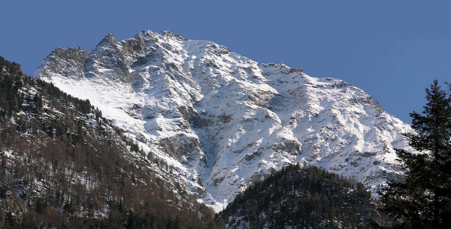 |
Da alpinismo con piccozza, ramponi (in inizio di stagione), corda, casco da roccia, moschettoni e chiodi da roccia.
External Links
- REGIONE AUTONOMA VALLE D'AOSTA the official site.
- FONDAZIONE MONTAGNA SICURA Villa Cameron, località Villard de la Palud n° 1 Courmayeur (AO) Tel: 39 0165 897602 - Fax: 39 0165 897647.
- A.I.NE.VA. (Associazione Interregionale Neve e Valanghe).