Known also as "Becca" of Pechenville (it would be interesting to investigate on the origins, surely more and more ancients, of this picturesque placename), on the crest to W-NW of the Becca of Viou between the Communes of Roisan and Valpelline. The same one, effecting the backtracking or from the Viou to the Roisan, it goes down enough steep, broked through the small rocky and inclined terraces, from the maximum Peak (2.856m) with a linear West crest that divides, in the specific one, the tall basin to Midday above the homonym alps, from a small and bare walloon set to North, contained among the Becca of Viou, Becca of Roisan and the Becca or Tête of Valfreyde or Valfreida, also Tête du Val-Frèide, and in which the ruins are found of a very ancient said Pasture "Les Baraques" (2.383m). The same one, after a first less accentuated small saddle, changes, with course arched direction near to Quota 2.508 meters, that it would be able denominated to be "Becca of Blavy", from the name of the underlying place (1.475m; beautiful small Church in the middle of the little village with fountain and canopy; identifiable in the underlying picture in low and on the border of left). From this point the crest watershed "it races" toward West-northwest and, formed a wide saddle 2.450 meters around (not very useful to the passage in the small Vallon of Valfreyde or Valfredda also Vofreyde and surely frequented in ancient times by the hunters and perhaps from some mountaineer to connect the two opposite alps; see, always, the great picture in First Ascents), and some meaningless rocky protuberances, reach the Becca of Roisan with a brief and small rocky crest. The same, positioned on the axle Sudest/Nordovest between the Communes of Roisan and Valpelline, introduces two small, as well as court, crests and two small rocky faces; her before or Crest East-southeast her "league" to the Quota 2.508 meters, while the second or Crest Northwest, shortly falls on a big wooded-rocky shoulder, overhanging up steep and horrid gorges and dark channels, in direction of the Communes of Doues and Valpelline and the projection of which it constitutes the border among the two Municipalities, from which her "Becca" it is pleasantly admirable (you see photo of emilius). The faces are turned to North on the small Vallon of Val Freida with a precipice of around 130/40 meters steep rocks and routswhat they fall on a grey ground stones above the ruins of the "Baraques" and to South with a brief rocky-stony jump, less steep and of about 120/30 meters, the terminal part of which it straightens him in an uphill street small triangular wall formed by enough good and fit rocks to an amusing draught of rope, for those people whom wanted so to conclude after a good gait/walk. Pleasant trip of beginning and end season allows a good training, what it becomes even more interesting and fatiguing, but also pleasant, in presence of snow, above all if tall. Good panorama on the surrounding mountains, since the small mountain is risen what bow of a ship turns to all her "Coumba Freida" or Valley of the Great Saint Bernard. with the Great Golliaz, the Mount Velan and the Combins, and splendid quick glances on below ancient Aosta Town and towards the Tall Central Valley of Dora Baltea Stream.
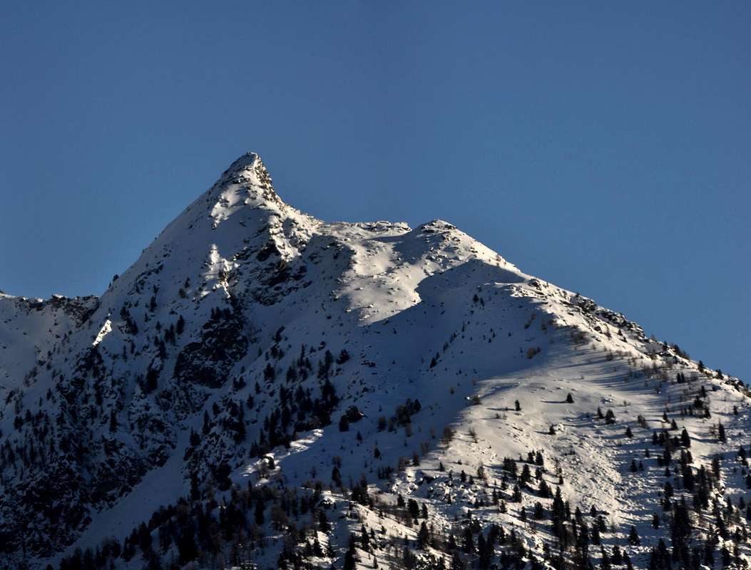
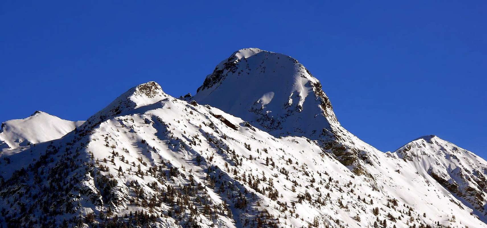
The BECCA of ROISAN (2.546m), with Nortwestern View from the Valley of Great Saint Bernard also called "Coumba Freida", by emilius alias Emilio BERTONA.
Conosciuta anche come Becca di Pechenville (sarebbe interessante indagare sulle origini, sicuramente alquanto antiche, di questo toponimo pittoresco), sulla cresta a W-NW della Becca di Viou, tra i Comuni di Roisan e Valpelline. La medesima, effettuando il percorso a ritroso ovvero dalla Viou alla Roisan, scende abbastanza ripida, spezzata da due piccoli terrazzamenti rocciosi inclinati, dalla Vetta massima (2.856 m) con una cresta Ovest lineare che divide, nello specifico, l'alto bacino a Mezzogiorno sopra le omonime alpi, da un brullo valloncello posto a Settentrione, racchiuso tra la Becca di Viou, la Becca di Roisan e la Becca oppure Testa di Valfreyde o di Valfreida, ed inoltre Tête du Val-Frèide, e nel quale si trovano i ruderi di un antichissimo alpeggio detto "Les Baraques" (2.383 m). La medesima, dopo una prima selletta scarsamente accentuata, cambia, con andamento arcuato direzione nei pressi di una Quota 2.508 metri, che potrebbe essere denominata "Becca di Blavy", dal nome della sottostante località (1.475 m; bella Chiesetta in mezzo al villaggetto con fontanile e tettoia; identificabile nella sottostante foto in basso e sul margine di sinistra). Da questo punto la cresta spartiacque "corre" verso Ovest-nordovest e, formata una larga sella 2.450 metri circa (non molto utile al passaggio nel Valloncello di Valfreyde o Vofreyde e sicuramente frequentato in tempi remoti dai cacciatori e forse da qualche montanaro per collegare le due opposte alpi; vedi, sempre, la foto in grande in First Ascents), ed alcune protuberanze rocciose insignificanti, raggiunge la Becca di Roisan con una breve piccola cresta rocciosa. La stessa, posizionata sull'asse Sudest/Nordovest tra i Comuni di Roisan e Valpelline, presenta due piccole, nonché corte, creste e due paretine rocciose; la prima o Cresta Est-sudest la "lega" alla Quota 2.508 m, mentre la seconda, o Cresta Nordovest, cade brevemente su di una grossa spalla boschivo-rocciosa, soprastante ripide e repulsive gole e tetri canaloni, in direzione dei Comuni di Doues e Valpelline e la proiezione della quale costituisce il confine tra le due Municipalità, dai quali la "Becca" é piacevolmente ammirabile (vedi foto di emilius). Le pareti sono rivolte a Nord sul piccolo Vallone di Val Freida con un dirupo di circa 130/40 metri di rocce ripide e rotte precipitanti su di una grigia pietraia sopra le rovine delle "Baraques" ed a Sud con un breve risalto petroso roccioso, meno ripido e di pressapoco 120/30 metri, la parte terminale del quale si raddrizza in un'erta piccola parete triangolare formata da rocce abbastanza buone ed atte ad un divertente tiro di corda, per coloro che volessero così concludere dopo una buona sgambata. Gita piacevole di inizio e fine stagione permette un buon training, che diventa ancora più interessante e faticoso, ma anche piacevole, in presenza di neve, soprattutto se alta. Ottimo panorama sulle montagne circostanti, poiché la piccola montagna si erge quale prua di una nave rivolta a tutta la "Coumba Freida" o Valle del Gran San Bernardo, con il Grand Golliaz, il Mont Velan ed i Combins, e splendidi colpi d'occhio sulla sottostante antica Città d'Aosta e sull'Alta Valle Centrale del Fiume Dora Baltea.
First Ascents
First climbers: Unknown.
First winter climb: Unknown. Ascensions are known suffered before the beginning and as soon as after the end of the bad season (you see under in "Route").
W-SW Wall of Quota 2.494m and traverse on crest: Ilario Antonio Garzotto and Osvaldo Cardellina, (Apr 11th, 1969), from Blavy Village.
Great Traverse from Becca of Roisan-Quota 2.494m-Becca of Viou-Mount Mary-Chamerod Point-Tête of Arpisson-Quota 2.888m-Senevé Point-Quota 2.945/50 meters about-Tsaat à l'Etsena Western and Eastern Points-Becchi of Fana-Croix of Fana: Osvaldo Cardellina, lone (Oct 11th, 1992), from Blavy Village to Trois Villes Villages.
Getting There & Approach
BY CAR:
From Torino, Milano, etc: Motorway A5. Exit at Aosta East.
PASSING from the STREET ROAD n° 26 to the REGIONAL ROAD to SAINT CHRISTOPHE and the MUNICIPAL to the BLAVY Village.
To the exit of the Motorway tollgate of Aosta East to continue toward the City of Aosta and, immediately after having overcome the Airport Conrad Gex, to turn to the right (North) toward the country of Saint Christophe, Fraction Chief Town (615m). To follow, after having doubled the Church on his right, attentively the poster for the Fraction of Sorreley (790/805m) and, leaving on the right (East) to alternative first for the Fraction of Cort (857m) and continue to the following one of Veynes little Village (834m); to reach i know with direction Northeast to alternative second to the altitude of 1.000 meters around. To still abandon on the right the deviation with poster "Montagne" that it is addressed in the opposite sense toward of Crétallaz-Janceyaz-Morgonaz and Prayon small Villages (1.087m; 1.092m; 1.205m; 1.128m), at the Southern slopes of Mount Mary (2.815m); to keep on climbing instead West way, discarding to the right still (but with North direction) another deviation for the very small Village of Cerisolaz (1.159m), and reaching, to altitude 1.263 meters, the place Chanté de Parléaz or Parleyaz. INTEGRAL EXCURSIONS from FLOOR VALLEY. (* here the paths n° 26/26A as that they also climb respectively from Saint Christophe Commune and from Quart Municipality; beautiful walking/excursions, what they constitute to alternative valid for the one that was interested to integrally effect to trip "naturalistic", with to longer run decidedly and dark surely interesting and such to allow the knowledge of the average hill of the "Adret" (= Southern side or sunny part) of the Central Valley of the River Dora Baltea, as soon as to Northeast of the City of Aosta. Besides for the "purists", or simply for those people who want to lengthen their training, it is possible to also go himself to Blavy from the Commune of Roisan (900 meters around and immediately to North of Aosta, on the road for the Hill of the Gran St. Bernard); in this case to use the dirt road "poderale" (prohibition for the automobiles), that climbs to the Fraction of Champvillair (902m)) and then it is addressed in opposite sense (North) to the Alp Bérrio Némoz (1.141m), but not to reach it. Turning, through always the same one, toward Southeast and through a rather long diagonal among the quotas of 1.150/1.250 meters around to reach the road asphalted for Blavy; not to follow it, on the contrary to take the path n° 25/105, that salt from the Fraction of Aosta of Porossan (707m; possibility therefore to also depart from here) and with this to reach the small village inserting himself for the final part in her "Route". For all these diversified departures and with a varying gradient among the 700/800 meters around, to calculate from 1h'30 to 2h'30 in more; well different the discourse for the winter trips with snow, where the time of route can be more than doubled.) From this point, leaving always in East a last deviation with two dirt roads "poderali" to Voltolanaz Pasture (1.492m) and, below, to another unnamed alp, the town road and always in asphalt, it changes way decidedly bringing itself to North (watching out well because even though asphalted the road it is very narrow and flood of curves, to lot of eposte and protected from to handrail in iron in the line that brings him, with light descent inside the vallon), after having gone beyond in to inclosure-shutting of the same "vallone" the characteristic one and dark even small Village of Parléaz or Parleyaz (1.214m; fountain; lower houses letter Church and buildings of the Napoleonic Era was with to characteristic fireplace to be admired); from this, crossing the fund of the vallon, with the road that goes improving in ampleness and dark with comfortable hairpins road to go up to the Village of Blavy (1.471/5m), site in a splendid and better and better panoramic meadows expanse to the threshold of the wood.
PASSAGGIO dalla STRADA STATALE n° 26 alla STRADA REGIONALE per SAINT CHRISTOPHE ed alla COMUNALE per il Villaggio di BLAVY.
All'uscita del Casello Autostradale di Aosta Est proseguire verso la Città di Aosta e, subito dopo aver superato l'Aeroporto Corrado Gex, svoltare a destra (Settentrione) verso il Paese di Saint Christophe, Frazione Capoluogo (615 m). Seguire, dopo aver doppiato la Chiesa sulla sua destra, attentamente i cartelli per la Frazione di Sorreley (790/805 m) e, lasciando sulla destra (Est) un primo bivio per la Frazione di Cort (857 m), procedere verso la successiva di Veynes (834 m); raggiungere così, con direzione Nordest, un secondo bivio all'altitudine di 1.000 metri circa. Abbandonare ancora sulla destra la deviazione con cartello "Montagne" che si indirizza nel senso opposto verso i piccoli Villaggi di Crétallaz-Janceyaz-Morgonaz e Prayon (1.087 m; 1.092 m; 1.205 m; 1.128 m), alle pendici Meridionali del soprastante Mont Mary (2.815 m); continuare a salire invece verso Ovest, scartando ancora a destra (ma questa volta a Nord) un'altra deviazione per il Villaggetto di Cerisolaz (1.159 m), e raggiungendo a quota 1.263 metri la località Chanté de Parléaz o Parleyaz. GITE/ESCURSIONI INTEGRALI con partenze dal FONDOVALLE. (* Qui giungono anche i sentieri n° 26/26A che salgono rispettivamente dal Comune di Saint Christophe e da quello di Quart; belle passeggiate/escursioni, costituenti una valida alternativa per chi fosse interessato ad effettuar una gita integralmente "naturalistica", con un percorso decisamente più lungo e sicuramente più interessante e tale da permettere la conoscenza della media collina dell'"Adret" (= lato Meridionale o parte soleggiata) della Valle Centrale del Fiume Dora Baltea, appena a Nordest della Città d'Aosta. Inoltre per i "puristi", o semplicemente per coloro che vogliano allungare il loro allenamento, é possibile portarsi a Blavy anche dal Comune di Roisan (900 metri circa e subito a Nord di Aosta sulla strada per il Colle del Gran San Bernardo); in questo caso utilizzare la strada poderale sterrata (divieto per le automobili), che sale alla Frazione di Champvillair (902 m)) e poi si indirizza in senso opposto (Nord) all'Alpe Bérrio Némoz (1.141 m), ma non raggiungerla. Svoltando, tramite sempre la medesima, verso Sudest e per mezzo di un alquanto lungo diagonale tra le quote di 1.150/1.250 metri circa raggiungere la strada asfaltata per Blavy; non seguirla, bensì prendere il sentiero n° 25/105, che sale dalla Frazione di Aosta di Porossan (707 m; possibilità quindi di partire anche da qui) e con questo raggiungere il piccolo villaggio inserendosi per la parte finale nella "Route". Per tutte queste partenze diversificate e con un dislivello variabile tra i 700/800 metri circa, calcolare da 1h'30 a 2h'30 in più; ben diverso il discorso per le gite invernali con neve, dove il tempo di percorrenza può essere più che raddoppiato.) Da questo punto la strada comunale, e sempre in asfalto, cambia direzione portandosi decisamente a Settentrione (facendo bene attenzione, perché, seppur asfaltata, la strada è molto stretta e piena di curve, molto eposte e protette da una ringhiera in ferro nel tratto portantesi, con leggera discesa, all'interno del vallone), dopo aver oltrepassato in una chiusa del valloncello medesimo il caratteristico ed ancora più piccolo Villaggio di Parléaz o Parleyaz (1.214 m; fontana; minuscola Chiesa ed edifici dell'Era Napoleonica, con un caratteristico camino da ammirare); da questo, attraversando il fondo del vallone, con la strada che va migliorando in ampiezza e con più comodi tornanti, salire fino al Villaggio di Blavy (1.471/5 m), sito in una splendida nonché panoramica distesa prativa al limitar del bosco.
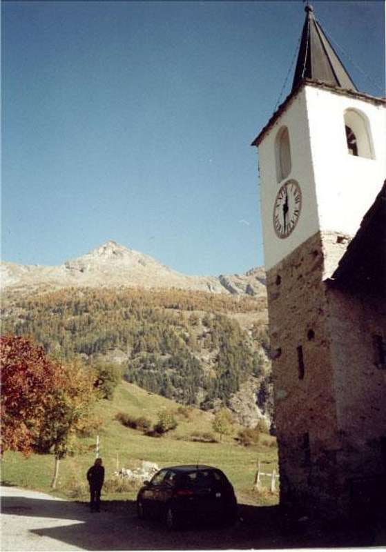
The Little Churc of Blavy Village (1.471/5 meters) & the meadows and forest to Roisan Becca & Viou Becca, by Maulwurf.
From Switzerland: through the Grand Saint Bernard Tunnel or the namesake pass.
From France: through the Mont Blanc Tunnel or Petit Saint Bernard Pass: It is not necessary to take Motorway A5: you can drive on SS.26, in the direction of Aosta.
BY PLANE:
Aeroporto "Corrado Gex" Saint Christophe (Aosta).
Route & Rocky Variant through Quota 2.494m
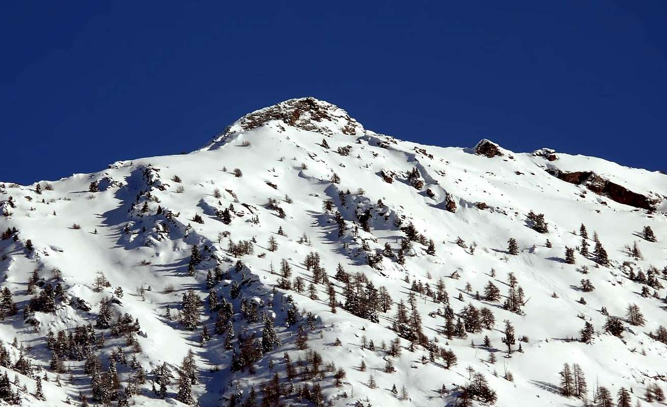
Park at the beginning of the dirt road (which is accessible only to authorized vehicles). Hike along the farm road that leads to the Praperia Pastures (1.737m). To go back immediately through the prairies to Southeast and after behind l'alpine Pasture to an enclosure, taking a path that travels the East-northeast verse forest. To follow the same one for some time but, as soon as above a rudimentary and minuscule "kiosk" equipped to area Pic Nic from the inhabitants of the place, to abandon mostly moving him to it on the left (East and then Northeast). * ROCKY VARIANT by Quota 2.508 meters also "Becca of Blavy" and relative traverse East/West, on crest & new Approach Variant: the same path goes up again almost the whole wood with this last direction going to "to become exhausted himself" in a debris and rubble slope of great "clapeys" (= great boulders), with shed trees, underlying the Wall West-southwest of the Quota 2.508 meters. Along this journey with slope of the same one the ascension of April 1969 happened, as from First Ascents, with relative crossing to nearby Becca of Roisan. He can constitute an alternative "Via", offering the possibility of a short, but enough binding climb, with passages from the II°/III° up to the IV° and with run not forced along to connection of seven alternate small rocky walls to short ledges, fit to training, on good rock discreetly, as well as for a varying gradient among the 120 and the140 meters around, according to where the point of beginning happens. (to calculate 1h'00/1h'15 in more in comparison to the Normal Route; in the first ascension 2h'00 from the Village of Blavy to the Quota 2.508 meters and another half hour for the crossing to Becca of Roisan in crest, always with snow; you see well in the underlying picture, where the small trapezoidal wall is frontally drawn back). * * It exists, besides, a small path of connection, but it is not easy to be individualized and such to ask for good knowledge of the territory, among what it climbs from Blavy toward the impending Pastures of Viou Inferior and Superior. From the point above described, where it mostly folds up him to Northeast, to continue for few thin time to meet the deviation it turns Southeast. The same, crossing in transverse completely the wood to the level of 1.930/2.000 meters around, over it passes the great coast coming from the Quota 2.508 meters and, always with the same sense of march, it reaches the dirt road "poderale" that from Blavy Village reaches the Inferior Alp of Viou (2.062m); just overcome the watershed of the great wooded rib hardly before the virtual border between the Communes of Roisan and Saint Christophe, and dark without trace of path, definitely to abandon the same and to go up again from quota 2.000 meters about, looking for the best journey, among plants, small meadow steep places and rocky blocks in direction of the Quota 2.494 meters, reaching basic the of it, below the two rocky Faces South-southwest and West-southwest. * * * Or directly departing from the Village of Blavy (1.475m) through the path n° 1/25/105 and therefore through a more start in more low level (1.475 meters against 1.737m precedents), but surely more forehand and express, at least towards the Quota 2.508 meters, and surely through path of best quality up to the meeting with the dirt road "poderale". For the conclusive part, or in the small basin among the Becca of Roisan and the aforesaid quota, the characteristics of the anticipated one they are similar entirely. The same one, therefore, can constitute a Variation of Approach, diversified by the departure by the Alp Praperia(z). But returning to our first itinerary of base, gradually to go himself toward a great band of oblique rocks that you direct him toward an a little accented crest, that goes up again up to the inferior extremity of the short West Ridge of the Becca of Roisan. To continue for a little walloon-very steep gorge on large blocks and "clapeys" (= boulders great and broken), in the shape of natural always steep stairway, reaching a small basin of large rocks and some snowcapped, just to the feet of the small as well as steep rocky wall that the mountain allows to fall toward Midday. From the same, and through rotten rocks with grassy and debris slope, easily to go back the final small and short Crest Southeast, on the watershed among Roisan/Valpelline Municipalities, and to travel it until in peak (2h'30/3h'00 from the Praperia(z) Alp).
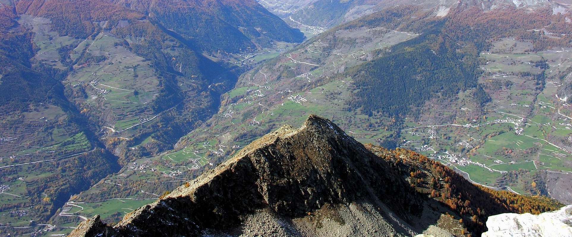
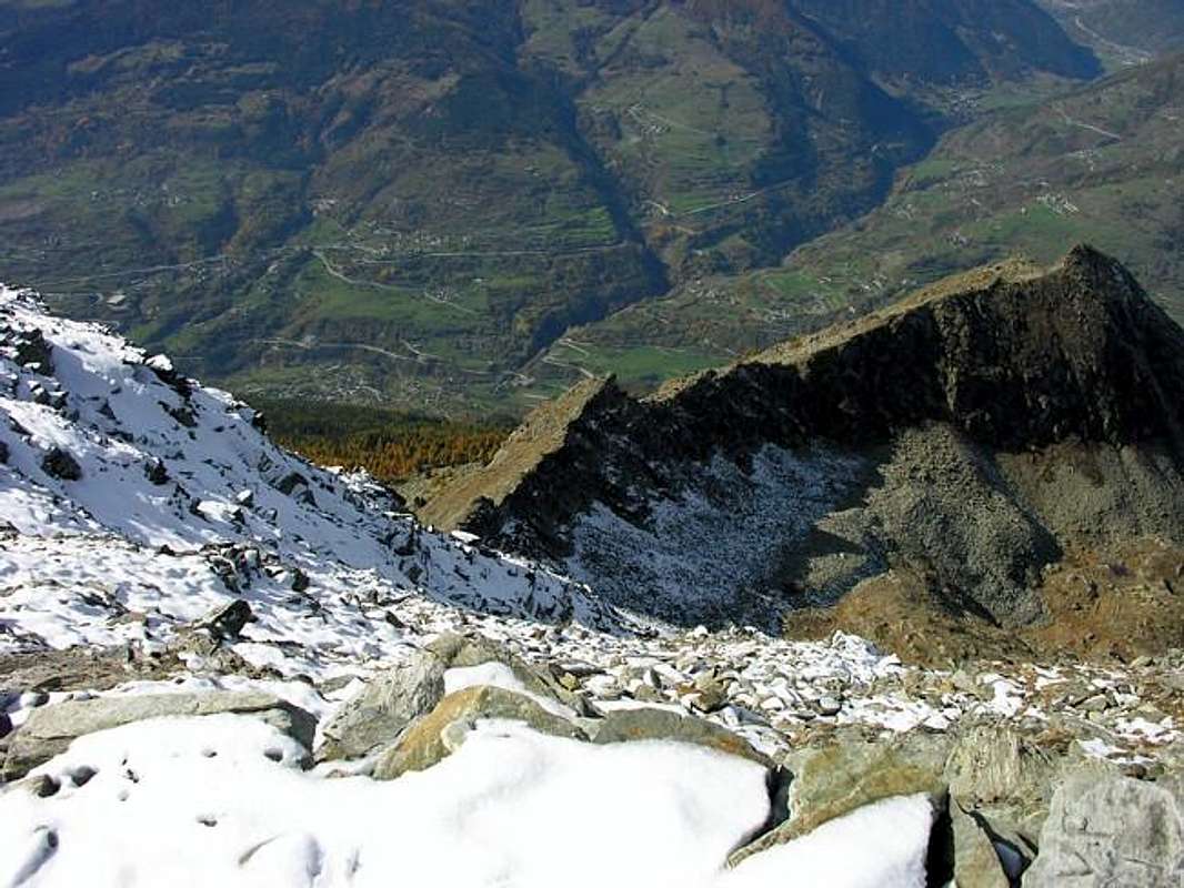
Almost Wintry Ascents on Becca of Roisan (2.546m), in 1968 & 1969, by Ilario Antonio GARZOTTO.
All'inizio della strada sterrata (oltre il traffico è consentito solamente ai mezzi autorizzati) lasciare l'auto e iniziare la salita a piedi lungo la strada sterrata poderale conducente all'Alpeggio di Praperia(z) (1.737 m). Risalire subito dopo dietro l'Alpe, prendendo un sentiero dapprima verso Sudest, attraverso i prati in direzione di una recinzione, e poi percorrente il bosco verso Est-nordest. Seguire il medesimo per un poco di tempo ma, appena al di sopra di un rudimentale e minuscolo "chiosco" attrezzato ad area Pic Nic dagli abitanti del posto, abbandonarlo spostandosi maggiormente sulla sinistra (Est e poi Nordest). * VARIANTE ROCCIOSA tramite Quota 2.508 metri o "Becca di Blavy", con susseguente traversata Est/Ovest sulla cresta, nonché nuova Variante d'Avvicinamento: lo stesso sentiero risale quasi l'intero bosco con quest'ultima direzione andando ad "esaurirsi" in un macereto di grandi "clapeys", con alberi sparsi, sottostante la Parete Ovest-sudovest della Quota 2.508 metri. Lungo questo tragitto con salita della medesima avvenne l'ascensione dell'Aprile 1969, come da First Ascents, con relativa traversata alla vicina Becca di Roisan. Può costituire una via alternativa, offrendo la possibilità di una breve, ma abbastanza impegnativa, arrampicata con passaggi dal II°/III° fino al IV° e con percorso non obbligato lungo un concatenamento di sette muretti rocciosi alternati a piccole cengie, atta ad allenamento, su roccia discretamente buona, nonché per un dislivello variabile tra i 120 ed i 140 metri circa, a seconda di dove e come avviene il punto di inizio. (calcolare 1h'00/1h'15 in più rispetto alla Via Normale; nella prima ascensione 2h'00 dal Villaggio di Blavy alla Quota 2.508 metri ed un'altra mezz'oretta per la traversata alla Becca di Roisan in cresta, sempre con neve; vedi bene nella sottostante fotografia, ove la paretina trapezoidale é ritratta frontalmente). * * Esiste, inoltre, un sentierucolo di collegamento, ma non é facile da individuare e tale da richiedere buona conoscenza del territorio, tra questo e quello che sale da Blavy verso le soprastanti Alpi di Viou Inferiore e Superiore. Dal punto sopra descritto, ove si dispiega maggiormente a Nordest, continuare per poco tempo sino ad incontrare la deviazione rivolta a Sudest. La stessa, percorrendo in traversata completamente il bosco alla quota di 1.930/2.000 metri circa, oltrepassa il costolone proveniente dalla Quota 2.508 metri e, sempre con il medesimo senso di marcia, raggiunge la strada sterrata poderale che da Blavy raggiunge l'Alpe Inferiore di Viou (2.062 m); appena superato lo spartiacque della grande costola boschiva appena prima del confine virtuale tra i Comuni di Roisan e Saint Christophe, e senza più traccia di sentiero, abbandonarlo decisamente e risalire sui 2.000 metri circa, cercando il tragitto migliore, tra piante, piccoli e ripidi spiazzi prativi e blocchi rocciosi in direzione della Quota 2.494 metri o "Becca di Blavy", raggiungendone la base, sottostantemente alle due Paretine rocciose Sud-sudovest e Ovest-sudovest . * * * Oppure partendo direttamente dal Villaggio di Blavy (1.475 m), tramite il sentiero n° 1/25/105, e quindi tramite un avvio più in basso come livello (1.475 metri contro 1.737 precedenti), ma sicuramente più diretto e rapido, almeno nei confronti della Quota 2.508 metri, e sicuramente tramite sentiero di migliore qualità fino all'incontro con la strada sterrata poderale. Per la parte conclusiva, ovvero nel piccolo bacino tra la Becca di Roisan e la quota predetta, le caratteristiche del precorso sono del tutto similari. Il medesimo, quindi, può costituire una Variante di Avvicinamento, diversificata dalla partenza dall'Alpe Praperia(z). Ma ritornando al nostro itinerario di base e primario, gradualmente dirigersi verso una grande fascia di rocce oblique dirigentesi verso un'appena accentuata crestina, che risale in fin dell'estremità inferiore della corta Cresta Ovest della Becca di Roisan. Proseguire per un valloncello-canalone molto ripido su grandi blocchi e "clapeys", formanti una naturale ed altresì ripida scalinata, raggiungendo una piccola conca di grandi macigni ed alcuni nevati, proprio ai piedi della piccola nonché ripida parete rocciosa, che la montagna lascia cadere verso Mezzogiorno. Da questa, e tramite un pendio di roccette rotte con erba e detriti, risalire alla Crestina Sudest finale, sullo spartiacque dei Comuni di Roisan/Valpelline, e percorrerla fino in vetta (2h'30/3h'00 dall'Alpe Praperia(z).
Difficulties
For the Standard Route: EE/A/F+, with brief passages of I° in final crest.
Per la Via Normale:EE/A/F+, con brevi passaggi di I° sulla crestina finale.
For the Variant on W-W Wall of Quota 2.508m with final crossing: A/ from D+ to D-, through short passages of II°/II°+/III° and IV°-, relatively to privileged route on rock through the small seven rocky jumps (see picture over).
Per la Variante sulla Paretina O-SO della Quota 2.508 m e relativa traversata finale in cresta:A/ dall'AD+ al D-, tramite passaggi corti di II°/II°+/III° and IV°-, a seconda dell'itinerario scelto in roccia attraverso i sette piccoli risalti rocciosi (vedi foto sopra).
Equipment
Normal hiking equipment. A short rope is recommended for the ridge if there is snow or ice (generally in the fall Autumn or in the beginning of wintry season or at the end of Winter).
Equipaggiamento normale da Escursionismo: Una corda corta oppure un cordino sono consigliabili qualora vi fosse presenza di neve o ghiaccio (in genere in tardo Autunno ed all'inizio dell'Inverno oppure al termine del medesimo).
Campings
Remember that free camping is forbidden (except for emergency reasons, over 2.500m, from darkness until dawn).
Mountain Condition
Meteo: you can find all the needed informations at the official site of the Valle d'Aosta Region:
"Guida della Valpelline" de l'Abbè Joseph-Marie Henry - Societè Editrice Valdotaine 1925 II Edition e Collana Reprint Musumeci (1986).
"Guida dei Monti d'Italia - Alpi Pennine (Vol.2)" di Gino Buscaini - Club Alpino Italiano/Turing Club Italiano, Luglio 1970 (In Italian).
"80 itinerari di Escursionismo Alpinismo e Sci Alpinismo in Valle d'Aosta", di Osvaldo Cardellina, Ed. Musumeci, Giugno 1977 (in Italian); seconda Ed. Luglio 1981; terza Ed. Luglio 1984; (in French), prima Ed. Febbraio 1978; seconda Ed. Marzo 1980.
"Dove andiamo in montagna? in Valle d'Aosta" di Domenico Caresio Edit. Tipografia Ferraro Ivrea, Marzo 1996.
"Ascensioni 1964-1969" Diario Alpinistico di Ilario Antonio Garzotto (unpublished).
"Diari Alpinistici" di Osvaldo Cardellina e Indice Generale accompagnato da Schedario Relazioni Ascensioni 1964-2021 (unpublished).
Parents refers to a larger category under which an object falls. For example, theAconcagua mountain page has the 'Aconcagua Group' and the 'Seven Summits' asparents and is a parent itself to many routes, photos, and Trip Reports.

 8223 Hits
 81.84% Score
 14 Votes