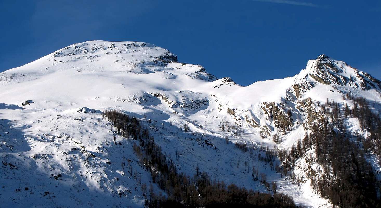
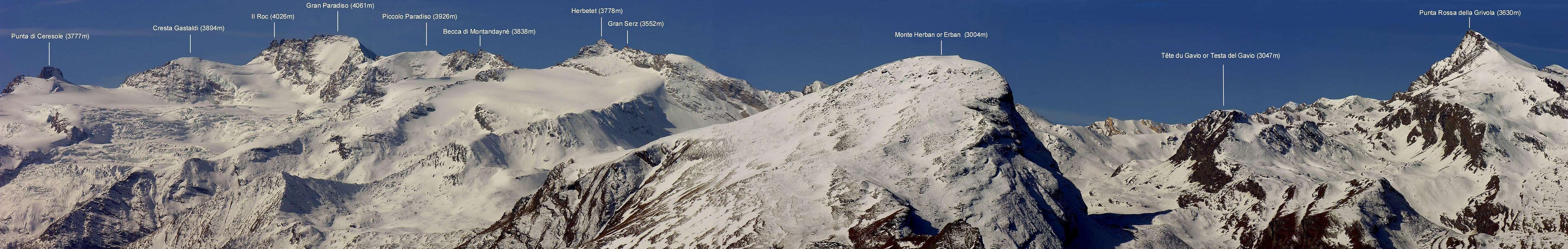
Roundish mountain. Fine point of observation on Cogne and its well known Sant'Orso Plain, from its summit an exceptional panoramic view of the close Grivola and Gran Paradiso Massif.
Montagna tondeggiante, ottimo punto di osservazione su Cogne e la sua rinomata piana di Sant'Orso, dalla sua vetta si gode un panorama eccezionale sulla Grivola e sul massiccio del Gran Paradiso.
First Ascents
First on the summit: Unknown.
In winter: Unknown.
Getting There
BY CAR:
From Torino, Milano, etc: Motorway A5. Exit at Aosta Ovest. Drive to the near Aymavilles. Follow the directions for Valle di Cogne.
From Switzerland: through the Grand Saint Bernard Tunnel or the namesake Pass. Drive to Aosta, then follow the direction for Courmayeur on SS.26. Just after Sarre, turn to the left, in the direction of Valle di Cogne.
From France: through Mont Blanc Tunnel or Petit St. Bernard Pass. It isn't necessary to take Motorway A5: you can drive on SS.26, in the direction of Aosta.Before arriving at the Village of Sarre, turn right following the sign for Valle di Cogne. After Aymavilles, the SR.47 crosses the Villages of Vieyes, Epinel and Cretaz and after about 25 Km arrives at Cogne (1.534m).
BY PLANE:
Aeroporto "Corrado Gex" Saint Christophe (Aosta).
Route
From the small built up area of Cretaz (1.499m), cross the two bridges over the Gran Eyvia and on the Valnontey Stream. On along the path in the wood and, after passing the sign of the Parco Nazionale del Gran Paradiso border, walk slightly to the right up to the Alpeggio di Les Ors (1.944m). To continue along the vallone of Vermiana up to the alternative that brings to the Colle della Rossa, to reach the small pass to SE (2.434m) that it separates the Point the Ouille (2.521m) from the oriental crest that goes down from the Herban Mountain. From this point to go up again the steep pastures and with intuitive run to reach the peak.
Dalla piccola frazione di Cretaz (1.499 m), nel Comune di Cogne, oltrepassare i due ponti uno sulla Gran Eyvia e uno che scende dal torrente della Valnontey. Risalire il sentiero che si inoltra nel bosco e superato il cartello che segnala i confini del Parco Nazionale del Gran Paradiso proseguire leggermente sulla destra sino a raggiungere l'Alpeggio di Les Ors (1.944 m). Continuare lungo il vallone di Vermiana fino al bivio che porta al Colle della Rossa, raggiungere il piccolo colle a SE (2.434 m) che separa la Punta l'Ouille (2.521 m) dalla cresta orientale che scende dal Monte Herban. Da questo punto risalire i ripidi pascoli e con percorso intuitivo raggiungere la vetta.
Within the borders of the P.N.G.P. (Parco Nazionale del Gran Paradiso), at the moment (summer 2004), dogs generally are not allowed, except on a couple of trails, and camping is forbidden (except for climbers from sunset till dawn). No fees are due.
Books and Maps
BOOKS:
"Guida dei Monti d'Italia-Gran Paradiso Parco Nazionale" E. Andreis, R. Chabod, M. C. Santis, Club Alpino Italiano/Touring Club Italiano, prima Ed. 1939; seconda Ed. 1963; terza Ed. 1980.
"Diari Alpinistici" di Osvaldo Cardellina e Indice Generale accompagnato da Schedario Relazioni Ascensioni 1964-2019 (inediti).
MAPS:
Kompass "Gran Paradiso Valle d'Aosta Sentieri e Rifugi" Carta Turistica 1:50.000.
Enrico Editore Ivrea-Aosta "Gruppo del Gran Paradiso" 1:50.000.
I.G.C. Istituto Geografico Centrale "Il Parco Nazionale del Gran Paradiso" 1:50.000.
L'Escursionista "Valle di Cogne Carta dei Sentieri" (n° 10) 1:25.000.
L'Escursionista "Tour de la Vallée de Cogne Grand Paradis" 1:25.000.
Parents refers to a larger category under which an object falls. For example, theAconcagua mountain page has the 'Aconcagua Group' and the 'Seven Summits' asparents and is a parent itself to many routes, photos, and Trip Reports.

 4986 Hits
 81.84% Score
 14 Votes