Small but acute rocky pyramid that emerges, after the massive Rosa of the "Benches" (Roizà or in ancient local "patois" language and Banchi or Bantses or with rocky great slabs), from the Rosa Pass between the Piedmont and the Valley of Aosta; really from this, surely and also mostly known and frequented, although there is no great differences in height in existence. Despite the appearances and to a first analysis effected by the lower part, reserve surprises for the mountain climber, being everything less that banal or simple her slope, especially in presence of snow. The quality of the rock, doesn't allow always unfortunately, because of her brittleness, to pleasant, even if brief climb forcing to continuous and officer attention. Interesting from the Peak the pursuance on the crest watershed toward West-northwest crossing the small Point Joseph Corona (2.992m) and reaching the Balma Pass (2.941m), center of ancient transits entirely abandoned by now almost by the inhabitants of the valleys and, wanting, also the nearby Peradzà Summit (3.021m), topographical knot among the Valleys of Campiglia Soana, Cogne and Champorcher; by Péradza you can finally reach the Saddle (2.948m) and descend directly from this toward the path that leads down to Lake Miserin (2.578m) by completing a beautiful circular tour from Dondena Dondena with a climb along the Walloon of Bantses and down through the Miserin Valley, with its Sanctuary and Refuge. Beautiful the glimpses on the a lot of neighbor Rosa dei Banchi (3.164m), on the duo Mounts Glacier-Delà, on Punta Tersiva and unusual the views on the Oriental Graian Alps, in direction of the Piedmont. But it is above all verse Southwest and West that the sight spaces in direction of the near Tower of Lavina (3.308m), around three Levannes to Piedmont, toward the Subgroup of the Chain of Apostles on which the Tower of Great Saint Peter (3.692m) dominates, on the whole Chain of the Great Paradiso from the maximum Peak (4.061m) up to her "Ardua Grivola Bella" (3.969m).
Piccola ma "acuta" piramide rocciosa emergente, dopo la massiccia Rosa dei Banchi, dal Colle della Rosa tra il Piemonte e la Valle d’Aosta; proprio da questa, sicuramente anche maggiormente conosciuta e frequentata, benché non vi siano grandi differenze d'altezza, viene alquanto ridimensionata. Nonostante le apparenze e ad una prima analisi effettuata dabbasso, riserva sorprese per l'alpinista, essendo tutto men che banale o di semplice salita, soprattutto in presenza di neve. La qualità della roccia purtroppo, a causa della sua elevata fragilità, non consente un'arrampicata sempre piacevole, anche se breve, costringendo ad una continua e vigile attenzione "assaggiando" costantemente appigli ed appoggi. Interessante dalla Vetta il proseguimento sulla cresta spartiacque verso Ovest-nordovest attraversando la piccola Punta Giuseppe Corona (2.992 m) e raggiungendo il Col de la Balma (2.941 m), sede di antichi transiti ormai quasi del tutto abbandonati dai valligiani e, volendo, anche la vicina Cima di Peradzà (3.021 m), importante nodo topografico tra le Valli di Campiglia Soana, Cogne e Champorcher. Dalla Peradzà si può infine facilmente ed in breve tempo raggiungere la larga Sella (2.948 m) e da questa scendere verso Est direttamente sul sentiero conducente al piccolo delta antecedente il Lago Miserin (2.578 m) completando in siffatta maniera uno splendido tour circolare da Dondena a Dondena con salita lungo il Vallone dei Banchi e discesa per mezzo di quello del Miserin, con i suoi Santuario e Rifugio. Certamente questa traversata risulta più gratificante nonché suggestiva rispetto alla salita tramite un singolo vallone. Belli i colpi d'occhio sulla molto vicina Rosa dei Banchi (3.164 m), sul binomio Glacier-Delà, sulla Punta Tersiva ed inconsuete le vedute sulle Alpi Graie Orientali, in direzione del Piemonte. Ma é soprattutto verso SO ed O che la vista spazia in direzione della vicina Torre di Lavina (3.308 m), sulle tre Levanne in direzione del Piemonte, verso il Sottogruppo degli Apostoli sui quali troneggia la Torre del Gran San Pietro (3.692 m), sull'intera Catena del Gran Paradiso dalla Vetta massima (4.061 m) fino all'"Ardua Grivola Bella" (3.969 m).
First Ascents
First on the summit: Unknown.
In winter: Unknown.
North Face: Osvaldo Cardellina and Emilio Bertona, (Jul 22th, 2007), in day from Dondena Village through Bantses Western Valley and Glacier.
East Crest (Integral on edge from Rosa Pass): Osvaldo Cardellina and Emilio Bertona, (Jul 22th, 2007), after the descent through Normal.
Complete traverse from Bantses Valley towards Rosa Pass–Asgelas Summit–Corona Point–Balma Pass–Peradzà Point–Saddle 2.946m-Miserin Lake: Osvaldo Cardellina and Emilio Bertona, (Jul 22th, 2007), in day from Dondena.
Getting There
BY CAR:
From Torino, Milano, etc: Motorway A5. Exit Pont Saint Martin for then to continue on SS.26 toward Hone Bard.
From Switzerland: through the Grand Saint Bernard Tunnel or the namesake pass. Drive to Aosta, Verrès and Hone Bard.
From France: through Mont Blanc Tunnel or Petit Saint Bernard Pass. It isn't necessary to take Motorway A5: you can drive on SS.26, in the direction of Aosta and Verrès and Hone Bard.
BY PLANE:
Aeroporto "Corrado Gex" Saint Christophe (Aosta).
Approach of base
If you take the motorway, exit in Pont San Martin and follow the direction Aosta along the normal route; take care after Donnas: right side, immediately after the village, you can see approx. 100 meters of the roman consular road and a nice arc. A few hundreds meters after the fort there is a bridge left side, over the Dora Baltea River, with the indication Champorcher; follow it. Drive a few km, till the village of Chateau, and look right side for the indication Petit Mont Blanc. Follow this road, not too large, for a lot of km. Part is asphalted, the most part no. Usually the conditions of this second part are good, ask in the area. Follow this road till Dondena Village. At the end a sign forbids the traffic after the parking; there are 3/4 parking area, but the road is steep and demaged. Take care and park in the upper one. When you start walking, you will find a table with the indications, and the map of the area. Come down left till the Torrent Ayasse, pass over the small bridge and along the road shortly time arrive to the Refuge of Dondena (2.097m;0h'15 from Parking).
Con l'Autostrada Torino-Aosta ed uscita al Casello di Pont Saint Martin; continuare sulla SS per Aosta (un centinaio di metri dopo il centro di Donnas ed a destra sull'attigua strada consolare romana si può ammirare un bel arco nella roccia); non molto più avanti si incontra il Forte di Bard, famoso per la resistenza effettuata conto l'Armata di Napoleone, e, tramite un ponte sulla Dora Baltea, passare sul lato opposto della medesima in direzione del centro di Hone (cartelli indicatori per la Valle di Champorcher). Percorrere tutta la strada regionale della vallata e, dopo il Comune di Pont Bozet, raggiungere quello di Champorcher in località Chateau. Voltando a destra sulla piazza centrale continuare verso i Villaggi di Mont Blanc e Petit Mont Blanc in stretta strada in asfalto e, successivamente, sulla strada sterrata costituente la ex Strada Reale per Dondena, generalmente in discrete condizioni. Raggiunto il Parcheggio con divieto di proseguimento per i mezzi e con abbondante segnaletica tramite panneaux, cartelli e mappe, scendere brevemente verso il Torrente Ayasse, presso una caratteristica casa contro un roccione. Oltrepassarlo tramite un ponticello e continuando con alcuni tornanti sulla poderale, in breve tempo pervenire al Rifugio di Dondena (2.097 m0h'15 dal Parcheggio).
Approach through Miserin Valley
From Dondena Village (2.110m) to come down the small bridge on the Torrent Ayasse, nearby in a characteristic house because built against a great rock, for the old real road and path before signed n° 7B/7C High Route n° 2 and after exclusively through the earth road n° 7B High Route n° 2 to reach the Lake Miserin with Hut and ancient Santuario della Vergine Maria of the Snow (2.582m; 1h'30), passing through the Dondena Shelter (2.097m, see above "Approach of Base"). From the Lake it travel in South direction, for small gravelly and morainic valleys and transiting from the Lac Gelé (2.767m), the path for the "Colle della Rosa" (2.957m; 2h'30/3h'30 from Dondena Village).
Dal Villaggio di Dondena (2.110 m) scendere al piccolo ponte sul Torrente Ayasse, vicino ad una casa caratteristica perché costruita contro una grande roccia, per la vecchia strada reale e sentiero siglato dapprima n° 7B/7C Alta Via n° 2 ed in seguito solamente tramite la strada poderale n° 7B Alta Via n° 2 raggiungere il Lago Miserin con Rifugio ed antico Santuario della Madonna della Neve (2.582 m; 1h'30), passando dal Rifugio di Dondena (2.097 m, vedi sopra "Avvicinamento di Base"). Dal Lago percorrere in direzione Sud, per valloncelli detritico-morenici e transitando dal Lac Gelé (2.767 m), il sentiero per il Colle della Rosa (2.957 m; 2h'30/3h'30 dal Villaggio di Dondena).
Approach through Vallone dei Banchi
From Dondena (2.110m) to go down to the small bridge on the Torrent Ayasse for the old Real Road in earth to reach the Shelter of Dondena (you see above "Basic Approach"). From this, leaving on the right (West) the earth road for the Miserin or path n° 4/7, to cross in South direction and always through groundroad that addressed to the Alps Pendent; to alternative the 2.220m to abandon on the left (Southeast) also this, continuing the slope with the path n° 6C, that it forwards him in the Vallon des Bantses along the Torrent of the Roèse. The same disappears near the Quota 2.520m; to continue then for small debris and with rubbles valleys, to overcome a beautiful series of slabs smoothed by the glacier and to reach the same. Revolving it on the right for a small and narrow mountain range, it is reached in path n° 7, coming from the Lake Miserin, really under the hill; through a last diagonal toward left in the middle of rotten rocks or snowfields, and by a final passage that asks for prudence, cause a slab in unstable balance (I°+/II°-), he escapes on the narrow carving of the Rosa Pass (2.957m; little Virgin's Mary statue and "salle à manger" with a terrace under a great boulder; 2h'30).
Da Dondena (2.110 m) scendere al piccolo ponte sul Torrente Ayasse per la vecchia Strada Reale e raggiungere il Rifugio di Dondena (vedi sopra "Basic Approach"). Da questo, lasciando sulla destra (O) la poderale per il Miserin o sentiero n° 4/7, percorrere in direzione sud e sempre tramite interpoderale quella indirizzata alle Alpi Pendent; al bivio 2.220 m abbandonare sulla sinistra (SE) anche quest'ultima, continuando la salita con il sentiero n° 6C che si inoltra nel Vallon des Bantses, lungo il Torrent de la Roèse. Lo stesso scompare nei pressi della Quota 2.520 m; continuare allora per piccoli valloni detritici, superare una bella serie di lastroni levigati dal ghiacciaio e raggiungere lo stesso. Aggirandolo sulla destra per una piccola, nonché stretta giogaia, si raggiunge in sentiero n° 7, proveniente dal Lago Miserin, proprio sotto il colle; con un ultimo diagonale verso sinistra in mezzo a rocce marce, oppure nevai, e con un passaggio finale che richiede prudenza, causa un lastrone in bilico (I°+/II°-), si fuoriesce sullo stretto intaglio del Colle della Rosa (2.957 m; piccola statua della Madonna e "salle à manger" con terrazzo sotto un gran roccione; 2h'30).
Routes from Rosa or Balma Passes also on North Face
From the pass to go up again the E Crest or By Normal; the same one is short but more binding than you are not thought, cause also the friability of the rock that, in many points, curtains to flake off herself. Two possibilities of run are offered:
1)- mostly holding himself to South under the crest and overcoming the same one with a ledge and following small wall, characteristic for so many small holes, on the Piedmont slope of Campiglia Soana (II°, delicate; non good rock); it follows another more binding passage on few grips (III°) or staying more to South for a fireplace (II°+). With other less binding passages the Peak is reached with little fellow (PD/PD+; 0h'30 from the pass).
2)- slightly going up again integrally on the thread of crest with best rock, more interesting passages but also mostly binding. To begin with a first tower (III°) and to continue on the rock with great horizontal breakings that you are directly overcome (also IV°) or they wander on the right, after a brief descent to North; to rejoin him to the preceding itinerary and through this to finish to the Peak (AD-/AD+; 1h'00/1h'30 from the pass). This way is more difficult and fun, but unfortunately the rock is not always good.
3)- From the Balma Pass (2.936m), reached by way of the Lake Miserin through its namesake valley, climbing through the long Ridge Northwest encountering on route at first a small rock wall before not long the scarcely evident Punta Giuseppe Corona (2.991m; much more marked on the Piedmont side). Going easy on the ridge or just below moving to the North you reach a tooth of rock that rises on its edge (III°-/III); you arrive, not far from the Summit, a small wall with polished rock that hovers in the North (II°-) or you deal directly with Southern exposure (III/III+). The final part is made up of large blocks that are overcome with funny "ginkana" (PD-/PD+, route much discontinous; 1h'00/1h'15 from Balma Pass; 3h'00 from Miserin Lake). Among the four exposed, this is certainly the route safer and therefore recommended.
4)- Is also possible to climb via the North Face through a small wall that falls into the partition between the two valleys (Bantses/Miserin); the same is directed towards the most Western edge of Glacier of Banchi, just above the trail that climbs the Rosa Pass. This is formed by a broad and steep slope about 250 meters of broken blocks divided in turn in the last 100 meters from a rocky small spur of rocks more compact, but covered with a lot of material suspended; another small crest directed more toward the Northwest breaks in two this side that in this last direction declines with lower steepness. The climbing is made along the vertical from the squared characteristic rock which forms the Top, with exit out immediately left on Eastern Crest. Climb enough difficult and dangerous and unwise in the last part; definitely not recommended; is reported only for the purpose of completeness of information (AD/AD+; 1h'30/2h'00 from the base on the glacier).
Descent: on the same route by route n° 1, also with subsequent traverse on Northwest Crest to Balma Pass and relative descent to Miserin Lake, Sanctuary and Shelter.
Standard Route from Bantses Glacier towards Rosa Pass with East Crest (Via n° 1, under the thread) and climbing on edge (Via n° 2)
Dal colle risalire la Cresta Est o Via Normale; la stessa è corta ma più impegnativa di quanto non si pensi, causa anche la friabilità della roccia che, in molti punti, tende a sfaldarsi. Vengono offerte due possibilità di percorso:
1) - tenendosi maggiormente a Mezzogiorno sotto la cresta e superando la stessa con una cengia e successiva paretina, caratteristica per tanti piccoli buchi, sul versante piemontese di Campiglia Soana (II°, delicato; roccia non buona); segue un altro passaggio più impegnativo su pochi appigli (III°), oppure restando più a Sud per un camino (II°+). Con altri passaggi meno impegnativi si raggiunge la Vetta con ometto (PD/PD+; 0h'30 dal colle).
2) - risalendo integralmente sul filo di cresta con roccia leggermente migliore, passaggi più interessanti ma anche maggiormente impegnativi. Iniziare con un primo torrione (III°) e continuare su della roccia con grandi spaccature orizzontali che si superano direttamente (anche IV°) o si aggirano sulla destra, dopo una breve discesa a Nord; ricongiungersi all’itinerario precedente (AD-/AD+; 1h'00/1h'30 dal Colle della Rosa). Questa via é più difficile e divertente, ma la roccia purtroppo non é sempre buona.
3) - Dal Colle della Balma (2.936 m), raggiunto con la via del Lago Miserin attraverso l'omonimo vallone, risalire tramite la lunga Cresta Nordovest incontrando un primo muretto di roccia rotta che precede di non molto la poco evidente Punta Giuseppe Corona (2.991 m; molto più marcata sul versante piemontese). Continuando facilmente sul filo di cresta od appoggiando appena sottostantemente a Nord si raggiunge un dente roccioso che si sale sul suo spigolo (III°-/III°); si arriva, non lontano dalla vetta, ad una paretina con roccia levigata che si aggira a Nord (II°-) oppure s'affronta direttamente con esposizione a Sud (III°/III°+). La parte finale é costituita da grandi blocchi superabili con divertente "ginkana" (PD-/PD+, alquanto discontinuo; 1h'00/1h'15 dal Colle della Balma; 3h'00 dal Lago Miserin).Tra i quattro esposti, é questo l'itinerario più sicuro e quindi raccomandabile.
4) - é inoltre possibile salire tramite il Versante Settentrionale per mezzo d'una piccola parete che cade verso il divisorio tra i due valloni (Bantses/Miserin); la stessa é rivolta verso il bordo più Occidentale del Ghiacciaio dei Banchi, proprio al di sopra del sentiero risalente al Colle della Rosa. Questa é formata da un largo e ripido pendio di circa 250 metri di blocchi rotti diviso a sua volta negli ultimi 100 metri da una costolina rocciosa di rocce più compatte, ma con molto materiale in sospeso; un'altra piccola cresta rivolta più verso Nordovest spezza in due questo versante che in questa ultima direzione declina con minor ripidezza. La salita avviene lungo il primo sulla verticale del caratteristico masso squadrato costituente la Sommità, uscendo subito a sinistra sulla Cresta Orientale. Salita non facile nell'ultima parte e pericolosa, nonché sconsigliabile; viene segnalata esclusivamente a scopo di completezza di informazione (AD/AD+; 1h'30/2h'00 dalla base sul ghiacciaio).
Discesa: lungo la stessa via di salita n° 1, oppure con susseguente traversata sulla Cresta Nordovest al Colle della Balma e discesa verso il Lago, Santuario e Rifugio del Miserin.
Exit out from Northern Face on East Crest (Via n° 4) and outline right Northwest Ridge, or recommended route (Via n° 3)
Difficulty
These routes can be considered from PD up to AD+, according to the select run.
Gli itinerari descritti sono da classificardi da PD sino a AD+, a seconda del percorso scelto.
Equipment
Standard mountaineering equipment with rope.
Da alpinismo con corda.
Huts
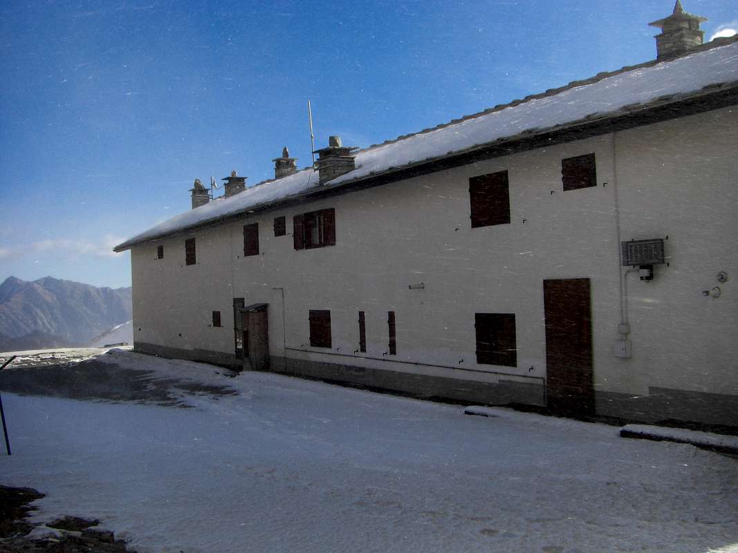
Refuge Dondena (2.186m). Difficulty: T. Sleeps 80 (in winter it sleeps -). Internet:Rifugio DONDENAEmail: info@rifugidellarosa.it
Campings
There are plenty of camping sites along the Gran Paradiso valleys. Remember that free camping is forbidden (except for emergency reasons, over 2.500m, from darkness until dawn).
Mountain Conditions
You can get meteo information at the official site of the Regione Valle d'Aosta:
"Guida delle Alpi Occidentali" di Giovanni Bobba e Luigi Vaccarone C.A.I. Sezione di Torino Volume II (parte II), 25 Maggio 1896.
"Guida dei Monti d'Italia–Emilius Rosa dei Banchi Parco del Mont Avic" di Giulio Berutto e Lino Fornelli-Club Alpino Italiano/Touring Club Italiano, Marzo 2005 (in Italian).
"I Rifugi della Valle d'Aosta" di Stefano Ardito, Ed. Guide iter, Febbraio 2003.
"Diari Alpinistici" di Osvaldo Cardellina e Indice Generale accompagnato da Schedario Relazioni Ascensioni 1964-2019 (inediti).
MAPS:
Enrico Editore Ivrea-Aosta "Gruppo del Gran Paradiso" 1:50.000.
I.G.C. Istituto Geografico Centrale Torino "Ivrea Biella e Bassa Valle d'Aosta" (n° 9), 1:50.000.
L'Escursionista "Valle di Cogne Carta dei Sentieri" 1:25.000.
Parents refers to a larger category under which an object falls. For example, theAconcagua mountain page has the 'Aconcagua Group' and the 'Seven Summits' asparents and is a parent itself to many routes, photos, and Trip Reports.

 5216 Hits
 84.27% Score
 18 Votes