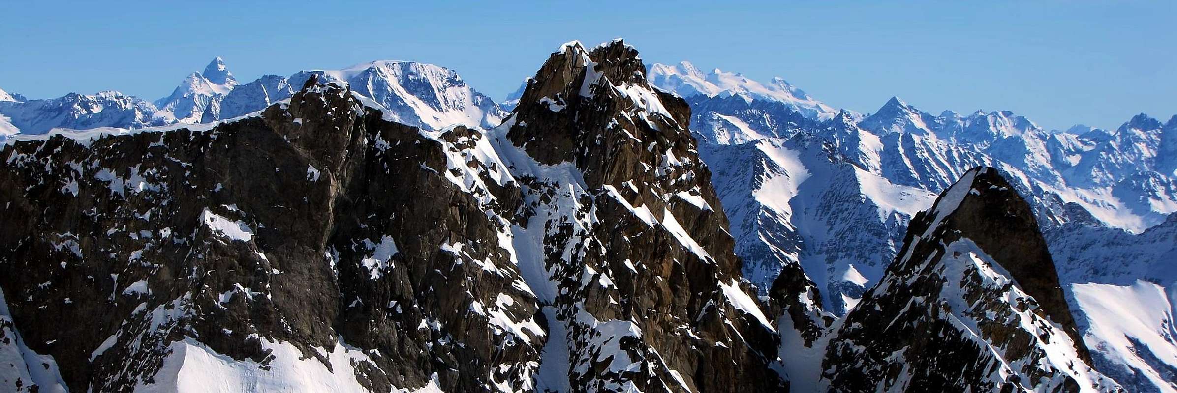
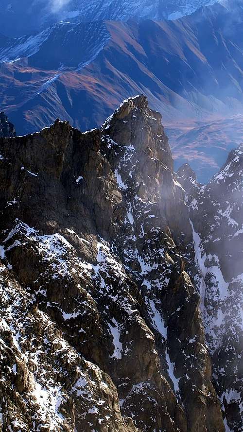
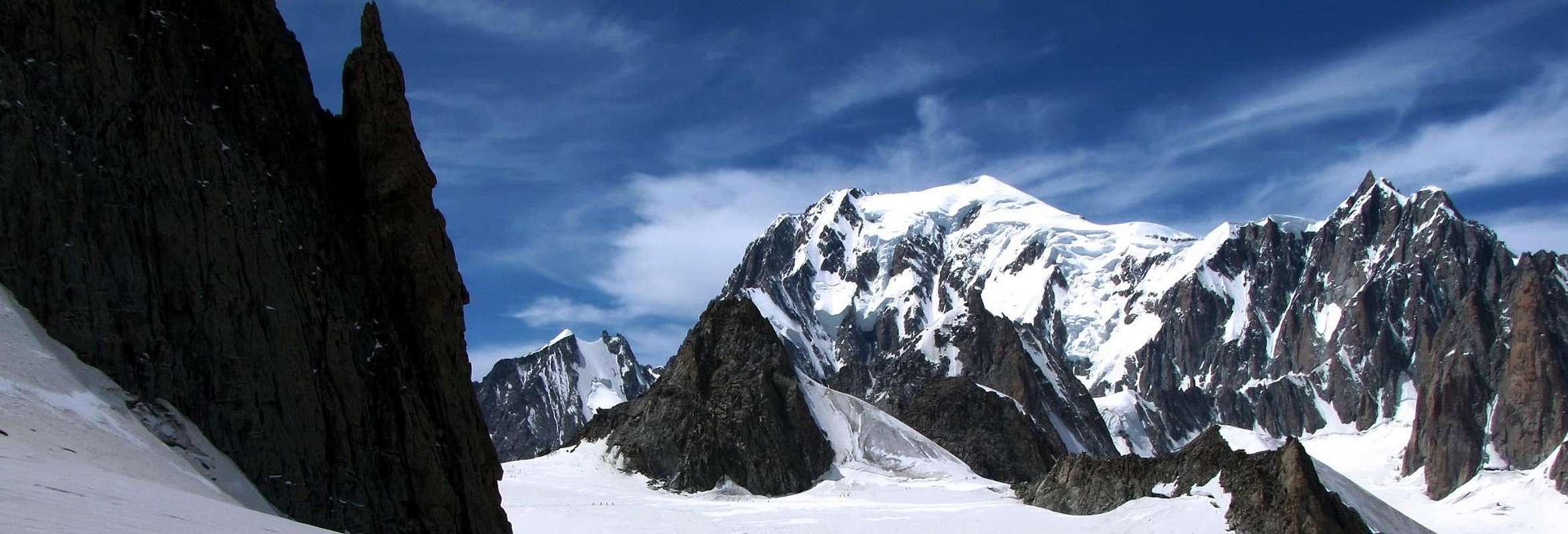
The crest of border Italian-French that from the Great Flambeau (3.566m), after having formed in succession the Point Helbronner (3.462m), the Gigante Pass (3.365m), the two Aiguilles Marbrées (South Point 3.483m; North Point 3.535m) and the of Rochefort Pass (3.387m), it connects him to the Jag of the Giant (4.013m) it projects verse South-southeast of the Marbrées a secondary buttress, action to separate on the slope of the Aosta Valley the small Glacier du Mont West Fréty from that wider than Rochefort to East. This granite rocky spur draws origin from a small saddle suffered to South of the Point South of the same and, after a brief descent, it raises again him forming at first the Tower or Mount de Jetoula (said also Jethoula) and the homonym Dent (3.306m), game rocky spike well in seen by the tourist center of Courmayeur (1.200/250m around). Enough popular top to the times of the classical mountaineering and on which the guides of Courmayeur conducted their clients, he has currently fallen in disuse, since supplanted by the mass for the most famous and equipped Dente of the Giant; currently to frequent a team has remained her reduced of "cristallier" (crystal/glass digger) to the search of mineral and some lean rope of mountain climber. Unusual sights on the Chain of the Mount Blanc and splendid glimpses on the aerial Ridge of Rochefort that from the Tooth it connects him to the splendid Grandes Jorasses.
La cresta di confine italo-francese, che dal Grand Flambeau (3.566 m), dopo aver formato in successione la Punta Helbronner (3.462 m), il Colle del Gigante (3.365 m), le due Aiguilles Marbrées (Punta Sud 3.483 m; Punta Nord 3.535 m) ed il Col de Rochefort (3.387 m), si collega al Dente del Gigante (4.013 m) proietta verso S-SE delle Marbrées un contrafforte secondario, atto a separare sul versante valdostano il piccolo Glacier du Mont Fréty ad Ovest da quello più esteso di Rochefort ad Oriente. Questo granitico sperone roccioso trae origine da una piccola sella subito a Meridione della Punta S delle stesse e, dopo una breve discesa, si rialza formando dapprima la Tour o Mont de Jetoula (detta anche Jethoula) e l'omonima Dent (3.306 m), ardito spuntone roccioso ben in vista dal centro turistico di Courmayeur (1.200/250 m~). Cima abbastanza popolare ai tempi dell'alpinismo classico e sulla quale le guide di Courmayeur conducevano i loro clienti, è attualmente caduta in disuso, poiché soppiantata dalla massa in favore del più celebre ed attrezzato Dente del Gigante; attualmente a frequentarla è rimasta una schiera ridotta di "cristallier" alla ricerca di minerali nonché qualche sparuta cordata di alpinisti. Viste inconsuete sulla Catena del Monte Bianco e ottimi colpi d'occhio sull'aerea Cresta di Rochefort che dal Dente del Gigante si collega alle splendide Grandes Jorasses.
First Ascents
First in the summit: Adolfo Hess, Federico Santi and Courmayeur mountain guide Cesar Ollier, (Sep 09th, 1898).
In winter: Unknown.
SE Slope: Adolfo Hess, Federico Santi and Courmayeur mountain guide Cesar Ollier, (Sep 09th, 1898), in ascent.
N-NW Ridge: Adolfo Hess, Federico Santi and Courmayeur mountain guide Cesar Ollier, (Sep 09th, 1898), in descent to Giant Pass.
Getting There
BY CAR:
From Torino, Milano, etc: Motorway A5. Exit at Morgex.
From Switzerland: through the Grand St. Bernard Tunnel or the homonym pass.
From France: through Mont Blanc Tunnel or Petit St. Bernard Pass.
BY PLANE:
Aeroporto "Corrado Gex" Saint Christophe (Aosta).
ACCESS FROM COURMAYEUR (La Palud) PUNTA HELBRONNER:
From A5 Morgex toll drive along the SS.26 toward Courmayeur, cross it and once in Entréves follow for the Village La Palud - car parking car parking - Funivies of the Monte Bianco.
Dall'uscita dell'Autostrada A5 nel comune di Morgex (921 m) proseguire lungo la SS.26, verso il Paese di Courmayeur (1.228 m) e, raggiunta la Frazione di Entrèves (1.370), parcheggiare l'auto nel parcheggio delle "Funivie del Monte Bianco".
Route
Tour de Jetoula
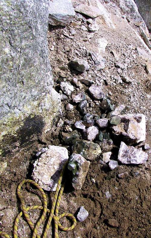
CRYSTALS
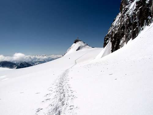
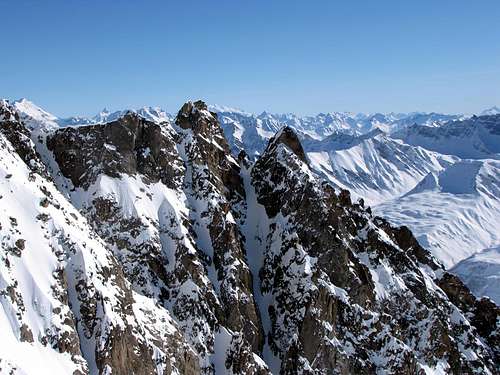
From the Shelters Old Turin (3.325m around) or New (3.371m) to quickly go down in direction of the Gigante Pass (3.365m) reaching him; from this, leaving to the left (North-northeast) the route for the Dente del Gigante, to decidedly address him verse East crossing the extreme southern edge of the Glacier du Géant to quota 3.400m around holding himself well distant from the frame that it falls toward the Valley of Aosta on the underlying Glacier du Mont Fréty. Taking as point of reference the South Point of the Aiguilles Marbrées transverse him for around 400 meters, doing well attention to the numerous existing crevasses (burdens with puddles of water); it is reached the know basic the of the South Crest of the same. A brief slide of snow less of 50 meters (30°/35°) it conducts on the same one. Abandoning the continuation of it toward North in direction of the Aiguilles, it is begun with direction South to brief descent toward the Tour de Jetoula, holding himself for the most greater possible time on the thread of crest on shattered rocks (I°+/II°+) or revolving to the left it on the slope Rochefort with the same typology and same difficulties. You reaches a small and double snowy saddle over which three humps are generally overcome with snow and frames to West; it almost follows a rocky line in false level route that, through a last he drinks slope, it conducts two sharp rocky asperities. From these to short descent conducts to another double and small saddle, generally snowy, really against the final part of the tower; after an initial passage of 2/3 meters in crack (III°), it crosses the Crest W-NW with passages of II°/II°- immediately to the left of the edge reaching the towered Top (PD; 1h'30/2h'00 from the two Refuges Turin). The prosecution, always toward South, toward the underlying Dent de Jetoula results instead more difficulty and complicated and it asks for a double rope also rappel of 40 meters around and non simple avoidances on the Oriental Slope of the same one.
Dai Rifugi Torino Vecchio (3.325 m circa) o Nuovo (3.371 m) scendere rapidamente in direzione del Colle del Gigante (3.365 m), raggiungendolo; da questo, lasciando a sinistra (N-NE) la via per il Dente del Gigante, indirizzarsi decisamente verso E attraversando l'estremo lembo meridionale del Glacier du Géant a quota 3.400 metri circa e tenendosi ben lontani dalla cornice che precipita verso la Valle d'Aosta sul sottostante Glacier du Mont Fréty. Prendendo come punto di riferimento la Punta Sud delle Aiguilles Marbrées, lo si attaversa per circa 400 metri, facendo ben attenzione alle numerose crepacce esistenti (alcune con pozze di acqua); si raggiunge così la base della Cresta Sud delle stesse. Da ultimo un breve scivolo di neve di meno di 50 metri (30°/35°) conduce sul filo della stessa. Abbandonandone la continuazione verso N in direzione delle Aiguilles, si inizia con direzione S una breve discesa verso la Tour de Jetoula, tenendosi per il maggior tempo possibile sul crinale di cresta su rocce frantumate (I°+/II°+) o aggirandolo a sinistra sul versante Rochefort, con la stessa tipologia e stesse difficoltà. Si raggiunge così una piccola e duplice sella nevosa, oltre la quale si superano tre gobbe in genere con neve e cornici ad Ovest; segue un tratto roccioso quasi in falsopiano che, tramite un'ultima breve salita, conduce a due aguzze asperità rocciose. Da queste una corta discesa conduce ad un'altra duplice e minuscola sella, in genere innevata, proprio contro la parte finale della torre; dopo un passaggio iniziale di 2/3 metri in fessura (III°), se ne percorre la Cresta O-NO con passaggi di II°/II°- subito a sinistra del tagliente raggiungendo la turrita Cima (PD-; 1h'30/2h'00 dai due Rifugi Torino). La prosecuzione, sempre verso Sud, verso la sottostante Dent de Jetoula risulta invece più difficile e complicata e richiede una corda doppia di 40 metri circa ed aggiramenti non semplici sul Versante Orientale della stessa.
Difficulty
This route can be considered PD- up to PD+.
L'itinerario è classificato da PD- a PD+.
Equipment
Mountaineering equipment, including rope, helmet, iceaxe, and crampons.
Da alta montagna, corda, casco, picozza e ramponi.
When To Climb
The period from mid June to mid September usually offers the best conditions. The rock climbs would be substantially more challenging off season.
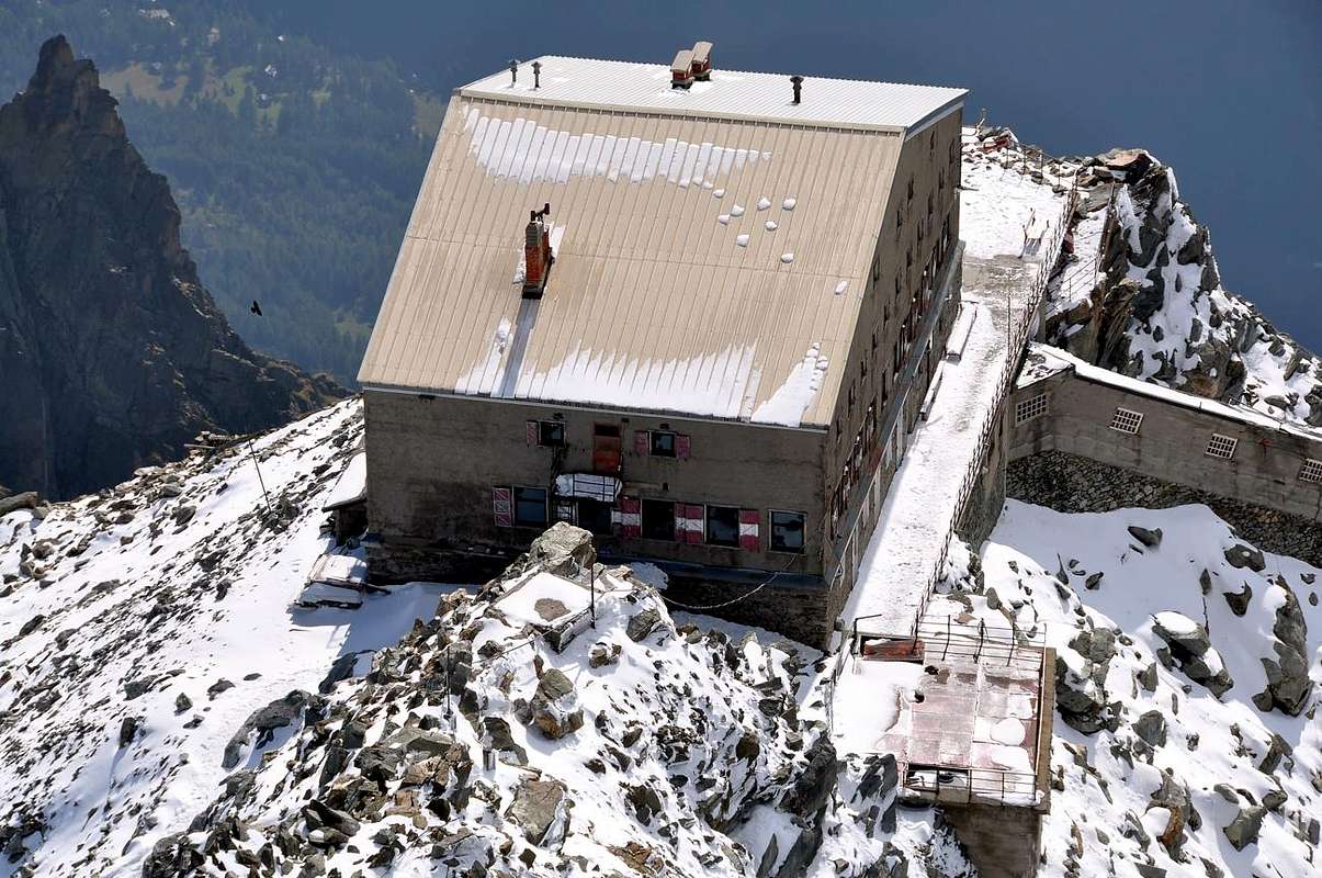
Huts
Rifugio Torino (3.329-3.375m) Tel.: Nuovo numero telefonico +39 3402270121 Cell. Gestore +39 3356184758 Funivie Monte Bianco +39 016589925
Red Tape
No permits are required and no fees must be paid to climb Aiguilles Marbrées. Since it is on the Italian-French border, carry some means of identification.
Campings
Remember that free camping is forbidden (except for emergency reasons, over 2.500m, from darkness until dawn).
Mountain Conditions
You can get meteo information at the official site of the Regione Valle d'Aosta:
A.I.NE.VA. (Associazione Interregionale Neve e Valanghe).
Useful Numbers
Protezione Civile Valdostana località Aeroporto n° 7/A Saint Christophe (Ao) Tel. 0165-238222.
Bollettino Meteo (weather info) Tel. 0165-44113.
Unità Operativa di Soccorso Sanitario Tel. 118.
Acknowledgements
I am greatly indebted to my friends "Osva" and Camillo Roberto Ferronato for the detailed description of the route and to Osvaldo for translation into English.
Parents refers to a larger category under which an object falls. For example, theAconcagua mountain page has the 'Aconcagua Group' and the 'Seven Summits' asparents and is a parent itself to many routes, photos, and Trip Reports.

 9968 Hits
 89.77% Score
 30 Votes