


desainme - Feb 8, 2004 4:05 pm - Voted 10/10
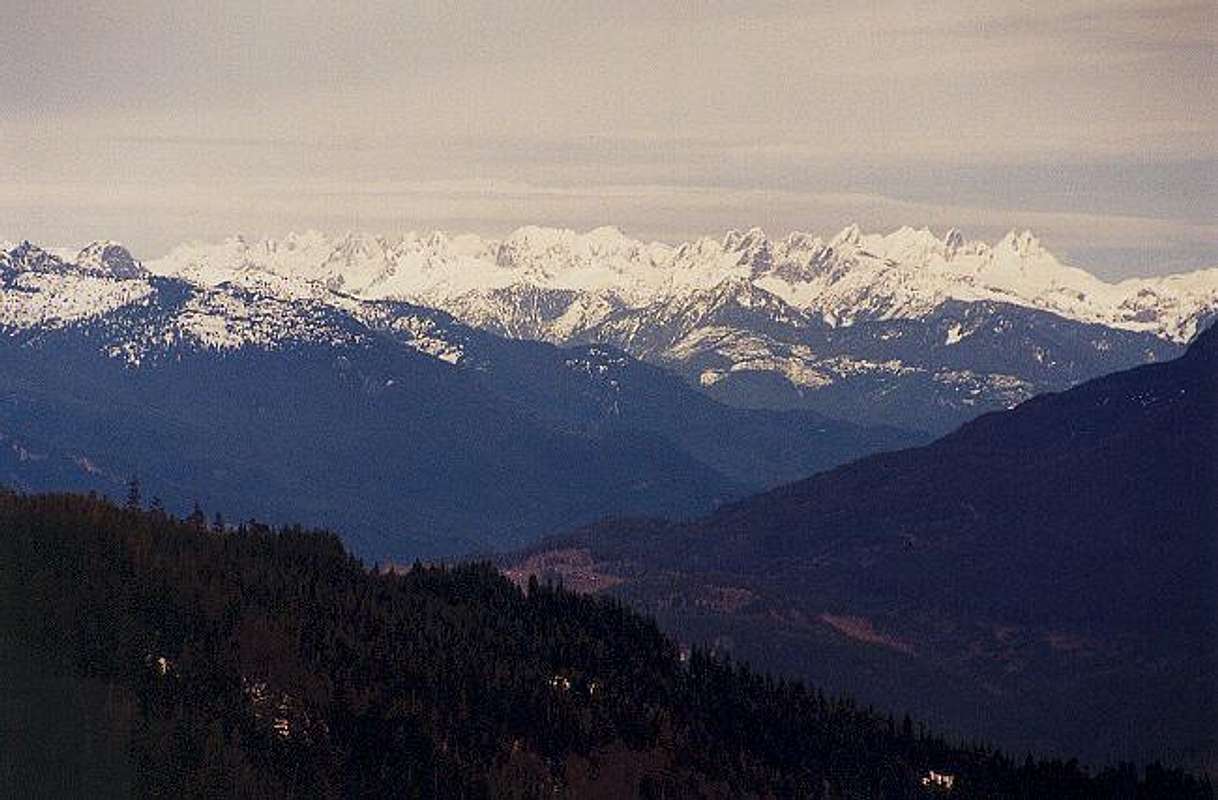
very nice detailI imagined the Pickets to be much a much longer range. The Pyramid must be interesting because I mistook it for Liberty Bell!

Klenke - Feb 8, 2004 4:23 pm - Hasn't voted
Re: very nice detailStraight line distance from Mt. Challenger to McMillan Spires is about 5.5 miles. The total length of the picket fence between those two peaks is about 10 miles (the range makes a reverse double-ogee from Whatcom to East Fury then a horseshoe from East Fury to McMillan Spire). There are more than 21 pickets on the fence over 7,500 ft in height. Picket Pass (the break point south of Outrigger Peak that separates the North Pickets from the South Pickets) is one of the least-accessible places in the Cascades.
Liberty Bell is about 35 miles to the ESE of The Pickets.

Noah (Oregon) - Feb 8, 2004 9:21 pm - Voted 10/10
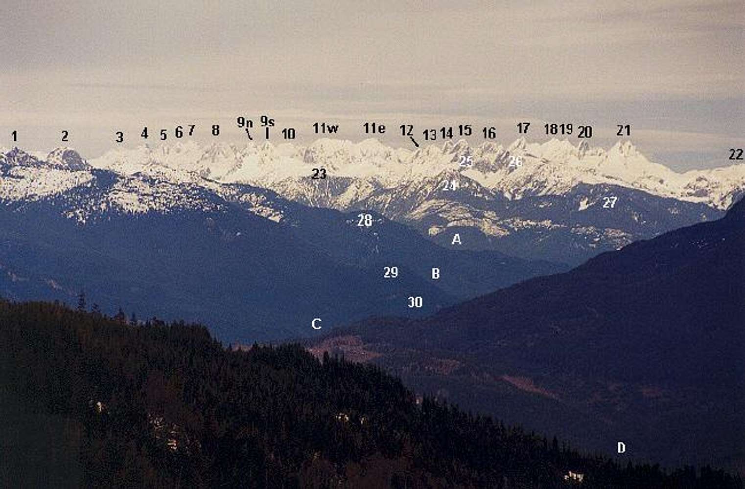
Luna?Cool chart. Where is Luna? I think it is higher than Fury but I don't know where it would be... Thanks! NOAH
Klenke - Feb 8, 2004 9:54 pm - Hasn't voted
Re: Luna?Topo software analysis:
From the perspective of North Mountain, Luna is directly behind #16 "The Rake (The Blob)." The Rake is 7,840+ ft high. North Mountain's summit (from where the photo was taken) is 3,840+ ft high. The distance from North to Luna is 38.93 miles; the distance to the Rake is 34.82 miles. Doing a like-triangles calculation, I get that The Rake obscures the tip of Luna by about one foot (8,312 ft vs. 8,311 ft). Even if you assume the highest possible elevation for North before the next contour (i.e., 3879 ft) and the lowest possible elevation for The Rake (7840 ft), the calculation shows that only the top four feet of Luna would be peeking above the Rake. This is obviously beyond the resolution of this image or my originating print. Both of these calculations do not account for curvature of the earth, which will further accentuate the obscuring factor. Therefore, Luna cannot be seen from the summit of North Mountain. More than you wanted to know, I'm sure.
Noah (Oregon) - Feb 9, 2004 11:44 am - Voted 10/10
Re: Luna?You are smart. Yikes! But to be honest it wasn't more than I wanted to know because a dose of smartness helps hold the tidal wave of stupidity at bay that is washing over our world (mixed metaphor). Thanks, Noah


Comments
Post a Comment