
-
 2832 Hits
-
 74.92% Score
-
 5 Votes
|
|
Route |
|---|---|
|
|
31.70520°N / 110.9455°W |
|
|
Hiking, Scrambling |
|
|
Spring, Fall, Winter |
|
|
Less than two hours |
|
|
Overview
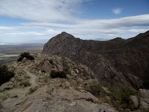 Elephant Head from the summit of "Little Elephant Head"
This short and simple outing takes in great desert scenery along the way to a bomber summit with wide-open views. The trip starts in high grasses and scrubby trees, moves into rolling hills covered with Ocatillo and prickly pear and finishes on a bear rocky summit. The route first leverages an official Forest Service trail before turning off onto a well-loved, informal footpath. Finally, some very easy scrambling and route-finding is required to reach the top, marked by a cairn, a pole and an ammo box summit register.

Roundtrip Distance: Less than 4 miles
Elevation gain: Less than 500 feet net, but higher cumulative due to ups and downs
Getting There
 Parking Area
 Searching through the tall grass for the trail sign
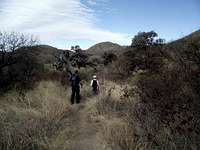 Lower part of trail
Though high-clearance is recommended for this route, the road to the trailhead is passable in dry conditions for 2-wheel drive vehicles. Having said that, I have driven this road in a front-wheel drive compact car and in a Jeep Rubicon, and I assure you that while 4-wheel drive is unnecessary unless the road is wet, the higher the clearance is extraordinarily nice to have. Parts of the road are loose, steep and rocky and parts are fairly rutted. The going is very slow in a standard passenger car. In the event of rain, do not come back here without 4x4.
• I-19 to Exit 56 (Canoa Road)
• Under highway toward east (roundabout?)
• Right (south) on Frontage Road for 3 miles to Elephant Head Road. Turn left.
• Cross the Santa Cruz River (usually dry)
• Right on Mount Hopkins Road (paved) for 5.5 miles to sign: Aqua Caliente Canyon KMSB.”
• Turn left on a dirt Forest Service road FS 183.
• Follow FS 183 for 2.5 miles. Park in pullout on right before road makes sharp left turn across wash with “Dead End” sign.
Route Description
 Mid-trail conditions
 Social Trail to Summit
 Ascending Pt 5079
 Chino Canyon
• Leave the parking area and head briefly back down the road you just drove in on. Do not continue up-canyon across the wash on the road.
• Look to your right in the high grass for a little fiberglass Forest Service sign pointing you to Trail 930.
• Follow the main trail for roughly ¾ of a mile to a saddle. Note the footpath traveling west to “Little Elephant Head.” Turn off from the main trail to the unmaintained footpath at approximately 31.70109, -110.93521.
• The footpath follows the curving ridgeline for roughly 1 mile to the summit of “Little Elephant Head.”
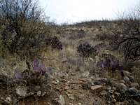
• The footpath through the ocotillo and prickly pear gets occasionally steep as you ascend and then descend un-named, unranked point 5079.
• Ascending out of the saddle between pt 5079 and “Little Elephant Head,” the terrain gets rockier and occasional easy scrambling moves are required. Continue to follow the use path all the way to the bear rocky summit.
• The top is marked by a cairn with a pole sticking out of it. Look for the summit register in a nearby ammo box. The wide-open views are astounding.
Essential Gear
 Approaching the summit block
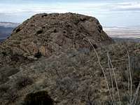 Descending Pt 5079
In addition to standard hiking gear appropriate to the season, you will find the following very useful in this desert environment:
• Long hiking pants instead of shorts for the social trail / footpath segment.
• A brimmed hat and sunscreen to block the sun.
• Plenty and plenty of water and salty snacks.
 Last little push to summit Last little push to summit |  Rocky footpath near summit Rocky footpath near summit |  Leaving the summit area Leaving the summit area |