
-
 4301 Hits
-
 79.78% Score
-
 11 Votes
|
|
Route |
|---|---|
|
|
33.69760°N / 116.7602°W |
|
|
Hiking |
|
|
Winter |
|
|
Most of a day |
|
|
Trail and Fire Road |
|
|
Overview
The incentive to hike Rouse Hill almost exclusively comes from its inclusion on the Sierra Club’s Hundred Peak Section list. It is merely a bump on the long west ridge of Thomas Mountain near Lake Hemet in the San Bernardino National Forest in Riverside County. Because of that, the vast majority of people drive on Forest Road 5S15 (Rouse Hill Road) to near the hill and walk a few yards to its summit. However, for people wanting to actually hike and still bag this hill there is a wonderful and scenic alternative to the effortless drive-up. The alternative route starts from the Highway 74 at the South Fork Trailhead, descends into the South Fork San Jacinto River, climbs the south side of the canyon, and intersects the Rouse Hill Road, which will lead to the summit. A great portion of this hike lies within the 2009 established rugged and beautiful South Fork San Jacinto Wilderness.
The route illustrated here total to about 11.6 miles with about 3,200 feet of elevation gain.
Rouse Hill
EveryTrail - Find the best Hiking in California
Description
From the trailhead the well maintained trail starts in southerly direction and climbs first about 200 feet to a small ridge. From here you have a beautiful and commanding view down to the canyon and the South Fork San Jacinto River. You will soon enter the South Fork San Jacinto Wilderness. The trail now continues with almost no elevation gain or loss high above the canyon for the next 1.5 miles. You will reach the “highpoint” along this part of the hike at about 1.5 miles from the start (~4,160’). After 2.1 miles the trail now steeply drops about 500 feet in switchbacks to the riverbed (2.5 miles, ~3,660’). After crossing the river you will reach the South Fork Campground. The crossing should not be an issue as the “river” resembles more a small creek, courtesy of the Lake Hemet dam upriver.
| South Fork San Jacinto River | South Fork San Jacinto River |
|---|---|
 |
 |
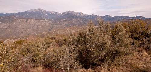
From the campground pick up the narrow trail on its south side, which steeply climbs the south side of the canyon in sixteen switchbacks (1.2 miles and 1,200 feet of elevation gain). From here (~4,880’) you have gorgeous views south. The trail now descends slightly, leaves the wilderness, and intersects with the Rouse Hill Road (5S15) at about 4.2 miles (~4,720’). The road continues to the left (east) towards Thomas Mountain. To reach Rouse Hill turn right (west) and follow the road over some bumps for about 1.5 miles, where it winds around the northeast side of Rouse Hill. Leave the road at any point you feel and hike a few hundred feet to its summit boulders (~5.8 miles from the start; ~5,168’). The views are beautiful and unobstructed. Peaks of the San Jacinto Wilderness and the Desert Divide to the north and east; Cahuilla Mountain and Little Cahuilla to the south; the Santa Rosa Mountains in the distance to the south; San Gorgonio and even Mount Baldy in the far distance to the west and northwest.
Enjoy the views, relax, and re-energize, but allow some time to hike back almost 6 miles with 1,000 feet of elevation gain.
| Rouse Hill | View North |
|---|---|
 |
 |
Getting There
The South Fork trailhead is located off Highway 74 east of Hemet and west of Mountain Center. There is a large dirt turnout on the south side of the highway. The trailhead is at an elevation of about 3,860’.
Essential Gear
No essential gear is necessary. Be sure to display your Adventure Pass in your parked car.