Overview
![]()
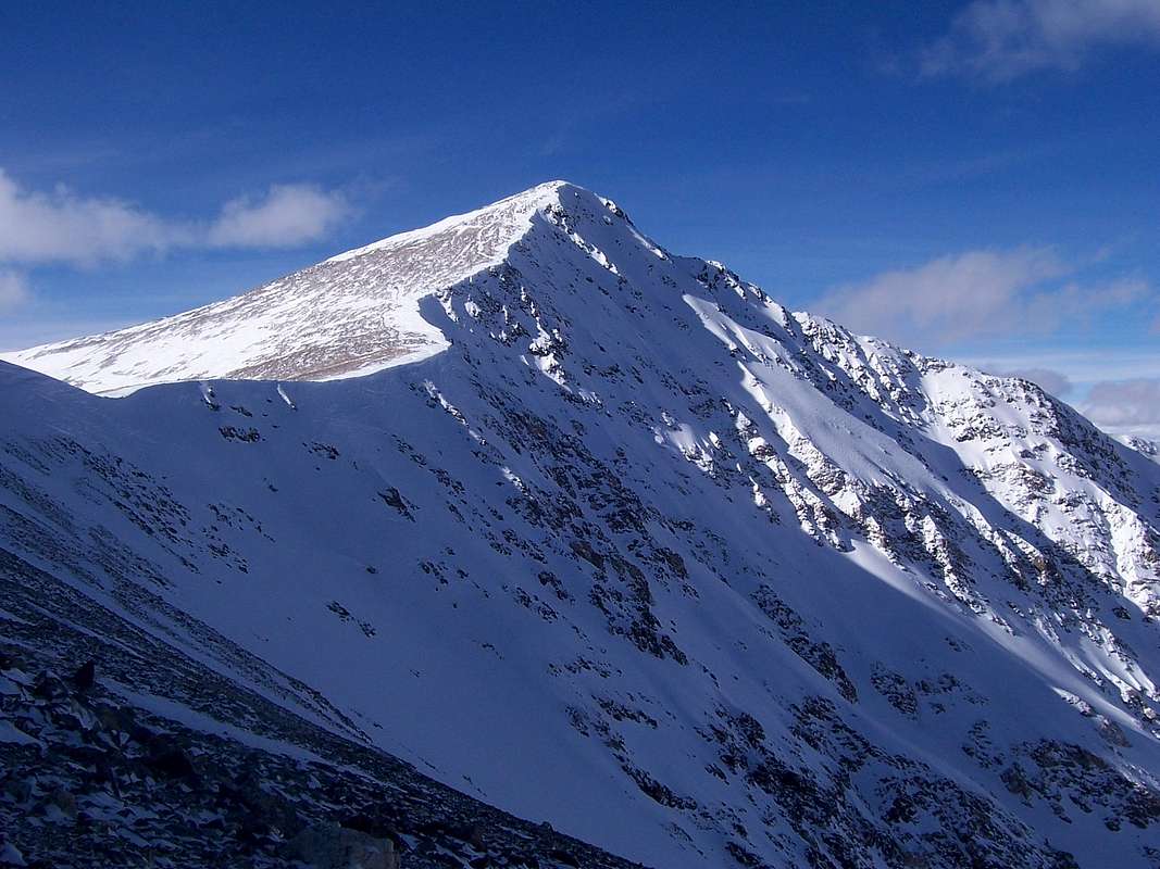
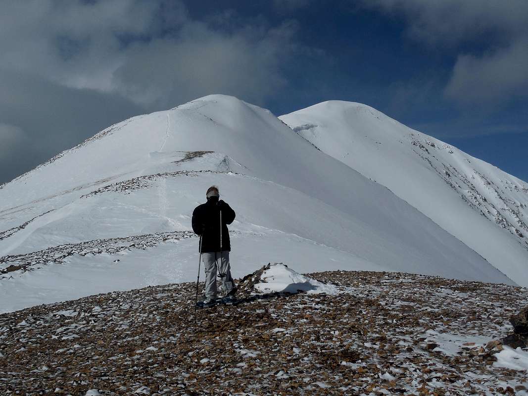
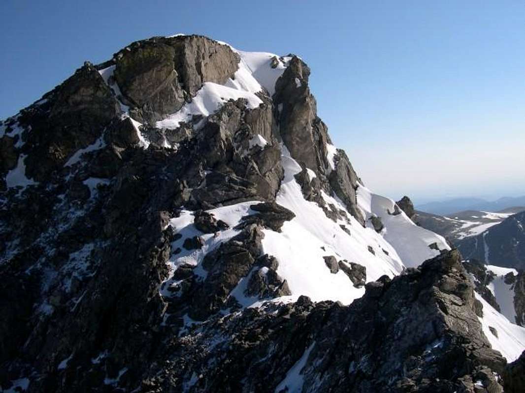
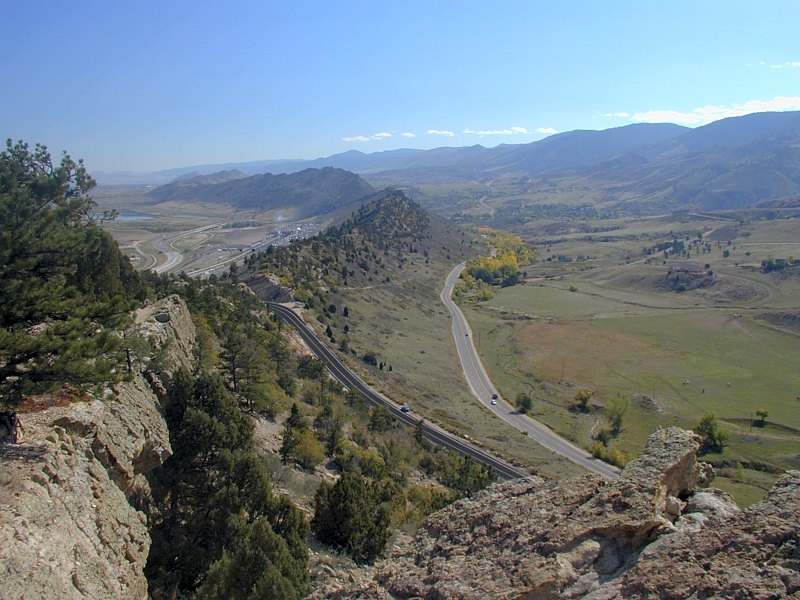
A look at the Loveland Pass/I-70 area from "Cupid."
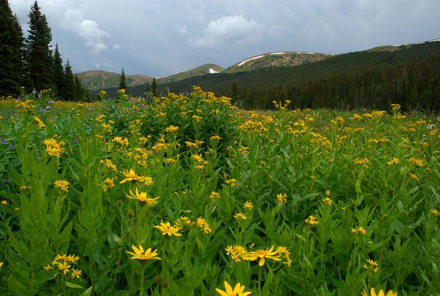
The Front Range is probably Colorado's best known mountain range. The altitudes of included peaks, mountains and points have a staggering range from 5,200ft. up to 14,278ft (9,000'+ departure!). Because the variance in altitude is so overwhelmingly large, vegetation and geology is typically diverse. Animal life likewise, is just as myriad. On the steep, talus covered slopes of the alpine, one would see bighorn sheep, pika (coneys), ermine and marmots. Lower down in the coniferous forests: bear, elk, deer, pine marten, ferns and even orchids call the sheltering trees home.
The Front Range is often referred to as the 'Urban Corridor' because of it being a prominent western boundary to Front Range cities like: Pueblo, Denver, Colorado Springs, Ft. Collins and Boulder. The effect the Front Range has on these cities in terms of weather can equate into milder & warmer temperature inversions or extremely severe thunderstorms, large hail and frequent tornado's.
It is the longest mountain range in Colorado. It stretches for roughly 182 miles from Cheyenne, Wyoming south to Pueblo, Colorado. But in some circles, the southern terminus is a bit ambiguous with Pueblo being contested and even some folks include features as far south as The Spanish Peaks (outside Walsenburg). From east to west, the Front Range is roughly 97 miles across. The eastern border is easy to discern as the mountains lower to foothills and then ultimately hogbacks (in areas) where they bottom out onto the high plains. The western border however, can be a bit harder to figure out as the sea of ambiguous mountains blend seamlessly into the Ten Mile and Mosquito Ranges.
But colloquially speaking, the three great parks (North Park, Middle Park & South Park) are generally accepted as the western limit. The land mass area of the Front Range is about 9,987 sq. miles (25,806 Km²). Mountain passes such as: Argentine Pass, Kenosha Pass, Milner Pass, Ute Pass, Loveland Pass, Berthoud Pass, Guanella Pass among countless others, offers the traveler options for further exploration off the beaten path.

The low point of the Front Range is Mariana Butte at a paltry 5,269' (1.606m) located just west of loveland near the golf course. The high point is Grays Peak at 14,278' (4.349m) just off I-70 near Bakersville. It is also the highest point along the Continental Divide, located off I-70 up Stevens Gulch in Clear Creek County.
When in Denver or further east out onto the plains, the Front Range almost acts as a kind of mountainous wall. I-70, US 285, State Highway 14 (Poudre Canyon), State Highway 24 (west of Colorado Springs), the Peak to Peak Highway and State Highway 50 (west of Pueblo) cut through the Front Range increasing accessibility. Because of this ease of access, The Front Range is almost limitless in terms of: hiking, climbing (Flatirons), skiing/snowboarding, mountain biking, fishing and even some off-roading. The Indian Peaks Wilderness seems to be one of the more popular places "to play." The Front Range contains most of Colorado's bigger cities and most of the population. It is essentially the Urban Corridor's playground.
With as many areas along the Front Range to choose from: IPW, Mt. Evans Wilderness, Brainard Lake, Poudre Canyon, Rocky Mountain National Park, Waterton Canyon, Roosevelt National Forest, Roxborough State Park etc. one could spend a lifetime exploring all that the Front Range has to offer without ever leaving for more westward adventures.
In 2003, The Colorado State Parks with the support of the citizens of Colorado, communities and stakeholders, initiated the Colorado Front Range Trail Project. The purpose of this trail is to create a multi-purpose trail from the Wyoming state line south to New Mexico, along the Front Range of Colorado. The 876-mile trail will link diverse communities, scenic landscapes, cultural and historic points, parks, open space and other attractions. When complete, the trail will connect a little more then 15 cities, 14 counties and many smaller towns and communities along its length.
To date, over 270 miles of the CFRT have been finished – one-third of the corridor. As of now, a final completion date for this massive trail project hasn't been finalized. This will give Colorado three MAJOR trail systems that either reside entirely in the state or bisect the area (Continental Divide Trail, Colorado Trail & Front Range Trail).
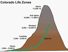 |
Alpine: The alpine tundra is defined as high-elevation vegetated regions above treeline. It is characterized by the absence of trees, short stature of plants and a low annual mean temperature (usually <50°F). There are no concise statistics on the size of this life zone, but it covers hundreds of square kilometers over various geographical areas. Precipitation is usually measured in snowfall. (Bristlecone Pine, Columbine, Moss Campion, Pika, Vole, Bighorn Sheep, Elk). |
| Sub-Alpine: This is the biotic zone immediately below treeline. Precipitation is typically measured in snowfall however, graupel and occasionally rain does fall. Temperatures are never warm, per se, but during summer months can be quite reasonable. Trees are usually stunted & the growing season though longer than the alpine is still quite short. Soil is usually nutrient poor. As in the alpine, winds can be fierce as well. (Bristlecone Pine, Englemann Spruce, Mountain Bluebell, Lynx, Vole, Red Fox, Wolverine). |
| Upper Montane: The word montane refers to the branch of ecology that studies high-altitude biomes. The upper montane is warmer still from the sub-alpine and tree growth is encouraged. Snow can fall, but rain can as well almost in equal measure. Vegetation & animal life are usually resplendent and temperatures are warmer. (Lodgepole Pine, White Pine, Bear, Marmot & Pine Marten). |
| Lower Montane: The word montane refers to the branch of ecology that studies high-altitude biomes. Not too much difference 'tween the upper & lower except animal life tends to be more rich and diverse. Both regions are sometimes lumped together into the same biome. (Lodgepole & Limber Pine, Bear, Marmot). |
| Foothills: Mainly a transition zone found at the base of mountains from lower altitudes. Temperatures are or can be rather warm, precipitation can be minimal (steppe) or severe. Open areas (meadows) are common. (Ponderosa Pine, Juniper, Piñon, Bobcat, Mule Deer). |
In terms of thinking about and trying to get a handle on where certain features are located along the Front Range, it's typically easier to dissect it into three parts. You have the Northern Front Range which, tends to be dryer and starts around North Denver/Boulder, the central portion which includes Denver proper south to around Colorado Springs, give or take and then the Southern Front Range which extends from COS south to the Spanish Peaks area, again, give or take. Just keep in mind, there are no empirical set boundaries.
The Northern Front Range includes features, peaks and areas such as:
| Rocky Mountain National Park |
Comanche Peak Wilderness |
Medicene Bow Wilderness |
Mummy Range |
| Poudre Wilderness Area |
Rawah Wilderness |
Boulder Group |
Roosevelt National Forest |
| Neota Wildrness Area |
Indian Peaks Wilderness |
Arapahoe National Forest |
Never Summer Mountains |
| State Highway 34 |
State Highway 36 |
State Highway 7 |
State highway 14 |
| Mount Lady Washington |
Hagues Peak |
Crosier Mountain |
Longs Peak |
| Milner Mountain |
Palisade Mountain |
Mt. Richthofen |
Mummy Mountain |
The Central Front Range includes wilderness areas, peaks and canyons such as:
| James Peak Wilderness |
Mt. Evans Wilderness |
Tarryall Mountains |
Byers Peak Wilderness |
| Rocky Flats National Wildlife Refuge |
Lost Creek Wilderness |
Eldorado Canyon |
Roxborough State Park |
| Vasquez Wilderness |
Kenosha Mountains |
Rocky Mountain Arsenal NWR |
Williams Fork Mountains |
| State Highway 40 |
State Highway 285 |
I-70 |
State Highway 287 |
| Mt. Evans |
Pettingell Peak |
Mt. Parnassus |
Grays Peak |
| Bison Peak |
"The Citadel" |
Arapahoe Peaks |
South Boulder Peak |
The Southern Front Range includes wilderness areas, peaks and canyons such as:
| Garden of the Gods |
Lake Pueblo |
Muller State Park |
Pike National Forest |
| San Isabel National Forest |
Cheyenne Mountain State Park |
Lake Pueblo State Park |
Greenhorn Mountain Wilderness |
| State Highway 28 |
State Highway 67 |
State Highway 9 |
State Highway 50 |
| Pikes Peak |
Noodle Heads |
Raspberry Mountain |
Almagre Mountain |
| Long Scraggy Peak |
Cheyenne Mountain |
Cameron Cone |
"Big Rock Candy Mountain" |
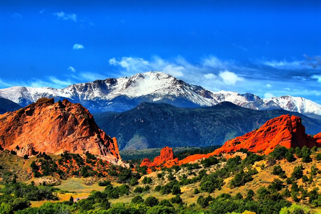
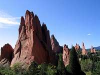
![Red Sandstone Spires of...]() Red Rock Splendour! -Garden of the Gods
Red Rock Splendour! -Garden of the GodsAs one can imagine, having a 'virtual outdoor playground' so close to urban area's, there is going to be a lot of rules, regulations and private property one must deal with or "attempt to travail," it's inevitable. Private property is one thing and there's not much one can do to access it save for attaining prior permission. However, in terms of wilderness areas, state parks, national parks or national forests, things can get kind of confusing...especially concerning regulations. As I found out the hard way via a state ranger around Red Mountain Open Space near the Wyoming border years ago, some swaths of land literally look like a quilt of mixed use. Here is a quick breakdown and synopsis of what to expect with said terrain:
National Forest:
Simply follow this LINK. There are too many rules & regulations to copy and paste. Many can be easily side-stepped depending on activity of course but with SO MANY people 'loving' the outdoors to death, it shouldn't be any surprise that there are so many rules put in place. It is a bit disheartening but than again, it's for our future generation's sake of enjoyment.
Wilderness Areas:
Are motor vehicles allowed in wilderness?
No. The Wilderness Act generally prohibits the use of motor vehicles in wilderness. The law contains special provisions for motor vehicle use when required in emergencies or as necessary for the administration of the area. Motor vehicles may also be permitted for special uses such as access to a private inholding, to support grazing, or to exercise valid existing rights.
People hunt or fish in most BLM Wilderness Areas. Some people prefer to hunt or fish in wilderness because they enjoy the primitive experience available there. Hunting and fishing in BLM Wilderness, like other BLM lands, is licensed by the State.
Wilderness Areas support a wide variety of recreation uses that are consistent with protection of wilderness characteristics. Recreational uses in wilderness include activities such as hunting, fishing, hiking, horseback riding, backpacking, camping, nature study, photography, and climbing. Bicycles and other forms of mechanical transport are not allowed in Wilderness Areas, since they are prohibited by the Wilderness Act.
The Wilderness Act prohibits construction of new roads.
BLM-authorized outfitters provide additional recreation opportunities in many Wilderness Areas. Outfitters commonly provide services in river running, hunting, and packing. Outfitters also provide wilderness therapy programs for-at risk youth and wilderness experience programs. Each BLM field office maintains a list of outfitters operating in the local Wilderness Areas.
Which agencies are responsible for wilderness management?
Wilderness is managed by four Federal agencies: the Bureau of Land Management, the Fish and Wildlife Service, the Forest Service, and the National Park Service.
National Wilderness Preservation System (in full)
State Parks:
Again, as with national forests, there is a plethora of regulations and rules that covers pretty much everything under the sun. However, here's a few tidbits more pertinent to campers/hikers etc.
1.) If one is going to enter, use or occupy State Parks when those areas are posted against such entry, use or occupancy, this is prohibited. Access to Division of Parks and Outdoor Recreation lands and waters is generally allowed between 5:00 a.m. and 10:00 p.m...daily. Restricted access generally will be allowed during other hours for camping and fishing.
2.) To remove, destroy, mutilate, modify or deface any structure, poster, notice, sign or marker, tree, shrub or other plant or vegetation, including dead timber and forest litter, or any object of archaeological, geological, historical, zoological or natural/environmental value or
interest on Parks and Outdoor Recreation Lands is not allowed. (This
regulation does not include removal of firewood from designated firewood areas, noxious weeds as defined by statute).
3.) It is unlawful to destroy or harass any wildlife or livestock on
Division of Parks and Outdoor Recreation Lands. (Hunting will be allowed in areas designated by the Division of Parks and Outdoor Recreation during hunting seasons as established by the Division of Wildlife.)
4.) To camp or to park a motor vehicle, trailer or camper on Parks and Outdoor Recreation Lands with the intention (or for the purpose) of camping other than on areas designated for camping; or to leave a set-up camp, motor vehicle, trailer or camper unattended for more than twenty-four 24 hours is prohibited unless otherwise posted. No person may camp or park a motor vehicle, trailer or camper on a state park for more than fourteen 14 days in any forty-five 45 day period, except that extensions totaling no more than a maximum of fourteen 14 additional days may be permitted.
5.) To build or tend fires within Parks and Outdoor Recreation Lands, except in designated sites in Division-furnished grills or fireplaces; or in hibachis, charcoal grills, stoves and other metal containers, unless otherwise prohibited by these regulations. To allow a fire to burn in a careless manner; to leave any fire unattended; or to fail to completely extinguish any fire on Division of Parks and Outdoor Recreation Lands is strictly prohibited.
National Parks:
The actual site for explicit rules and regulations for Rocky Mountain National Park (ROMO) seems to be missing at the moment. So here's a LINK to related information you might find useful/helpful. Regulations are similar to State Parks but add to this, government regulations and where appropriate, Wilderness regulations. Things in and around national parks can get confusing (something else I've learned the hard way). It does pay to invest a little time to school oneself in the laws.

Roxborough State Park (Southern Front Range)
Front Range Wilderness Areas
“Wilderness appealed to those bored or disgusted with man and his works. It not only offered an escape from society but also, was an ideal stage for the romantic individual to exercise the cult that he frequently made of his own soul.
The solitude and total freedom of the wilderness created a perfect setting for either melancholy or exaltation.
--Robert Nash
Excerpt from, “Wilderness and the American Mind”
“Thousands of tired, nerve-shaken, over-civilized people are beginning to find out going to the mountains is going home; that wilderness is a necessity...”
--John Muir
| LOST CREEK WILDERNESS |
| Similar in vein to the Mt. Evans Wilderness Area, the Lost Creek is unique due to its reputation of NOT being an alpine destination. This is a bit of a misnomer however because the alpine portions of this fantastic area are huge, rolling and massive. They are gentle areas just as prone to the savage winds as anywhere else but they are also places of rolling, treeless expanses. The Lost Creek Wilderness received its name due to the Lost Creek vitually disappearing under the talus fields and meadows before reappearing far down valley. The valleys in this area are typically broad and wide and open space seems abundant. This wilderness area is a backpackers dream come true! Among the Front Range's wilderness areas, the Lost Creek received most of the votes during the monument act of congress in 1980. Initially, it was about 106,000 acres but later on in 1993, another 14,700 acres were added bringing the total to 119,800 acres. This place contains about 100 miles of formal trail and literally contains all if not most of the Platte River Mountains, Kenosha Mountains and a healthy portion of the Tarryall Mountains. Bear, bobcat, deer and elk are thick in this area. Administration is supervised through the Pike National Forest. At one time in the early 1900's, a local company attempting to dam the Lost Creek in hopes of building a reservoir, endlessly poured concrete into the recesses and nooks of one of the many talus fields hoping to block the stream. This futile attempt went on my nearly a decade until the company finally gave up saying it was impossible. The Lost Creek kept redirecting and springing back up down valley. Access is quite good here, trails are good and the Lost Creek remains as one of many favourite places to go hike. Key Features: Ben Tyler Trail, Craig Meadows, Bison Peak, Buffalo Peaks South Park Ranger District/Pike National Forest- 320 US 285 Fairpaly, Co. 80440 (719) 836.2031 |
| INDIAN PEAKS WILDERNESS |
| The Indian Peaks is probably the Front Range's premier wilderness. The alpine lakes are abundant, forests are thick, wildflowers profuse, the high peaks, crags and points are steep & sharp and...it's EXTREMELY popular among folks living in the Urban Coridor. So don't expect solitude in the Indian Peaks.This marvellous area is only 25 miles west of Boulder and is about 76,700 acres. Access is excellent, miles and miles of hiking trails and good access to trailheads. The bittersweet part of the Indian Peaks is that among the wilderness areas, it contains the most restrictions and regulations.The Arapaho & Roosevelt National Forest administer this area. Come fall, since the peak to peak highway (Co. 7) borders this area, it's not uncommon to run into pockets of tourists & locals alike gawking at the areas changing aspens.Key Features: Navajo Peak, Mt. Audobon, Lake Isabelle, Arapaho Pass, Crater Lake, Cascade Creek Trail Boulder Ranger District- 2140 Yarmouth Ave. Boulder, Co. 80303 (303) 541.2515 |
| MT. EVANS WILDERNESS |
| The Mount Evans Wilderness like the Indian Peaks, is easily accessable from Denver. Its namesake peak, Mt. Evans is likewise easily seen from most of the urban coridor. Though due to its bulk and gentle stature, it can be hard to distinguish along the western skyline.This wilderness area is somewhat unique among Colorado's protected areas in that, on my hand, there is a paved road (the highest such road in N. America) that extends like an asphalt vein into the tundra clear to the summit. When completed in 1927, this proved to be an extremely popular destination among tourists and locals alike.Then on the other hand, there are small micro-cosims that exist in the tundra and sub-alpine...like the Mt. Goliath Natural Area. This special place habours the bristlecone pine (named thus due to the bristles found on the female cones). These trees can live as long as 1,500-2,000yrs and have been documented to exceed 4,000yrs of age! Far longer than any other known organism on Earth. There are also scattered swaths located along the upper eastern slopes of Mt. Bross south of Breckenridge. The Mt. Evans Wilderness contains roughly 72 miles of trail and comprises a little over 74,000 acres. Trailheads are good and plentiful, trails themselves are usually in decent shape and easy to follow and camping areas (formal) abound on the perimeter.Key Features: Mt. Bierstadt, Mt. Evans, Chicago Lakes, Rosalie Peak, Abyss Creek TrailCleer Creek Ranger District/Arapaho National Forest- 101 Chicago Creek Dr. Idaho Springs, Co. 80452 (303) 567.3000 |
| RAWAH WILDERNESS |
| The Rawah Wildeness is named for the mountain range which traverses its bredth/length. This 76,400 acre area is located far north along the Wyoming state line and also includes the Medicene Bow Mountains and Routt National Forest. It contains about 76-70 miles of trail with elevation ranges of 8,200 to 13,000ft.The Rawah, which in Native American (multiple tribes) means "wild place" was set aside and designated in 1964. Elevations in the Rawah Wilderness range from 8,400 to 13,000 feet. The high peaks were carved by glaciers, resulting in spectacular cirque [cold] lakes and moraines. There are twenty-five named lakes, ranging in size from five to 39 acres. This high alpine area contains the headwaters of the McIntyre, Rawah, and Fall Creeks, as well as the Laramie River. The Rawahs are host to mammals such as elk, moose, mule deer, black bear, bighorn sheep, marmot and beaver. There are many species of birds including the red-tailed hawk, white-tailed ptarmigan, golden eagle, raven & Stellers Jay. Wildlife in general as it is with the Neota and Comanche Peak is rich here. Lakes and streams are inhabited with lake, cutthroat, rainbow and brown trout. Graylings are also found in this area. This area alone would make for an excellent fishing trip destrination.The Rawah is one of the initial five wilderness areas that was decided upon by congress (wilderness act) in 1964. It is under the administration of the Roosevelt National Forest.Key Features: Montgomery Pass, Medicene Bow Trail, Blue LakesCanyon Lakes Ranger District/Roosevelt National Forest- 1311 S. College Ave. Ft. Collins, Co. 80524 (970) 498.2770 |
| COMANCHE PEAK WILDERNESS |
| The Comanche Peak Wilderness is roughly 66,800 acres. It lies 30 miles west of Fort Collins and borders the northern edge of Rocky Mountain National Park. At its lowest, 8,100ft, this wilderness is thick with aspen and spruce. Moving higher into the Mummy Mountains (11,000-12,500ft), the wind-scoured tundra dominates. But what is probably the most surprising aspect, despite having only three basins (Emmaline, Brown & Comanche), the area is replendent with vegetation and wildflowers. It's not usually known for water. The Comanche is downright beautiful. And due to its convoluted border with the national park & national forest, access is generally quite good. Trailheads from Pingree Park, Dunraven/North Fork, Long Draw Reservoir and Crown Point are excellent.Key Features: Emmaline Lake, Comanche Peak, Big South Trail, Signal Mountain, Flowers TrailCanyon Lakes Ranger District/Roosevelt National Forest- 1311 S. College Ave. Ft. Collins, Co. 80524 (970) 498.2770 |
| NEVER SUMMER WILDERNESS |
| Straddling the Coninental Divide and officially annexed by Rocky Mountain National Park, the Never Summers (as they are more widely known), lie just west of Trail Ridge Road. One won't find high peaks here as the areas highest peak, Mt. Richthofen is only 12,940ft. However, due to the wilderness bestowment and that it is also part of Rocky Mountain National Park, the areas beauty remains pristine and unspoiled. Leave no trace ethics are tantamount here which, for future travelers is marvellous.With names like: Static Peak, Ruby Peak, Bearpaws Peak, Skeleton Gulch, Mt. Cirrus, Mt. Stratus, Mt. Nimbus and the nearby ghost town of Lulu City, the area almost seems poetic. The Never Summer Wilderness only contains about 20 miles of trail and is about 21,100 acres. Plus, like said, one does have nearby RMNP. The Never Summers were part of the massive 1980 act of congress in wilderness designation.The special aspect about this range is that the Never Summer Mountains are really good at a weather phenomenon called 'orographic weather' (clouds). The mountains push up incoming weather resulting in excessive moisture. It happens whereever there's mountains and low-lying valleys as a general rule but the Never Summers are exceedingly good at producing this effect. The result...massive and old growth trees; dense vegetation and ample underground water/open streams and consequently, abundant wildlife. Indeed, the northern reaches of the Never Summers are so imbibed with moisture, a simple hiking adventure could take on the feel of a maritime adventure! Undoubtedly, this is one of the more scenic and wild places in Colorado.Key Features: Nokhu Crags, Mt. Richthofen, Static Peak, Lulu City, Michigan Ditch Trail, Bowen Pass TrailSulpher Ranger District/Arapaho National Forest- 9-10 Mile drive Granby, Co. 80446 (970) 887.4100 |
| JAMES PEAK WILDERNESS |
| The James Peak area became part of the National Wilderness Preservation System in 2002. Named for Edwin James, an American physician and botanist who traveled to Colorado on the 1819-20 U.S. Army Expedition led by Major Stephen Long (Longs Peak). Along the way, James was the first botanist to describe many of the plants of the Rocky Mountains. The 14,500 acre James Peak Wilderness is located within the Arapaho and Roosevelt National Forests within Boulder, Gilpin and Clear Creek counties. Adjacent to the Continental Divide on the eastern slope, the James Peak Wilderness Area includes several peaks over 13,000 feet and countless sparkling alpine lakes.The James Peak Wilderness is one of Colorado's newest. When combined with the other wilderness areas along the Front Range (Comanche, Byers, RMNP, Rawah), the Denver area residents/urban coridor inhabitants have over 500,000 acres of pristine wilderness in which to play in only a few hours at most away. Many people living in the greater Denver area don't realize it but there is SO MUCH MORE to the Front Range than simple mountain biking, fishing & skiing. The proximity of these wilderness areas is testament to this.Key Features: James Peak, Mt. Bancroft, Continental Divide Trail (CDT), S. Boulder Creek trailBoulder Ranger District- 2140 Yarmouth Ave. Boulder, Co. 80303 (303) 541.2515 |
| VASQUEZ PEAK WILDERNESS |
| This small (12,300 acres) wilderness area occupies the eastern side of the Fraser Experimental Forest Area. It only contains 18-20 miles of trail but without doubt, its key feature is a 7-mile stretch of the Continental Divide National Scenic Trail. It is similar to the Byers Peak Wilderness in that what it lacks in serrated peaks spires & crags, it makes up for in warm solitude and time to oneself. Its forests of engleman spruce, lodgepole pine and columbine are thick and yet, meadows are resplendant with flowers. The tundra is windswept and gnarled and it's here, in the Vasquez that one can truly find solitude from the city.Key Features: Vasquez Lake, Nystrom Peak, Vasquez Peak, Continental Divide TrailSulpher Ranger District/Arapaho National Forest- 9-10 Mile Drive Granby, Co. 80446 (970) 887.4100 |
| PTARMIGAN PEAK WILDERNESS |
| The Ptarmigan Peak Wilderness lies south of Byers Peak Wilderness and is sandwiched between the Arapaho and White River National Forests though technically, it is supervised by the Routt & White River NF. Taken directly from the Mark Pierson book, "Colorado's Wilderness Areas", the following excerpt describes the Ptarmigan formation:"When wilderness and water resource development run headlong into one another, all too often wilderness winds up the loser. Certainly there are exceptions, but when the Williams Fork roadless area became tangled in an ongoing debate, water development prevailed and the result was a half-hearted wilderness area called the Ptarmigan Peak that includes non of the WIlliams Fork watershed. Instead, Ptarmigan Peak consists entirely of the south slope of the Williams Fork Mountains, the steep, forested ridge upslope of I-70 on the west side of the Eisenhower Tunnel." Like a few of the other wilderness areas located to the north (IE: Comanche Peak), the Ptarmigan and surrounding land is blessed with water. After reading Mark's book some many years ago, I have since ventured into multiple parts of the state. And indeed, I am inclined to agree with his opinion that even though the urban coridor cities need water to thrive, it is unfortunately at the expense of our mountainous resources which, vegetation, animals & biodiversity become casualties.The Ptarmigan Peak contains 40 miles of trail and is among the smaller areas at 13,170 acres. Fishing is great here and vegetation is somewhat typical for the Colorado highcountry.Key Features: Ptarmigan Peak, South Fork Trail, Fly Fishing, Ptarmigan PassDillon Ranger District- 680 River Parkway Silverthrone, Co. 80498 (970) 468.5400 |
| NEOTA WILDERNESS |
| At just under 10,000 acres and 70 miles west of Fort Collins up Poudre Canyon, the Neota is one of the Front Range's smallest wilderness areas. However, like the Comanche Peak Wilderness, it is equally graced with abundant water leading to thick forests and vegetation. Spruce, Engleman Fir, bear and pine marten call this remore corner home.The Neota Wilderness received its designation in 1980 alongside the Mt.Evans Wilderness. In fact, a few tracts in Colorado received their status in 1980 during an act of congress. The Neota lies west of the Comanche Peak Wilderness and abuts the northern fringe of Rocky Mountain National Park.The Neota is practally trailless. Bushwhacking and off-trail reigns supreme here. Due to its remote setting and difficulty of access, bear, mountain lion, grouse, martin and elk are plentiful. This is a place where one can go and be virtually guaranteed of solitude and and a true wilderness experience...even more so than what's expected in the Byers and Vasquez Peak areas.Key Features: Iron Mountain, Neota Creek Trail (primitive), Zimmerman LakeCanyon Lakes Ranger District/Roosevelt National Forest- 1311 S. College Ave. Ft. Collins, Co. 80524 (970) 498.2770 |
| CACHE LA POUDRE WILDERNESS |
| The biggest draw to the Cache la Poudre WIlderness is undeniably its fly fishing, rafting & kayaking. This is one of the lowest averaged-elevation areas in Colorado. It routinely dips to 7,000ft, bottoms out around 6,200ft and rises to over 8,750ft. The Cache la Poudre is small. It only comprises 9,258 acres and contains just a few miles of trail. Most of the area is lodgepole pine, douglas fir and bitterbrush. It was designated in 1980. What is special about the Cache la Poudre, is that come 1986, about 10 square miles, mostly inaccessable, was additionally labeled as a National Wild and Scenic River above the small community of Poudre Park. To access most of the peaks and lower quad-points, due to so few trails, expect to fully utilize a map, compass & GPS. And wear boots. Most of the south-facing slopes are generally snow free come winter but cacti and yucca are plentiful. Key Features: Mt. McConnel Trail, Bear Mountain, Cache la Poudre RiverCanyon Lakes Ranger District/Roosevelt National Forest- 1311 S. College Ave. Ft. Collins, Co. 80524 (970) 498.2770 |
| BYERS PEAK WILDERNESS |
| The Byers Peak Wilderness Area is the smallest such area in the Front Range region. In size, it is only 8,100 acres but half of its terrain is alpine tundra. This isolated pocket is part of the Vasquez Mountains which, in turn also makes up the Vasquez Wilderness and the Fraser Experimental Forest area sandwiched in between. The Byers Peak and Vasquez Peak Wilderness were both designated together in 1993. It is under the the administration of the Routt and Arapaho National Forests. What the Byers Peak Wilderness lacks (high rugged ridges, glacial lakes), it more than makes up for in solitude and isolation.Key Features: St. Louis Continental Divide Trail, Byers Peak Trail, Horseshoe Lake, Ptarmigan PeakSulpher Ranger District/Arapaho National Forest- 9-10 Mile Drive Granby, Co. 80446 (970) 887.4100 |
 |
| Top 5 Highest Peaks in this Wilderness |
| The Platte River Wilderness Area does not contain any significant peaks or points.This is primarily riparian. However, a great area for fishing, rafting and bird-watching. |
| |
| |
| |
| PLATTE RIVER WILDERNESS |
| The Platte River Wilderness was established in October 1984. It ranges over approximately 22,800 acres. It is located entirely within the Medicene Bow/Routt National Forests. The average elevation is 7,500 feet. The Douglas Creek Trail and the Platte River Trail are located in this wilderness. The Douglas Creek Trail follows the creek in an open canyon. The Platte River Trail is along the banks of the river in a deep, narrow canyon. Moose, golden eagles and bear frequent the area. The Platte River is a Blue Ribbon trout fishing stream. |

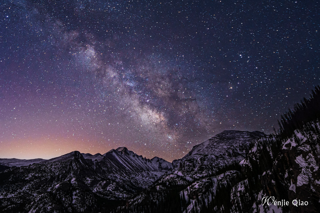
The night sky above Loveland Pass
Drainages of the Front Range
 |
South Platte River DrainageThe South platte is one of the major river tributaries of the larger Platte River which eventually meanders its way northeast through Denver & Nebraska before draining into the Mississippi. Originally names the Rio Chato, it was renamed some years later the Rio Jesus Maria before the French had their way and christened it the Platte.The South Platte has its origins in Park County a few miles upstream from the confluence of the South and Middle Forks. Before it reached this dry but picturesque area of the Forks, it courses through towns like: Deckers, South Platte and Lake George. It flows east for roughly 45-50 miles through the Platte Canyon and Waterton Canyon (southwest of Denver) before it's stopped by Chatfield Reservoir in Littleton.There are several dams along the Platte. Most notable are Spinney Mountain Reservoir and Eleven Mile Reservoir (great place for rock climbing!). The South Platte has several well-known smaller rivers that drain into it like the Big Thompson, Clear Creek, Pawnee, Cache la Poudre & Cherry Creek.● Drainage System Map |
 |
Arkansas RiverThe Arkansas River headwaters is one of the better known systems in Colorado simply because of its reputation with fly fishing, rafting and proximity to the Sawatch Fourteeners. The cradle for the Arkansas is located at the bottom of Fremont Pass (near the Climax Mine) and Mt. Arkansas. The Lake Fork portion has its start out west near Turquoise Lake outside the town of Leadville.The Arkansas River is used for pretty much everything under the sun: recreation, agriculture, farming, drinking water etc. However, of special note concerning the Arkansas...is mining. Routinely, during spring thaw/melt in the highcountry, the mines east of Leadville (California Gulch) will breach their holding dams and spill leached materials and metals into the Arkansas. It's thought that the Arkansas now contains an additional 115,000 cubic yards of mine tailings from these discared mines on the lower slopes of peaks such as: Mt. Sherman, Peerless and Finnback Knob.The river flows south through the Arkansas Valley to towns like Buena Vista and Salida before dog-legging east through Bighorn Sheep Canyon, Canon City and the Royal Gorge. It exits via Pueblo in a southeast direction.● Drainage System Map |
 |
Pikes Peak DrainageThe Pikes Peak Drainage though technically, a continuation of the Arkansas is distinguishable enough to separate it. The canyon and placers in between Salida and Pueblo drain the whole region, Fountain Creek and Beaver Creek being the most notable.Beaver Creek drains to the east...the southern slopes and foothills of Pikes Peak. It eventually exits into the Arkansas between the towns of Penrose and Pueblo. Fountain Creek originates on the northern slopes near Woodland Park and drains away towards the southeast (Colorado Springs). It eventually merges with Monument Creek before joining into the Arkansas near Pueblo. This general vicinity loosely seperates from the Sangre de Cristo to the south.The Pikes Peak Watershed consists of nearly 13,000 acres owned by the City of Colorado Springs. Colorado Springs tasked the Colorado Springs Utilities Water Resources Department to manage the Watershed. Cooperative Watershed management with the Colorado State Forest Service started in 1984. The managed Watershed parcels are known as: North Slope, South Slope, Longs Ranch, and Rosemont.● Drainage System Map |
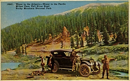 |
The Colorado RiverThe headwaters of the Colorado start high in Rocky Mountain National Park on the west side of the Continental Divide at Milner Pass. This area is astoundingly beautiful, just rugged enough to support a healthy population of bighorn sheep, elk and bear and yet, remain accessable enough for anglers and hikers.It flows south through the lower valley of the Kawunechee paralleling Trail Ridge Road. In the lower meadows/wetlands, moose are frequently seen.The Colorado is captured by Shadow Mountain Reservoir and Lake Granby. From here, it is let loose again to flow through Gore Canyon, Kremmling and into the impressive Glenwood Canyon.Because so many in the desert states depend on the Colorado for drinking water and irrigation, the Colorado is highly regulated and litigated. It is a constant source of dispute for MANY principalities, cities, counties for access and useage.● Drainage System Map A list of all of Colorado's rivers including those above along with major tributaries can be found on this Wikipedia link. |
Geology of the Front Range

The geology of the Front Range consists of some of the oldest rock in Colorado. The foothills and 'hogbacks' along the eastern border as they butt up against the Urban Corridor are among the oldest and consequently, the most weathered.
The Front Range is one of the geological features that makes Colorado unique and technically, functions as the eastern edge of the North American Cordillera which ranges as a whole, from Alaska clear down to Southern Mexico.
Roughly 68 million years ago, the Rocky Mountains began to form & grow during what's called the Laramide Orogeny. The techtonic plates began to push against each other essentially lifting the Rocky Mountain region. Add to that, erosion over the next few million years and you have our current state of the Rocky Mountains.
The Front Range, Elk and Sawatch Mountains are faulted anticlines with the Elk Mountains in particular, being examples of those ancestral rockies.
The basement strata was vaulted or thrusted upwards, breaking & bending under the stresses, bowing over the top sediments. The 'hogbacks' along the far eastern edge of the Front Range are prime examples of this process.
The geology of the Front Range was first noted and studied by the Hayden Surveys of the 1870's. Everything from white granite, sandstone, conglomerates, schist & gneiss etc. make up the multiple formations and what is known as the mineral belt. In one day, one could be climbing the red sandstone towers of Garden of the Gods west of Colorado Springs, drive through ancient tidal flats and subsequent shale deposits of the Pierre and Denver Formations, and be camping under the massive granite protrusions of 'Ships Prow' in the Longs Peak Cirque twenty miles west of Loveland by nightfall.
Take a virtual FIELD TRIP throughout the Front Range.
A few definitions of classic geology terms:
- Sandstone: Most sandstones as we know them are comprised of quartz, silica and feldspar. Sandstones are usually very colourful ranging from off-whites, browns, pinks, tan, reds, burnt sienna's to almost black. Sandstone is probably one of the biggest indicators of conditions that were marine or aquatic in origin but due to uplift, now straddles altitudes of several thousand feet. Deserts also make up a good percentage of where sandstone has or can be found. Sandstone, unlike granites, balsaltic or pumices is 'claystic' in nature. Meaning, the composition is cemented togther using typically, calcite (CaCO2- carbonate) or silica. Due to the composition of sandstone, it isn't always the most reliable medium for climbing (Indian Creek, Roxborough State Park, Garden of the Gods, Red Rocks Ampitheater).
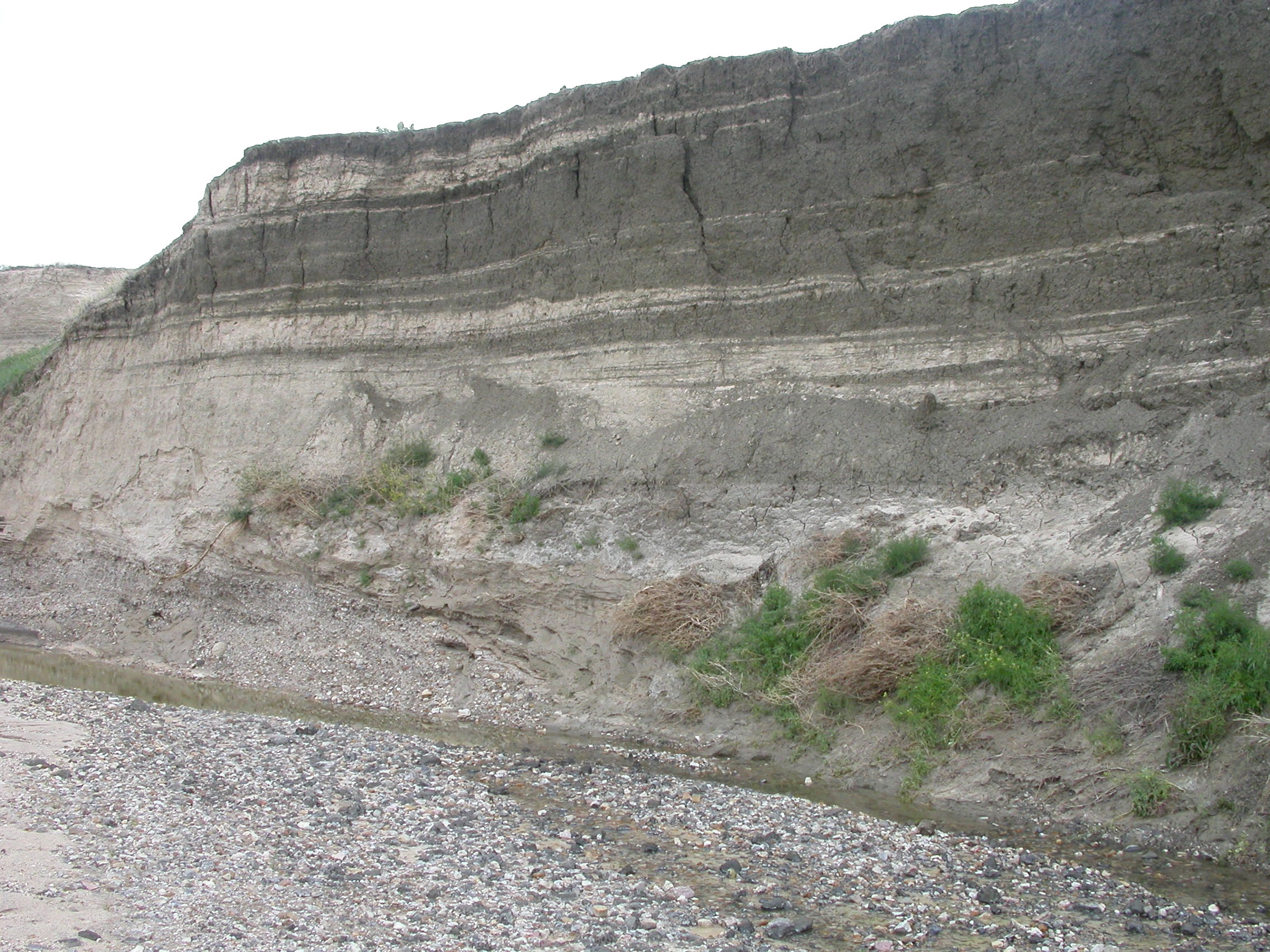
- Shale: is also a sedimentary rock of clastic origins that usually entail mud and finer grained minerals the size of silt or even as fine as ash. Shale is characterized by it's even, laminar breaks as it's broken easily in sheets or layers. Clays are the most predominant matrix composing shale but due to inherent mixtures of minerals, shales can take on hues ranging from tan, brown, black or green. Shale is the most common type of sedimentary rock and is also indicative of aquatic environments.
- sedimentation: The tendency for particles in suspension (liquid) to settle out of the fluid in which they are entrained, and come to rest against a barrier is sedimentation. This is due to their motion through the fluid in response to the forces acting on them: these forces can be due to gravity or centrifugal acceleration. Settling is the falling of suspended particles through the liquid, whereas sedimentation is the termination of the settling process.
The term is typically used in geology, to describe the deposition of sediment which results in the formation of sedimentary rock (siltstone, sandstone, shale,) and in various chemical and environmental fields to describe the motions of often-smaller particles and molecules.
Sedimentation pertains to objects of various sizes, ranging from large rocks in flowing water to suspensions of dust. Even small molecules such as aspirin can be sedimented, although it can be difficult to apply a sufficiently strong force to produce significant sedimentation.
- Formation: In a geologic context, 'formations' are used as a term to describe and group similar rock compositions into strata different from neighbouring strata. Usually metamorphic or sedimentary in nature, formations are not used as an end-all term for sizes of various strata. But instead, formations are useful for classifying rock of similar composition across a wide range of territory. Formations in turn, can be further sub-divided into smaller, more specific classifications such as members and groups.
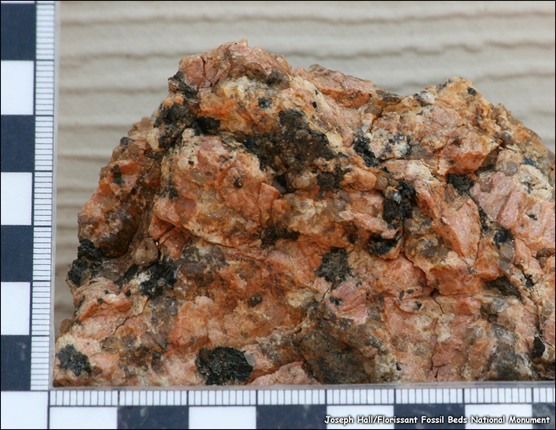
- Granite: The word 'granite' comes from the latin, granum, meaning 'a grain' mostly due to its rough or course nature. granite is the most common type of igneous rock with examples being: feldspar, quartz and mica. Granite itself can carry a wide-array of constituent elements ranging from: silica, iron, aluminum, magnesium etc. Colors do vary as in all types of rock but white and pink are the usual culprits; white being due to carbonates (calcium) and pinks due to heavier deposits of feldspar.
Granite is typically found throughout the Earth's crust and is generally considered the most abundant 'basement layer' strata. Granite typically is quite safe (and preferred) for climbing due to it's stability and strength.
- Igneous: Any of various crystalline or glassy, noncrystalline rocks formed by the cooling and solidification of magma. Igneous rocks comprise one of the three principal classes of rocks, the others being: metamorphic & sedimentary. Though they vary widely in composition, most igneous rocks consist of quartz, feldspars, pyroxenes, amphiboles, micas, olivines and apatite.
- strata: In geology, strata is usually defined as a mass of homogeneous sedimentary material, either consolidated rock or unconsolidated soil, occurring in distinct layers and visually separable from other layers above and below.
- orogeny: Formation of an orogen is accomplished in part by the tectonic processes of subduction, where a continent rides forcefully over an oceanic plate (noncollisional orogens), or convergence of two or more continents.
Orogeny usually produces long arcuate (from arcuare, to bend like a bow) structures, known as orogenic belts. Generally, orogenic belts consist of long parallel strips of rock exhibiting similar characteristics along the length of the belt. Orogenic belts are associated with subduction zones, which consume crust, produce volcanoes, and build island arcs. The arcuate structure is attributed to the rigidity of the descending plate, and island arc cusps are related to tears in the descending lithosphere. These island arcs may be added to a continent during an orogenic event.
The processes of orogeny can take tens of millions of years and build mountains from plains or the ocean floor. The topographic height of orogenic mountains is related to the principle of isostasy, that is, a balance of the downward gravitational force upon an upthrust mountain range (composed of light, continental crust material) and the buoyant upward forces exerted by the dense underlying mantle.
Frequently, rock formations that undergo orogeny are severely deformed and undergo metamorphism. During orogeny, deeply buried rocks may be pushed to the surface. Sea bottom and near shore material may cover some or all of the orogenic area. If the orogeny is due to two continents colliding, the resulting mountains can be very high (Himalaya & Karakoram).
An orogenic event may be studied as (a) a tectonic structural event, (b) as a geographical event, and (c) a chronological event. Orogenic events (a) cause distinctive structural phenomena related to tectonic activity, (b) affect rocks and crust in particular regions, and (c) happen within a specific period of time. -Direct from Wikipedia
- Basalt: Also an igneous rock alongside granite, basalt ranks as one of the most common types found in the Earth's crust. This is what we see, mostly, when we view magma erupting out from volcanoes. The crystalline structure of balsaltic rocks is extremely fine-grained due to its 'Hadesesque origins'.
| |
Starting with the oldest formations along the Front Range, this includes the: Precambrian, Fountain Formation, Lyons & Lynkins Formations and Morrison Formation (also known as Morrison Sandstone). Some of the youngest rock includes: the Pierre Formation, Fox Hills and Green Mountain Formations. Some of the best places to see these strata are along I-70 through the cut, up in Golden Gate Canyon State Park just west of Golden, Red Rocks State Park, US 285 south of Morrison and Owl Canyon Road northwest of Laporte. The following section details some of the formations one would encounter while driving or climbing. |
| Pikes Peak Granite |
Fountain Foundation |
| In the Colorado region, the molten rock that was spewed during the continent-forming epoch, finally cooled. It formed what we call the Precambrian Pikes Peak Granite (an igneous intrusion). Over the next 500 million years, little is known about changes in the sedimentation (sediment deposition) after this granite was produced. Roughly around 470–280 million years ago, the region began to sink and sediments began to deposit in the empty, hollowed-out space. After the volcanic activity died away, a large mass of molten magma was left underground. Because the magma was buried about 2 miles underground, it took thousands of years for it to cool. This ended up creating the [mostly white] granite batholith that we now see on the slopes of Pikes Peak and other areas throughout the Front Range. Over time, the weathered and consequently, eroded granite produced sand particles (various sizes) that began to form strata/layers of sediment. Sedimentation would continue to take place until about 300 million years ago. The granite is typically dominated by a various composition of feldspar, quartz and biotate mica. |
About 300 million years ago, the 'magmic' sinking suddenly reversed and the sediment-covered granite began to uplift thus giving rise to the Ancestral Rocky Mountains. Over the next 150 million years (the Pennsylvanian age), the mountains would continue to erode and cover themselves in their own sediment. Wind, gravity, rainwater, snow, and ice-melt supplied rivers that ultimately carved through the granite mountains and eventually led to their demise. The sediment from these mountains lies in the Fountain Formation which, is very rich and abundant in pink feldspar. Red Rocks Amphitheater outside of Denver & The Flatirons outside of Boulder are actually set into the Fountain Formation. Those of us whom have climbed at Red Rocks or Garden of the Gods knows how crumbly the rock can be...evidence of sedimentation. |
| Lyons Sandstone |
Lykins Sandstone |
| At 250 million years ago, sea levels were low and present-day Colorado was part of the super-continent Pangaea. Sand deserts covered most of the area spreading as dunes seen in the rock record...known today as the Lyons Sandstone. These dunes which, are basically fossilized, appear to be cross-bedded and show various fossil footprints and leaf imprints in many of the strata making up this section. Lyons Sandstone forms a gradual but definite boundary with the Fountain Formation. |
The Lykins Formation consists of fine-grained sandstone, siltstone, mudstone, red shale-beds and limestone. The depositional (aquatic) environment was probably an inter-tidal zone in an epicontinental lagoon with shallow pools of hypersaline water. This formation began right after Earth’s largest extinction period 250 million years ago at the Permian-Triassic Boundary. Ninety percent of the planet’s marine life was destroyed during this event. There are only sporadic outcrops of the Lykins Formation exposed. Fortunately, the entire section can be seen at the US Highway 24 roadcut |
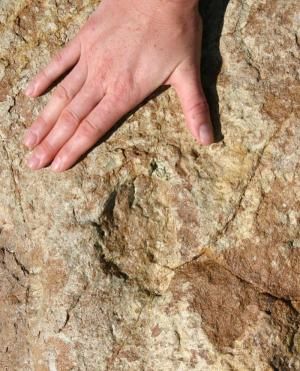
| Morrison Formation |
Dakota Sandstone |
| The Morrison Formation is famous for its dinosaur fossils, which have been collected for more than a century beginning with a find near the town of Morrison, Colorado in 1877. It is especially known for its sauropod tracks and sauropod bones among other dinosaur fossils. Radiometric dating indicates that the Morrison Formation is between 148 million and 155 million years old. The sediments in the Morrison Formation include multicoloured mudstones, sandstones, conglomerates as well as minor amounts of limestone and clay. The sediments were derived from western mountains, such as the Sierra Nevada range, that were uplifted during Late Jurassic time. There are also numerous volcanic ash beds within the formation that have been used to date the deposits through radiometric techniques. Some sediments in the lowest portion of the Morrison Formation are marine in origin, but the majority of the sediments were deposited along rivers, streams, lakes, mudflats, swamps, and alluvial plains that covered the western interior of North America during the Late Jurassic. |
Dakota Sandstone, which was deposited ~100 million years ago towards Colorado’s eastern coast, shows evidence of ferns, fish, insect and dinosaur tracks somewhat anaglous with the Morrison Formation. Sheets of ripple marks can be seen on some of the strata, confirming the shallow-sea environment. The Dakota Sandstone tends to form the top-most layers of the hogbacks, usually in a north-south direction, of which is so popular for top-roping. Ripple and current marks are also usually evident again, of an aquatic environment. |
| Pierre Shale |
Denver Formation |
| The Pierre Shale Formation is a division of the upper Cretaceous rocks in the United States (the Cretaceous Period lasted from about 146 million to 65.5 million years ago). Named for exposures studied near old Fort Pierre, S.D., the Pierre Shale strata occurs in South Dakota, Montana, Colorado, Minnesota, New Mexico, Wyoming, and Nebraska. The Pierre Shale consists of about 2,000 feet of dark gray shale, some sandstone, and many layers of bentonite (altered volcanic-ash falls that look and feel much like soapy clays). In some regions the Pierre Shale may be as little as 650 feet thick. Archelon, the Cretaceous sea turtle fossil and largest known turtle species, has been found in the Pierre Shale of South Dakota. The shale is rich in marine fossils and is solidly indicitive of an ocean environment. |
This medium thickness strata contains fossils and bones from dinosaurs like Tyrannosaurus rex and Triceratops. While the forests and lower vegetation, dinosaurs, and other organisms thrived, their reign would come to an end at the Cretaceous–Paleogene boundary (which is also known as the K-T boundary). Like just about everywhere else in the world, Colorado literally burned to the ground in the aftermath of the meteor impact (off the coast of the Yucatan). A rather inconspicuous clay layer devoid of fossils but rich in extraterrestrial iridium, impact-shocked quartz grains and elemental carbon (char) marks the K-T boundary all over the globe (Denver Formation). In Colorado, the K-T clay and char crops out in only a few locations in the south, including a road cut on I-25 between Trinidad and Raton, where it's all of 5-10 cm thick—not much to show for a global catastrophe. It's also exposed at the south end of Lake Trinidad west of Trinidad in a 5 cm white clay over coal layer The uplifted Front Range continued to constantly erode and, by 40 million years ago, the range was once again buried in its own rubble. |
| Castle Rock Conglomerate |
Quartanary Deposits |
| 37 million years ago, a great volcanic eruption took place in the Collegiate Range and covered the landscape in molten hot ash that instantly torched and consumed everything across the landscape. An entire lush environment was capped in a matter of minutes with 20 feet of extremely resistant rock...rhyolite. However, as seen before, life rebounds, and after a few million years mass floods cut through the rhyolite and eroded much of it as plants and animals began to recolonize the landscape. The mass flooding and erosion of the volcanic rock gave way to the Castle Rock Conglomerate that can be found up and down the Front Range. |
Eventually, at about 10 million years ago, the Front Range began to rise up again and the resistant multi-colored Pikes Peak Granite in the heart of the mountains, thrust upwards while the weaker sediments deposited above it eroded and were carried away. Quaternary sediments are commonly recognized in the field by their lack of consolidation into rock and by association with landforms representing processes of deposition. The fossils in these deposits are very similar to modern life-forms but they may represent evidence of cooler (or perhaps sometimes warmer) climates. Quaternary sediments are most easily distinguished in temperate latitudes where glacial or periglacial processes held sway. Till is a distinctive type in many locations. This poorly sorted mix of debris contains a fine matrix enclosing outsized pebbles, cobbles, boulders, and sometimes rock types carried from distant locations. As the Front Range continued to rise however, streams and recent glaciations (16,000 years ago) during the Quaternary Age literally unburied the range by cutting through some of the weaker sediment and giving rise to the granitic peaks that are present today. This was the last step in forming the present-day geologic sequence and history of the Front Range. |

The Fourteeners
 The Front Range contains six of Colorado's 56 Fourteeners'. Due to the proximity these peaks have towards Denver, Colorado Springs, Monument, Boulder, Fort Collins & Castle Rock, these peaks are exceedingly popular and busy on summer weekends. All the Front Range Fourteeners by way of their easiest route to the summit are nothing more then simple walk-ups...with the only exception being Longs Peak which requires class-3 scrambling skills. However as with all mountains, other routes do exist of varying difficulty.
To maximize solitude or relative isolation, it would be prudent to scale these peaks mid-week. All peaks are likewise accessible during the winter months with marginal increases in approach mileage.
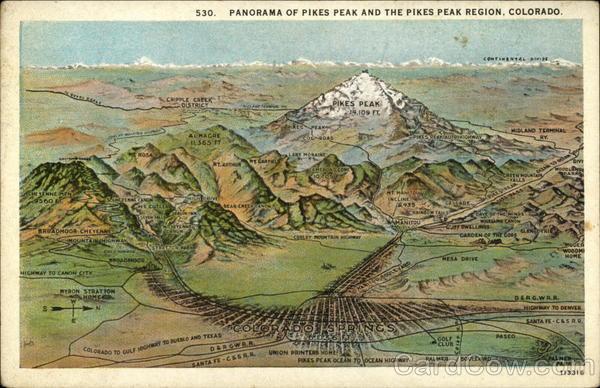
Pikes Peak
...stands at 14,110 feet. It is Colorado's 30th highest peak. It rises above Cheyenne Mountain and NORAD and dominates the Colorado Springs skyline. Pikes Peak has a [private-fee involved] road and a cog railway to the summit. Pikes Peak is the easternmost fourteener in the United States. While standing on the summit & obviously moved by the vistas before her, Katherine Bates penned the iconic “America the Beautiful”, a poem which was later put to music.
Pikes Peak also offers the highest elevation gain in Colorado with a vertical rise of 7,800 feet above downtown Manitou Springs in just over 7 miles. Pikes Peak is the monarch of the southern Front Range and is the second most prominent peak in Colorado...behind Mt. Elbert.
Statistical beta via Lists of John
![]()
Grays Peak
...stands at 14,270 feet and is the 9th highest peak in Colorado. It is
located about 4 miles south of Exit 221 on Interstate 70 and is the highest point on the Atlantic-Pacific Continental Divide. It is also the highest point of Clear Creek and Summit Counties. Grays Peak and it's neighbor Torreys Peak are the only fourteeners on the Continental Divide and are frequently climbed together. Both Grays and Torreys Peaks were named after a pair of botanists from the greater Denver area.
Grays Peak has a Class 1 standard route and several Class 2 routes that are accessible from multiple trailheads.
Statistical beta via Lists of John
![]()
Torreys Peak
...stands at 14,267 feet and is the 11th highest peak in Colorado. It is
located about 3.5 miles southeast of Loveland Pass and about 3.5 miles south of Interstate 70. It is quite impressive, particularly in winter, as seen from Interstate 70 near mile marker 221 near Bakerville.
Grays Peak and Torreys Peak are the only fourteeners on the Continental Divide and are frequently climbed together. Torreys Peak has several Class 2 and 3 routes that are accessible from multiple trailheads.
If attempted in combination with Grays Peak the only Class 2 section is the ridge traverse between the two peaks.
Statistical beta via Lists of John
Longs Peak
...stands at 14,259 feet and greets travelers entering Colorado from the
north on I-25 or from the northeast on Interstate 76. Longs Peak is the most northern fourteener in Colorado and in the Rocky Mountains. It is the highest point in Rocky Mountain National Park and of Boulder County.
Longs Peak is the monarch of the northern Front Range. Longs Peak with it's Class 3 standard route is the only Front Range fourteener without a Class 1 or Class 2 route.
Statistical beta via Lists of John
![]()
Mt. Evans
...stands at 14,264 feet and is located approximately 35 miles west of
downtown Denver and is visible from much of the metropolitan area. Mt. Evans is the 14th highest peak in Colorado, lies in Clear Creek County and carries a respectful 2,764' of prominance. There is a paved road to the summit accessible from Interstate 70 at Idaho Springs (Exit 240).
A classic route is to start at the Guanella Pass trailhead and summit Mt. Bierstadt then traverse the Sawtooth, a fun and airy Class 3 scramble to the summit of Mt. Evans.
Statistical beta via Lists of John
![]()
Mt. Bierstadt
...stands at 14,060 feet and is the lowest Front Range fourteener. It carries about 720' of prominance and is Colorado's 38th highest peak. It is
one of Colorado’s easiest fourteeners to hike and is frequently hiked/snowshoed/skied in winter. Guanella Pass (from I-70) is currently undergoing rock scaling and re-grading. Closures are common until the road improvements are finished. To mitigate extra approach mileage from the north come winter, approach from the south from the small town of Grant on #285.
Mt. Bierstadt is commonly climbed/scrambled with Mt. Evans via The Sawtooth...a GREAT scrambling ridge!
Statistical beta via Lists of John
The Thirteeners
 |
Mt. Meeker 13,911' Contains 451' of prominence and is located right next to Longs Peak. Mt. Meeker is a very slabby, granite peak. It has a number of excellent alpine climbing routes. |
![]() |
Mt. Edwards 13,850' Contains 470' of prominence and is located in Clear Creek Summit counties. It's often climbed with Argentine Peak from the Waldorf-Santiago Mines just south of Georgetown on I-70. |
 |
Mt. Silverheels 13,822' This gentle giant of
a mountain carries 2,280' of prominence
and has fantastic views of South Park. Silverheels is named in honor of girl who died from smallpox while taking care of smallpox-stricken miners. |
 |
Square Top Mountain 13,794' This mountain sits opposite of Mt. Bierstadt to the west of Guanella Pass. It makes for a great winter peak and has 814' of prominence. |
 |
Argentine Peak 13,738' This peak is named after the latin 'argentum' for silver. This was due to the mines in the area. Argentine Peak is an easy summit to hike usually along with Square Top and Mt. Edwards. |
![]() |
Bald Mountain 13,684' This is likewise an easy summit to hike and very easy to dismiss. An unassuming name doesn't help of course. Bald Mountain is located near the town of Breckenridge. It presents with 2,100' of prominence! |
 |
Bard Peak 13,641' Bard Peak is almost always hiked along with Mt. Parnassus. Both peaks have great views of the I-70 corridor below and of Grays and Torreys Peaks to the southeast. |
![]() |
Gray Wolf Mountain 13,602' Like most of the other peaks in this table, Grey Wolf is as gentle as they come. It's located just north of Mt. Spaulding, next to Mt. Evans & Bierstadt. Gray Wolf carries 581' of prominence. |
![]() |
Chiefs Head 13,579' This hidden granite bastion is a worthy destination located in Rocky Mountain National Park. This massif is west of Longs Peak in the Glacier Gorge drainage. It is the #203 highest in Colorado. |
![]() |
Mt. Rosalie 13,575' Mt. Rosalie is nothing more then a simple walk-up. It is Colorado's #207 highestpeak and is situated in the Mt. Evans Wilderness. Great views of Denver and the Front Range can be had. |
 |
Mt. Parnassus 13,574' This huge bulk of a mountain is easily seen from I-70. It is often hiked with Woods Mountain & Bard Peak. Parnassus carries 537' of prominence is Colorado's#208 highest. |
 |
Hagues Peak 13,560' Hagues Peak sits a fair way into the backcountry in Rocky Mountain National Park. It is next to Mummy Mountain and offers some good scrambling near the summit. |
| HONORABLE MENTIONS |
 |
![]() |
 |
![]() |
| Pettingell Peak 13,553' |
"Epaulie Peak" 13,530' |
Ypsilon Peak 13,514' |
North Arapaho Peak 13,502' |
Hiking Opportunities/Areas of Interest
 Hiking along the Colorado Trail Hiking along the Colorado Trail |
There are certain aspects that simply must be understood and acknowledged. But when one has 50-80 mile vistas to deal with, watching trout dart from above in crystal clear stream or hearing elk call out during the seasonal rut, can one REALLY complain about the 'seemingly' smaller aggravations of having to share the same trail with others? I would hope not.
Because the terrain of the Front Range is so varied, especially in terms of vegetation and altitude, one can take a trail of similar difficulty and length in say, Red Mountain Open Space and compare it with something in Mueller State Park and have completely different experiences. There's a reason why Colorado has so many Wilderness Areas and granted, population certainly has a hand in why but even more so, the astounding beauty in the natural world is why I think, the powers that be set aside these tracts for preservation for others. Everyone recognizes the wealth we have along the Front Range in raw beauty.
The following list is a few ideas and suggestions to look at or to explore while out and about. They range anywhere from a few hours commitment to a whole day. But regardless, all are deserving of our attentions and memories. ENJOY! 
Northern Front Range • • • • • • • • • • • • • • • • • • • • • • • • •
Mt. Margret Trail (Red Feathers Lake)- This is an easy stroll through moderate to dense pine and evergreen forest. The trail itself is easy to follow & in terms of difficulty, it is also easy and gentle. Views from the top aren't exactly what I'd call the best, but the hiking & scenery along the way is rather nice.
Mt. McConnell Trail (Poudre Canyon)- This is a good combination of easy to moderate hiking with the last little section (to the summit) being a bit off route, an easy hikers path. There is a good parking lot at the bottom with occasional signs along the way. Views from the top are decent especially west towards the Never Summer Mountains. This trail can be exceedingly hot and dry in the summer...and crowded. In the winter, expect solitude!
Hewlett Gulch (Poudre Canyon)- The Hewlett Gulch Trail is a dry trail. It is also very hot in mid-summer. Expect to see many hikers, trail runners, people walking their dogs and mountain bikers. Vegetation is a lot of cactus, bitterbrush, yucca (Spanish bayonet) and thistle. Many lower quad=points are attainable from Hewlett Gulch. It is close to Fort Collins and the ever-more popular, Gray Rock.
Young's Gulch (Poudre Canyon)- Located only a few miles further up Poudre Canyon from Hewlett Gulch, Young's Gulch is a great alternative if Gray Rock & Hewlett are over-crowded. The trail is as easy to follow and gentle. It crosses the creek many times and you'll have to share the trail with mountain bikers who are looking for some 'muddy sections'. To access the quadpoints located up this gulch, simply identify from a topo map and proceed straight up the canyon walls to the higher ridges. This whole area was affected by the High Park Fire in the summer of 2012.
Zimmerman Lake Trail (Cameron Pass)- This is a wonderful trail located fairly near to treeline. It is a long drive from Fort Collins but the forest surrounding Zimmerman Lake is thick. Bear, deer and elk frequent the area. Pine Martin is also seen. The trail is short but offers some great, pristine views in the Neota. This is a great place slightly off the beaten track.
Gray Rock (Poudre Canyon)- This is undoubedtly the premier trail in Poudre Canyon. There are two routes to the gray monolith, the shorter Gray Rock Trail and the slightly longer, Gray Rock Meadows trail. This is popular with hikers, dogs and climbers. There are some fantastic routes on Gray Rock ranging from 5.4 to 5.12+. Like pretty much everything else in Poudre Canyon, the trail can be hot and dry come summer. The meadows are a fantastic place to camp.
Crosier Mountain (Loveland/Estes Park District)- This is a kind of 'local's mountain.' Many hike, trail run and snowshoe this easy trail. And the great part is, if one trailhead is too crowded, there are two other trails that converge just below its summit! All three trailheads are located in the Little Thompson Canyon between the towns Drake and Estes Park. All three trails are moderate in difficulty but different in mileage. Great views of the Estes Valley from atop!
 Gem Lake Gem Lake |
Devil's Backbone (Loveland District)- This is a popular area for trail runners, mountain bikers and hikers. There is climbing and scrambling along the 'backbobe' itself as well but be warned, the rock is highly fractured, weathered and crumbly. To access the 'highpoint' of the 'backbone', some low 5th climbing will be required. This area is prime mountain lion habitat. Trails are easy to follow and gentle. This area does eventually connect up with Coyote Ridge Open Space further north.
Horsetooth Mountain Trail (Fort Collins)- A great place with stellar views of Ft. Collins and the rest of the front range. Due to increased useage, Larimer County has in recent years implemented a toll booth and larger parking lot with picnic tables and restrooms. The trail is moderate and easy to follow. There are MANY trails that criss-cross this area. One can spend most of an afternoon hiking or running them all. Horsetooth is also popular with mountain bikers. Great place to hike at night to watch the city lights!
Lake Isabelle (Boulder/Ward Area)- Lake Isabelle is a moderate but stunning hike through the Indian Peaks Wilderness. The trailhead is Brainard Lake located just past the small town of Ward on the Peak-to-Peak Highway. There is an entrance fee & restrictions. The hike passes by waterfalls, profuse wildflowers and the lake itself, offers views of the higher peaks & crags (Mt. Audobon, Navajo Peak, Dicker's Peck, Niwot Ridge et al. This is a terrific hike to take not all that far from Boulder or Nederland.
Royal Arch Trail (Boulder)- The Royal Arch Trail is great for short, day excursions only a matter of minutes from Boulder. The scenery is great as views of Boulder and the Flatirons are always either in front of you or right behind your back. Views of the Third Flatiron especially. Raptors call this place home so be on the lookout for eagles! The scenery can be a bit reminiscent of Utah.
Gem Lake (Estes Park)- This is a moderate to slightly difficult trail. The trailhead was relocated in recent years to minimize damage to the nearby historic McGraw Ranch. The trail winds and switchbacks frequently. There is plenty of shade and come Autumn, the aspens are beautiful. Gem Lake sits somewhat isolated and sheltered. Great place for a picnic or simple scrambling on the local granite. Just take care for the thieving chipmunks!
Central Front Range • • • • • • • • • • • • • • • • • • • • • • • • •
Mt. Sniktau (Loveland Pass/I-70)- This is an alpine hike along a mellow and gentle ridge. The hike from the trailhead which, really is nothing more than Loveland Pass, starts out on the steep side. Once the ridge is attained, the views are incredible! "Cupid", Torreys Peak & Grays Peak, Grizzley Peak and Lenawee Peak all to the south and east and Loveland Ski Area to the west. Bring a jacket. Winds are the norm.
Bear Peak (Boulder Area)- Bear Peak is one of the two, South Boulder Peak being the other peak that leers over Boulder like two twins. Fact, I'm shocked that these two weren't remaned the twins at some point. The trail starts at the top of NCAR. The trail meanders through forest, meadow and sandstone slab before steepening considerably to the summit. The views from the top are amazing! Bear Peak & South Boulder Peak both are moderate to difficult trails. Oh. And since this is Boulder County we're talking about, non-county residents are forced to pay a parking fee...yeah...I know. 
South Boulder Peak (Boulder Area)- This is Bear Peaks' partner in leering over Boulder. The trail is fairly similar to Bear Peak except that the peak itself is slightly higher. What this trail DOES offer is great views of the climbing pinnacle, Devil's Thumb. Otherwise, scenery is alomst identical.Oh...so are the fees.
Green Mountain Trail (Denver Area)- This fairly low elevation, gentle bulk of a mountain is akin to Denver. The trail is a easy as they come. Is it possible to have a class 0.5? Great place for runners, hikers, bikers only out for an hour or two. Plus one does have the advantage of, after an hour or so of good running, of downing a pint in Morrison. Views from the summit ridge are surprisingly good!
Watrous Gulch Trail (Denver/I-70 corridor)- Mid-week, this is a good trail to hit to get some decent elevation in. Come weekends, 'buyer beware!' This, along with the Herman's Gulch Trail are popular outings right next to the Eisenhower Tunner and Loveland Ski raea. The trail courses through evergreen forest, now thinned out due to beetle but parallels I-70. It's possible to access Mt. Parnassus and Woods Mountain from this trail. Trail is moderate.
Herman Lake/Gulch (Denver/I-70 corridor)- Of all the offerings located in the central portion of the Front Range, Herman's Gulch has to be one of my favourite destinations. If taken to its terminus, Herman's Lake awaits...a small, alpine lake nestled underneath the bulk of Pettingell Peak. Then of course, the Continental Divide Trail runs through here and The Citadel & Mt. Machebeuf are also accessed. The trail is moderate and about 3.0 miles one way. Just like the Watrous Trail, this is a popular place to go. Great in winter for cross country skiing or snowshoeing.
Fountain Valley Trail (South Denver Area)- This is a loop trail that is sporadically marked to explain features of the terrain. It is easy class-1 and about 2.5 miles. Access is terrific. Open meadows, red rock sandstone crags and deer are encountered. This is one of the more popular trails at Roxborough State park.
Chicago Lakes (Denver/I-70 corridor)- This is one of the better offerings in the central portion of the Front Range. The trail is moderate to difficult. The forest it winds through is dense. After a brief drop into the small gorge below, it follows the creek to the lakes higher in the valley. The Chicago Lakes are located in the Mt. Evans Wilderness and at a respectful 5.0 miles one way, this hike will take up a good part of ones day. Highly recommended.
Waterton Canyon (Denver South)- Waterton Canyon is a great place to go to kill a few hours. The initial few miles up the canyon is hardpacked and asphalt in places. Mountain bikers are common. Once past the dam (Strontia Dam), the path turns to dirt. This is also where one can find the Colorado Trail. Expect plenty of people traffic.
Grays & Torreys Peaks (Denver/I-70 corridor)- Grays Peak is an officially designated NRT path. And due to easy and close access to Denver, a good, maintained parking lot and restrooms at the trailhead, this is one of the Front Range's most popular destinations...in summer. Come winter, things get pretty quiet as the Steven's Gulch Road becomes impassable except for snowshoe or ski. The trail is maintained and easy to follow. It starts out easy but eventually turns moderate in difficulty. For the Summitpost link, scroll up to the Fourteeners section.
Southern Front Range • • • • • • • • • • • • • • • • • • • • • • • • •
Ben Tyler Trail (Denver South)- This is a great trail just to spend a couple hours on an easy, undelating dirt path. The trail is easy to follow and borders the Lost Creek Wilderness. In the fall, due to the numerous aspen, this few mile stretch comes alive in yellows and oranges. Nothing too difficult and this would make for a great path to trail run. Useage is light to moderate.
The Crags (Colorado Springs West)- This is a heavily used trail located west of Colorado Springs. This is an easy hike on a good, maintained dirt trail. This is popular for both hikers (and their dogs) and bikers. The scenery is of thick forest, wonderful spires on the higher ridges (crags) and sparse open meadows. Water is available to drink via filter.
 Garden of the Gods Garden of the Gods |
Devil's Head (Colorado Springs North)- The Devils Head Trail is actually a short hike to the state's only permenently staffed fire lookout. It is a short trail through pine, aspen and evergreen. This is a popular trail for locals so like The Crags, don't expect too much isolation. But it is a quick way to get out for an hour or two.
The Incline (Manitou Springs)- The "Incline" is probably the most well-known 'hikes' on the Southern Front Range. In roughly one mile, you'll gain just over two thousand feet with an average grade of 40% and a maximum of 68%. This is a strenous hike to say the least. The path follows an old railroad bed once used by the Manitou railroad. The ties are still in place. Many people use this as a 'mother of sorts' of workouts. The Incline will test your legs and resolve!
Pikes Peak/Barr Trail (Manitou Springs)- Alongside The Incline, The Pikes Peak Barr Trail is probably the most well-known trail in Southern Colorado (Front Range). This is a long trail. It is very well maintained, dirt, easy to follow and ends at the summit of Pikes Peak. Many people hike and trail run this year round. In terms of useage, expect moderate to heavy pending on day of the week. The trail rises to over 7,800ft in just over 12 miles. So this is a strenous trail.
Catamount Trail (Colorado Springs West)- This is more of a little-known trail in the Colorado Springs West area. I won't say isolation & solitude is to be had, but this is a good choice to try and get that. Very unlike the Barr Trail, the trail can be a bit primitive to follow at times. It starts out near a neighborhood and switchbacks frequently through dry brush to the Catamount Reservoir. Good trail/place to get away from the crowds.
Garden of the Gods (Colorado Springs West)- There isn't one particular trail to mention here since the area is literally criss-crossed with multpile trails to choose from. If rock climbing isn't your thing, this still makes for a great outing (with a picnic of course) to hike and sit watching the rock climbers muscle their way up thin cracks and finger holds. Plus the scenery. The scenery is breathtaking.
Fox Run Regional Park (Colorado Springs North)- As pleasant as this area is, it almost reminds me of what a residential open space/park would resemble if set into the foothills. The trails are wide, hardpacked and maintained. There are two lakes and designated areas to picnic. Pine, birch and some aspen dot the area.
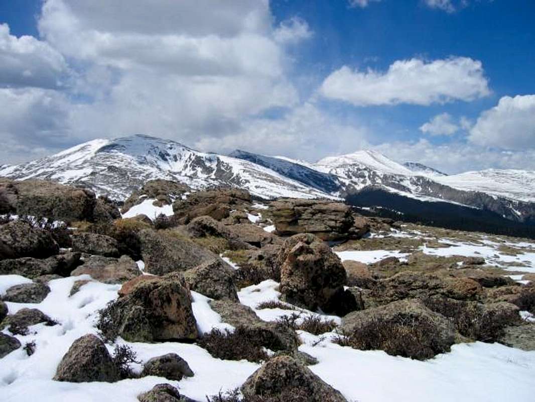
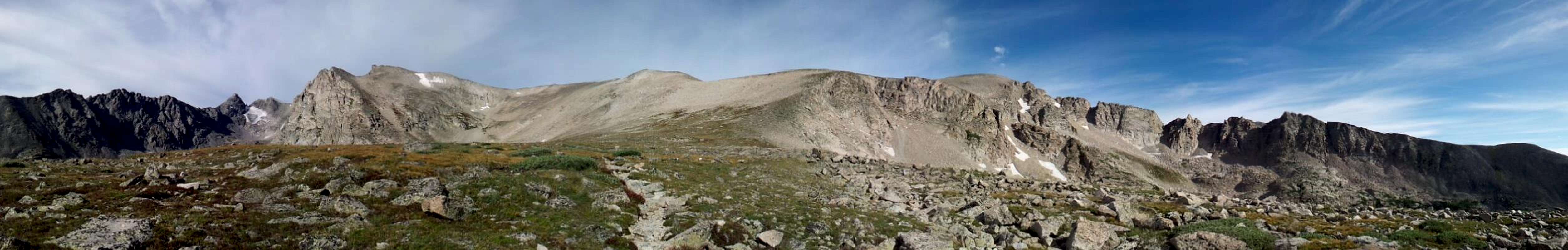
Indian Peaks Wilderness from just below Pawnee Pass
Summer, 2013
Wildlife
A smattering of animals & critters that one is likely to see while exploring the Front Range
Miscellaneous Links


RyanS - Nov 4, 2006 3:30 pm - Voted 10/10
Is there another Front Range?I was just wondering if the "(CO)" was necessary?
Kiefer - Nov 20, 2017 9:41 pm - Voted 10/10
Re: Is there another Front Range?Fixed. I agree, thanks, Ryan!
John Kirk - Nov 30, 2007 6:57 pm - Voted 10/10
Furthest east and relief?Nice page - wondering about the intro portion where Front Range is said to be furthest east in CO - the Spanish Peaks are further east than Pikes, and Fishers Peak is four quadrangles east of the Spanish Peaks. The relief of the Front Range is not unique - the Sangre de Cristos also have this on the east side.
Kiefer - Nov 20, 2017 9:42 pm - Voted 10/10
Re: Furthest east and relief?Thanks, John. I'll work on this description and make the requisite changes. Cheers, buddy!
wr - Jul 9, 2013 3:16 pm - Voted 10/10
Front Range definitionTraditionally the Front Range southern border is the Pikes Peak Massif. I agree that the "Greater Front Range" covers Spanish Peaks and Fishers Peak (also pointed out by Noel & Fielder in a book Colorado 1870-‐2000 Revisited: The History Behind the Images). I recently finished the Front Range Atlas, called "Eagle’s View of the Front Range" that covers those. You may download a pdf file of it from http://pikespeakphoto.com/aerials/front_range.html Note: it's a 53M file: 572 pages.