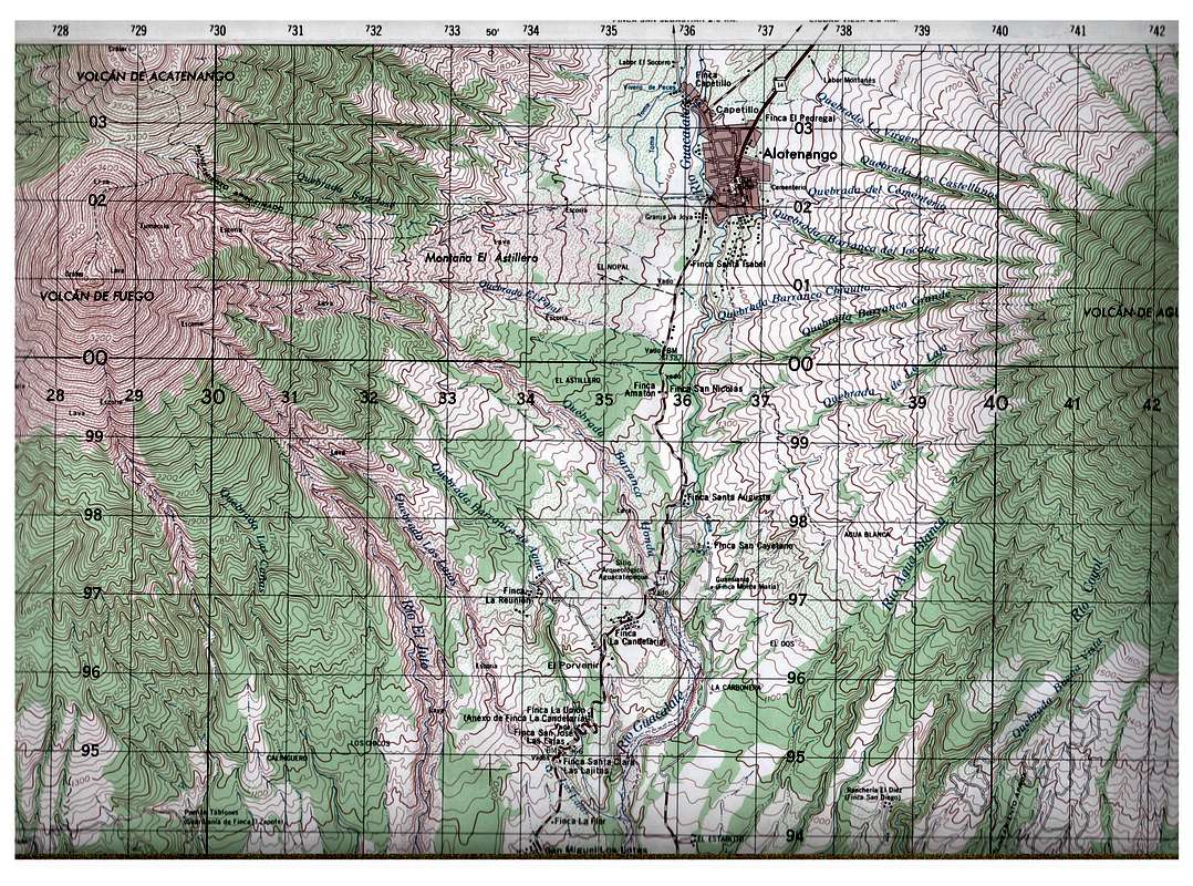
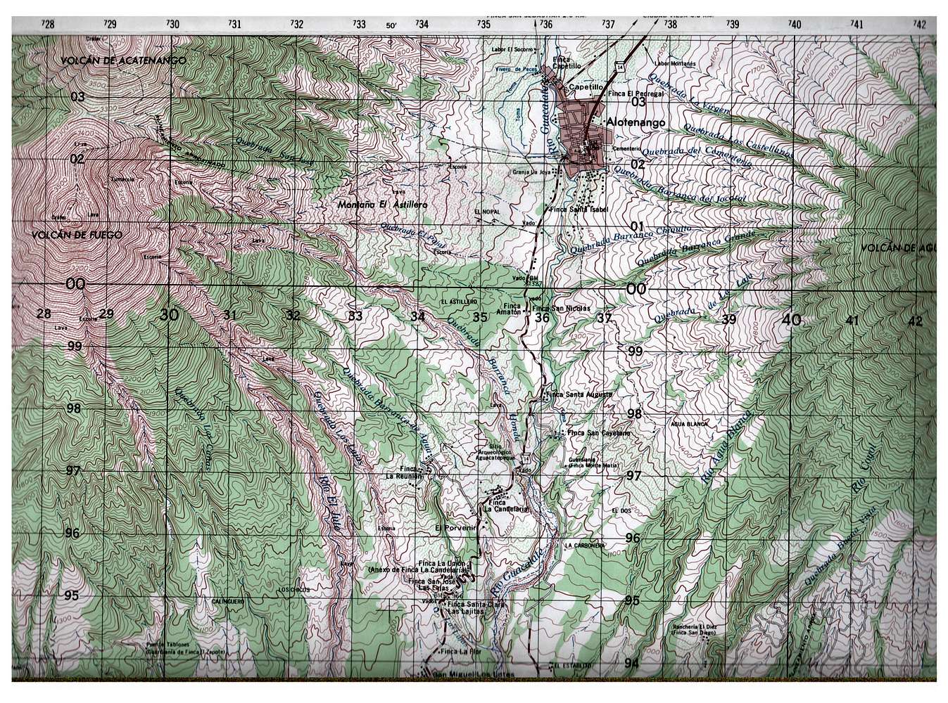
Published by the Instituto Geographico Nacional. Map name: Alotenango, Reference number: HOJA 2059 III. Contour intervals 20 meters. This section of the map includes most of Fuego, the southern half of Acatenango, and the western half of Agua. It also includes the town of Alotenango.


