
-
 8889 Hits
-
 81.84% Score
-
 14 Votes
|
|
List |
|---|---|
|
|
Valgrisenche/La Thuile/Val d'Isère/Haute Tarentaise |
|
|
GRANDE SASSIERE/RUTOR/PARAMONT OVERVIEW > TO 40° ~
MONT BLANC/JORASSES/VERTE and 33 MOUNTAIN CHAINS of the AOSTA VALLEY & SURROUNDINGS
AOSTA VALLEY 360° from West to East and from East to West in TOPOGRAPHIC clockwise system and order from Seigne Pass towards Seigne Pass (PARTS A+B+C+D+E+F+G).
SEVENTH PART (G):
PART G)- AOSTA VALLEY PART F)-SOUTHERN PARTIAL HALFCIRCULAR PERIMETER (40°~) OUTSIDE AREA from East to West and INSIDE AREAS to North and towards ISERE Valley (FRANCE)
This area, which continues towards West the Mountain Chain of Gran Paradiso, affects the GRAIAN CENTRAL to the Range Rutor and, more specifically, the Col de la Seigne, where shall start on the Mont Blanc Massif. In fact it is an arbitrary allocation and artificial, even if correct, valid from Geological point of view, since the Graian are a unique set, between the Cottian and Pennine Alps. The division, also corroborated through the famous "reads" by Dante Alighieri: "But (Maritime) with (Cottian) great (Graian) worth (Pennine) the (Lepontines) bears (Carnian and Rhaetian) down (Julian)" more and more, alas, unknown to the students, it is still valid and retains its classic and traditional distribution from the point of view of Geography. That's why we have included the Graian Southeast, not just Eastern, as opposed to those of the Northwest, or the Mountain Chain of Mount Blanc to the Ferret Hill, on the border with Switzerland. A great divide semicircular, starting from Piedmont, passing from France to conclude with the Mount Dolent, at the top of three Nations and the aforementioned hill, where the chain has its origin to the East of the Pennine Alps (from the Celtic Pen, ie Summit).
In our turn we split subtitles for this area (the number 14 to 17) highlighting the peaks of greater importance and those tiny subgroups belonging to the same, so as to highlight important Nodes Topographical or small areas in their own right and of some importance, knowledge and attendance mountaineering.
In this area, which includes the Valleys of Valgrisenche, La Thuile and its branch to the Little Saint Bernard Pass, he has held a direction diametrically opposite to that on the Gran Paradiso (again excluding the part towards the border with the France), or the crossings are described starting from Italian territory to conclude in this Transalpine.
***
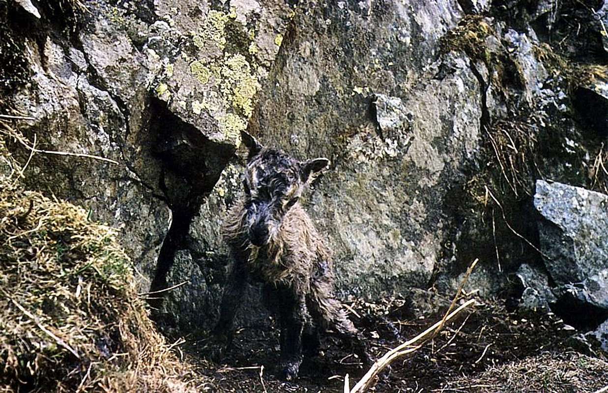
I am just BORN on the Wild Crest East Fourquin of Bioula in Rhêmes Valley into Central GRAIAN Alps,
by Ilario Antonio Garzotto
![]()
^^^^^^^
AOSTA VALLEY 360° from West to East and from East to West in TOPOGRAPHIC clockwise system and order from Seigne Pass towards Seigne Pass (PARTS A+B+C+D+E+F+G).
SEVENTH PART (G):
PART G)- AOSTA VALLEY PART F)-SOUTHERN PARTIAL HALFCIRCULAR PERIMETER (40°~) OUTSIDE AREA from East to West and INSIDE AREAS to North and towards ISERE Valley (FRANCE)
This area, which continues towards West the Mountain Chain of Gran Paradiso, affects the GRAIAN CENTRAL to the Range Rutor and, more specifically, the Col de la Seigne, where shall start on the Mont Blanc Massif. In fact it is an arbitrary allocation and artificial, even if correct, valid from Geological point of view, since the Graian are a unique set, between the Cottian and Pennine Alps. The division, also corroborated through the famous "reads" by Dante Alighieri: "But (Maritime) with (Cottian) great (Graian) worth (Pennine) the (Lepontines) bears (Carnian and Rhaetian) down (Julian)" more and more, alas, unknown to the students, it is still valid and retains its classic and traditional distribution from the point of view of Geography. That's why we have included the Graian Southeast, not just Eastern, as opposed to those of the Northwest, or the Mountain Chain of Mount Blanc to the Ferret Hill, on the border with Switzerland. A great divide semicircular, starting from Piedmont, passing from France to conclude with the Mount Dolent, at the top of three Nations and the aforementioned hill, where the chain has its origin to the East of the Pennine Alps (from the Celtic Pen, ie Summit).
In our turn we split subtitles for this area (the number 14 to 17) highlighting the peaks of greater importance and those tiny subgroups belonging to the same, so as to highlight important Nodes Topographical or small areas in their own right and of some importance, knowledge and attendance mountaineering.
In this area, which includes the Valleys of Valgrisenche, La Thuile and its branch to the Little Saint Bernard Pass, he has held a direction diametrically opposite to that on the Gran Paradiso (again excluding the part towards the border with the France), or the crossings are described starting from Italian territory to conclude in this Transalpine.
I am just BORN on the Wild Crest East Fourquin of Bioula in Rhêmes Valley into Central GRAIAN Alps,
by Ilario Antonio Garzotto
Quest'area, prolungante ad Ovest la Catena del Gran Paradiso, interessa le Alpi GRAIE CENTRALI insino alla Catena del Rutor e, più specificatamente, al Col de la Seigne, ove prende inizio il Massiccio del Monte Bianco. In realtà é una suddivisione arbitraria ed artificiale, anche se valida e corretta dal punto di vista Geologico, poiché le Alpi Graie sono un'insieme unico, compreso tra le Cozie e le Pennine. La suddivisione, avvalorata anche dalla famosa "recita" di Dante Alighieri: "Ma (Marittime) con (Cozie) gran (Graie) pena (Pennine) le (Lepontine) reca (Retiche e Carniche) giù (Giulie)", sempre più, ahimé!, sconosciuta agli studenti, rimane sempre valida e conferma la classica e tradizionale ripartizione dal punto di vista della Geografia. Ecco perché abbiamo inserito le Alpi Graie del Sudest, e non semplicemente Orientali, in contrapposizione a quelle del Nordovest, ovvero della Catena del Monte Bianco fino al Colle Ferret, al confine con la Svizzera. Un grande spartiacque semicircolare che, iniziando dal Piemonte, passa dalla Francia per concludere con il Mont Dolent, al vertice di tre Nazioni ed al succitato colle, dove verso Oriente prende origine la Catena delle Alpi Pennine (dal Celtico Pen, ossia Sommità).
A nostra volta abbiamo diviso per sottotitoli questa zona (dal numero 14 al 17) mettendo in rilievo le Vette di maggiore importanza e quei minuscoli sottogruppi appartenenti alle medesime, tali da evidenziare importanti Nodi Topografici o piccole aree a se stanti e di una certa importanza, conoscenza e frequentazione alpinistica.
In quest'area, che comprende le Valli di Valgrisenche, La Thuile e relativa diramazione verso il Passo del Piccolo San Bernardo, s'é tenuto un senso di marcia diametralmente opposto a quello concernente il Gran Paradiso (anche qui esclusa la parte verso il confine con la Francia), ovvero le traversate son descritte con partenza dal territorio italiano per concludere in quello d'Oltralpe.
LEGENDA
In red: paths, routes, cable railway, chair lift & main roads;
in green: Summits, Spurs, Buttress, Spires;
in blue: Glaciers, Dams, Lochs, Ponds, Streams, Torrents, Brooks & Fountains;
in purple: Passes, Saddles, Hills, Brèches, Carvings & Collars;
in brown: Historical Remarks, Sanctuaries, Hermitages, Oratories, Castles, Churchs, Chapels, Crosses, Cairns, Tumulus, Mines, Historic Bridges or Roads, Campings, meaning of place names & various informations.
By plane:
***
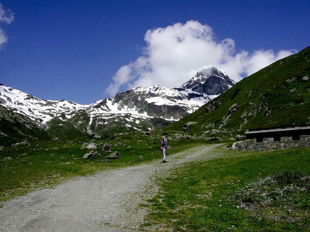
From Saint Grat Walloon to Mont Hill,
by Antonio
![]()
^^^^^^^
A nostra volta abbiamo diviso per sottotitoli questa zona (dal numero 14 al 17) mettendo in rilievo le Vette di maggiore importanza e quei minuscoli sottogruppi appartenenti alle medesime, tali da evidenziare importanti Nodi Topografici o piccole aree a se stanti e di una certa importanza, conoscenza e frequentazione alpinistica.
In quest'area, che comprende le Valli di Valgrisenche, La Thuile e relativa diramazione verso il Passo del Piccolo San Bernardo, s'é tenuto un senso di marcia diametralmente opposto a quello concernente il Gran Paradiso (anche qui esclusa la parte verso il confine con la Francia), ovvero le traversate son descritte con partenza dal territorio italiano per concludere in quello d'Oltralpe.
LEGENDA
In red: paths, routes, cable railway, chair lift & main roads;
in green: Summits, Spurs, Buttress, Spires;
in blue: Glaciers, Dams, Lochs, Ponds, Streams, Torrents, Brooks & Fountains;
in purple: Passes, Saddles, Hills, Brèches, Carvings & Collars;
in brown: Historical Remarks, Sanctuaries, Hermitages, Oratories, Castles, Churchs, Chapels, Crosses, Cairns, Tumulus, Mines, Historic Bridges or Roads, Campings, meaning of place names & various informations.
GETTING THERE
By car:- From Torino, Milano, etc: Motorway A5. Exits at Ivrea, Quincinetto, Pont Saint Martin, Verrès, Saint Vincent, Chatillon, Aosta Est, Aosta West/Aymavilles, Morgex.
- From Switzerland: through the Grand Saint Bernard Tunnel or the namesake pass.
- From France: through the Mont Blanc Tunnel or Petit Saint Bernard Pass. It is not necessary to take Motorway A5: you can drive on SS.26, in the direction of Aosta.
By plane:
- Aeroporto Internazionale "Corrado Gex" Saint Christophe (Aosta)
G1)- *** ALL EXTERNAL PASSES, saddles, brèches, collars, "carvings" & ROUTES from AOSTA's VALLEY to FRANCE
From Saint Grat Walloon to Mont Hill,
by Antonio
BETWEEN AOSTA VALLEY and FRANCE
G)- *** Amongst AOSTA VALLEY (Northeast) and ISERE VALLEY (South) / HAUTE TARENTAISE (West) in FRANCE.
Valgrisenche Valley/Val d'Isère: from Liverogne little Town to, by car, Valgrisenche, Bonne, Menthieu, Rognettaz Desot, Chatelet, Surier (1784m) Villages, in Beauregard Dam, West shore. Also, by car, in East shore (but at present closed, landslides reason) from Valgrisenche, Mondanges, Usellières Villages to crossroads 1784m. From fork towards Bezzi Refuge, by path ---> n° 12 in East of of Valgrisenche Dora Stream.
1)- From refuge to Sassière East and West Pass, by Bassac Deré Pass path ---> n° 12c and by Glairetta Glacier, in final part and to France.
2)- Also from Rognettaz Desot little Village to Mount Pass, by path ---> n° 13 HRG (= High Glacial Route) or from alternative 2174m to Saint Grat Lake and Sachère Pass, by path ---> n° 14 VA (Alpine Route) in Saint Grat Vallon (very wild).
La Thuile Valley/Val d'Isère: from Pré Saint Didier little Town to La Thuile Tourist Resort, by car, and from Town:
1/2)- to La Joux Village (1646m), by car, and by path ---> n° 3, 8, AV N° 2 to Albert Deffeyes Refuge (2500m).
From refuge by path ---> N° 16 in quota 3000 m~ before, after by Rutor Side East Glacier with direction South-southwest by Becca du Lac also Noeud des Vedettes Pass towards Invernet Glacier in France.
3)- Also same route and from Vedette Pass, with Northwest direction, by Loydon East Pass and Grand Glacier in France to La Sassière Alp, near Ruitor Refuge (2032m).
4)- Same route also from refuge, initial part of ---> n° 16, small path among Rutor, Vert, Gris, Superior,Sereacs, Neuves Lakes, Side West Rutor Glacier, with South-southwest direction and by Loydon West Pass to Grand Lac du Petit and Petit Lac du Petit Lakes in France and towards Ruitor Refuge.
5)- From Neuves Lakes (2551m) by Rutor Glacier, Eastern of Grande Assaly Glaciers, Assaly Pass to Lakes Grand and Petit du Petit and La Sassière Alp in Vanoise National Park.
***
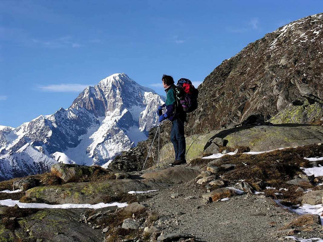
Antonio arriving to Albert Deffeyes Shelter with Mount Blanc,
by emilius
![]()
^^^^^^^
H)- BETWEEN La Thuile/La Rosière Tourist and Ski Resorts/Bourg-Saint Maurice in Haute Tarentaise:
6/7/8)- From La Joux Village by paths ---> n° 3, 8, AV n° 2 to crossroads 2050m~, near Third Rutor Waterfall and by ---> n° 8 to Bellecombe Vallon and four Lakes (2377, 2379m the majors); from 2379m to Tachuy seven Lakes (2550m major) and by Tachuy Pass towards Grand, Petit Lacs du Petit and Ruitor Refuge.
7)- From 2379m Lake with West direction between Third and Fourth Lakes and by Lex Blanche Pass to Louie Blanche Passage, Pierre Gravin and by French National Route n° 90 La Rosière little Tourist Town, Bourg-Saint-Maurice Town, in Haute Tarentaise to Isère Valley by French National Route n° 202.
8)- From Fourth 2631m Lake with Northwest direction and by Serre Pass to France by little Lake 2344m, Moulins Torrent, Pierre Gravin in crossroads 2184 m towards Plan Pigeux and by Nat. Route n° 90 La Rosière, Bourg-St.-Maurice Towns in Vanoise National Park.
9)- From La Joux to path near Maisonnettes Torrent in Ponteilles Valley to Mount Valaisan Fourth little Lakes and Glacier and by Grand Glacier Pass to little lakes 2596, 2532m in France, near le Grand OEillard, and to Pierre Gravin/Plan Pigeux/La Rosière/Bourg-St. Maurice Towns and N. R. 90.
10)- From La Suche Cantamont Ski-Station and Resort (2185 m c.; fountain) by dirt road-path ---> n° 9 to Bedalla or Suche Plan in crossroads 2465m and by Mount Belvedere Pass to Long Lake in France and by French National Route n° 90 to La Rosière/Bourg-St.-Maurice and to Isère Valley Nat. R. 202.
11)- From Bedalla crossroads 2465m by groundroad in Northwest to Little Saddle 2516m also in North direction with ---> n° 9 by Fourclaz Pass towards Touriasse mini Lakes andLittle Saint Bernard Pass, near Little Saint Bernard Chair Lift and Roman Mansio, above Verney Lake. From pass by French N. R. 90 to Bourg-St.-Maurice Towns in Haute Tarentaise.
12)- From La Thuile-Pont Serrand Village (1602m; fountain) towards Little Saint Bernard Pass, by car or by path---> n° 9, near very ancient Roman Route (Roman Mansio, Celtic Cromlech, Jove Column, Chanousia Botanical Garden, Abbot Chanoux Chapel, Museum, Little Saint Bernard Ancient Hospice nearby the Pass) . From pass, by N. R. 90 to La Rosière, Bourg-St:-Maurice, Haute Tarentaise Capital.
I)- AMONG La Thuile-Breuil Vallon/Versoyen Vallon/La Thuile-Chavannes Vallon/Seigne or Glacier Vallon:
13)- from Parking 2098 m of the regional road, nearby Verney Lake by path before and moraine after to Verney Dessus or Upper, 2310m~., 2402m little lakes and by Rousses Pass towards by moraine 2508, Rousses little Lakes in little Beaupré Vallon and by path to le Teppier Pastures and little lake, les Crottes Alp (2060m) and , by route, to Plan des Veys in Versoyen Vallon and Versoye-les-Granges (1084m) to National Route 90.
14)- From Verney Dessus Lake (2280m) by path near Torveraz Torrent, Point Rousse Lake, Tormotta(z) Lakes, Hermite Glacier to Arguerey Pass and to, by moraine, Rousses Lake in Beau Pré little Walloon therefore by previous route to Plan des Veys in Versoyen Vallon and Versoye-les-Granges to N. R. 90.
15)- From Tormotta Lochs in Tormotta Plan in direction West-northwest by moraine, Glacier of Arguerey Lakes, moraine and Veys Pass to , by moraine, Chalet de la Platte and from path to Pont de Chézari and by route to Veys Plan in Versoyen Vallon and to N. R.
16)- From Tormotta, Glacier of Arguerey Lakes with West-northwest direction by moraine, between Arguerey Northern and Breuil Glaciers, and Breuil Pass towards by path la Platte little four Lakes, la Platte Chalet,Chézari Bridge and by route to Veyes Plan, Versoye-les-Granges, Bonneval-les-Bains, Bourg-Saint-Maurice to N. R.
17)- From La Thuile-Pont Serrand (1602 m; fountain and +) to Chavannes Vallon by farn dirt road and path ---> n° 11, Alta Via n° 2 to Chavannes Passures Desot, d'en Bas, d'en Haut, Chavannes Pass. From pass, by path ---> n° 11, High Route n° 2 to Veny Valley and by path ---> n° 12, TMB (Mount Blanc Tour) and Seigne Pass to Glacier Vallon, La Rosière, Bourg-St. Maurice and N. R.
***
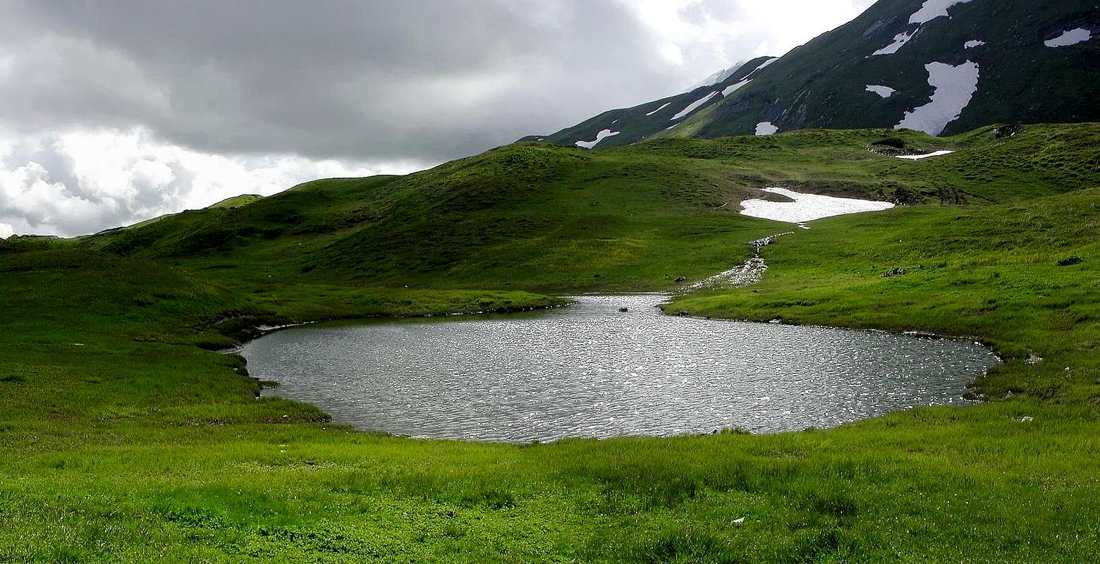
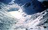
Verney Upper Loch near Little Saint Bernard Pass,
by Antonio
![]()
^^^^^^^
G)- *** Amongst AOSTA VALLEY (Northeast) and ISERE VALLEY (South) / HAUTE TARENTAISE (West) in FRANCE.
Valgrisenche Valley/Val d'Isère: from Liverogne little Town to, by car, Valgrisenche, Bonne, Menthieu, Rognettaz Desot, Chatelet, Surier (1784m) Villages, in Beauregard Dam, West shore. Also, by car, in East shore (but at present closed, landslides reason) from Valgrisenche, Mondanges, Usellières Villages to crossroads 1784m. From fork towards Bezzi Refuge, by path ---> n° 12 in East of of Valgrisenche Dora Stream.
1)- From refuge to Sassière East and West Pass, by Bassac Deré Pass path ---> n° 12c and by Glairetta Glacier, in final part and to France.
2)- Also from Rognettaz Desot little Village to Mount Pass, by path ---> n° 13 HRG (= High Glacial Route) or from alternative 2174m to Saint Grat Lake and Sachère Pass, by path ---> n° 14 VA (Alpine Route) in Saint Grat Vallon (very wild).
La Thuile Valley/Val d'Isère: from Pré Saint Didier little Town to La Thuile Tourist Resort, by car, and from Town:
1/2)- to La Joux Village (1646m), by car, and by path ---> n° 3, 8, AV N° 2 to Albert Deffeyes Refuge (2500m).
From refuge by path ---> N° 16 in quota 3000 m~ before, after by Rutor Side East Glacier with direction South-southwest by Becca du Lac also Noeud des Vedettes Pass towards Invernet Glacier in France.
3)- Also same route and from Vedette Pass, with Northwest direction, by Loydon East Pass and Grand Glacier in France to La Sassière Alp, near Ruitor Refuge (2032m).
4)- Same route also from refuge, initial part of ---> n° 16, small path among Rutor, Vert, Gris, Superior,Sereacs, Neuves Lakes, Side West Rutor Glacier, with South-southwest direction and by Loydon West Pass to Grand Lac du Petit and Petit Lac du Petit Lakes in France and towards Ruitor Refuge.
5)- From Neuves Lakes (2551m) by Rutor Glacier, Eastern of Grande Assaly Glaciers, Assaly Pass to Lakes Grand and Petit du Petit and La Sassière Alp in Vanoise National Park.
Antonio arriving to Albert Deffeyes Shelter with Mount Blanc,
by emilius
H)- BETWEEN La Thuile/La Rosière Tourist and Ski Resorts/Bourg-Saint Maurice in Haute Tarentaise:
6/7/8)- From La Joux Village by paths ---> n° 3, 8, AV n° 2 to crossroads 2050m~, near Third Rutor Waterfall and by ---> n° 8 to Bellecombe Vallon and four Lakes (2377, 2379m the majors); from 2379m to Tachuy seven Lakes (2550m major) and by Tachuy Pass towards Grand, Petit Lacs du Petit and Ruitor Refuge.
7)- From 2379m Lake with West direction between Third and Fourth Lakes and by Lex Blanche Pass to Louie Blanche Passage, Pierre Gravin and by French National Route n° 90 La Rosière little Tourist Town, Bourg-Saint-Maurice Town, in Haute Tarentaise to Isère Valley by French National Route n° 202.
8)- From Fourth 2631m Lake with Northwest direction and by Serre Pass to France by little Lake 2344m, Moulins Torrent, Pierre Gravin in crossroads 2184 m towards Plan Pigeux and by Nat. Route n° 90 La Rosière, Bourg-St.-Maurice Towns in Vanoise National Park.
9)- From La Joux to path near Maisonnettes Torrent in Ponteilles Valley to Mount Valaisan Fourth little Lakes and Glacier and by Grand Glacier Pass to little lakes 2596, 2532m in France, near le Grand OEillard, and to Pierre Gravin/Plan Pigeux/La Rosière/Bourg-St. Maurice Towns and N. R. 90.
10)- From La Suche Cantamont Ski-Station and Resort (2185 m c.; fountain) by dirt road-path ---> n° 9 to Bedalla or Suche Plan in crossroads 2465m and by Mount Belvedere Pass to Long Lake in France and by French National Route n° 90 to La Rosière/Bourg-St.-Maurice and to Isère Valley Nat. R. 202.
11)- From Bedalla crossroads 2465m by groundroad in Northwest to Little Saddle 2516m also in North direction with ---> n° 9 by Fourclaz Pass towards Touriasse mini Lakes and
12)- From La Thuile-Pont Serrand Village (1602m; fountain) towards Little Saint Bernard Pass, by car or by path---> n° 9, near very ancient Roman Route (Roman Mansio, Celtic Cromlech, Jove Column, Chanousia Botanical Garden, Abbot Chanoux Chapel, Museum, Little Saint Bernard Ancient Hospice nearby the Pass) . From pass, by N. R. 90 to La Rosière, Bourg-St:-Maurice, Haute Tarentaise Capital.
I)- AMONG La Thuile-Breuil Vallon/Versoyen Vallon/La Thuile-Chavannes Vallon/Seigne or Glacier Vallon:
13)- from Parking 2098 m of the regional road, nearby Verney Lake by path before and moraine after to Verney Dessus or Upper, 2310m~., 2402m little lakes and by Rousses Pass towards by moraine 2508, Rousses little Lakes in little Beaupré Vallon and by path to le Teppier Pastures and little lake, les Crottes Alp (2060m) and , by route, to Plan des Veys in Versoyen Vallon and Versoye-les-Granges (1084m) to National Route 90.
14)- From Verney Dessus Lake (2280m) by path near Torveraz Torrent, Point Rousse Lake, Tormotta(z) Lakes, Hermite Glacier to Arguerey Pass and to, by moraine, Rousses Lake in Beau Pré little Walloon therefore by previous route to Plan des Veys in Versoyen Vallon and Versoye-les-Granges to N. R. 90.
15)- From Tormotta Lochs in Tormotta Plan in direction West-northwest by moraine, Glacier of Arguerey Lakes, moraine and Veys Pass to , by moraine, Chalet de la Platte and from path to Pont de Chézari and by route to Veys Plan in Versoyen Vallon and to N. R.
16)- From Tormotta, Glacier of Arguerey Lakes with West-northwest direction by moraine, between Arguerey Northern and Breuil Glaciers, and Breuil Pass towards by path la Platte little four Lakes, la Platte Chalet,Chézari Bridge and by route to Veyes Plan, Versoye-les-Granges, Bonneval-les-Bains, Bourg-Saint-Maurice to N. R.
17)- From La Thuile-Pont Serrand (1602 m; fountain and +) to Chavannes Vallon by farn dirt road and path ---> n° 11, Alta Via n° 2 to Chavannes Passures Desot, d'en Bas, d'en Haut, Chavannes Pass. From pass, by path ---> n° 11, High Route n° 2 to Veny Valley and by path ---> n° 12, TMB (Mount Blanc Tour) and Seigne Pass to Glacier Vallon, La Rosière, Bourg-St. Maurice and N. R.
Verney Upper Loch near Little Saint Bernard Pass,
by Antonio
G2)- *** DORA BALTEA HYDR. CATCHMENT ALL SUMMITS of Right & INSIDE AREAS from Arvier (Liverogne) /Valgrisenche/Derby/Morgex/Pré Saint Didier/La Thuile Communes to Courmayeur Town , VENY Valley and SEIGNE Pass
In AOSTA VALLEY.
I)- INSIDE RANGES:
Dora Baltea Stream Right Hydrographic Watershed:
From East to West "Appendages" of the: Valgrisenche Valley, Arpy Conca, La Thuile Valley, Little Saint Bernard Valley to Little Saint Bernard Pass and Veny Valley, South side, to Seigne Pass, between ITALY and FRANCE.
***
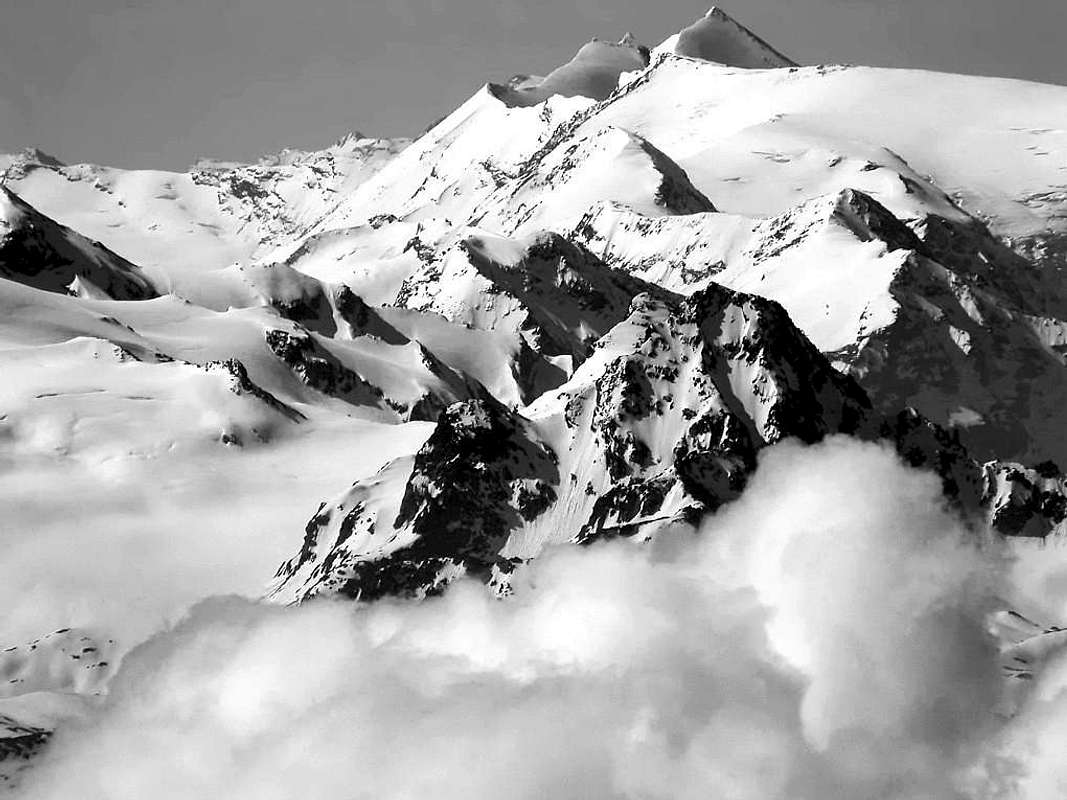
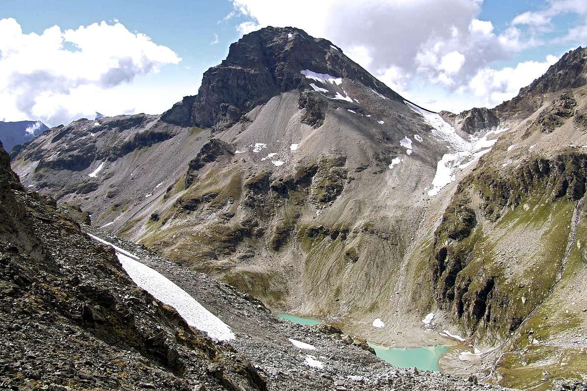
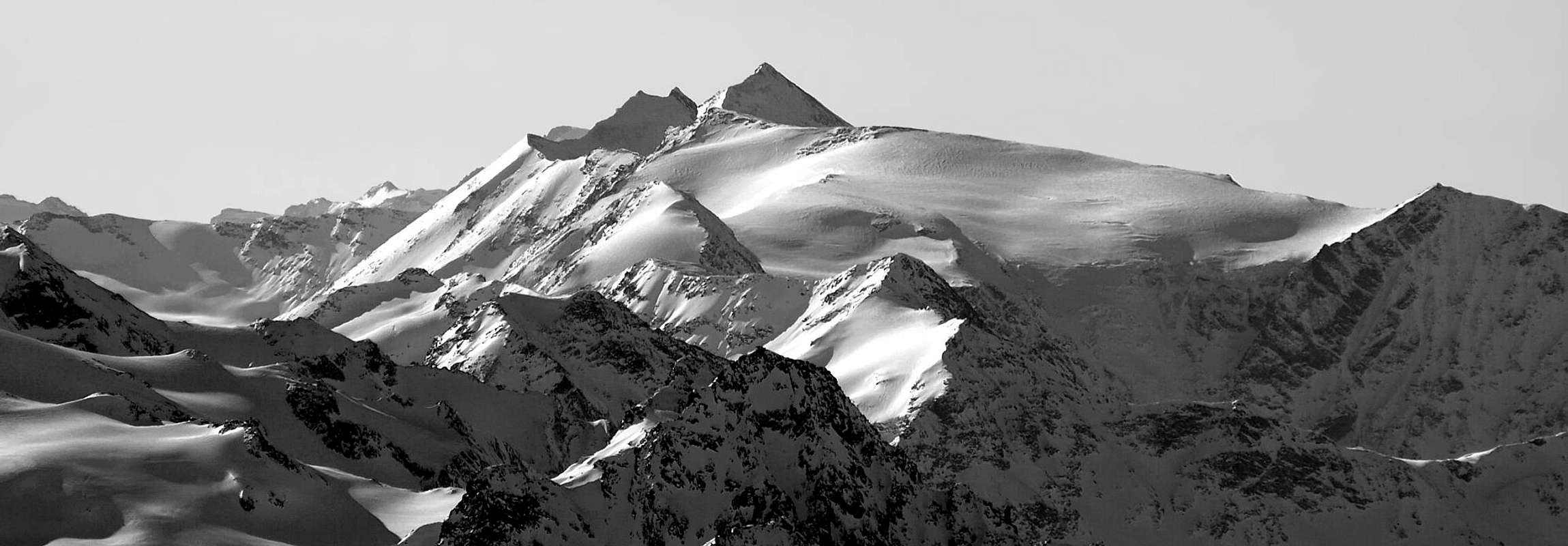
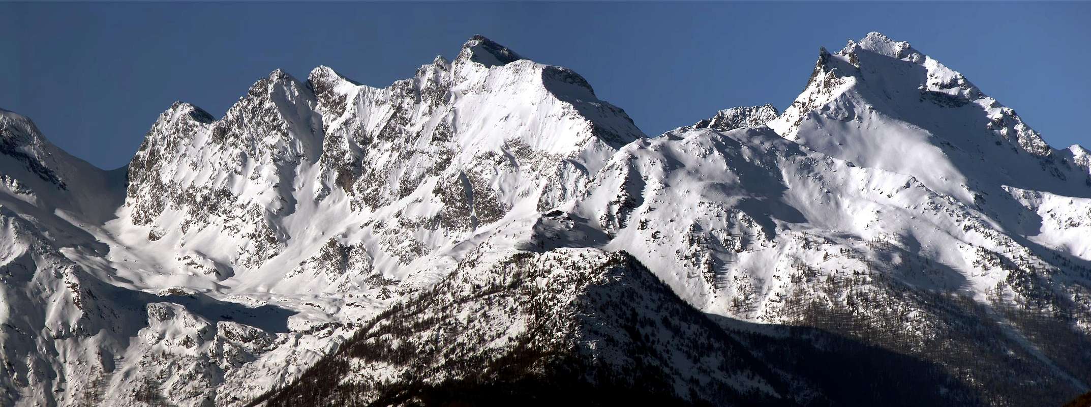
GREAT SASSIERE (3751m) First on North-northeast Face on August 24th, 1980
^^^^^^^
14)- Grande SASSIERE - Petite Sassière - Punta del Nantcruet or Nant Cruet - Punta Plattes des Chamois - Becca di Suessa - Becca Percià or du Pertcha - Mont Quart. Pointe du Serrù or Punta Maurin - Pointe du Soudzei - Mont Ormelune - Pointe de l'Archeboc - Le Rocher Brune.
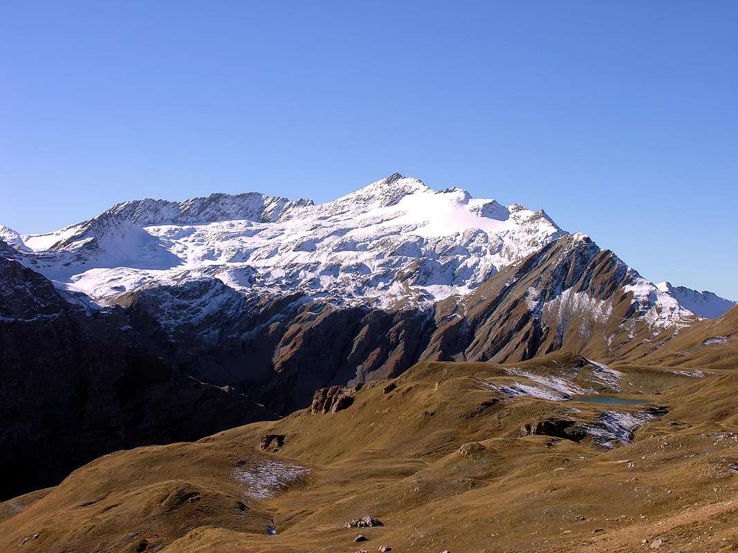
TESTA of RUTOR (3486m) and traverse to CHATEAU BLANC (3406m) in AUGUST 12th, 1973, by Marco Cossard "Crevassino"
***
15)- Mont de l'Ane - Grand Becca du Mont - Arete du Loydon - Becca du Lac - Mont d'Arp Vieille - Mont Pelà. Cresta di Morion - Becca dell'Aouille. Testa del RUTOR - Chateau Blanc - Mont Cornet - Becca Céré. Doravidi Sud e Nord - Mont Orfeuille. Flambeau. Pointe d'Avernet; Vedettes du Rutor South and North. Punta Loydon - Grande Assaly - Pointe du Tachuy - Mont Favre - Pointe de la Loie Blanche - Monts freduaz - Mont Valaisan - Bella Valletta - Monte Belvedere; Pointe de Chaz Dura - Terre Nere.
***
MONT CHARVET (2489m), Tereza Pass (2636m), BECCA POUEGNENTA (2825m), Ameran Hill & POINTS (2736m), Serra Hill (2758m) & Pietra Rossa Loch (2553m) from MONT COLMET (3020m), on AUGUST 05th, 1993 & W Slope from Prairies of Little Saint Bernard Pass Road Old B&W in MAY 1969
16)- Punta Chenal - Punta Nera - Punta Bianca - ointe des Invergneures. Petit Paramont -
MONT PARAMONT (3300m), North icy Face (Third Ascent), on JULY 06th, 1969
***
MONT PARAMONT (3300m), NW Ridge, on JULY 06th, 1996
***
Mont PARAMONT - Mont Pit - Pointe de la Crosatie - Bec Taillà - Torre del Tighet o du Tignet - Torre Tonda - Punte di Faveroy - Monte Colombo. Testa del Paramont - Mont Monchette - Mont Lussé - Pointes d'Ameran - Becca Pou(i)gnenta - Mont Charvet. Mont Colmet Southern and Northern Summits - Tete d'Arpy.
MONT COLMET Northern Summit (3020m), by North Wall (First Replay 1939 Route) in ascent and North-northwest Crest in descent, on AUGUST 07th, 1992 & through Northeast Face of North Summit, in ascent & Direct descent by East Slope of South Summit (3024m), on AUGUST 05th, 1993.
***
17)- Pointe de Lancebranlette - Bec des Rousses - Mont di Fourclaz - Sommet des Rousses - Aiguilles des l'Hermite - Aiguille Veis - Mont Miravidi - Pointe des Ouillons - La Fourclaz - Petit Léchaud. Punte di Bassa Serra - Punta del Fornet - Monte Ouille; Monte Ciavaretta - Mont Laityre. Punta Léchaud - Mont Léchaud - Mont Percé - Mont Fortin - Pointes des Chavannes - Mont Favre - Pointe des Charmonts. Mont BERRIO BLANC - Cote de Laugeron - Mont Combe Varin.. Mont Bellefaçe Northwest, Central and South. Mont Nix - Fourches de la Youlaz - Crest de la Youlaz - Tete d'Arp - Mont Brise. Tete de l'Ane - Tete de Vieux - Tete des Jeunes. Tete du Grand Mont - Mont Crammont - Mont de Nona or Becca di Nona.
MONT LECHAUD (2815m) and POINTE LECHAUD (3127m) Traverse from Chavannes Walloon and Chavannes Pass (2603m), on JUNE 13th, 1974 and BECCA POUI(E)GNENTA (2827m) in several times
***
BERRIO BLANC & MOUNT CRAMMONT Subgroup from Northeast,
by andrea.it
![]()
^^^^^^^
I)- INSIDE RANGES:
Dora Baltea Stream Right Hydrographic Watershed:
From East to West "Appendages" of the: Valgrisenche Valley, Arpy Conca, La Thuile Valley, Little Saint Bernard Valley to Little Saint Bernard Pass and Veny Valley, South side, to Seigne Pass, between ITALY and FRANCE.
GREAT SASSIERE (3751m) First on North-northeast Face on August 24th, 1980
 |  |  |  |  |  |  |
14)- Grande SASSIERE - Petite Sassière - Punta del Nantcruet or Nant Cruet - Punta Plattes des Chamois - Becca di Suessa - Becca Percià or du Pertcha - Mont Quart. Pointe du Serrù or Punta Maurin - Pointe du Soudzei - Mont Ormelune - Pointe de l'Archeboc - Le Rocher Brune.
 |  |  |  |  |  |
15)- Mont de l'Ane - Grand Becca du Mont - Arete du Loydon - Becca du Lac - Mont d'Arp Vieille - Mont Pelà. Cresta di Morion - Becca dell'Aouille. Testa del RUTOR - Chateau Blanc - Mont Cornet - Becca Céré. Doravidi Sud e Nord - Mont Orfeuille. Flambeau. Pointe d'Avernet; Vedettes du Rutor South and North. Punta Loydon - Grande Assaly - Pointe du Tachuy - Mont Favre - Pointe de la Loie Blanche - Monts freduaz - Mont Valaisan - Bella Valletta - Monte Belvedere; Pointe de Chaz Dura - Terre Nere.
MONT CHARVET (2489m), Tereza Pass (2636m), BECCA POUEGNENTA (2825m), Ameran Hill & POINTS (2736m), Serra Hill (2758m) & Pietra Rossa Loch (2553m) from MONT COLMET (3020m), on AUGUST 05th, 1993 & W Slope from Prairies of Little Saint Bernard Pass Road Old B&W in MAY 1969
 |  |  |
16)- Punta Chenal - Punta Nera - Punta Bianca - ointe des Invergneures. Petit Paramont -
 |  |  |  |  |  |  |
MONT PARAMONT (3300m), NW Ridge, on JULY 06th, 1996
 |  |  |  |  |  |  |  |
Mont PARAMONT - Mont Pit - Pointe de la Crosatie - Bec Taillà - Torre del Tighet o du Tignet - Torre Tonda - Punte di Faveroy - Monte Colombo. Testa del Paramont - Mont Monchette - Mont Lussé - Pointes d'Ameran - Becca Pou(i)gnenta - Mont Charvet. Mont Colmet Southern and Northern Summits - Tete d'Arpy.
MONT COLMET Northern Summit (3020m), by North Wall (First Replay 1939 Route) in ascent and North-northwest Crest in descent, on AUGUST 07th, 1992 & through Northeast Face of North Summit, in ascent & Direct descent by East Slope of South Summit (3024m), on AUGUST 05th, 1993.
 |  |  |  |  |
17)- Pointe de Lancebranlette - Bec des Rousses - Mont di Fourclaz - Sommet des Rousses - Aiguilles des l'Hermite - Aiguille Veis - Mont Miravidi - Pointe des Ouillons - La Fourclaz - Petit Léchaud. Punte di Bassa Serra - Punta del Fornet - Monte Ouille; Monte Ciavaretta - Mont Laityre. Punta Léchaud - Mont Léchaud - Mont Percé - Mont Fortin - Pointes des Chavannes - Mont Favre - Pointe des Charmonts. Mont BERRIO BLANC - Cote de Laugeron - Mont Combe Varin.. Mont Bellefaçe Northwest, Central and South. Mont Nix - Fourches de la Youlaz - Crest de la Youlaz - Tete d'Arp - Mont Brise. Tete de l'Ane - Tete de Vieux - Tete des Jeunes. Tete du Grand Mont - Mont Crammont - Mont de Nona or Becca di Nona.
 |  |  |
INSIDE AREAS IN AOSTA VALLEY CENTRAL WITH CIRCULAR PERIMETER > to North
BERRIO BLANC & MOUNT CRAMMONT Subgroup from Northeast,
by andrea.it

We are going to observe and analyze these four areas, all internal to the Valley of Aosta and between the Gran Paradiso Massif, to the East, and the Mount Blanc Mountain Chain in the Northwest. These include the Valleys:
1)- Rhemes Notre Dame and Saint George, where flows the river of the same name and Dora di Rhemes which originates from the hill of the same name and that of Fond famous hills and difficult routes in the past.
2)- Valgrisenche, in the local dialect Valgrisenza or Grey Valley, with its Dora that originates from the Glacier de la Grande Glairetta between Sassière and Beak of Traversière (East).
3)- Valley of La Thuile, always with his Dora, who hails from the great ice expanses between the Chateau Blanc and the Head of the Rutor to the East, Becca du Lac in South and Great Assaly in West.
4)-: Valley of Little Saint Bernard with the Torrent Verney, who hails from the slopes of the famous mountain pass on the border with France, the route for centuries and, unfortunately, by the armies entrance to Italy. An alternative to the Mount Blanc Tunnel, however, is only open for 7/8 months of the year, given the significant accumulation of snow in the winter season. This great valley flows into the Valley of La Thuile right in the Tourist Resort of this name; numerous secondary small valleys (Breuil- Tormotta, Orgère and Chavannes) down to the same direction with waters from North to South and from East to West, after La Thuile Centre.
5)-: Val Vény with small vallons that come from the watershed ridge formed by the preceding walloons and such as slide and merge their waters in the Dora di Veny, formed by the valleys and those from previous slide and merge their waters in the Dora di Veny, one of the two branches, together with that of Ferret, that give rise to Baltea Stream, gathering just beyond the important Tourist Center of Courmayeur, at the foot Mount Blanc.
These chains are divided into:
a)-: Group of the Great Sassière going to join, after the Mont Hill important, than the Rutor. It is already the border ridge with the Isère Valley and, in the "high" with the Vanoise National Park .
b)-: Group of Rutor reaches Planaval Pass and then get up again in the Subgroup of Mount Paramont (mountain that covers the repair or upstream). In our work we have shown how autonomous this small subgroup.
c)-: Northwest branch to the Head of the Rutor to Becca du Lac and the Great Assaly through long border ridge that reaches the Little Saint Bernard Hill.
d)-: Subgroup of Punta Léchaud that actually turns out to be the continuation of the border ridge to the Seigne Pass, here we dealt with separately by including all Appendices mountain to the East of the same.
***
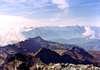
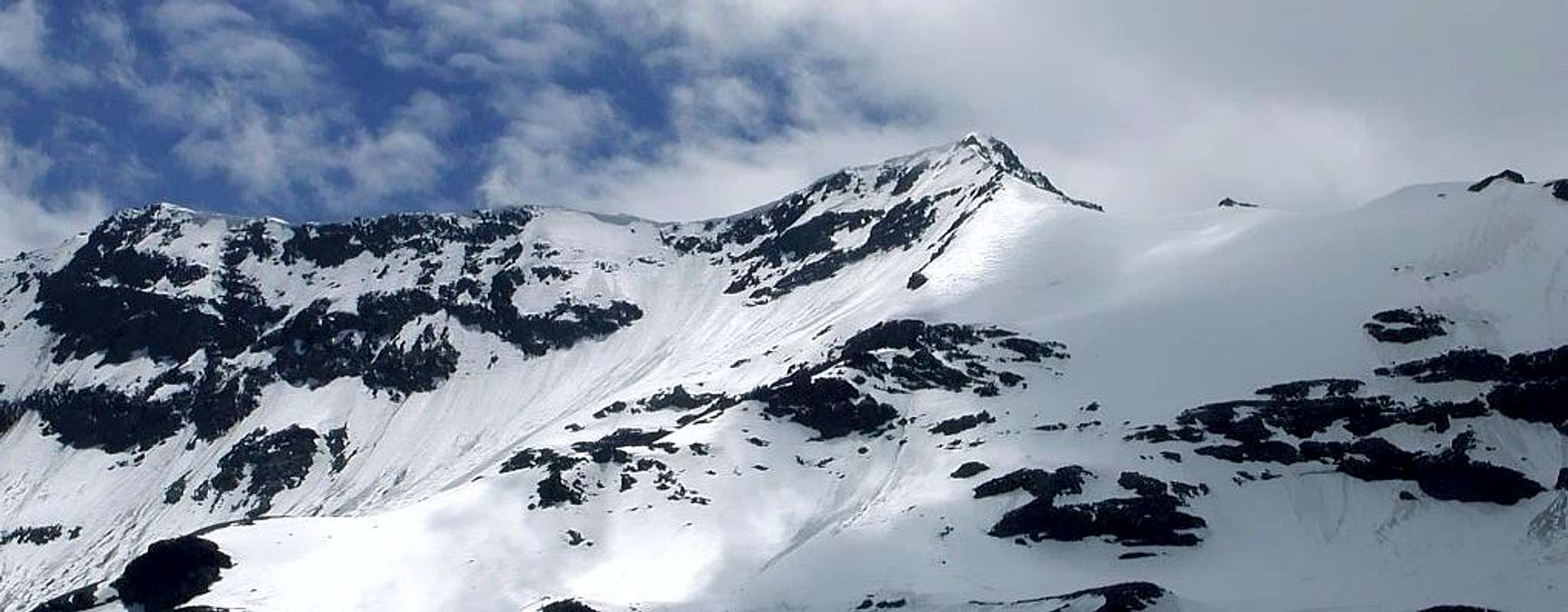
GREAT SASSIERE & GREAT ASSALY into Clouds from North-northeast,
by Antonio
![]()
^^^^^^^
1)- Rhemes Notre Dame and Saint George, where flows the river of the same name and Dora di Rhemes which originates from the hill of the same name and that of Fond famous hills and difficult routes in the past.
3)- Valley of La Thuile, always with his Dora, who hails from the great ice expanses between the Chateau Blanc and the Head of the Rutor to the East, Becca du Lac in South and Great Assaly in West.
4)-: Valley of Little Saint Bernard with the Torrent Verney, who hails from the slopes of the famous mountain pass on the border with France, the route for centuries and, unfortunately, by the armies entrance to Italy. An alternative to the Mount Blanc Tunnel, however, is only open for 7/8 months of the year, given the significant accumulation of snow in the winter season. This great valley flows into the Valley of La Thuile right in the Tourist Resort of this name; numerous secondary small valleys (Breuil- Tormotta, Orgère and Chavannes) down to the same direction with waters from North to South and from East to West, after La Thuile Centre.
5)-: Val Vény with small vallons that come from the watershed ridge formed by the preceding walloons and such as slide and merge their waters in the Dora di Veny, formed by the valleys and those from previous slide and merge their waters in the Dora di Veny, one of the two branches, together with that of Ferret, that give rise to Baltea Stream, gathering just beyond the important Tourist Center of Courmayeur, at the foot Mount Blanc.
These chains are divided into:
a)-: Group of the Great Sassière going to join, after the Mont Hill important, than the Rutor. It is already the border ridge with the Isère Valley and, in the "high" with the Vanoise National Park .
b)-: Group of Rutor reaches Planaval Pass and then get up again in the Subgroup of Mount Paramont (mountain that covers the repair or upstream). In our work we have shown how autonomous this small subgroup.
c)-: Northwest branch to the Head of the Rutor to Becca du Lac and the Great Assaly through long border ridge that reaches the Little Saint Bernard Hill.
d)-: Subgroup of Punta Léchaud that actually turns out to be the continuation of the border ridge to the Seigne Pass, here we dealt with separately by including all Appendices mountain to the East of the same.
GREAT SASSIERE & GREAT ASSALY into Clouds from North-northeast,
by Antonio
Andiam ad osservare ed analizzare queste quattro aree, tutte interne alla Valle di Aosta e comprese tra il Massiccio del Gran Paradiso, ad Est, e la Catena del Monte Bianco a Nordovest. Esse comprendono le Valli di:
1)-: Rhemes Notre Dame e Saint George, ove scorre il torrente omonimo o Dora di Rhemes traente origini dal colle omonimo e da quello del Fond, celebri e difficili passi percorsi nel passato.
2)-: Valgrisenche, in patois o dialetto locale Valgrisenza ovvero Valle Grigia, con la sua Dora originantesi dal Glacier de Glairetta tra la Grande Sassière ed il Becco della Traversière (Est).
3)-: Valle di La Thuile, sempre con la sua Dora, che proviene dalle grandi distese glaciali comprese tra il Chateau Blanc e la Testa del Rutor ad Est, dalla Becca du Lac a Sud e dalla Grande Assaly ad Ovest.
4)-: Valle del Piccolo San Bernardo con il Torrente Verney, proveniente dalle pendici del famoso valico al confine con la Francia, percorso da secoli e, purtroppo, dalle armate in ingresso verso l'Italia. Alternativo al Tunnel del Monte Bianco é però aperto per soli 7/8 mesi all'anno, visto il notevole accumulo delle nevi nella stagione invernale. Questo grande vallone confluisce nella Valle di La Thuile proprio nel Centro Turistico di questo nome; numerosi valloni secondari (Breuil-Tormotta, Orgère e Chavannes) discendono verso il medesimo con direzione delle acque da Settentrione a Sud e da Est ad Ovest, dopo La Thuile.
5)-: Val Vény con valloncelli che provengono dalla cresta spartiacque formata dai precedenti valloni e tali da far scorrere e confluire le loro acque nella Dora di Vény, uno dei due rami, insieme a quello di Ferret, che danno origine alla Dora Baltea, riunificandosi appena oltre l'importante Centro Turistico di Courmayeur, ai piedi del Monte Bianco.
Queste catene si dividono in:
a)-: Gruppo della Grande Sassière che va ad unirsi, dopo l'importante Col du Mont, a quello del Rutor. Costituisce già cresta di confine con la Valle dell'Isère e, nella parte "alta" con il Parco Nazionale della Vanoise.
b)-: Gruppo del Rutor raggiunge il Passo di Planaval per poi rialzarsi nuovamente nel Sottogruppo del Mont Paramont (monte che ripara o copre il monte). Nel nostro lavoro abbiamo evidenziato come autonomo questo piccolo sottogruppo.
c)-: diramazione a Nordovest dalla Testa del Rutor verso la Becca du Lac e la Grande Assaly tramite lunga cresta di confine raggiungente il Colle del Piccolo San Bernardo.
d)- Sottogruppo della Punta Léchaud, che in realtà risulta essere la prosecuzione della cresta di frontiera fino al Colle della Seigne; qui l'abbiam trattata a parte inserendo anche tutte le Appendici montuose ad Oriente della medesima.
***
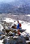
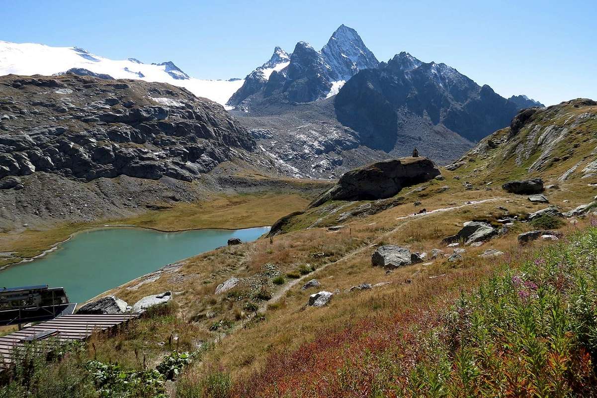
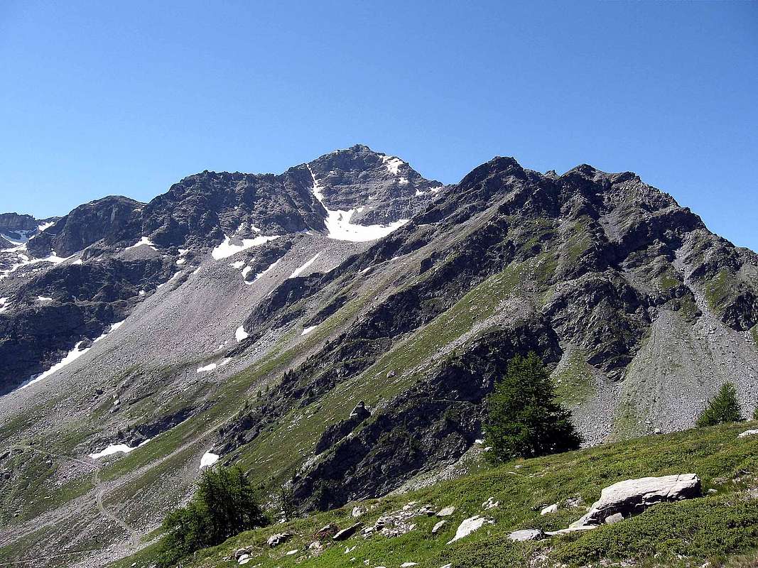
GRAND BECCA du MONT also BEC de l'ANE with Northeastern View,
by emilius
![]()
^^^^^^^
![]()
1)-: Rhemes Notre Dame e Saint George, ove scorre il torrente omonimo o Dora di Rhemes traente origini dal colle omonimo e da quello del Fond, celebri e difficili passi percorsi nel passato.
2)-: Valgrisenche, in patois o dialetto locale Valgrisenza ovvero Valle Grigia, con la sua Dora originantesi dal Glacier de Glairetta tra la Grande Sassière ed il Becco della Traversière (Est).
3)-: Valle di La Thuile, sempre con la sua Dora, che proviene dalle grandi distese glaciali comprese tra il Chateau Blanc e la Testa del Rutor ad Est, dalla Becca du Lac a Sud e dalla Grande Assaly ad Ovest.
4)-: Valle del Piccolo San Bernardo con il Torrente Verney, proveniente dalle pendici del famoso valico al confine con la Francia, percorso da secoli e, purtroppo, dalle armate in ingresso verso l'Italia. Alternativo al Tunnel del Monte Bianco é però aperto per soli 7/8 mesi all'anno, visto il notevole accumulo delle nevi nella stagione invernale. Questo grande vallone confluisce nella Valle di La Thuile proprio nel Centro Turistico di questo nome; numerosi valloni secondari (Breuil-Tormotta, Orgère e Chavannes) discendono verso il medesimo con direzione delle acque da Settentrione a Sud e da Est ad Ovest, dopo La Thuile.
5)-: Val Vény con valloncelli che provengono dalla cresta spartiacque formata dai precedenti valloni e tali da far scorrere e confluire le loro acque nella Dora di Vény, uno dei due rami, insieme a quello di Ferret, che danno origine alla Dora Baltea, riunificandosi appena oltre l'importante Centro Turistico di Courmayeur, ai piedi del Monte Bianco.
Queste catene si dividono in:
a)-: Gruppo della Grande Sassière che va ad unirsi, dopo l'importante Col du Mont, a quello del Rutor. Costituisce già cresta di confine con la Valle dell'Isère e, nella parte "alta" con il Parco Nazionale della Vanoise.
b)-: Gruppo del Rutor raggiunge il Passo di Planaval per poi rialzarsi nuovamente nel Sottogruppo del Mont Paramont (monte che ripara o copre il monte). Nel nostro lavoro abbiamo evidenziato come autonomo questo piccolo sottogruppo.
c)-: diramazione a Nordovest dalla Testa del Rutor verso la Becca du Lac e la Grande Assaly tramite lunga cresta di confine raggiungente il Colle del Piccolo San Bernardo.
d)- Sottogruppo della Punta Léchaud, che in realtà risulta essere la prosecuzione della cresta di frontiera fino al Colle della Seigne; qui l'abbiam trattata a parte inserendo anche tutte le Appendici montuose ad Oriente della medesima.
GRAND BECCA du MONT also BEC de l'ANE with Northeastern View,
by emilius
GRANDE SASSIERE / ORMELUNE AREA - GREAT SASSIE'RE NATURE WILDLIFE RESERVE & VANOISE NATIONAL PARK
From Sassière East and West Pass to North-northeast: GRANDE SASSIERE AREA (*): Petite Sassière - Nant Cruet Point - Pointe des Plattes des Chamois - Mario Bezzi Refuge - Becca di Suessa - Suessa or Vaudet Hill - Vert (Green) Lake - Becca de Perchà - Pointe du Serrù or Maurin - Pointe du Suzzei - Mont Ormelune Southeastern, Central, Northwestern Summits - Pointe d'Archeboc - Le Rocher Brune to Mount Pass or Col du Mont.
![]()
TESTA del RUTOR or RUITOR / GRANDE ASSALY / MONT VALAISAN AREA - VANOISE's NATIONAL PARK
|

From Col du Mont or Mount & Reculaz Passes Bec de l'Ane - Gran Becca du Mont. From Quota 3172m Loydon Crest; Becca du Lac and Saint Grat Lake to South. Eastern Ramifications of the Group from Shout: Mont Pelà - Bauregard Dam, artificial Lake - M. de l'Arp Vieille - Becca dell'Aouille - M. Cornet - Becca Céré - M. Orfeuille. TESTA del RUTOR or RUITOR AREA (*): Angels Refuge (ex Scavarda Refuge), in East - Chateau Blanc - Doravidi South and North - Flambeau to Planaval Pass. From Becca du Lac Pass - Vedettes Noeud (Vedettes "Knot" or junction) Avernet Point; Invernet Crest - Invernet Point - Piagnes Point; Loydon Point - Neuves or Neuws, Glacial Marginal, Seracs, Ruitor or Rutor Lochs - Albert Deffeyes Refuge. Grand(e) Assaly Area. To Northeast: Testa d'Assaly. To North: Little Assaly. From Grande Assaly great ramification to Westnorth: Pointe du Tachuy and Lakes - Tachuy Crest; les Oeillasses; Mont Charve - Dents Rouges - Dents Rouges Little Crest - Roc Rouge. To South: Aiguilles du Charvet - Pointe de la Grande Imbasse. T. du Charvet - la Lex Blanche. To Southwest: Roche Envers Crest (X mines) - Pointe de Couloureuses - Pointe de la Roche Jaille and Lac du Retour. From Serre Pass la Louie Blanche and Bellecombe Lakes. To Northeast:: Mont Fréduaz Central and East - Mont Thuilette. From Grand Glacier Pass: le Grand OEillard. Mont Valaisan Area: Tete de l'Ane; Bella Valletta - Bella Valletta Crest (Quote 2767, 2710, 2731, 2704m) - Belvedere Hill - Monte Belvedere - Mont Chaz Dura - Terre Nere to Little SAINT BERNARD Pass and Verney Lake.
![]()
![]()
MONT PARAMONT / MONT COLMET / TIGHET or TIGNET TOWER AREA
From Planaval Pass Punta Chenal - Punta Nera - Punta Bianca or Becca Blanche. Little ramification to West-northwest: Quota 3054m - Pointe des Invergneures - Invergneuress (various little), Superieur also Upper, Gris or Grey, Vert, dans la Roche Lakes in South and in West. From Saddle 3160m Quota 3225/30m~ or Little Paramont - Mont PARAMONT Area (*; +): Mont Pit - Fond Lake to East - Punta de la Crosatie - Bec Taillà - Tignet or Tighet Tower - Petit Tignet Point - Tonda Tower - Faveroy Points Southwest and Northeast - Monte Colombo. From Ussellettes Pass ramification to Northwest: Testa del Paramont - Mont Monchette - Mont Lussé - Ameran Crest - Becca Pouignenta or Pougnenta - Mont Charvet. From Comba Sorda Pass small ramification to West:: Mont Colmet.
![]()
![]()
PUNTA LECHAUD / BERRIO BLANC / MONT CRAMMONT AREA

From Little SAINT BERNARD Pass to North: Lancebranlette - Bec des Rousses - Mont de Fourclaz; Pointe du Lac sans Fond - Roc de Belleface; Sommet des Rousses - Aiguilles de l'Hermite - Aiguille Veys - Torvera Crest - Mont Miravidi - Punta dei Ghiacciai; Pointe des Oillons - La Fourclaz - Petit Léchaud. Little ramification to South-southeast: from Bassa Serra Western Pass - Bassa Serra - Pointe de La Tormotta(z) and Lakes - Pointe Rousse to Verney Lakes. Southeast ramification: from Bassa Serra Eastern Pass or Echelles des Chavannes Pass Pointe du Fornet - Mont Ouille; M. Ciavaretta; Laityre - Grand Berrier.
Punta Léchaud Area: Mont Léchaud - Mont Percé - Mont Fortin - Pointes des Chavannes - Mont Favre - Pointe des Charmonts. Mont BERRIO BLANC Area (*): Cote de Laugeron - M. Combe Varin. South-southeast ramification: from Orgère Pass Mont Belleface (North, Central, South Summits) and Rocky Gym above La Thuile Tourist Village. From Charmonts Pass Northeast ramification: Mont Nix - Fourches de Youla - Testa d'Arp - Tete d'Arp little Lake in North - M. Brisé to Chécrouit Pass and Mont Chécrouit above COURMAYEUR little Town. Tete de l'Ane - Mont Crammont little Area: Becca di Nona; Tete des Vieux - Tete des Jeunes.
![]()
Punta Léchaud Area: Mont Léchaud - Mont Percé - Mont Fortin - Pointes des Chavannes - Mont Favre - Pointe des Charmonts. Mont BERRIO BLANC Area (*): Cote de Laugeron - M. Combe Varin. South-southeast ramification: from Orgère Pass Mont Belleface (North, Central, South Summits) and Rocky Gym above La Thuile Tourist Village. From Charmonts Pass Northeast ramification: Mont Nix - Fourches de Youla - Testa d'Arp - Tete d'Arp little Lake in North - M. Brisé to Chécrouit Pass and Mont Chécrouit above COURMAYEUR little Town. Tete de l'Ane - Mont Crammont little Area: Becca di Nona; Tete des Vieux - Tete des Jeunes.
COMPLETE WORKS & OPERA SUMMARY - BOOKS & MAPS
Idealization of the Omnia Work and Texts, by Osvaldo CARDELLINA.
Mountain Chains & of action Colorphotos, colorpictures, B&W photographs, by Antonio GIANI, Emilio BERTONA & Osvaldo CARDELLINA
Moreover, Action photographs & other, by Various AUTHORS & WRITERS:
"MOUNT PARAMONT (3300 m) icy NORTH FACE Above the serac and escaping the avalanche", by Ilario Antonio GARZOTTO;
"G.Trevisan along the North...", by Ilario Antonio GARZOTTO;
"Osvaldo Cardellina on the Northern Wall of Monte Paramont (3301m)", by Ilario Antonio GARZOTTO;
"Sotto il grande seracco della...", by Ilario Antonio GARZOTTO;
"M. Paramont N Face Taste of terminal part 1969", by Ilario Antonio GARZOTTO;
"MONT PARAMONT (3300m) North Face 1969", by Ilario Antonio GARZOTTO;
"LECHAUD POINT (3127m) & "strong HIMALAYSTS" on 1974", by Giuseppe LAMAZZI;
"Northwest Crest from Mollette Pass", by Camillo Roberto FERRONATO;
"Mont Paramont on Northwest Ridge", by Camillo Roberto FERRONATO;
"From the Summit of Paramont (3301m) to S-SW or Rutor Group", by Ivo CHUC;
"Green Prairies of Little Saint Bernard May 1969, by Ilario Antonio GARZOTTO;
"MOUNT COLMET from Little Saint Bernard Valley", by Ilario Antonio GARZOTTO;
"Aiguille de la Grande Sassière..." (four pictures), by Camillo Roberto FERRONATO;
"Aiguille de la Grande Sassière...", by Giuseppe LAMAZZI;
"Mont Colmet", by andrea.it;
"Grande Sassiere seen from Grande Traversiere", by andrea.it;
"From Becca della Traversiere...", by buxlex;
"RUTOR TESTA or HEAD The Summit Virgin 1973", by Marco COSSARD;
"The Old Scavarda Shelter ... (burnt) ... 1973", by Marco COSSARD;
"RUTOR TESTA or HEAD Return from Summit", by Marco COSSARD;
"Ascending on Rutor to Morion Lochs & Walloon 1973", by Marco COSSARD;
"From Rutor to Chateau Blanc, Doravidi & Paramont 1973", by Marco COSSARD;
"But where is the Rutor of here or there? in August 1973", by Marco COSSARD;
"Monte Crammont and Berrio Blanc", by andrea.it;
"GREAT PARADISE "Just Born" on East Ridge of Fourquin de Bioula 1967", by Ilario Antonio GARZOTTO.
"Voyages dans les Alpes", by Horace Bénedict De Saussure, Tome I 1779, Tome IV 1796;
"Manuel du voyageur en SUISSE et à Chamonix" - Nouvel Ebel, by Adolphe Joanne, Second Edition 1859;
"La Vallée d'Aoste", by Edoard Aubert, 1860;
"A Handbook for Travellers in Switzerland, Savoye, and Piedmont", by John Murray, Twelfth Edition 1867;
"Studi sul Gruppo del Gran Paradiso", by Martino Baretti, 1867;
"Historique de la Vallée d'Aoste", by Jean Baptiste De Tillier, 1888;
"Climbers' Guide to the Central Pennine Alps", by William Martin Conway, 1890;
"The Mountains of Cogne", by George Yeld and W.A.B. Coolidge, 1893;
"Guida delle Alpi Occidentali Vol. II°, Parte 2°, by Giovanni Bobba and Luigi Vaccarone, 1896;
"Scrambles in the Eastern Graians 1878-1897", by George Yeld, 1900;
"Nel Regno del Cervino", by Edmondo De Amicis, 1905;
"Les Alpes Occidentales", by Federico Sacco, 1913;
"Guide du Valpelline", by Abbot Joseph Maria Henry, 1925;
"Le Alpi Pennine", by Silvio Saglio, 1951;
"La Luce delle vette", by Francesco Cavazzani, 1954;
"Guida della Regione Autonoma della Valle d'Aosta", by Mario Aldrovandi, 1964;
Monte Marzo e la cresta dal Colle dei Corni al Colle di Valbella", by Piero Falchetti, 1966;
"Dal Bec d'le Steje alla Cima Battaglia", by Piero Falchetti, 1968;
"Gran Paradiso - itinerari scelti", by Roberto Mantovani and Renato Misischi, 1974;
"80 itinerari di escursionismo alpinismo sci alpinismo in valle d'aosta", by Osvaldo Cardellina, 1977;
"Guida del Monte Emilius, by Osvaldo Cardellina, 1978.
C.A.I./T.C.I. Collana Guide dei Monti d'Italia-Italy's of the Mounts Guides SERIES, Volumes:
"Monte Rosa", by Sivio Saglio and Felice Boffa, 1960;
"Gran Paradiso", by Emanuele Andreis, Renato Chabod and Mario Carlo Santi, 1939; Reprint 1963;
"Monte Bianco Volume I°", by Renato Chabod, Laurent Grivel and Silvio Saglio, 1963;
"Aggiornamenti alla Guida del Gran Paradiso (Seconda Edizione)", by Renato Chabod and Piero Falchetti, 1964;
"Monte Bianco Volume II°", by Renato Chabod, Laurent Grivel, Sivio Saglio and Gino Buscaini, 1968;
"Alpi Pennine Volume II°", by Gino Buscaini, 1970;
"Alpi Pennine Volume I°, by Gino Buscaini, 1971;
"Gran Paradiso", by Emanuele Andreis, Renato Chabod and Mario Carlo Santi, Third Edit. with revisions and collaborations by Renato Chabod, Ugo Manera and Corradino Rabbi, 1980;
"Alpi Graie Centrali", by Alessandro Giorgetta, 1985;
"Monte Rosa e Mischabel", by Gino Buscaini, 1991;
"Monte Bianco Volume I°", by Gino Buscaini, 1994;
"Emilius Rosa dei Banchi Parco del M. Avic", by Giulio Berutto and Lino Fornelli, 2005;
"Valgrisenche mt 1664 ITINERARI ESCURSIONI ARRAMPICATE", Edit. Pro Loco, Syndicat d'initiative Valgrisenche Comunità Montana Gran Paradiso (a cura delle Guide Remo Bethaz e Bruno Bethaz con cartina allegata).
BASE MAPS
Mountain Chains & of action Colorphotos, colorpictures, B&W photographs, by Antonio GIANI, Emilio BERTONA & Osvaldo CARDELLINA
Moreover, Action photographs & other, by Various AUTHORS & WRITERS:
"MOUNT PARAMONT (3300 m) icy NORTH FACE Above the serac and escaping the avalanche", by Ilario Antonio GARZOTTO;
"G.Trevisan along the North...", by Ilario Antonio GARZOTTO;
"Osvaldo Cardellina on the Northern Wall of Monte Paramont (3301m)", by Ilario Antonio GARZOTTO;
"Sotto il grande seracco della...", by Ilario Antonio GARZOTTO;
"M. Paramont N Face Taste of terminal part 1969", by Ilario Antonio GARZOTTO;
"MONT PARAMONT (3300m) North Face 1969", by Ilario Antonio GARZOTTO;
"LECHAUD POINT (3127m) & "strong HIMALAYSTS" on 1974", by Giuseppe LAMAZZI;
"Northwest Crest from Mollette Pass", by Camillo Roberto FERRONATO;
"Mont Paramont on Northwest Ridge", by Camillo Roberto FERRONATO;
"From the Summit of Paramont (3301m) to S-SW or Rutor Group", by Ivo CHUC;
"Green Prairies of Little Saint Bernard May 1969, by Ilario Antonio GARZOTTO;
"MOUNT COLMET from Little Saint Bernard Valley", by Ilario Antonio GARZOTTO;
"Aiguille de la Grande Sassière..." (four pictures), by Camillo Roberto FERRONATO;
"Aiguille de la Grande Sassière...", by Giuseppe LAMAZZI;
"Mont Colmet", by andrea.it;
"Grande Sassiere seen from Grande Traversiere", by andrea.it;
"From Becca della Traversiere...", by buxlex;
"RUTOR TESTA or HEAD The Summit Virgin 1973", by Marco COSSARD;
"The Old Scavarda Shelter ... (burnt) ... 1973", by Marco COSSARD;
"RUTOR TESTA or HEAD Return from Summit", by Marco COSSARD;
"Ascending on Rutor to Morion Lochs & Walloon 1973", by Marco COSSARD;
"From Rutor to Chateau Blanc, Doravidi & Paramont 1973", by Marco COSSARD;
"But where is the Rutor of here or there? in August 1973", by Marco COSSARD;
"Monte Crammont and Berrio Blanc", by andrea.it;
"GREAT PARADISE "Just Born" on East Ridge of Fourquin de Bioula 1967", by Ilario Antonio GARZOTTO.
BASE BOOKS & MAPS
BASE BOOKS:"Voyages dans les Alpes", by Horace Bénedict De Saussure, Tome I 1779, Tome IV 1796;
"Manuel du voyageur en SUISSE et à Chamonix" - Nouvel Ebel, by Adolphe Joanne, Second Edition 1859;
"La Vallée d'Aoste", by Edoard Aubert, 1860;
"A Handbook for Travellers in Switzerland, Savoye, and Piedmont", by John Murray, Twelfth Edition 1867;
"Studi sul Gruppo del Gran Paradiso", by Martino Baretti, 1867;
"Historique de la Vallée d'Aoste", by Jean Baptiste De Tillier, 1888;
"Climbers' Guide to the Central Pennine Alps", by William Martin Conway, 1890;
"The Mountains of Cogne", by George Yeld and W.A.B. Coolidge, 1893;
"Guida delle Alpi Occidentali Vol. II°, Parte 2°, by Giovanni Bobba and Luigi Vaccarone, 1896;
"Scrambles in the Eastern Graians 1878-1897", by George Yeld, 1900;
"Nel Regno del Cervino", by Edmondo De Amicis, 1905;
"Les Alpes Occidentales", by Federico Sacco, 1913;
"Guide du Valpelline", by Abbot Joseph Maria Henry, 1925;
"Le Alpi Pennine", by Silvio Saglio, 1951;
"La Luce delle vette", by Francesco Cavazzani, 1954;
"Guida della Regione Autonoma della Valle d'Aosta", by Mario Aldrovandi, 1964;
Monte Marzo e la cresta dal Colle dei Corni al Colle di Valbella", by Piero Falchetti, 1966;
"Dal Bec d'le Steje alla Cima Battaglia", by Piero Falchetti, 1968;
"Gran Paradiso - itinerari scelti", by Roberto Mantovani and Renato Misischi, 1974;
"80 itinerari di escursionismo alpinismo sci alpinismo in valle d'aosta", by Osvaldo Cardellina, 1977;
"Guida del Monte Emilius, by Osvaldo Cardellina, 1978.
C.A.I./T.C.I. Collana Guide dei Monti d'Italia-Italy's of the Mounts Guides SERIES, Volumes:
"Monte Rosa", by Sivio Saglio and Felice Boffa, 1960;
"Gran Paradiso", by Emanuele Andreis, Renato Chabod and Mario Carlo Santi, 1939; Reprint 1963;
"Monte Bianco Volume I°", by Renato Chabod, Laurent Grivel and Silvio Saglio, 1963;
"Aggiornamenti alla Guida del Gran Paradiso (Seconda Edizione)", by Renato Chabod and Piero Falchetti, 1964;
"Monte Bianco Volume II°", by Renato Chabod, Laurent Grivel, Sivio Saglio and Gino Buscaini, 1968;
"Alpi Pennine Volume II°", by Gino Buscaini, 1970;
"Alpi Pennine Volume I°, by Gino Buscaini, 1971;
"Gran Paradiso", by Emanuele Andreis, Renato Chabod and Mario Carlo Santi, Third Edit. with revisions and collaborations by Renato Chabod, Ugo Manera and Corradino Rabbi, 1980;
"Alpi Graie Centrali", by Alessandro Giorgetta, 1985;
"Monte Rosa e Mischabel", by Gino Buscaini, 1991;
"Monte Bianco Volume I°", by Gino Buscaini, 1994;
"Emilius Rosa dei Banchi Parco del M. Avic", by Giulio Berutto and Lino Fornelli, 2005;
"Valgrisenche mt 1664 ITINERARI ESCURSIONI ARRAMPICATE", Edit. Pro Loco, Syndicat d'initiative Valgrisenche Comunità Montana Gran Paradiso (a cura delle Guide Remo Bethaz e Bruno Bethaz con cartina allegata).
BASE MAPS
- Les cartes DEPARTEMENTS France n° 333 Michelin "Isère, Savoie", 1:150.000.
- "Valdigne Mont-Blanc Les Sentiers", Carta della Comunità Valdigne Mont Blanc, Ediz. 2001 1:50.000.
- L'Escursionista "La Thuile-Piccolo San Bernardo", (Carta n° 2) 1:25.000.
- A.I.A.T. La Thuile Petit-Saint Bernard espace San Bernardo, "La Thuile Pianta dei Sentieri", 2004 (Plastico con Pianta dei sentieri di trekking ed indirizzi utili).
- A.I.A.T. La Thuile Petit-Saint Bernard espace San Bernardo (Pianta del Comune con indirizzi utili)
- I.G.C. Istituto Geografico Centrale "Il Parco Nazionale del Gran Paradiso", 1:50.000.
- I.G.C. Istituto Geografico Centrale Torino "Monte Bianco-Courmayeur-Chamonix M.B.-La Thuile", (carta n° 107), 1:25.000.
- Studio F.M.B. "Monte Bianco-Mont Blanc", Bologna 1988 1:50.000.
- Carta del T.C.I. allegata a Monte Bianco Volume I", 1964, nella "Guida dei Monti d'Italia 1:50.000.
- Kompass "Massiccio del Monte Bianco Valle d'Aosta Sentieri e Rifugi" Carta turistica 1:50.000.
- I.G.C. Istituto Geografico Centrale Torino "Massiccio del Monte Bianco" (n° 4), Torino, 1998 1:50.000.
- L'Escursionista "Monte Bianco Courmayeur" (n° 1) Edizioni Rimini 2004 1:25.000.
- Hapax "Comunità Montana Valdigne Mont - Blanc Cartografia Escursionistica" (territorio Sentieri & natura della Comunità), Aosta 2009 1:50.000.
- "Carta Turistica della Valle d'Aosta", della Regione Autonoma della Valle d'Aosta Assessorato al Turismo, a cura di Alessio Nebbia; Istituto Geografico De Agostini Novara, 1957 1.100.000.