
-
 5869 Hits
-
 80.49% Score
-
 12 Votes
|
|
Mountain/Rock |
|---|---|
|
|
47.70748°N / 12.33493°E |
|
|
Hiking, Mountaineering, Skiing |
|
|
Spring, Summer, Fall, Winter |
|
|
5932 ft / 1808 m |
|
|
Overview
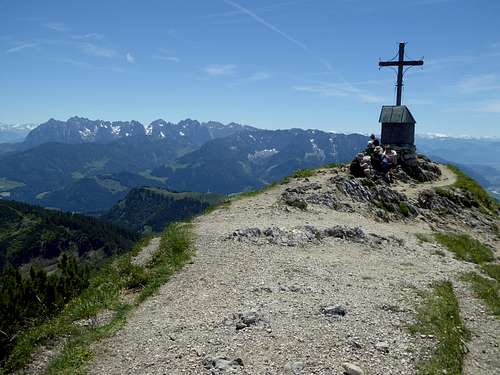
Geigelstein summit with chapel and Wilder Kaiser range
One of the most prominent and therefor most frequented summits of Chiemgau Alps is Geigelstein.
Despite its “only” 1808 m, Geigelstein is a good portion higher than the surrounding summits and thus offers spectacular views.
Geigelstein is the highest point of the subrange of the same denomination. In fact Geigelstein is the only “true” summit of the subrange, the other summits being more or less bumps and heights on its many ridges with the only exception of Breitenstein, the neighbor summit of Geigelstein.
Located in the southwestern part of Chiemgau Alps Geigelstein rises above the Walchsee – Kössen – valley to the south, the Tiroler Ache valley to the east and the Prien valley to the east.
The adjacent summits are Chiemgauer Breitenstein to the south and Roßalpenkopf to the north. Laubergraben and Talgraben go down from near the summit to Prien valley, Lochbachgraben and Schneiderhangraben do the same down to Tiroler Ache valley.
 Geigelstein as seen from the west |  Geigelstein summit area |
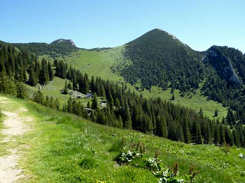
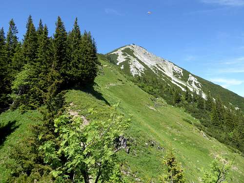
Geigelstein is a prime hiking area with spectacular wildflowers blossoming from may through july. Biking is allowed only on forest roads as huge parts of the subrange is a nature protection area. In winter ski touring is allowed only on marked routes.
Despite of being very frequented some Geigelstein routes are astonishingly solitary and quiet. Maybe this is due to the fact that there are so many routes. But all are ending at the same culmination point: Geigelstein (mostly crowded) summit.
Getting There
Main trailheads are: Geigelstein and Schleching / Ettenhausen valley | 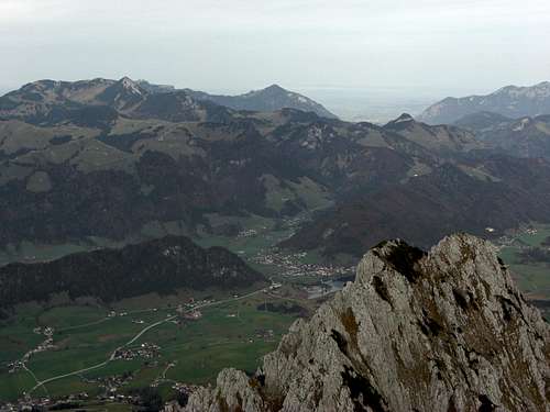 Geigelstein south and Walchsee region as seen from Zahmer Kaiser |
Sachrang and Sachrang / Huben can be reached by car
by using highway A 8 from Munich or Salzburg to exit Frasdorf, then on road number St2093, passing through Aschau. Both hiker parking areas (fee required) are directly besides the road and are signposted.
Schleching can be reached by car
by using highway A 8 from Munich or Salzburg to exit Bernau, then on road number B 305 to Marquartstein. Turn then on road B 307 to Schleching.
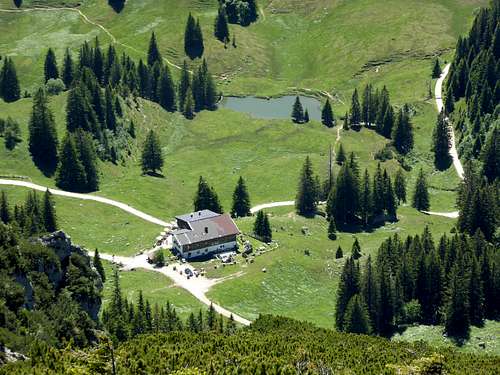 Priener Hütte as seen from the summit | 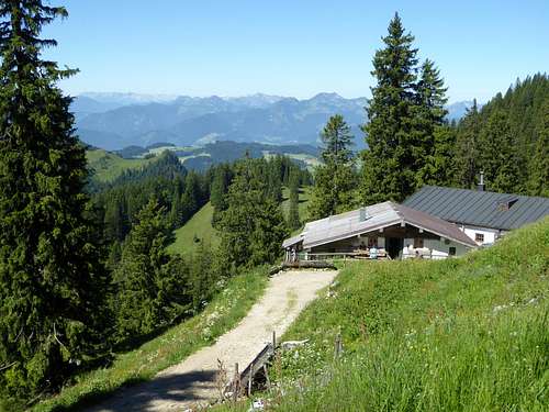 Beautiful Schreckalm |
Walchsee / Winkl can be reached by car
from highway A 12 (Innsbruch) / A 93 (Munich, Rosenheim) by using exit Oberaudorf. Cross the German – Austrian border and proceed on road number 172 to Walchsee.
Turn there on Hausbergstraße and proceed to Winkl and a hiker parking area.
All trailheads are not directly linked to the railway system. You have to use busses from the nearest railway stations – Aschau for the Sachrang trailheads; Bernau for the Schleching trailheads, Oberaudorf for the Walchsee trailhead. See the Chiemgau Alps main page for further information.
Routes Overview
Geigelstein Routes Overview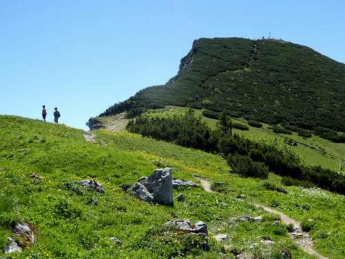
Summit zone / west routes
Western ascents from Sachrang and Sachrang / Huben
Route via Priener Hütte
From Sachrang or Sachrang / Huben parking area follow the forest roads up to their junction point above the Judensee. Follow the forest road up to Priener Hütte using Talgraben valley.
One switchback of the forest road can be shortcut using the marked old trail.
From Priener Hütte follow the forest road to its end at Oberkaser Alm. Ascend trail number 200 (also 207, 8, 20) to the col between Rossalpenkopf and Geigelstein and follow the trail up to the summit.
 On the Schreckalm trail |  Near Schreckalm |  Summit slopes, west ascents |
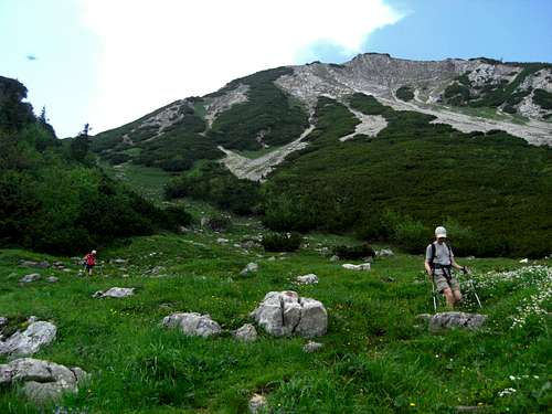
Route via Schreckalm
Shortly after the junction point of the forest roads from Schleching and Schleching / Huben trailhead a trail leaves the forest road to the left. Follow this marked route (number 207) on trails and partly on forest roads up to the lovely Schreckalm. Proceed on the trail number 3 to Sulzing Alm where you meet the route via Priener Hütte. Ascend the summit as described above.
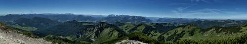
Summit panorama
Eastern ascents from Schleching and Schleching / Ettenhausen
Route via Wuhrsteinalm
Follow the forest road from the parking area up to Wuhrsteinalm and further on to Wirtsalm, where the road ends. Ascend on trail number 8 to the broad col beween Geigelstein and Breitenstein and follow the trail up the south ridge of Geigelstein to the summit.
 South trail from summit to Wirtsalm |  Wuhrsteinalm and Breitenstein |
Route via Roßalm
Ascend the forest road starting at the trailhead to a road junction at about 900 m near Alpbach valley. Follow the marked route, first on a road then on a trail on the orographic left side of Alpbach creek until you rejoin the first forest road again. Immediately after that you arrive at Schusterbauer Alm where the road ends.
Trail number 81 / 207 takes you up to the south slopes of Weitlahnerkopf and to a trail junction with the northern route via Weitlahnerkopf. This summit can easily climbed from the trail junction within 10 minutes.
The ascent trail goes west and then southwest and hits Roßalm, the highest Alm of Chiemgau Alps (food and drinks available).
 Trail to Roßalm with Weitlahnerkopf |  Schusterbaueralm on Roßalm trail |  Roßalm, highest Alm of Chiemgau |
At Roßalm the trail goes south to the col between Roßalpenkopf and Geigelstein where it meets the Schleching routes. Climb the north ridge of Geigelstein on a good trail to the summit.
Northern ascent
The northern ascent uses the forest road of Dalsenbach valley up to Dalsenalm. From there on follow a trail number 200 (also 8 or 20 up) the north slopes of Weitlahnerkopf until you reach this summit. Turn west to Roßalm and follow the above described route to the summit.
Southern ascent from Walchsee / Winkl via Priener Hütte
Follow the road Oberwinkl and then the forest road using Rahmbach valley up to Priener Hütte.
From Priener Hütte follow the forest road to its end at Oberkaser Alm. Ascend trail number 200 (also 207, 8, 20) to the col between Rossalpenkopf and Geigelstein and follow the trail up to the summit.
 Geigelstein south ridge on the way to Breitenstein | 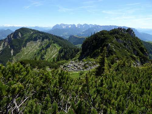 Ridge from Geigelstein to Breitenstein |
Traverses
Geigelstein to Breitenstein using the south ridge trail of Geigelstein and the north ridge trail up to Breitenstein, crossing the broad col between the two summits in some ups and downs. Short scrambling is required.
Ski routes
Red Tape & Accommodation
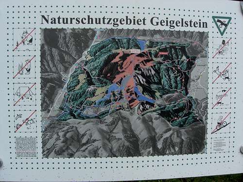
Geigelstein: red tape areas
Huge parts of Geigelstein area are a nature protection area.
See some basic information here.
There is a core zone which is closed for hikers and ski tourists from 1st december through 31. may every year.
Ski touring is possible in special indicated corridors within the protection area, as is snow shoe touring or hiking on the marked trails!
Mountain biking is forbidden in the protection area as is camping, fire, domestic animals, collecting plants.
Please respect all regulations and stay on the trails or the marked ski routes.
Accommodation can be found at:
Aschau/Chiemgau
Schleching
Walchsee
Kössen
Sachrang
Marquartstein
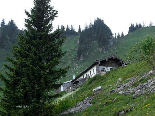 Upper Wirtsalm near Wuhrsteinalm | 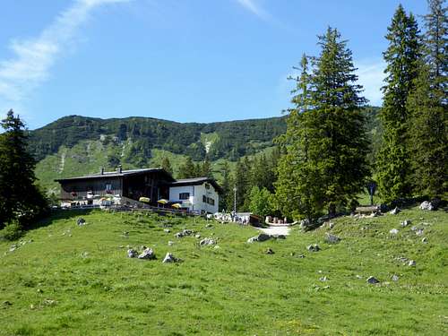 Priener Hütte |
Mountain huts:
Priener Hütte
Wuhrsteinalm
Obere Wirtsalm
Roßalm (highest Alm hut of Chiemgau Alps)
Gear & Mountain Condition
Geigelstein is a year round summit.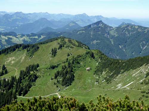 Geigelstein: hikers summer dream | 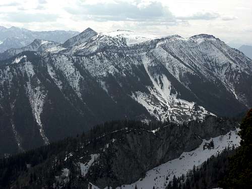 Geigelstein: ski hikers winter dream |
In spring, summer and autumn it’s the hikers realm, in winter and early spring it’s a well known ski and snow shoe target.
For your hiking activities bring good shoes, maybe hiking poles and in spring and early summer some gaiters.
In winter full ski/snow shoe gear and avalanche gear is mandatory.
See the Bavarian avalanche bulletin here.
Current Weather:
Maps
Alpenvereinskarte, Bayerische Alpen, number BY 17, Chiemgauer Alpen West; with trails and ski routes, UMT-grid, scale 1 : 25.000, edition 2014Topographische Karten von Bayern, number UKL 50-54, Chiemsee, Chiemgauer Alpen, trails and MTB routes, UTM grid, scale 1 : 50.000, edition 2016
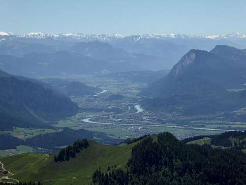 Summit view into Inn valley and Kitzbüheler Alps | 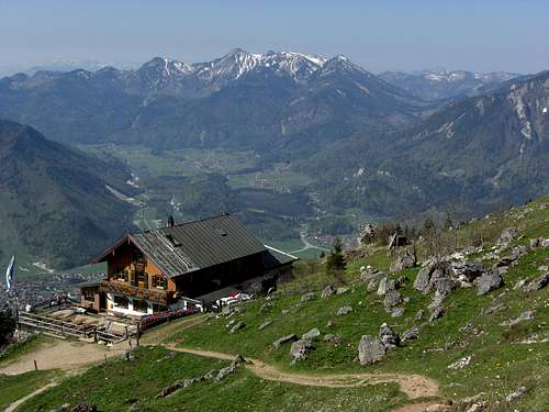 A view from Hochgernhaus to Geigelstein |
Geigelstein Wildflower Album
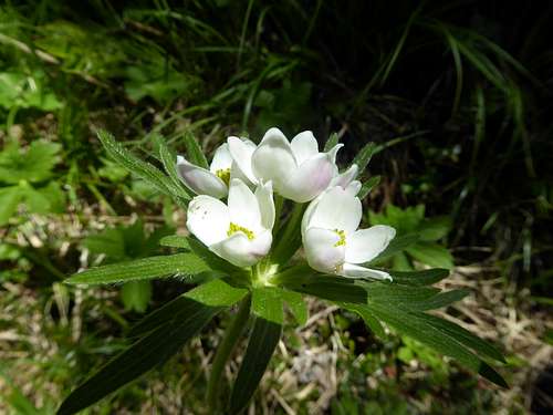 Unknown beauty - who knows this plant? | 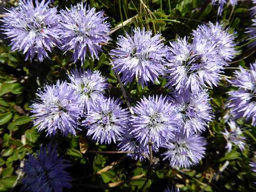 Globularia nudicaulis |
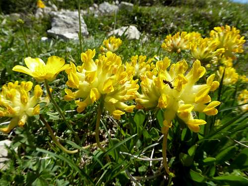 Anthyllis vulneraria | 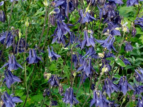 a bunch of Aquilegia |
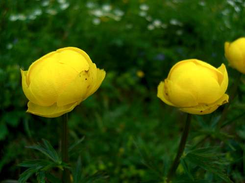 Trollius europaeus | 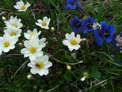 Dryas octopetala and Gentiana acaulis |
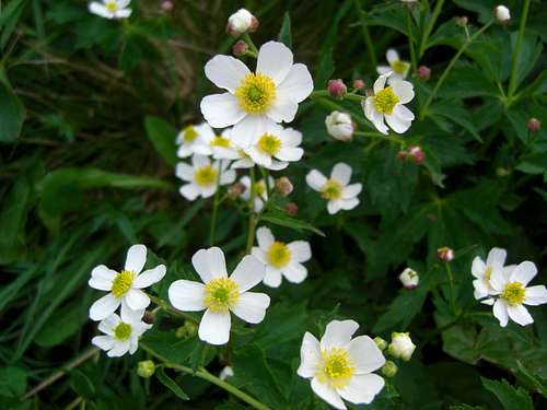 Anemone species | 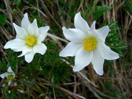 Anemone sylvestris |
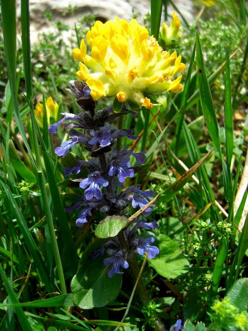 Ajuga cf. genevensis and Anthyllis vulneraria | 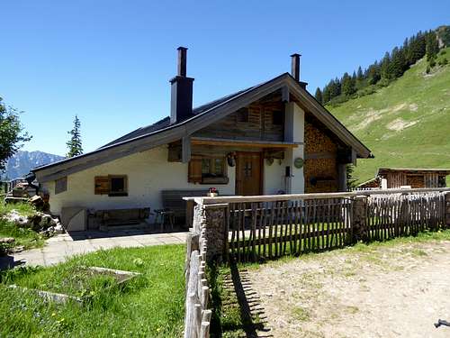 The cows of the dairy farming keeps the meadows brush free and thus allow many wildflowers to grow |