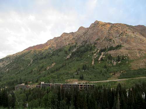
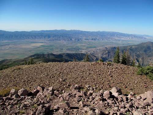
Saluting American Forks - Sep 7th, 2013
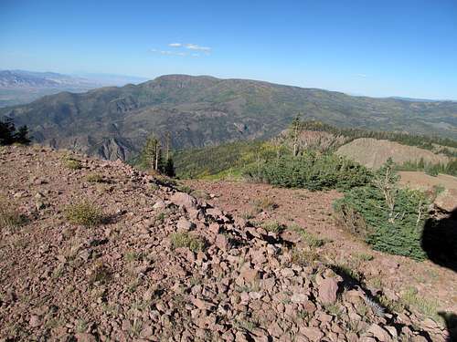
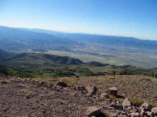
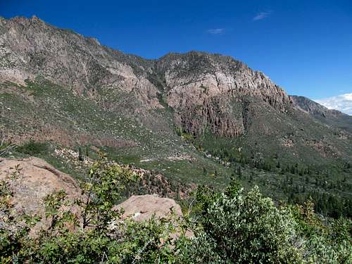
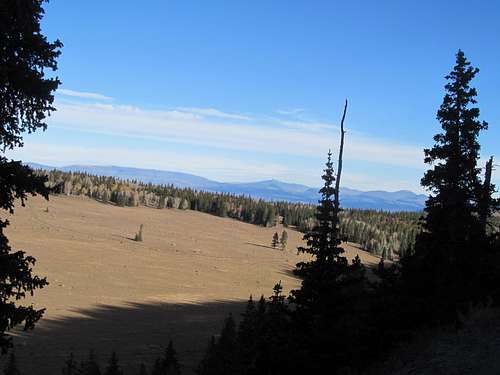
After maiming my ankle on Provo Peak the last week of June I had spent every weekend driving up to the northern Rockies (with the exception of a weekend back in Mass for a wedding). It was no coincidence that this time period fit seamlessly between the end of the Bruin’s Stanley Cup Run and the beginning of football season. Opening Day for the Patriots fell on the first weekend after Labor Day, and Sunday’s 11 AM MST kickoff against the Bills limited my options for the weekend. I considered Lone Peak for Saturday, but inclement weather and a surprisingly attractive week 1 slate of college football games led me to go after American Fork Twin Peaks instead. Despite their stature as the P3K’s and the highest summits of the Central Wasatch, the AF Twin Peaks have a less exciting reputation compared to their 11er neighbors.
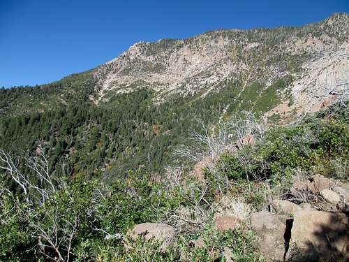
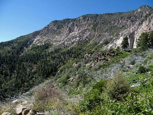
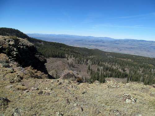
I drove around the various Snowbird Parking Lots several times, trying to figure out where the trail proper started. Eventually I found the dirt road leading up towards the northwest ridge of the peaks. I followed it until I got sidetracked off another dirt path that quickly faded into trail then nothingness, and found myself bushwacking through some mucky areas before I located a steep and recently graded dirt road that lead back to the end of the main Dick Bass “Highway”, rejoining the standard route at the base of a meadow and a small field of boulders sitting at the base of the northwest ridge. I opted to ascend the boulders, which proved to be loose and unpleasant enough for me to consider an alternative on the way back. Past the boulders was a steep grassy slope to reach the ridge proper; the grassy areas were easy to ascend but there was some loose terrain as well.
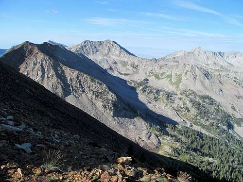
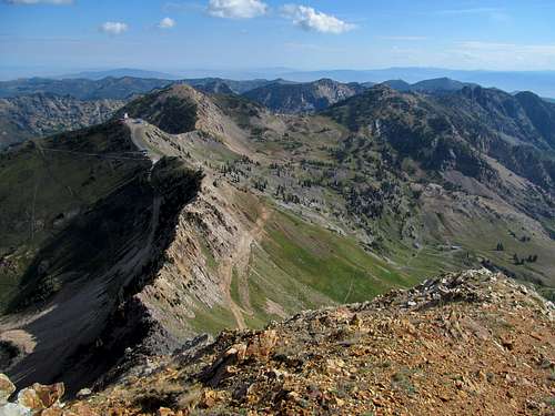
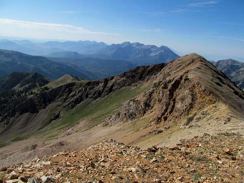
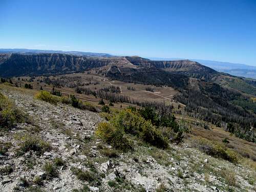
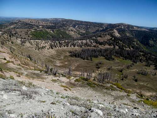
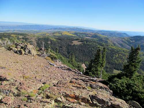
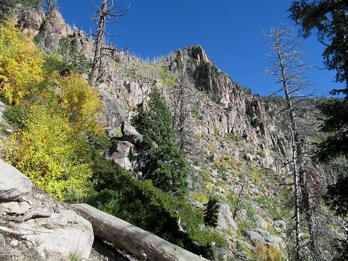
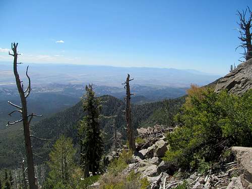
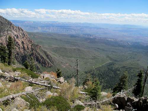
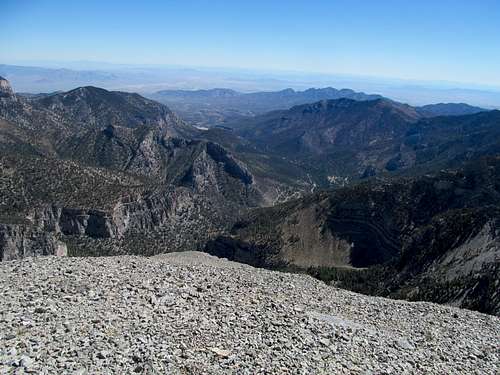
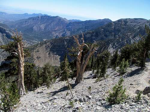
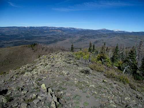
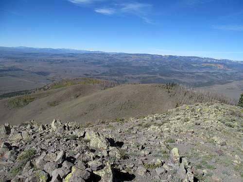
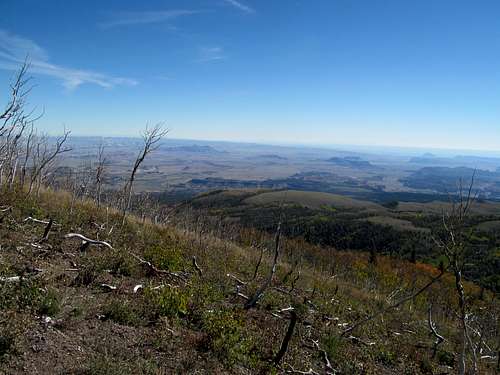
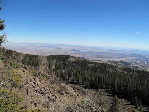
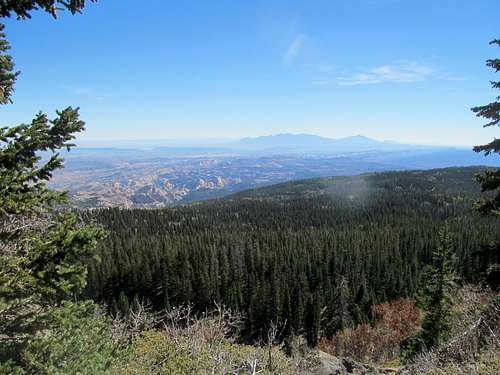
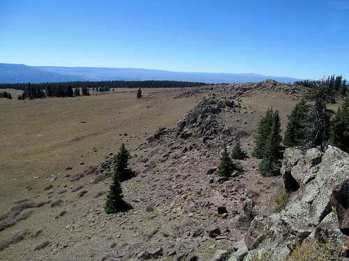
Once along the ridge the terrain shifted to hopping along the use trail as it appeared and disappeared alternated by sections requiring some minor scrambling, and interspersed by the occasional brushy area that the sometimes narrow ridge forces you to traverse. Further up the ridge my destination peaks loomed darkly above the route, blotting out the early morning sun. Parts of the ridge and face looked like it still wore the scars of its mining past though, and the entire area seemed used rather than pristine. Which is fine, since its easy access allows for more football watching when it’s all said and done.
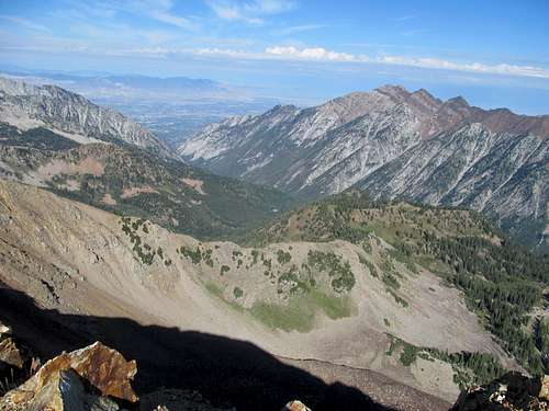
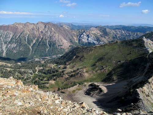
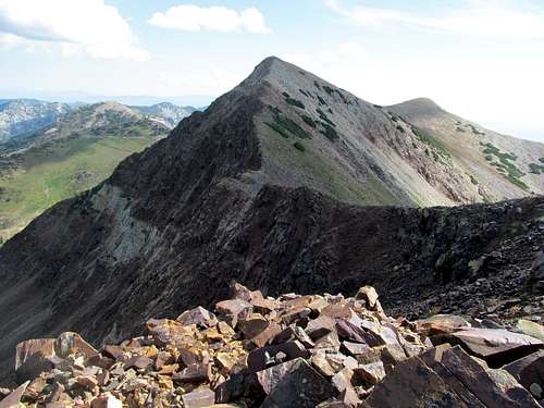
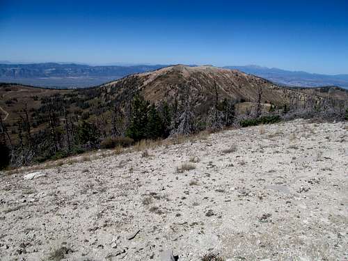
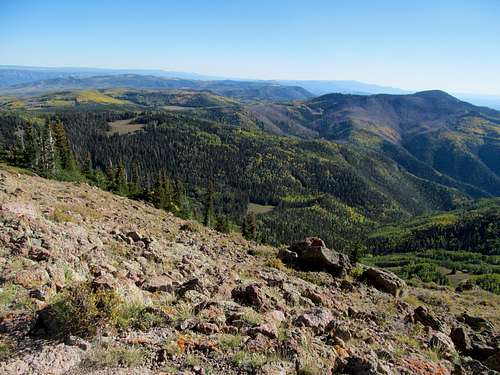
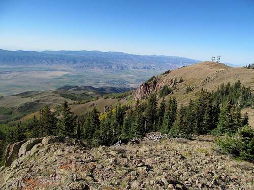
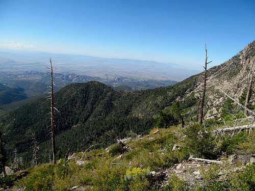
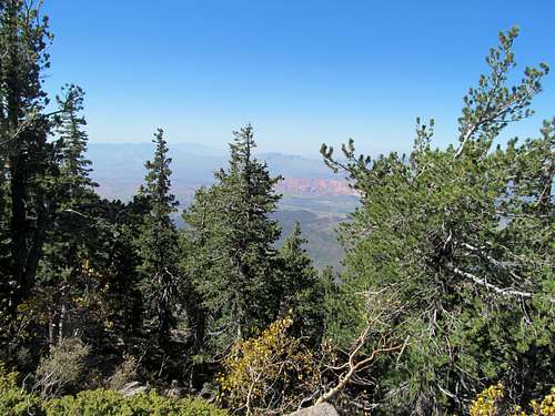
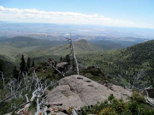
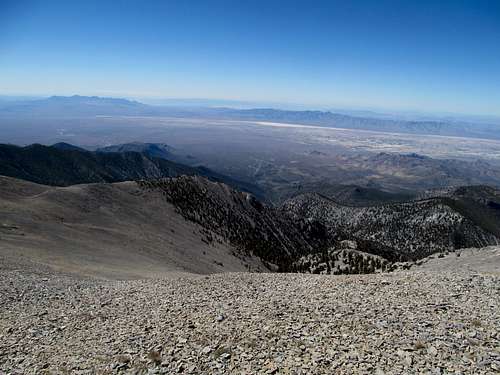
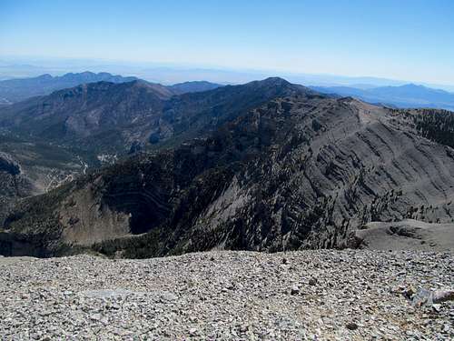
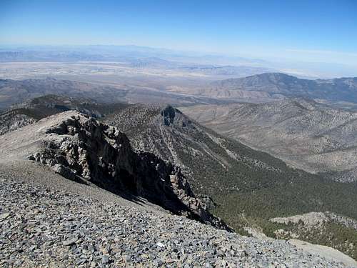
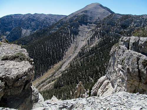
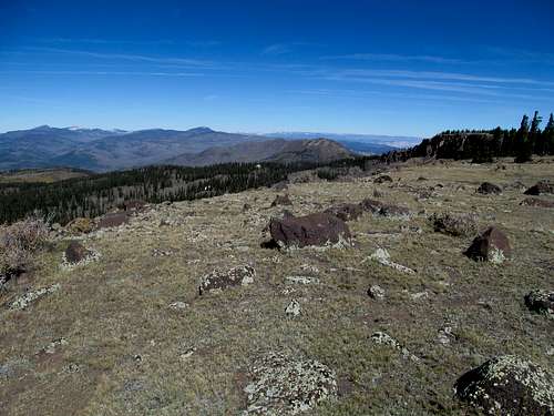
A final scramble brought me to the false summit, also known as Red Top, where I took a good look at the traverse down red rocks to towards Red Baldy and beyond, spectacular peaks that I would have to save until the next summer. Turning east, I traversed some black talus to finally arrive at the west and higher of the Twin Peaks and looked south at Box Elder and Timp with the satisfaction of having already stood atop those summits. I ventured east to the lower twin peak, glimpsed down towards the knife edge ridge that blocks easy access from the top of the ski lift at Hidden Peak, and returned savoring the final views of Pfeifferhorn, especially awe-inducing from this angle facing west, while retracing my steps down the ridge.
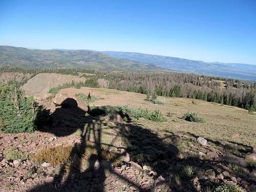
Rather than deal with the loose and steep slope and boulder field again, on the way down I descended further down the ridge criss-crossed northwest, finding a steep, wet, and grassy north-ish facing ramp to downclimb to the obvious meadow next to the terminus of the road.
I had no problem following the road/trail hybrid back down until within sight of the resort. There seemed to be quite a crowd, and I remembered this was around the time Oktoberfest was hosted the ski area. Distracted by the hubbub, my ankle gave way below me in the loose and steep dirt path, and I screamed in pain at twisting the same ankle on the same type of dirt path as this past June on Provo Peak. I got up, recovered, flexed it, and continued down with a slight hobble. After letting a couple by on their way up, my mind wandered again and like Provo, I twisted the same ankle a second time, this time more painful than the last. Cursing again, I managed to make it back to the car without further injury. Oktoberfest seemed tempting, but my ankle hurt, I was pissed from the twists, I likely reeked of sweat, and I had no guarantee that they would have TV’s at the resort where I could catch the afternoon slate of SEC and other exciting football games, so I headed back home.
The next day brought the fall’s first wave of rain/snowstorms, an early 11 AM Patriots kickoff, and a sore ankle, so I sat out my first weekend day in months (not counting the trip back home) to watch the good guys beat the Bills. Through ardent icing I was able to bring the ankle up to par, enough to take on Bonneville Peak and a long hike up and even longer
deadfall death march on Mt. Sheridan on one last trip back north the following weekend.
Bumping into Tents - Sep 20th, 2013
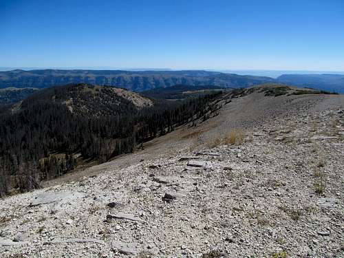
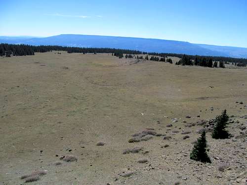
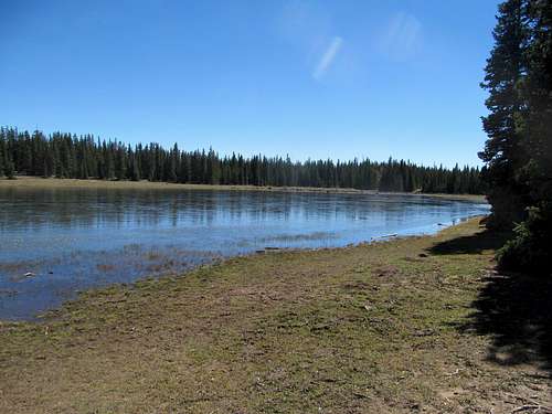
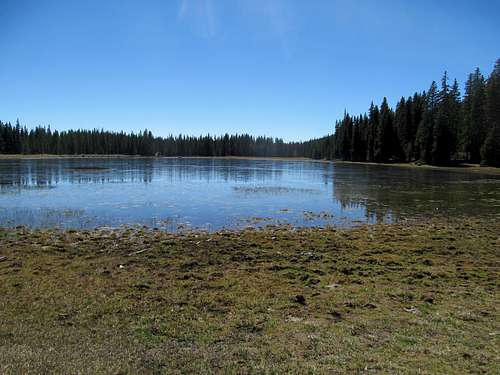
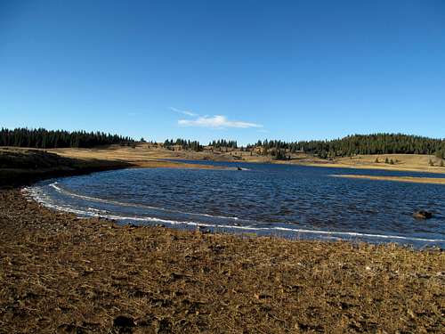
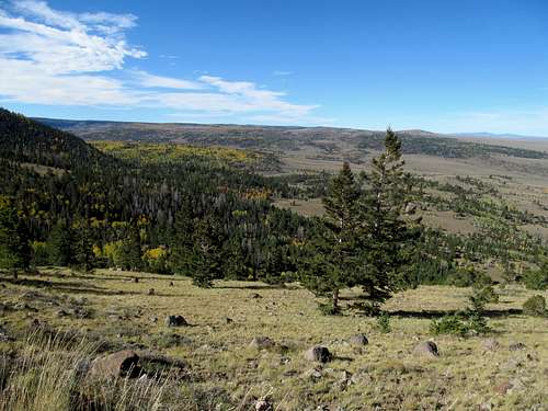
I would have a short workweek. With some friends in Vegas, I decided to call a few extra days off and get some peaks along the way. I left a day before my friends were due to arrive from Boston. My goal for the rest of the year was to get as high as possible given the season, and try to get as many higher elevation range highpoints before they met their inevitable snowy fate for the year and shut down access-wise until the following June or July. South Tent was a priority. The Wasatch Plateau had bugged me for a long time now, having driven through and by it and seen it from so many neighboring peaks. I had intended to get this peak all summer but the timing never worked out. For one thing this was definitely one of those late summer peaks, with Skyline Drive often not fully melted until July.
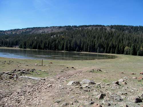
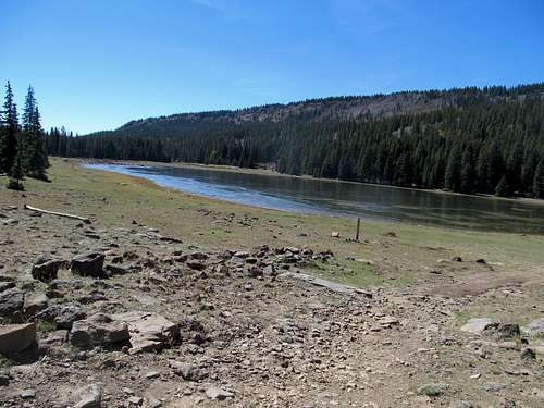
I got a later than planned start and set off for Skyline Drive from its northern terminus. In my mind this road traversing the whole of the plateau was as much of an attraction as the peaks themselves, and I would’ve liked to have driven it from beginning to end. Alas, while the first section made for an easy and scenic drive, the road deteriorated quickly and dramatically after passing the highway coming up from Huntington Canyon. The last 10 miles or so to South Tent were some of the most tortuous, rutted miles of road I’ve ever driven, endless amounts of bumping and bruising on the poor 4Runner. I guess this is a combination of this section being the highest part of the road and the last to melt, an unseasonably wet summer season in South-Central Utah, and the endless parade of ATV’s and 4 Wheelers with their weather and mud be damned attitudes. At the time I didn’t realize that the road improved once past North Tent, so I parked at the jeep track junction a few miles north of North Tent and, tired of driving dirt roads, started walking south along the perfectly drivable dirt road towards North Tent.
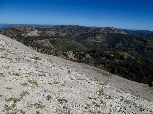
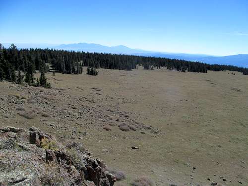
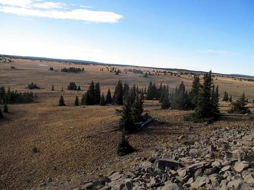
I had somewhat expected these peaks to be a walk in the park, but the terrain was a little more difficult than I expected. Gaining the northwest ridge of North Tent saw some loose rocky areas as well as brush.
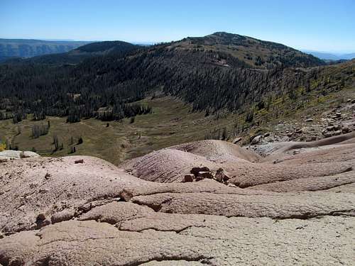
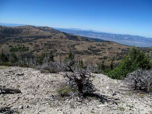
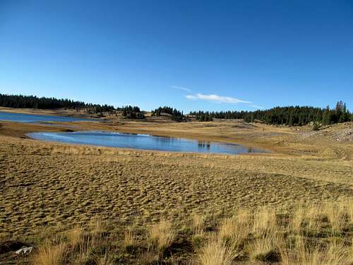
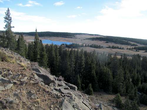
The terrain got easier once at the summit of North Tent, and the occasional blotches of badlandish clay terrain was fascinating, but the traverse was still a pain, especially trying to stay on the sometimes sparse trail so as to avoid the brushy areas.
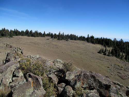
The summit of South Tent was surprisingly populated by a moderate dense (by summit standards) groves of brush/small trees. I walked around, took some pictures, and hurried back and over the North summit to the car.
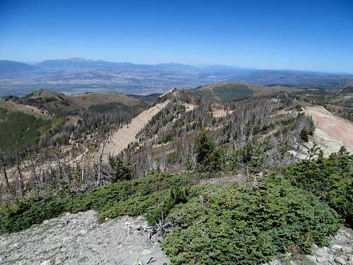
But not before enjoying the views once more on my second stop atop the north summit
With the late start, the rough roads, and the longer/tougher than expected hike, I was running behind schedule. Not knowing the conditions of the rest of Skyline Drive, I decided to backtrack a few miles, take the road to descend to Spring City, then continue south.
Twilight on Monroe - Sep 20th, 2013
I stopped in Manti to grab lunch and check on road conditions at the forest ranger station. I had hoped to pick up both Glenwood and Monroe today, but decided to go after only Monroe; with Vegas on the horizon and a tight schedule the next day to get Signal Peak while still making it poolside at a reasonable hour at Aria, I needed an early arrival and curfew at Cedar City.
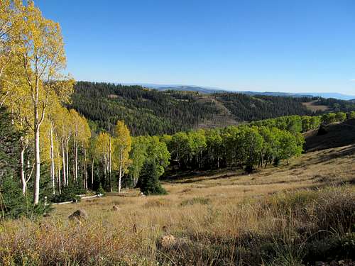
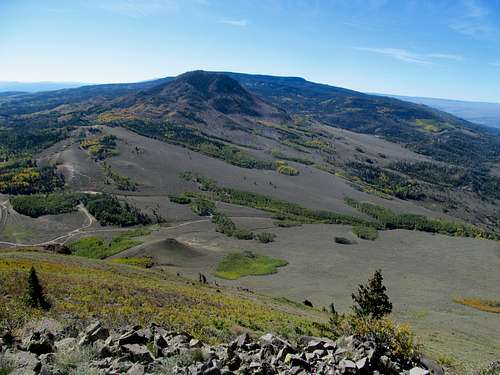
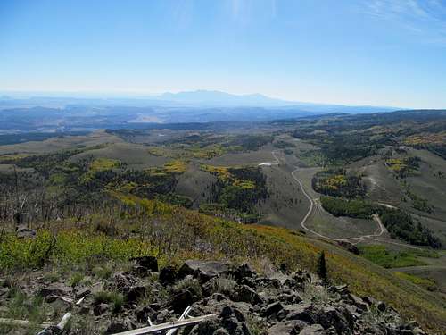
The drive up Monroe in the waning hours of the day took me through the oddly creepy town of Monroe, with its broad yet abandoned main streets. Most of the town seemed to be on the mountain, riding roughshod in their ATV’s around the blind curves of the road leading to the summit of this 11,000 ft peak and possible highpoint of the geologically ancient Sevier Plateau (Glenwood being the other candidate). The canyon leading into the mountains from the town was surprisingly charming, following a small creek, and bright groves of aspen lined the slopes leading up to the summit.
I enjoyed the views from the highpoint, though the Tushars to the southwest were already well within the glare of the evening sun, then drove to the northern edge of the summit, which featured great open views towards the Fishlake Plateau.
I enjoyed the views of the setting sun's reflections against the fall aspen on the drive out.
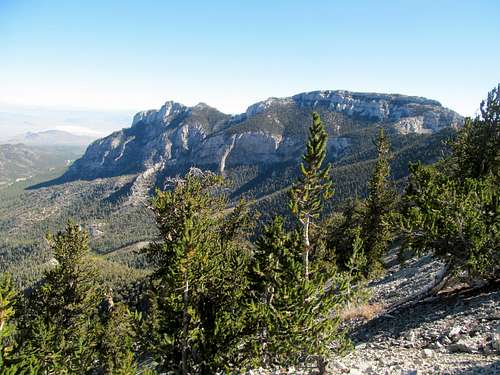
Signal to Vegas - Sep 21st, 2013
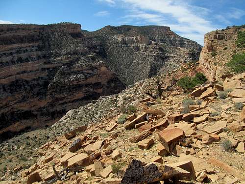
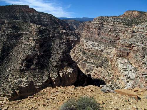
I struggled but managed to rise pre-sunrise in Cedar City and continued my drive south. Appropriately enough the first rates of light in the morning fell upon the still distant visage of the Pine Valley laccolith, and the entire range was bathed in full alpenglow when I pulled up the road to the Oak Grove Trailhead.
The last quarter to half mile of the road leading into the campground was closed due to fire danger regarding the campground itself, but the trail was open. Mere minutes past the sunrise stages of the morning and it was already warming up considerably, not surprising for a route known for its typically scorching conditions late spring through the summer. My concern however lay in wind and time. The west winds were supposed to gust up to 60 mph this day, but fortunately most of the route as well as the wooded summit plateau made the wind a non factor most of the time. The other concern was time, in that I hoped to get this peak done as soon as possible; every minute I dallied here was a minute less I got to lounge and drink poolside in Vegas. So amidst the fast rising temps I found the well cairned left off the initial trail and started up the steep, lowest, and hottest portion of the trail as it follows a steep trunk of a ridge.
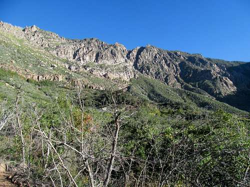
Not really knowing what to expect about this route, I was surprised at the quality of the well marked and maintained trail. There are many switchbacks in the steeper sections, buffered by a few milder connecting zones. The trail turned over to the left side of the ridge after its initial ascent, revealing the alarmingly vertical cliff faces marking the southeastern face of the range. Similar to the La Luz Trail on Sandia in New Mexico, if more steep, the trail parallels the sheer cliffs and pinnacles while occasionally traversing over them, giving the hiker a faint whiff of vertigo.
The modest modicum of elevation gain along this route signaled the gradual transition from scrub desert to sky island forest that any seasoned desert hiker is familiar with, even if he/she isn’t up to speed with the scientific specifics. There was relief in the shade as I found milder temperatures, though non relief as the trail continued its unrelenting climb to the crest.
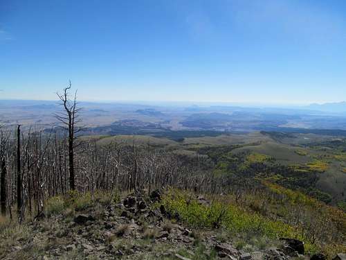
Scattered groves of fall aspen greeted me near the top. Views east towards Zion were still within the morning sun’s glare, so I continued on. After an initial descent from the rim, the trail continued a longer, gradual descent, and I backtracked a few times wondering if I had missed the branch left that leads to the summit. Not finding a junction, I doubled back and down and eventually found the signed turnoff, passing the two meadows along the way as well as a few up and downs in between. Water still flowed through the pastures, though I’m sure spring would find the area much more lush.
I spotted the recognizable summit hump at the second meadow (though I doubt the true highpoint is in view), and continued past and back into the forest, choosing to leave the trail at a high pass. Lacking a GPS, my strategy was to climb blindly through the trees higher and higher until I could go no higher no mo. Strangely enough, this strategy worked, as I made my way to the two summity cairned areas, the latter near the rim with some limited views southwest.
I assumed that I had hit whatever true summit there was to challenge for the title, and from here I had to decide whether or not to hit nearby Burger Peak, which promised perhaps the views Signal lacked (at least according to google earth). I followed as best I can the crest of the ridge between the two peaks, finding the saddle and feeling the furious wind gusts coming up from the desert below. The terrain since leaving the trail to ascend and descend the summit had been easy “bushwhacking” through a mostly open forest, but whatever vantage point I had of Burger looked discouraging, with its summit guarded by brush and some cliffy areas. I’m sure there’s probably an easy way up, but laziness and thoughts of pools, resorts, and bikinis got the best of me, and I decided to forego the second summit of the Pine Valley Range. I vaguely followed the outlines of the map that I had in my head through the forest to relocate the trail, though I got lost pretty badly on the way back at a blind turn in which I also misjudged my location relative to where I had originally come up. Back to the range rim, where furious gusts and now several groups of hikers greeted me, as well as better views towards Zion. As if Vegas wasn’t enough, the winds further discouraged me from staying past taking a few pictures.
The summit attained, I aimed to descend as quickly as possible. This was made difficult however by the steep nature of the trail. The footing wasn’t great for a speedy descent, so I took my time at the more precarious, looser spots before finally cruising as the trail mellowed near the bottom.
I couldn’t get to Vegas fast enough, and the furious gusts of wind fought me and the 4Runner every mile of the way.
Chewed up by Charleston - Sep 24th, 2013
I made it in time to still enjoy some QT at the pool same day. This wasn’t going to be the rager trips of old. We're all old men at this point. My friend I was meeting was on a business trip anyway, so more time was devoted to relaxing, lounging, and maybe the occasional near blackout drunk afternoon at the pool, followed by naps and more relaxing. With my buddy preoccupied during the day with convention events, I hoped to convince myself at some point to sneak away from the pool and get Charleston which, for the amount of times I’ve been to this city, was way overdue.
Sunday seemed to work, as it was a day based on historical experience that I wouldn't be missing out too much on poolside. So I took it easy Saturday night and got up relatively early by Vegas standards to drive all the way to the little town of Mt. Charleston. My plan was to do the South Loop and still make it back for some pool time, but alas after driving around in circles at the campground area for quite awhile I found out that access to the trail was closed due to the pretty major wildfire from earlier in the summer. I was pretty pissed that I had wasted all this time and gas to find the mountain off limits. Despite the presence of nearby Gass Peak, I felt the daytime temperatures already rising towards scorching levels and decided that I didn’t feel like trudging up a low desert peak in such conditions. I made my way back to the Strip in defeat.
It was only after browsing the recent log and peak entries online that I realized that it was still possible to access the peak. One alternative that seemed appealing was intersecting the North Loop from the Mt. Charleston ski area from the north. Monday was my day to drive back to Utah. I had allotted the possibility of trying to get a peak or two on the way back, but with Charleston still unclimbed, it had to come first. I found the route through the ski area easy enough, passing a few construction crews getting the resort ready for its early season.
Based on a trip report I had found, I decided that an ascent of the neighboring wooded ridge to the right of the chute route described on the SP page would be a preferable alternative. This made more sense as I started up the lower areas of the chute, which was quite brushy and rocky. I made a quick, steep and loose exit right and the terrain got better once I reached the ridge proper.
It was still steep, but the open woods made for easy climbing and pleasant aromas. Near the crest of the ridge I found some rocky areas. Fun scrambling, and one section even had a rope over what seemed like someone’s idea of a crux? It seemed overkill even for someone with a profound fear of heights such as myself, and I climbed around the rope. The scrambling turned to some loose talus before I made it up and over the ridge crest to find the North Loop trail which, after the off trail sections, seemed a super highway. I followed it as it curved up and down and over a few areas, but made one crucial mistake as the trail lead towards the Lee Peak area.
The trail took a sharp curve right as it switchbacked up several ledges. I didn’t see the turn, and instead followed the likely false trails left by others who had missed the turn down a loose and gravelly area. I hopped and skipped down this section and quickly lost control, sliding on a loose rock and falling face forward down the slopes. I was pretty banged up all around, but my right wrist suffered the most. The sharp and sandy rocks scraped away a shit ton of skin in the area, and later, as the flesh wounds healed, I realize I had sprained my wrist pretty badly to the point where it hindered my weekday weight lifting for a considerable amount of time and took well over 8-9 months to fully almost heal.
I sauntered along these low loose ledges, often finding faint climbers trails and mistaking them for the real thing, only to see the fade away within a few hundred yards at the most. Up and down through this surprisingly cliffy area I traversed slowly towards the peak. Eventually I realized with the pretty intimidating cliffs in that direction there was no way the trail was below me, so I began a steep and tortuous trek upward, a slippery slog through endless palm size rocks stacked precariously on the steep slope. The gaping bloody hole in my hand made scrambling even more of an ordeal, as I had to avoid contact on rock with the wounded areas.
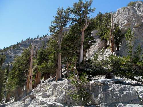
Finally I regained the trail and continued on. The pain in my hand was exquisite, but fortunately the scenery of the sturdy bristlecones lined up against square ledges made up for my discomfort.
I ran into an older couple coming down the peak who noticed my bloody hand and offered bandaids and disinfectants (for whatever stupid reason I always leave my first aid in the car). I thanked them profusely and continued on, less worried about an infection now. Eventually I reached the final switchbacks leading to the summit.
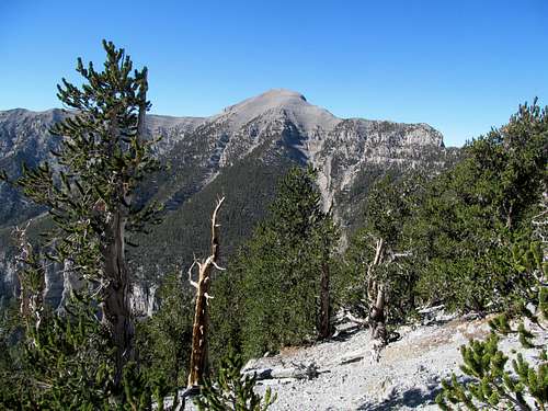
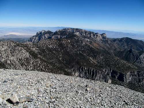
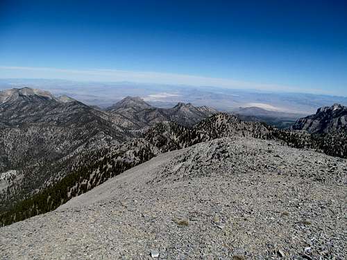
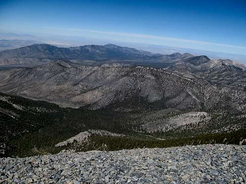
Up until now I had hiked in comfortable summer conditions, but Charleston’s summit gave me my first glimpses of the upcoming winter. Furious 50 mph winds bathed the top of Charleston in arctic conditions, and despite the amazing views of the surprisingly close Telescope Peak across the valley and the Sierras beyond I made a quick dash back down the trail and away from the wind. I shared the summit with a few other hikers and ran into others along the trail, but save for the older couple and a few German kids on their way up as I was descending, most of the local hikers seemed strangely anti-social and standoff-ish.
The trail part of the descent was easy as I picked my way back to approximately the point I joined up with the trail from the ski area.
My concern was the rocky section. With a bloody hole in my hand I really didn’t want to need to use my hands to downclimb the rocks, so I left the trail prior my junction to contour around that area. I started my descent a little more to the west of my ascent route, then continued sidehilling northeast to try and get back to the ridge I had ascended. The terrain was pretty easy as I picked the path of least resistance through the woods, but in my eagerness to get down I had gone too east, and by the time I was low I was waddling amid brush in a different drainage pretty much below the face of Mummy Mountain. It took me awhile to realize that I had missed the ridge, that I had likely passed it too high before it was a defined ridge yet, and that I was in the wrong drainage and needed to zig zag back through more brushy sidehilling until I was able to find a stock trail that took me back to the ski area.
In contrast to the arctic summit it was blistering hot at the trailhead. I added a few bandages to the patchwork of wraps and gauzes around my wound and drove back to Utah, bloody but successful.
Geyser & Thousand Lakes - Sep 28th, 2013
I had hoped for an easy low key weekend without a lot of driving after Vegas. Maybe one last last chance to get up north, head up to Idaho and get Meade and Caribou around Montpelier, but a storm stood in the way, moving through the state and northern Utah. It soaked the Bear River Range, where Greg had already started Friday his 100 mile ultra-marathon. By contrast, I had it easy as I drove south in search of better weather.
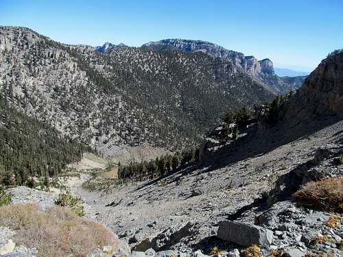
I hoped to make further progress on the high plateaus of south central Utah, but first was Geyser Peak, a P1K north of Thousand Lakes Mountain. It had easy access off Geyser Pass along the road to the latter peak, and I hoped that it would yield views that the perhaps flat summit of Thousand Lakes wouldn’t. Alas, a steep, loose and brushy at the top thousand feet of gain to the summit yielded no views north due to the thick groves of trees lining the north face of the peak.
I got some decent views towards the San Rafael Swell, and thankfully great views back down towards Geyser Pass, aspen ringed Hens Hole Peak, and Thousand Lakes in the distance.
I continued the drive to the standard trailhead for the peak, enjoying the initial ascent through the crisp woods past some rocky switchbacks that topped out at the ridge with views again towards the San Rafael Reef. The temperature seemed to dip as I traversed the dry, boulder lined plateau top, and as the trail led southwest towards Flat Top Spring I left it briefly to visit the rim and get some views of the Fishlake Plateau, with the high peaks already coated with its first snow of the season.
The rest of the plateau traverse was pretty tedious, and the brushy woods before the summit mildly annoying, but I was pleasantly to find the summit in the shape of a small hill that did rise above the summit tundra, yielding great views of Boulder Mountain to the south.
I returned north through the woods, heading northwest until I found the Snow Lake Trail, which led me back down to the woods and around the quiet pristine lake, concluding the hike with a dry and blistering road walk back to the car.
Bouldertop to Fremont - Sep 29th, 2013
I sped to my motel in Bicknell, which had better deals than peak season Torrey right next to the national park. I chatted with Greg, who had just finished his hundred mile race in a blizzard up north, and enjoyed the rest of the college football contests, interrupting myself only to get dinner from a nearby restaurant which specialized in pies. They had a pie sampler package I bought, which I split between dessert and breakfast the next morning. I had never heard of pickle pie, but it was damn good. I guess that almost makes up for the lack of bars in town.
With no Patriot games to worry about (they had a Monday night game vs Atlanta), I woke early Sunday morning and drove south to get Bluebell Knoll, the gentle highpoint of Boulder Mountain and the Aquarius Plateau. The road was nice until the last few miles to the rim, and after that, very rocky and rough. It didn’t help that the sun rising to the east in my direction conspired with my windshield to blind me from the large boulders and potholes that laid themselves with great pleasure along the highland dirt road. I ventured past the knoll to visit both nearby Raft and Elbow Lakes.
It was in the high twenties at first, but had warmed reasonably by the time I decided to jog up the gentle slopes and give my sneakers a rare summit visit. I was surprised to have some far reaching views, even glimpsing the Tushars and the Fishlakes off past the horizon of the plateau rim.
The large summit register and cairn I had seen in many pictures were missing though, and I circled around the summit area for quite awhile looking for it to insure that I had reached the correct highpoint. No success, but after pulling up enough information on my phone and matching the summit photos of others' to my own, I realized that I had to be at the correct area, and surmised it likely that perhaps the area rangers had dismantled the structures.
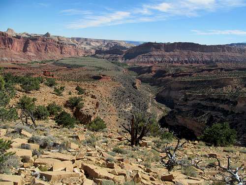
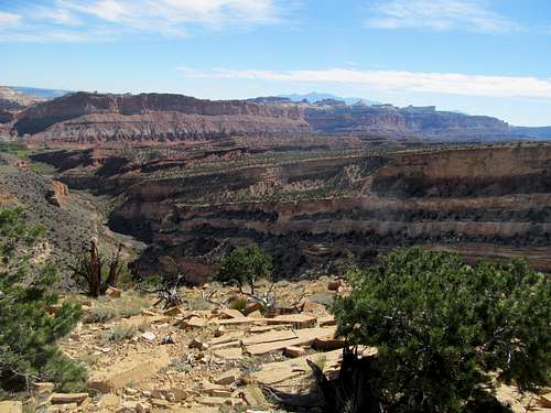
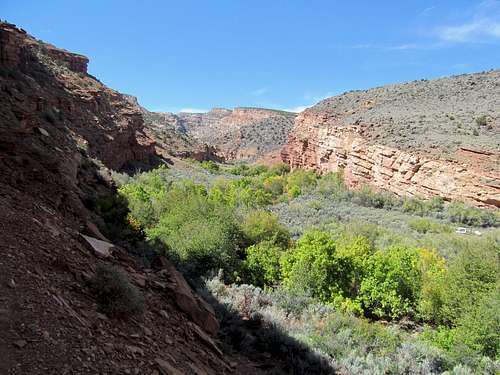
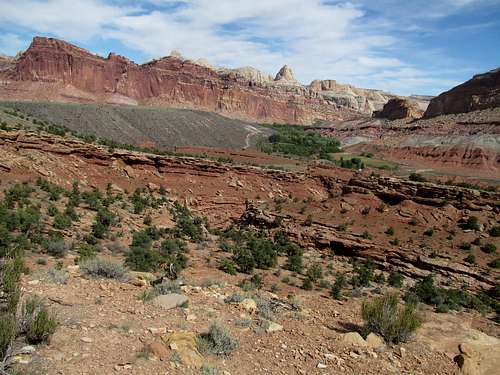
Ironically, a season in which I aimed to get as many high peaks as possible ended with a literal low. I hoped to get Lookout Peak, a ranked peak on the drive out with views south towards the Awapa Plateau, but sans GPS, wandered around in the woods for over an hour before realizing that I had no clue where this peak was. I made my way back to the car and drove back down, finding myself in the desert for the first time in months. Thankfully, my consolation prize was a few very pleasant hikes in Capitol Reef National Park along the Fremont Canyon and Fremont River Trails, and after a chilly morning I worked up a nice afternoon sweat, savoring the rarely sweet fruit of defeat.
Comments
No comments posted yet.