
-
 27186 Hits
-
 87.31% Score
-
 24 Votes
|
|
Mountain/Rock |
|---|---|
|
|
39.48400°N / 105.883°W |
|
|
12853 ft / 3918 m |
|
|
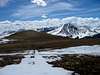
Glacier Peak Overview
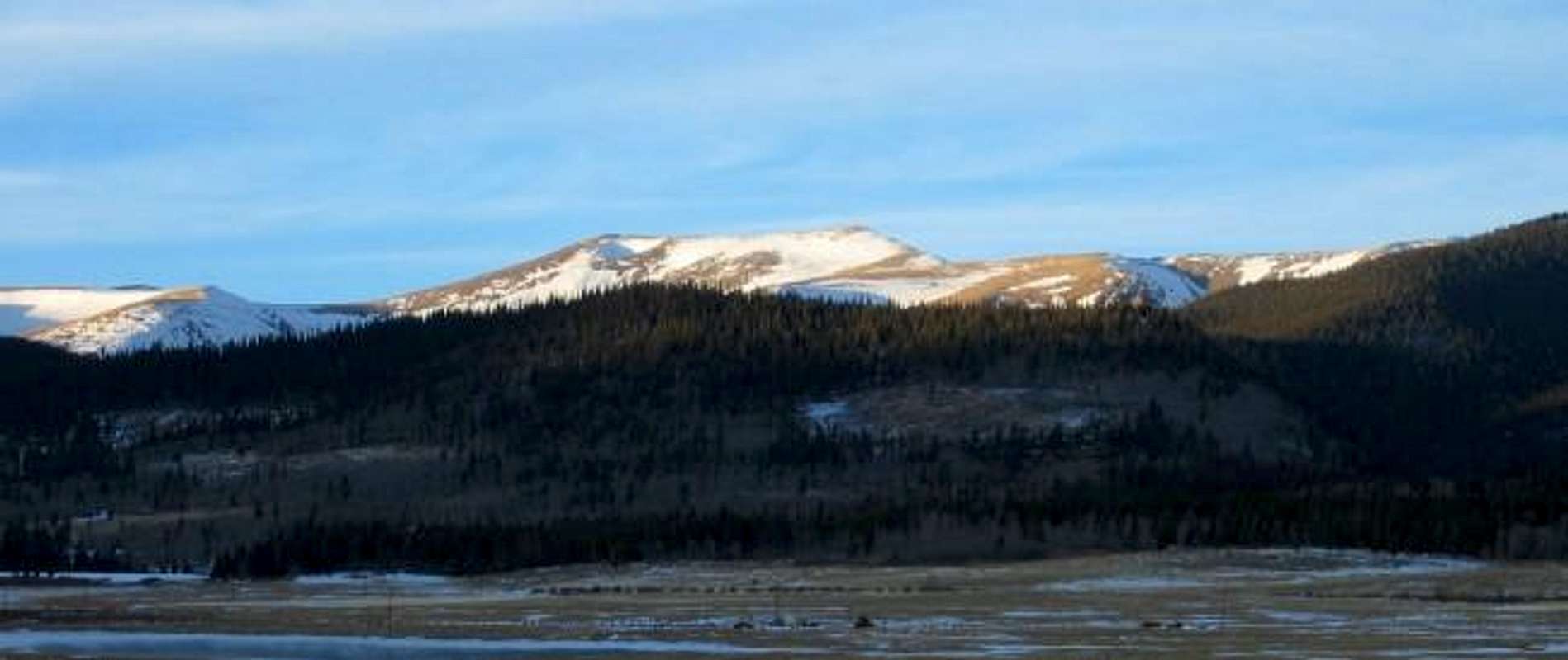
Glacier Peak from South Park during a January sunset.
 Glacier Peak is a moderate and gentle summit located near Georgia Pass in the southwestern region of Colorado’s Front Range. Stradling the Continental Divide, Glacier Peak surveys a lot of territory. It is archetypal of the summits in this region possessing a relaxed demeanor much like that of nearby Whale Peak. Glacier Peak is visible from US 285 near the small town of Jefferson; it rises as a “Squaretop” ridge on the northwestern mountainous boundary of South Park.
Glacier Peak is easily accessible from multiple trailheads. It can be approached from Georgia Pass, Jefferson Lake, or Gibson Lake. Its gentle slopes and proximity to a high pass make it ideal as a year round mountain (although the approach is much longer during the winter months). There is even an old 4-wheel drive road that climbs up along Glacier Ridge from Georgia Pass to within 40 or so feet of the summit.
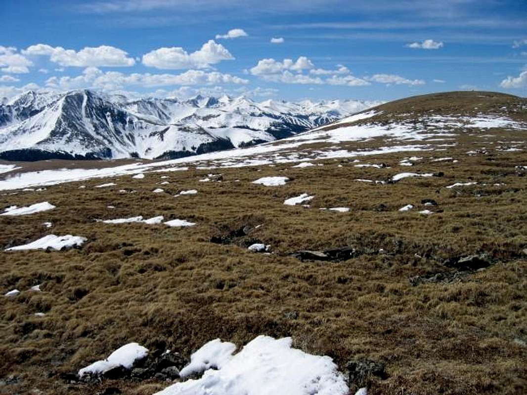
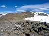
Despite the humble posture of Glacier Peak it does offer outstanding views of more rugged terrain. South from Glacier Peak, across Georgia Pass, rises handsome Mount Guyot. The ridge walk of the Glacier Ridge Route offers successive fantastic views of Mount Guyot’s impressive north face. Across the Blue River Valley to the west are the highlights of the Tenmile Range: Fletcher Mountain, “Atlantic Peak”, Pacific Peak, Crystal Peak, the numbered Tenmile Peaks above Breckenridge, and the mighty duet of Peak 1 and Tenmile Peak. To the northwest the majestic Gore Range roars up beyond Lake Dillon. The numerous avalanche paths on the south sides of many of the Gore Mountains are worth examining. To the north the rest of the Front Range marches on to the heights of Grays and Torreys Peaks. From the eastern high point of Glacier Peaks summit ridge you can even get a good view of the Mount Bierdstadt and Mount Evans Massif. Below to the east lies the wide basin of South Park bordered by the Kenosha and Tarryall Mountains. And to the extreme south even the Sangre de Cristos can be seen on a clear day. For such efforts as required by the ascent the views are disproportionately rewarding.
The downside of Glacier Peak’s easy access and close proximity to Colorado’s Front Range metropolis is that the area can be heavily utilized on nice weekends. This area is not a designated wilderness so motorized vehicles are allowed on the roads. In the winter the Georgia Pass road is very poplar with snowmobiles. Come summer ATVs can be frequently encountered. Despite this Glacier Peak is not a popular summit and you probably will enjoy some solitude. On March 21 I had the entire summit walk to myself after encountering a small guided group of snowmobilers near Georgia Pass.
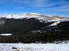 | 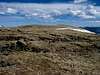 |  |  |  |
The Views from Glacier Peak
 |  |  |  |  |
Getting There
All described routes can be reached from US 285 near Kenosha Pass. Kenosha Pass is about an hour and a half drive from Denver.
To reach the Georgia Pass Road trailhead follow US 285 to the small town of Jefferson. From Jefferson turn west onto Park County 54 (this road is marked with signs for Jefferson Lake). Follow Park County 54 past the turnoff to Jefferson Lake. Bear right at a Y. At a junction with Park County 870 (marked with a dead end sign) turn right. Drive past the Michigan Creek Campground. In the winter months the Georgia Pass Road frequently becomes impassable to vehices above the Michigan Creek Campground. In the summer a vehicle can continue all the way up to 11,858 foot Georgia Pass. Park wherever appropriate. From Georgia Pass the ridge walk would be a lark.
The Jefferson Lake Trailhead is reached by turning off of US 285 at Jefferson and following Park County 54 to the first right turn. From here on it is just necassary to follow the signs to Jefferson Lake State Park. This is a pay area with a $5 entry fee.
See Whale Peak for a description of the Gibson Lake Route. This long tour requires a traverse of Whale Peak to get to Glacier Peak and provides a scenic route to attain the summits of these two mountains, seperated by just a mile.
 |
Red Tape
Glacier Peak lies on the boundary of two Forest Service jurisdictions. On the west is Araoaho National Forest and on the east is the Pike National Forest.
Contact information for Pike National Forest:
South Park Ranger District
320 Hwy. 285, Box 219
Fairplay CO, 80440
719-836-2031
Contact Information for Arapaho National Forest:
Clear Creek Ranger District
101 Chicago Creek, Box 3307
Idaho Springs, CO 80452
303-567-2901
 |
When To Climb
Glacier Peak's gentle slopes, road access, and ridge routes combine to make it a year round mountain. Although an ascent of Glacier Peak is a mere 4 miles roundtrip from Georgia Pass (possible in the summertime) it can be become a daunting 12-16 miles when deep snow hinders road access. The slopes and ridge route to Glacier Peak from Georgia Pass minimize avalanche danger. However this 3 mile long Ridge is exposed to the elements and would not a pleasant place to be in inclement weather. Summer months make this mountain an easy hike and allows alternative routes to the Georgia Pass/ Glacier Ridge Route.
 |
Camping
Many developed campgrounds exist near Glacier Peak. Here is a link to a map of National Forest Campgounds in the vicinity of Jefferson. Michigan Creek or Jefferson Lake Campgrounds offer the best acess to Glacier Peak. More primitive camping can be had above Georgia Pass.
 |  |  |
Mountain Conditions

Dogs on Glacier Peak
This is a dog friendly mountain.
 |  |  |  |  |