
-
 4466 Hits
-
 71.06% Score
-
 1 Votes
|
|
Route |
|---|---|
|
|
49.82000°N / 7.83000°E |
|
|
Hike and Scramble |
|
|
Less than two hours |
|
|
Walk-Up |
|
|
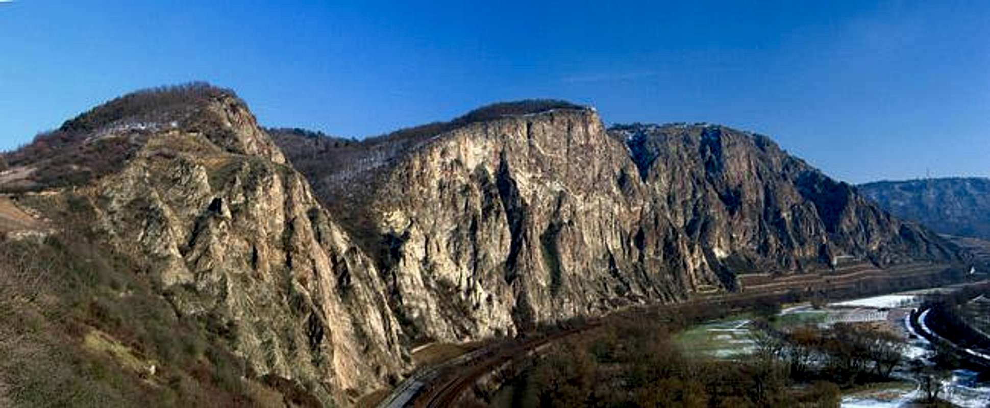
Approach
See the main page for the itineraries to Rotenfels. This Route along the Götzenfels Ridge starts at the village of Norheim. It is located directly on the Nahe River west of Rotenfels and Götzenfels and can be reached from Traisen (see Getting There) by following one of two southward bound roads.The trail starts at the eastern end of Norheim. There is a pedestrian/bike bridge across the Nahe River on one side of the road and an abandoned filling station on the other.
Route Description
- Start altitude: 110m
- Summit altitude: 327m
- Prevailing exposition: S
- Type: 2h over forest roads and steep paths
- Protection: marked sparsely
Start at the filling station and follow a dirt track uphill, which ultimately leads in the direction of Traisen. after about a km a shallow valley comes down from the right through the vineyards. Head upwards and take the first possible turn right. This is a sharp turn which leads you southwest to the starting point on Götzenfels, which again is located above the road from which you started.
Follow the ridge for a while until the trail splits. The dirt track goes straight on but leaves the ridge. Follow the narrow and steep path which turns off to the right. You'll reach a little (fenced off) orchard which is overhanging the road. Shortly afterwards another dirt track turns off left. Follow it for 10m but then turn sharply onto the Götzenfels ridge trail. From here you have some stuning views onto the road below and - of course over towards Rotenfels. Take your time in slippery conditions. Though relatively easy to hike several locations are quite exposed.
After having reached the top of Götzenfels the remainder of the ascent turns away from the walls to circumvent the deep valley which separates Götzenfels from Rotenfels. The path ends at an intersection. If you turn right (south) here you directly head for the lookout on top of Bastei. From there you can follow a well worn trail which follows the bend of Rotenfels up to its unnamed highpoint.
 |  |  |  |  |
Essential Gear
Bring hiking boots. The terrain is rugged.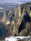 |  |  |  |  |