SW Ramp of Granite Peak
I scheduled Granite Peak for Labor Day weekend in the hopes of avoiding any significant snow or ice on the route and the need to pack or travel with ice axe/crampons/ropes/etc. The week before the trip I was able to get a condition report that the route was clear. No snow gear needed. Still just to be safe we brought microspikes and my light weight axe...neither were needed. This trip report is for the SW Ramp. It wasn't until the week before that the route choice was decided. I went back and fourth several times between this and the standard route. The biggest concern for the SW Ramp was all the comments I read and heard about the rockfall hazard. Plus I was told that the climbing is really fun on the standard route.
My reasons for finally choosing the SW Ramp:
- Scenery: It seemed the trek up the skytop drainage was more appealing then the FTD plateau
- Less Gear: The conditions in the ramp made it so we didn't have to pack technical gear. Which also makes it easier/cheaper to fly on Allegiant airlines.
- Water: Water is available all the way to the upper most sky top lake right below the Granite massive
- Experience: The combination of my limited trad "lead" experience and my fiancees limited trad rock climbing experience
- Less Strenuous: Reading route descriptions and examining maps it seemed the SW ramp route was slightly shorter and and had less elevation gain and loss.
DAY 1: Travel to Montana & Hike to Basecamp
The alarm was set early to catch the 6:00am flight from Mesa, AZ to Billings, MT. The weather forecast looked sunny and warm throughout the weekend with the exception of some potential light rain Thursday afternoon/evening. The plan was to pick up any supplies needed (water, fuel, food) and then drive straight to the trailhead near Cooke City with a quick stop in Red Lodge for some lunch.
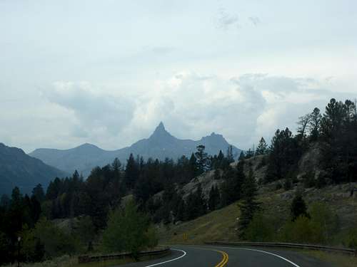
![Beartooth Highway]() Beartooth Highway
Beartooth Highway
The drive over the beartooth pass was pleasant coming in on a Thursday and beating the weekend traffic. There were a few clouds building, but still too early to tell if we would hike in this afternoon or wait until the morning. We typically build in a "weather" day into our schedule to give us options and wait on any bad weather conditions. This trip was no exception as we had 4 days to accomplish our mission. We arrived at the upper trail head parking with growing clouds and some light thunder. It looked like we arrived in time to hike the 5-7 miles to get us to a camp spot close enough to summit the next day so we prepared out packs and headed out. (As a side note the last 1/4 mile isn't too rough, but the Subaru Impreza we rented scraped the bottom a few times - Oops)
![GP Trailhead]() Granite Peak TH
Granite Peak TH
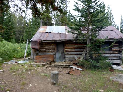
| ![cabin]() Old Cabin - Go around the left side to pick up the trail
Old Cabin - Go around the left side to pick up the trail
|
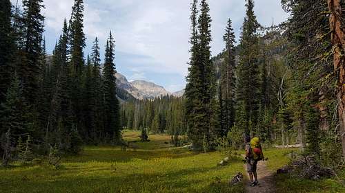
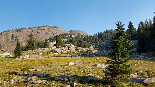
The trail has a slight climb of a few hundred feet before it drops back down to Lady of the Lake. After that it remains fairly flat until you enter the skytop drainage. The scenery was outstanding and met every expectation. As always pictures do not do it justice...but we take them anyway.
![Meadow]() Meadow
Meadow![Lady of the Lake]() Lady of the Lake
Lady of the Lake
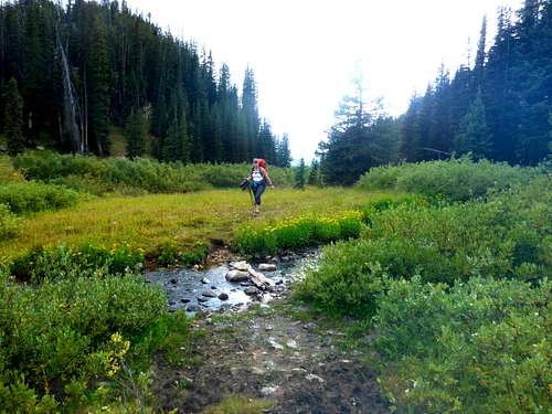
| ![Meadow]() First Creek Crossing
First Creek Crossing
|
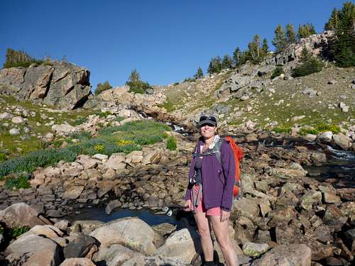
I thought the trail was easy to follow. The trail junction at the south end of the lake is signed and obvious which way to go (North or Left). The trail junction just north of the lake is also signed and obvious. The left fork will take you uphill back to Lulu pass road the right fork or straight ahead will take you to the Broadwater crossing. Just before the first creek crossing (Lady of the Lake inlet stream) make sure you sort of leave the trail you are following to a left branch. If you stay right the trail will lead back toward the opposite side of Lady of the Lake. The left branch enters a small meadow and crosses the inlet stream.
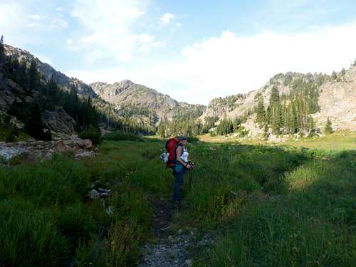
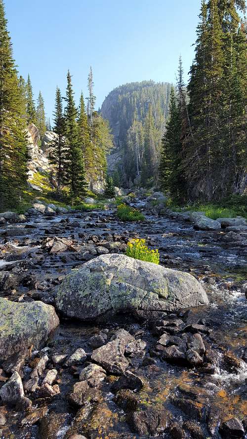
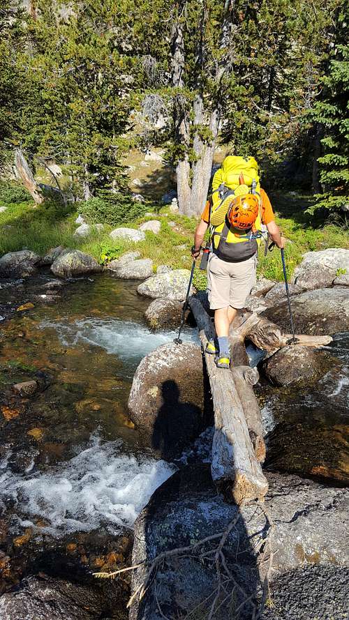
The unsigned junction where the trail splits for the Aero Lake (Left) or Skytop (Right) is easy to spot. Shortly after the junction you will reach the Broadwater crossing. We crossed right below the confluence. We changed into our water shoes, but on the return we crossed by rock hoping without changing shoes and keeping our feet dry. Pick up the trail on the other side of the crossing which turns right (heads East) and leads away from the Zimmer creek drainage which has been in front of you for most the time. The trail will descend slightly until you reach sky top creek and starts to head up the sky top drainage. The trail stays on the left (North) side of the the gorge and creek for the most part. There are some meadows that have some branches you cross, but that is further up.
![Sky top 1]() Sky Top Meadow
Sky Top Meadow
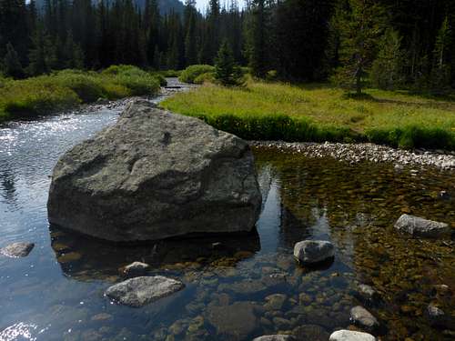
| ![sky top creek]() Sky Top Creek
Sky Top Creek
|
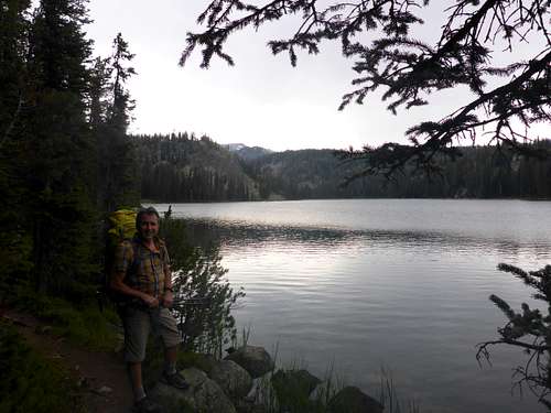
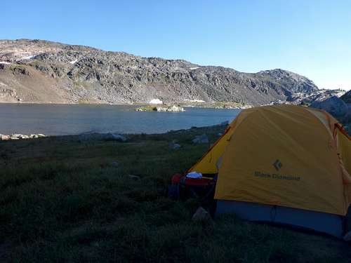
We again changed shoes for the creek draining Aero Lake, but again didn't have to on the return hike. It just takes a little ingenuity and searching to find a crossing - I think we crossed a fallen tree. Once we reached the Shelter lake drainage I knew we had entered the zone that would allow us to summit the next day without making it too long of a day. Since we still had daylight left we decided (or rather I decided) to keep going and either stop at Lone Elk or Rough Lake. When we reached Lone Elk Lake we were getting tired so Kelli suggested we set up camp there. I was reluctant thinking Rough lake would be a better spot to camp and a little closer to our destination. So we compromised and found a nice spot on the north side of the lake near the inlet stream. In hindsight Lone Elk lake was better. I didn't notice any really great camping spots on the south side of Rough lake and it would be a little extra unnecessary hiking to the East side of the lake. Plus there ended up being a group of 5 guys camping up there. We had Lone Elk Lake to ourselves. STATS: 7.5 miles, 3 hours 43 minutes, 1150+ of climbing.
![Lone Elk Sunset]() Lone Elk Lake at Sunset
Lone Elk Lake at Sunset
| ![Kitchen Rock]() Kitchen Rock - Where we cooked our meals
Kitchen Rock - Where we cooked our meals
|
![Inlet to Lone Elk Lake]() Inlet to Lone Elk Lake
Inlet to Lone Elk Lake
| ![Lone Elk]() Rough Lake
Rough Lake
|
![Lone Elk Lake Camp]() Lone Elk Lake Camp
Lone Elk Lake Camp
| ![Lone Elk Lake Reflections]() Lone Elk Lake Reflections
Lone Elk Lake Reflections
|
DAY 2: Summit Day
We started at day break, not having to worry about melting snow or ice. As we reached Rough Lake, it was the first time we realized we were not alone. Five young guys were also headed for the summit via the SW Ramp.
![Rough Lake morning]() Rough Lake morning
Rough Lake morning
| ![Rough Lake Traverse]() Rough Lake Traverse
Rough Lake Traverse
|
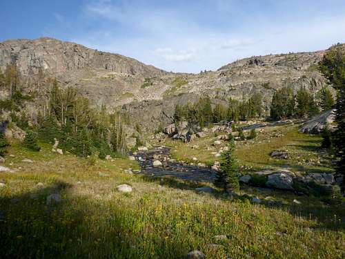
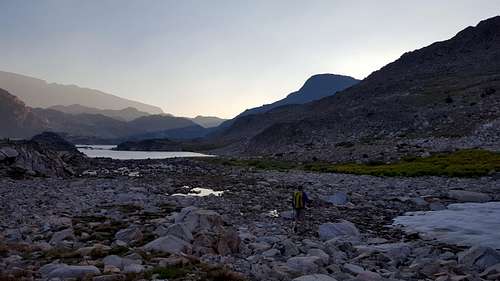
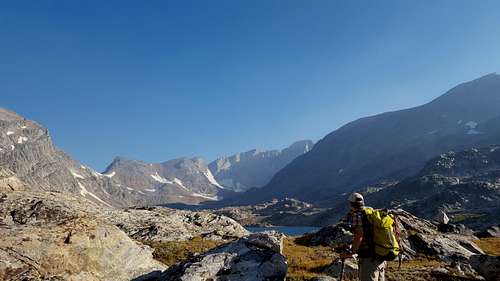
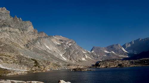
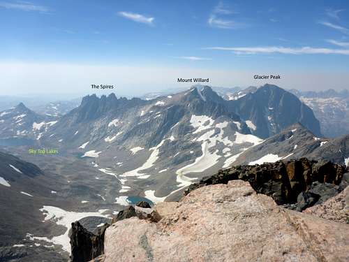
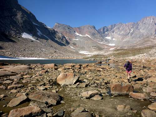
As you entered the Sky Top lake area is where you get your first glimpse of Granite Peak. This is also where the non-stop boulder and rock hopping begins. Just as you start building confidence you will step on a boulder that will shift or move under your weight. There were a few snowy patches, but nothing to worry about, but there was one that if you slipped you could slide into the chilly waters of one of the lakes.
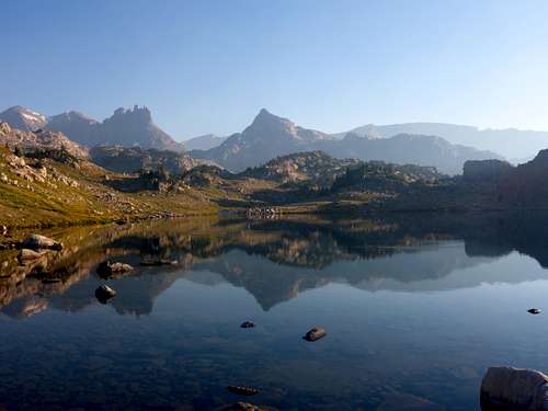
![Spires]() Villard Spires
Villard Spires
| ![Onto some snow]() Onto some snow
Onto some snow
|
![Granite Views]() Granite Peak First View
Granite Peak First View
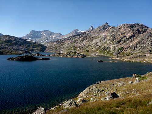
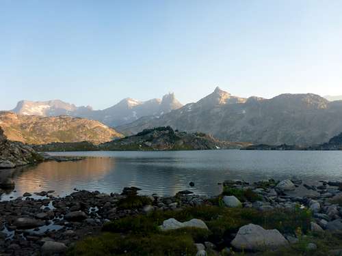
| ![SKy Top lakes]() Sky Top Lakes
Sky Top Lakes
|
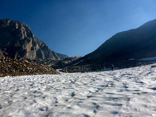
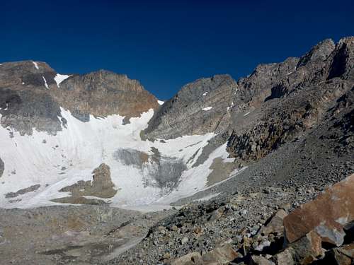
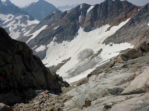
As we approached Granite Peak near the top of the Sky Top Lakes there was still a nice size snowfield to cross. This was a nice welcome and rest from the rock hopping. This is where the five guys caught and passed us. It must be nice to have young legs still.
![Snow Field]() Snow Field
Snow Field
| ![Granite approach]() Top of the snow field
Top of the snow field
|
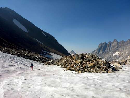
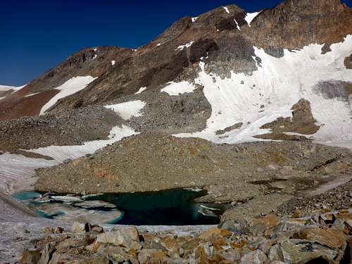
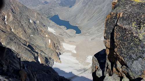
![Top of sky top]() Upper most Sky Top Lake
Upper most Sky Top Lake
| ![Granite Peak - Sky Top Glacier]() Mostly melted Sky Top Glacier
Mostly melted Sky Top Glacier
|
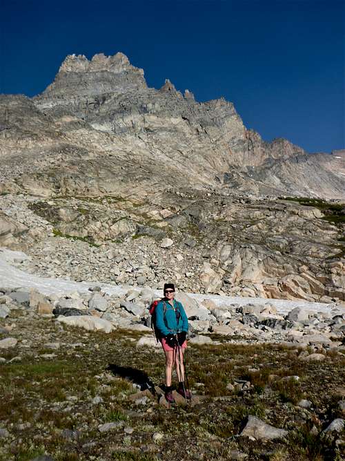
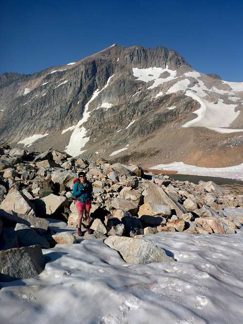
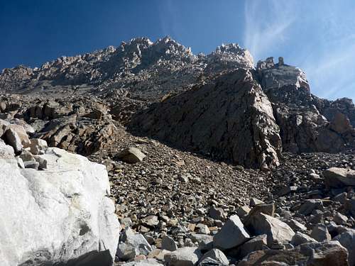
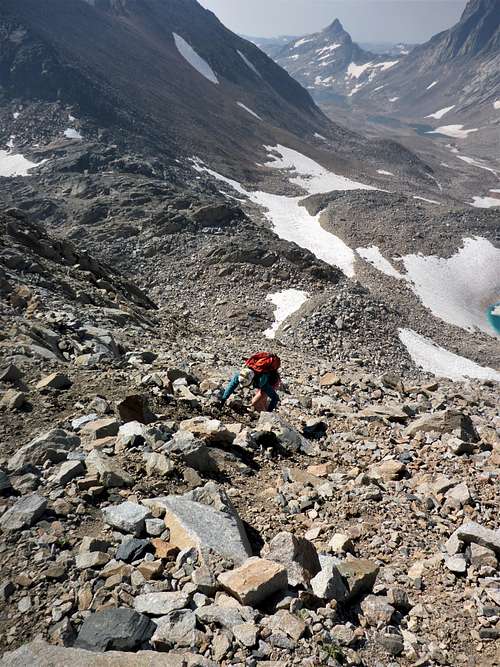
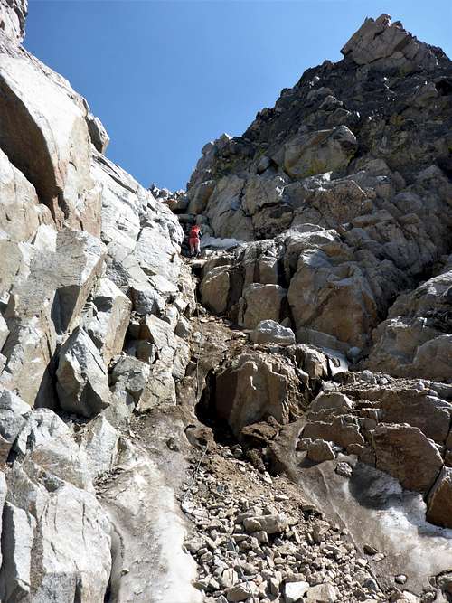
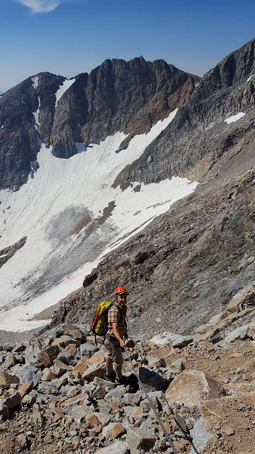
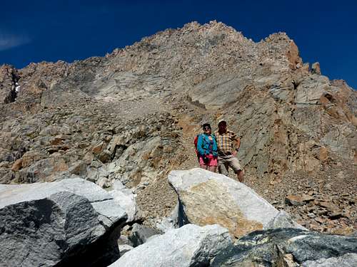
We finally reached the base of our goal (Granite Peak). We took an extra long break to let the guys get some distance on us, but close enough to keep them in our sights going up the scree slope and traversing under the slab. We took another break once we hit the SW Ramp to make sure they were out of our way. However, once we started climbing the ramp we caught them once we got past the first hand-line. Then we waited, and waited, and waited. Finally I decided to climb up and find out what was going on. They had reached the second hand-line. There was still a little ice left in the chute and they didn't have any traction device. It was steep and lose here, but very manageable with the hand-line. Two of them climbed to the top of the rope. From there there is a technical move to climb the boulder the rope is attached to. The guys were worried about reversing the move on the way down. After many minutes of debate with their team, they decided to not climb any higher and decided to turn around. It is very lose in this area, so we had to wait until both guys could climb back down the rope. Once it was cleared Kelli and I went up and passed by the rock without any issues. We both felt there were plenty of hand holds to reverse the move and climb down the rock without falling.
![Start of the skree climb]() Start of the scree climb - 5 guys are up ahead
Start of the scree climb - 5 guys are up ahead
| ![Lower SW Ramp]() Waiting on the SW Ramp
Waiting on the SW Ramp
|
![Lower Granite]() Climbing the Scree below the Slab
Climbing the Scree below the Slab
| ![First look at the ramp]() First look at the ramp - Slab on the right
First look at the ramp - Slab on the right
|
|
|
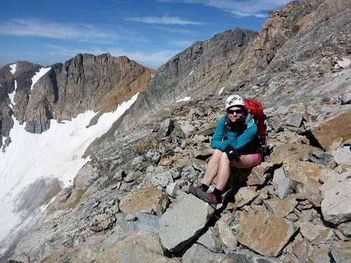
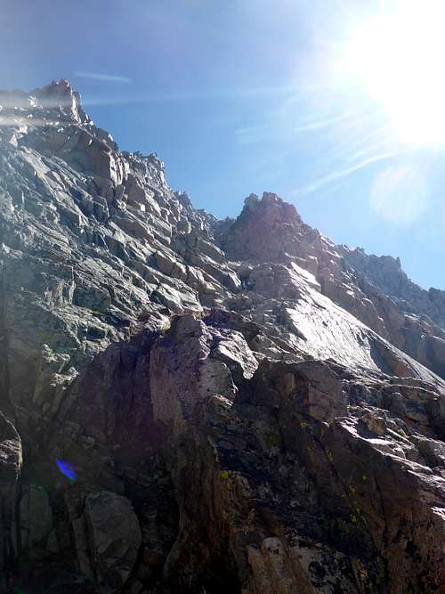
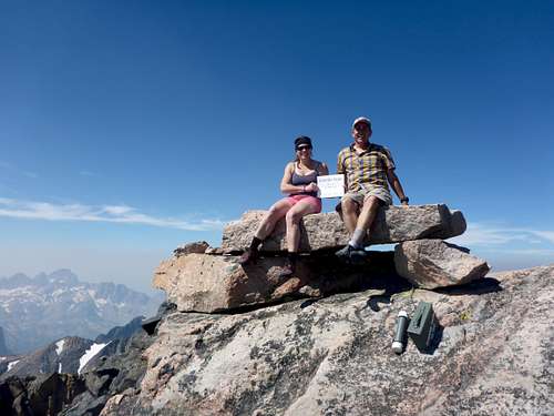
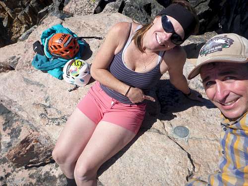
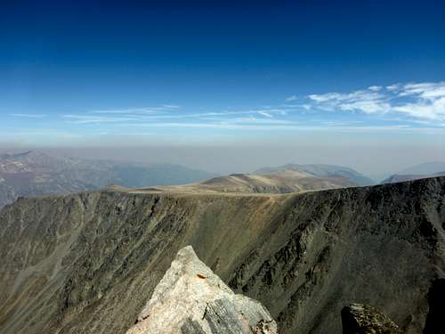
As described in the beta we kept climbing until we reached the gash. We stayed mostly on climbers right since you can use the side wall as hand holds and avoid kicking rocks lose. After the Gash we headed to the left and slightly uphill until we reached the summit ridge. There was one other guy on top who came up the standard route. The views were spectacular despite the haziness from all the fires in the area. We spent about 45 minutes on the summit. The weather was perfect, being sunny with only a slight breeze.
![Summit Rock HP #46]() Granite Peak Summit: Highpoint #46
Granite Peak Summit: Highpoint #46
| ![Granite USGS Marker]() Granite Peak USGS Marker
Granite Peak USGS Marker
|
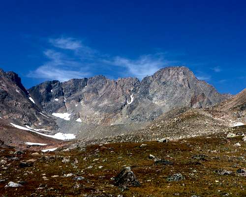
![Granite Peak - Looking South]() Granite Peak - Looking South
Granite Peak - Looking South
| ![Granite Peak - Froze to Death Plateau]() Granite Peak - Froze to Death Plateau
Granite Peak - Froze to Death Plateau
|
![Granite Peak - Descending The Crux]() Granite Peak - Descending The Crux
Granite Peak - Descending The Crux
| ![Granie Peak - First Hand-Line]() Granite Peak - The Lower Hand-Line
Granite Peak - The Lower Hand-Line
|
![Looking down the ramp]() Looking down the ramp near the top
Looking down the ramp near the top
| ![Looking down the steep north side]() Looking down the steep north side of Granite Peak
Looking down the steep north side of Granite Peak
|
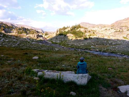
We had no issues coming down the mountain other than some tired knees. We took our time since we knew we were tired and had a lot of rocks to cross. We re-filled water as we crossed between two of the lakes. Summit day ended up being a 10 hour day covering 11.5 miles and over 2200 feet of climbing. I think when we got back to camp we filled water, ate, and went to bed before it got dark - LOL.
![Granite Peak - The Beast]() Granite Peak - Proud Moment
Granite Peak - Proud Moment
| ![Granite Peak 2]() Granite Peak
Granite Peak
|
![Granite Peak - Sky Top Lake]() Granite Peak - Sky Top Lake
Granite Peak - Sky Top Lake
| ![Granite Peak - Sky Top Crossing]() Crossing between the Sky Top Lakes
Crossing between the Sky Top Lakes
|
DAY 3: Hike out to Trailhead
We slept in a little and casually got up, had breakfast, and packed up camp. we tried to take our time but there were celebratory drinks waiting for us in the car. :-) Hiking out was 7.8 miles since we ended up hiking to Shelter Lake by accident. We were following some cairns that we took down on the return. It took us the same amount of time to hike out, but we did stop several times to talk to hikers on their way in and give them the most recent conditions.
![Granite Peak Area]() Granite Peak Area
Granite Peak Area
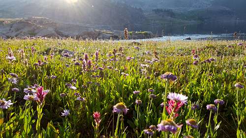
| ![Wild Flowers]() Wild Flowers
Wild Flowers
|
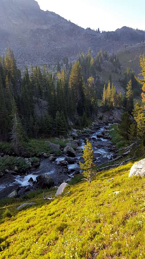
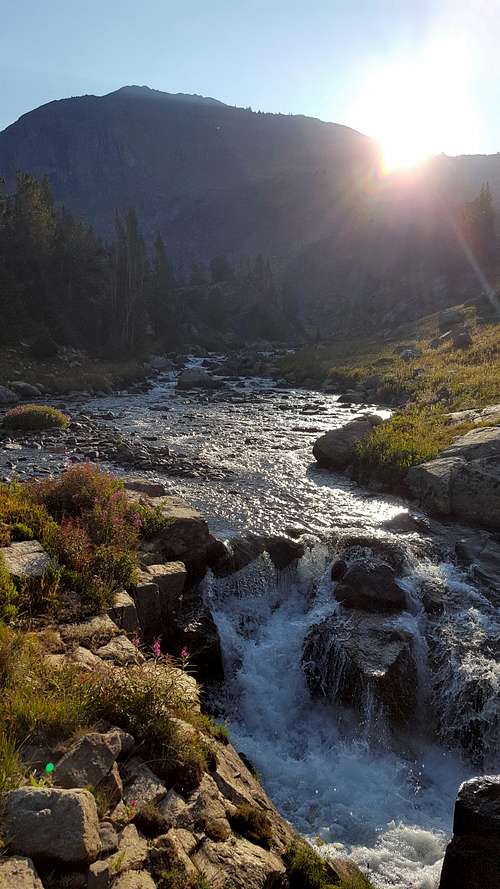
![Sky Top Gorge]() Sky Top Gorge
Sky Top Gorge
| ![Sky Top Falls]() Sky Top Falls
Sky Top Falls
|
![Sky Top area 2]() Sky Top Creek
Sky Top Creek
| ![Aero creek crossing]() Aero creek crossing
Aero creek crossing
|
A Couple extra photos. The left one is the fork in the trail where you go left to climb to Aero Lake. If you go straight you will get to the broadwater crossing and access to the Sky top drainage. The right photo is right at the confluence of Star Creek and Zimmer Creek looking up Zimmer Creek. This is where the broadwater starts and where we crossed. We crossed right below Zimmer creek so we only had to cross one stream. Immediately after crossing you pick up a trail going into the woods and starts to head East.
![Aero Lake-Sky Top Fork]() Aero Lake-Sky Top Fork
Aero Lake-Sky Top Fork
| ![Star Zimmer Confluence]() Star Zimmer Confluence
Star Zimmer Confluence
|


Comments
Post a Comment