
-
 60016 Hits
-
 88.61% Score
-
 27 Votes
|
|
Mountain/Rock |
|---|---|
|
|
48.33547°N / 113.77719°W |
|
|
Hiking, Mountaineering |
|
|
Summer |
|
|
8705 ft / 2653 m |
|
|
Overview

By saintgrizzly
By CamelCarson

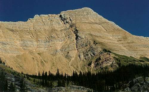
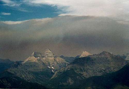
Great Northern Mountain is part of the the Flathead Range and is the monarch of the Great Bear Wilderness. It is not high as great mountains go, but its ruggedness, remoteness and northerly latitude make it a great and challenging peak that offers Glacier Park-like scenery. From the summit, there are outstanding views of southern Glacier National Park, nearby summits such as Mount Grant, and the receding Stanton Glacier. It is a beautiful mountain with beautiful views, and it is a gem among Montana's many.
Great Northern is not a mountain that is very easy to see well from paved roads. When one is close enough to the peak to see it in any detail, trees usually obscure the view. But from U.S. 2, which parallels the Middle Fork Flathead River on the northern side of the wilderness area, there are occasional glimpses of two snowy peaks looming to the south; the one on the left is Mount Grant, and the one on the right is Great Northern Mountain.
The mountain gets its name not from its size, height, or latitude but rather from the famous Great Northern Railroad. The area is rich in railroading history, and some of the structures of Glacier National Park, including the popular and expensive Glacier Park Lodge, are remnants of the railroad empire's heyday. The trains still run through the Middle Fork Flathead Valley today, and railroad enthusiasts might enjoy a stay at the Izak Walton Inn in the small community of Essex. The trains make frequent stops at the Inn, and the property is rich in designs and relics from the great steam era; in fact, you can even spend the night there in a refurbished caboose.
Routes
There are two "known" routes up the peak, but at least two other reasonable ones may exist. The first two have pages attached to this one.
1. Standard Route-- A trail follows the north side of Hungry Horse Creek, on the west side of the mountain, past treeline to the northwest ridge of the mountain. From there, a goat trail continues to the summit. It is mostly Class 2 with a touch of Class 3 possible. Some people may be uncomfortable with the exposure in places, but attentiveness and careful footing are all one needs here.
2. Dudley Bowl-- This is a bushwhacking/scrambling route from the south side of Hungry Horse Creek, and there are no maintained trails. It requires a bushwhacking elevation gain of over 2000' through dense, steep forest with lots of trees and deadfall and thorns and willows, steep clambering on talus, and a little Class 3 work depending on how direct an approach you take once you reach the bowl at the base of the peak. Love or hate this arduous outing, you will not forget it. It is best done as a day trip-- about 6 miles and 4800' (including a ridge-bowl-summit dip) RT. Taking the real trail from the north side of Hungry Horse Creek may not be as direct, but the footing will be much better, the going easier, and the elevation gain a few hundred feet less.
3. There is an approach possible from the Grant Ridge Trail on the east side of the mountain, and it is longer and has more elevation gain, but there is a maintained trail for some of the way.
4. On the west ridge, I noticed a trail joining it from the north side of the peak, seeming to originate in the vicinity of Stanton Lake, a short, easy hike from U.S. 2. Maps do not show a trail from Stanton Lake to the ridgeline, so be prepared for a bushwhack. This route, too, will entail more elevation gain than 1 and 2 will, but its directness may make the distances about the same.
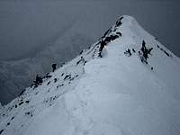
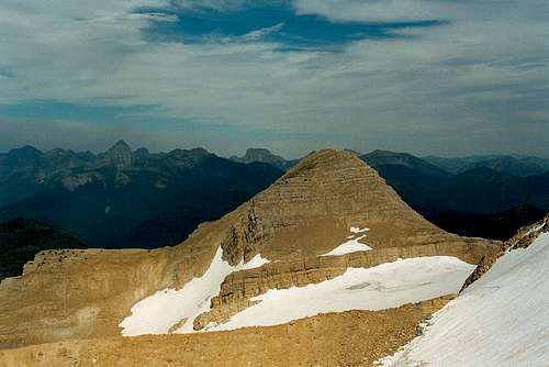
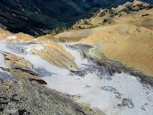
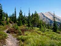
Views of the Mountain
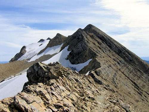 By saintgrizzly
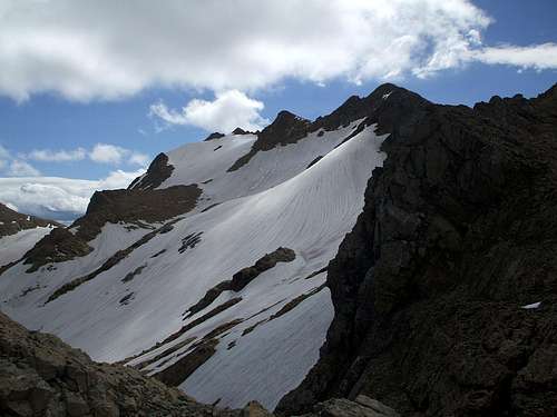 By Kowski
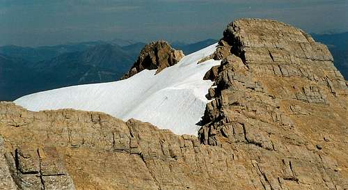
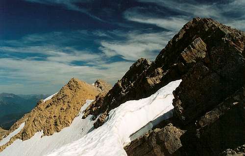
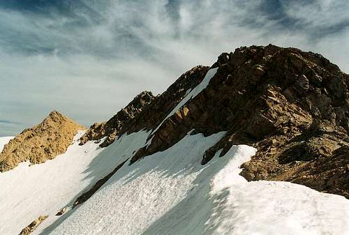
Views from the Mountain
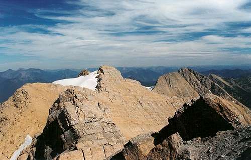
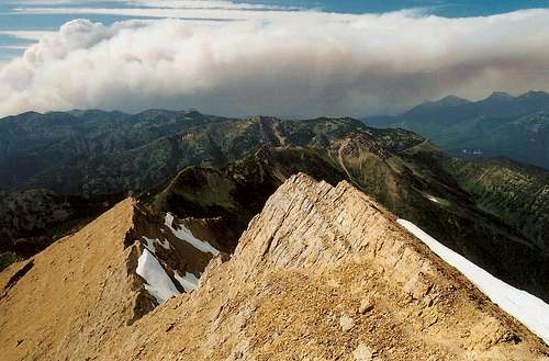
 By saintgrizzly
Getting There, Red Tape, Camping, and Contact Information

By saintgrizzly
By CamelCarson
Getting There
These instructions should get you there if you have a decent map, but the instructions on the attached trailhead page are more precise.
Follow the east side of Hungry Horse Reservoir from the village of Hungry Horse on FR 38 (according to USGS topo maps) for several miles (around 15) and then turn left on 1048. This is a very sharp left, and you follow this road for about a half-mile to a bridged crossing of Hungry Horse Creek. Right after crossing Hungry Horse Creek, you will find a small parking area on the left, and it will likely be empty.
There are no signs indicating the way to the trailhead, and route signs may be nonexistent, so carry a good map and consult it as you drive.
On the north side of Hungry Horse Creek, there is a good trail to the top--thanks to SP member saintgrizzly for letting me know. To take the painful way, though, you head into the trees south (right) of the creek and work uphill to the ridgeline.
The road is easily passable to passenger vehicles.
Red Tape
As of July 2014, no permits or parking fees were required.
You are in grizzly country. Respect the natural inhabitants and know what to do. I did come almost face-to-face with a young grizzly. Again, know what to do. Don't become a statistic, and don't be responsible for some bear's being shot.
Camping
You can camp at the trailhead if you arrive or finish late in the day.
Backcountry camping is possible, but strong hikers would be better off doing this as a day trip. There are some great campsites on the ridge above the bushwhacking section, but getting there with a full pack on would not be a lot of fun. There may be some good campsites along the trail on the north side of the creek, but the land is steep and heavily wooded in most places until you reach timberline, where it's still very steep and then becomes mostly rocky.
Contact Information
Flathead National Forest
Hungry Horse & Glacier View Ranger Districts
10 Hungry Horse Drive
Hungry Horse, MT 59919
(406) 387-3800 (voice)
(406) 387-3889 (fax)