Overview
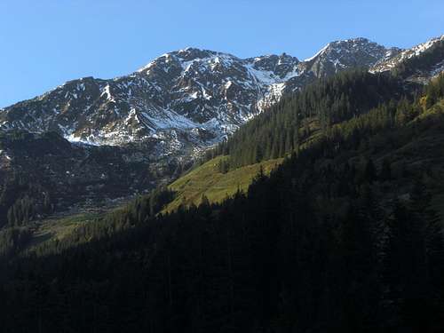
![Großer Beil]() Großer Beil as seen from Wildschönau
Großer Beil as seen from Wildschönau is one of the highest summits of the
Alpbach - Wildschönau range within Kitzbüheler Alpen. It is a dominating summit, too, despite of the mostly “tame” appearance of the Kitzbüheler mountains. The west and the east face drops down over 1000 meters of altitude difference to the adjacent valleys.
Großer Beil is one of my favourite Kitzbühel summits. It is a great lookout point for the western part of Kitzbüheler Alpen. The icy peaks and summits of Hohe Tauern to the south and the pale and steep rock faces of the Northern Limestone Alps to the north and west are dominating the scene.
The summit is located in the long ridge, running from Torhelm to the south to Schatzberg in the north, thus dividing
Alpbachtal from
Wildschönau valley. The neighbouring summits are
Gressenstein to the south and
Seekopf and
Kleiner Beil to the north.
The denomination is strange. Beil normally means axe, hatchet. But this summit has no axe shape. If the summit would be named after an axe, the writing would be Großes Beil. But it is Großer Beil, so there must be another meaning.
I learned from the German Wikipedia entry for Großer Beil that this denomination derives from a dialect word for a sort of hunting trap. Howsoever ......
These two faces of that mountain, a smooth south side and a rugged north face, together with its central position in the long, south - north running ridge and the proximity to two main tributary valleys of Kitzbüheler Alpen makes Großer Beil an interesting undertaking. The mountain is a great and easy hike in summer and autumn, a brilliant ski tour in winter and spring. There are two interesting ridge traverses in which Großer Beil can be included. The western or the eastern ascent routes are both not very crowded. Especially the eastern route leads you in a very remote mountain valley with an old wooden Alm hut and a huge boulder, called the “
devils rock”.
The tale is, that Gressensteinalm was the home of a devil. He terrorized the whole Wildschönau valley. So the locals started to build a chapel to ban the devils activities. The devil was so upset that he took a huge boulder from Großer Beil and flung it in the direction of that chapel. In this moment the bell of the chapel started to ring for the first time and the devils charms were broken. The boulder crashed down in that place below Gressensteinalm, where it can be admired today. If you look close you can see the scratches of the devils claws on both sides of the huge stone.
The disillusioning scientific truth is: it is a huge boulder transported by glaciers to its actual location and the scratches were made by glacier movements.
Getting There
![Großer Beil]() Großer Beil summit
Großer Beil summit
Main trailheads for Großer Beil are:
The general accesses to the valleys are described on the
Kitzbüheler Alpen main page.
Routes Overview
Trails
![Großer Beil]() View to Lämpersberg, Kleiner Beil View to Lämpersberg, Kleiner Beil | ![Großer Beil]() View to Kreuzjoch-Torhelm range and Großvenediger View to Kreuzjoch-Torhelm range and Großvenediger | ![Großer Beil]() View to Salzachgeier range and Großglockner View to Salzachgeier range and Großglockner |
Traverses
![Großer Beil]() Alpbachtal Alpbachtal | ![Großer Beil]() Wildschönau valley Wildschönau valley |
Ski routes
Red Tape & Accommodation
![Großer Beil]() Old Gressensteinalm
Old Gressensteinalm
There are no restrictions or regulations, as far as I know.
Accommodation
Wildschönau
Alpbachtal
Kelchsau
Hopfgarten
Kaltenbach / Stumm
Schönangeralm at the end of Wildschönau valley is a mountain inn with a genuine cheese dairy in summer - don´t miss that!
Gressensteinalm provides some drinks and food during the Alm season.
Otto - Leixl - Hütte is a private hut, accessible only for members of the possessing alpine club section.
Gear & Mountain Conditions
Großer Beil is an all - season mountain.
In the hiking season you need full hiking gear and good shoes. The summit routes are easy hikes on mostly marked mountain trails and - near the valleys - forest roads.
The traverses Sonnenjoch - Großer Beil and Lämpersberg - Großer Beil do need some easy rock scramble and, with low visibility - a knack for orientation.
![Großer Beil]() Summit signposts for the traverse routes Summit signposts for the traverse routes | ![Großer Beil]() Schafsiedel and Großglockner mountains - summit view Schafsiedel and Großglockner mountains - summit view | ![Großer Beil]() Summit south slope Summit south slope |
The Wildschönau ski route is an easy one. The Alpbachtal ski ascent is steep and more difficult. Both routes are a treat for the advanced ski mountaineer.
Full ski and avalanche gear is required.
Check the
Tirol avalanche bulletin here.
Current Weather:
Maps & Guide Books
For a wide list of Kitzbüheler maps and guide books see the Kitzbüheler Alpen main page.
Maps
Alpenvereinskarte 1 : 50.000; Kitzbüheler Alpen West, Nr. 34/1, Deutscher Alpenverein, 2010; - topo map with trails; the same with ski routes.
Österreichische Karte 1 : 50.000 - UTM (ÖK50), map number 3213, Wörgl
![Großer Beil]() Großer Beil as seen from Sonnenjoch Großer Beil as seen from Sonnenjoch | ![Großer Beil]() Wildschönau valley Wildschönau valley |
Available only antiquarian but an indispensable mountain guide book:
Georg Bleier / Kurt Kettner: Alpenvereinsführer Kitzbüheler Alpen, Bergverlag Rudolf Rother, München, 1984
Horst Höfler, Kurt Kettner: Kitzbüheler Alpen. Mit Skirouten. Führer für Täler, Hütten und Berge, Bergverlag Rudolf Rother, München, 1976
R. Weiss: Skitouren Kitzbüheler Alpen mit angrenzendem Salzburger Anteil am Nationalpark Hohe Tauern, Gebietsführer, Steiger Verlag Innsbruck, 2000 (there is an antiquarian edition from 1985 with only Kitzbüheler Alpen, too)

 5266 Hits
 79.04% Score
 10 Votes
 Großer Beil as seen from Wildschönau
 Großer Beil summit
 View to Lämpersberg, Kleiner Beil
 View to Kreuzjoch-Torhelm range and Großvenediger
 View to Salzachgeier range and Großglockner
 Alpbachtal
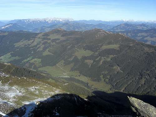 Wildschönau valley
 Old Gressensteinalm
 Summit signposts for the traverse routes
 Schafsiedel and Großglockner mountains - summit view
 Summit south slope
 Großer Beil as seen from Sonnenjoch
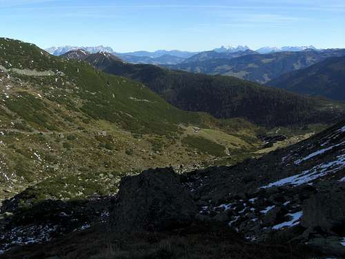 Wildschönau valley