
-
 26607 Hits
-
 0% Score
-
 0 Votes
|
|
Route |
|---|---|
|
|
44.27060°N / 71.3047°W |
|
|
Hike (Class 1-2) |
|
|
Less than two hours |
|
|
Walk-up |
|
|
Approach
This description entails the part of the 6.8 mile Gulfside Trail from the summit of Mt. Washington to the intersection with the Jewell Trail. Access is via a number of intersecting trails such as Trinity Heights Connector, Great Gulf Trail, Crawford Path, Westside Trail, and the Mount Clay Loop.
Route Description
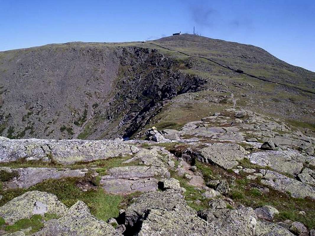
From the summit of Mt. Washington this section of the Gulfside Trail can be used as a descent or ascent route via the Great Gulf Trail, Crawford Path, or Jewell Trail. This section of the trail is 1.4 miles in length and totally exposed to all weather that may approach is the trail is on the ridge between Mt. Washington and Mt. Clay.
This trail never exceeds class 2 hiking and is for the most part a boulder hop. Once you reach the summit plateau of Mt. Washington it is easy hiking on the alpine tundra all the way to the base of the summit cone. From here hop onto the Trinity Heights Connector and head up the class 2 trail to the highest summit in the Presidential Range.
Be prepared for inclement weather and if it approaches make a fast retreat below treeline without shame. Many people have died from exposure on this part of the mountain even in the summer!
Here are some distances and intersections given by the AMC's White Mountain Guide (27th ed.).
From the summit of Mt. Washington:
to Crawford Path (6,150ft.): 0.2mi.
to Trinity Heights Connector (6,100ft.): 0.3mi.
to Great Gulf Trail (5,925ft.): 0.5mi.
to Westside Trail (5,500ft.): 1.0mi.
to Mount Clay Loop (5,400ft.): 1.1mi.
to Jewell Trail (5,400ft.): 1.4mi.
 |
Essential Gear
Comfortable hiking shoes, inclement weather gear, snacks/water, and a camera.