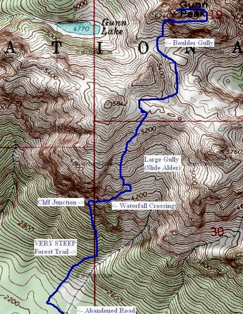
Gunn Peak - Sample Route Topo
This is a sample route pictorial I have created on a topography map, for the standard southern approach for Gunn Peak, located in Washington. I thought including this sample topo of the route, even if there are some minor discrepancies, was important because so few such route maps for Gunn Peak currently exist on SummitPost.
The path line might not be exact, but the basic structure and notable sections are shown. I used my GPS track log as my main reference to help create this route map. This pictorial shows the route as it ascends from the abandoned road (lower-left of pictorial).
NOTE: If people are unable to locate the trail junction leading up the westside ridge of the large slide alder gully, or mistakenly walk by that trail junction (as I did in 2010, then losing the path afterwards), the gully can be followed north. The slide alder in the large gully is annoying in places, but the northern ridge (connecting Point 5842 to Point 5760) is the obvious goal if the gully is directly ascended. There are several areas to attain the ridge from the upper gully, and those routes can be more easily seen as the gully is ascended.
Also, some people traverse north to the large boulder gully from near Point 5842, rather than dropping down slightly into the basin east of it.
Map route created on June 17, 2011.


