
|
|
Mountain/Rock |
|---|---|
|
|
1.73664°N / 110.33293°E |
|
|
Spring, Summer, Fall, Winter |
|
|
2658 ft / 810 m |
|
|
Overview
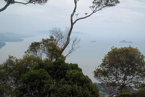
View of the Islands from the summit region.
Gulung Santubong is a sharp peak located on a peninsula 35 km North of Kuching, Malaysia. Although not tall, it rises directly from the ocean and has a prominence nearly equal to that of its elevation. The area around the peak is a national park which protects a small patch of primary forest.
Legend – According to legend, there were once two beautiful princesses from heaven, Santubong who was famed for weaving beautiful clothes and Sejinjang who was famous for pounding rice to make it delicious. When they both met the prince, Serapi, he decided that it would be great to marry both of them. However, the two princesses each wanted to be his sole wife and waged a bitter fight, battering each other with their tools for weaving and pounding rice. When their father learned what was happening, he turned the princesses into the two mountains, Santubong and Serjinjang. In addition, since Serkinjang’s head had been broken into many pieces, these broken parts became the many islands that lie around the peninsula (Story courtesy of Catohrinner Joyce Guri).
In 1855, the famous British Naturalist Alfred Wallace spent time at Mt. Santubong and Mt. Sejinjang collecting specimens that helped lead to his discovery of the theory of evolution by natural selection. By chance, he mailed a copy of his manuscript to Charles Darwin who realized that he was about to get scooped on the theory. Consequently, the work of both scientists was presented jointly to the public on July 1, 1858 although neither man was actually there at the Linnaean Society of London for the presentation of the work. Because Darwin had worked out the theory for longer and in more detail, he is the one currently associated most closely with the work.
The first ascent of the peak is unclear. At the present, the peak can be climbed without hiring a guide up a steep trail that includes many ladders in its upper portions.
Getting There
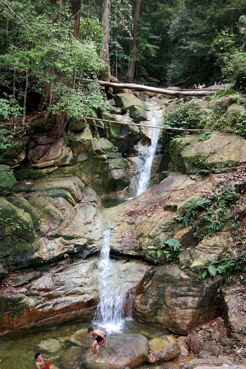
Waterfall on the blue trail.
There are several ways to reach Gunung Sandubong from Sarawak’s capital of Kuching. The easiest may be to use the “Grap” app to hire a ride. You may want to arrange a return trip before leaving the car as getting “Grab” pick-ups at Sandubong can be difficult, especially late in the day. It is also possible to hire a cab for the same ride. The cost of this is approximately twice that of a “Grab” ride and will likely run around $15 USD. There are also shuttle buses that run from early morning until the evening that depart from the Hotel Grand Margherita in central Kuching to the Sarawak Cultural Village, which is not far from Gunung Sandubong. This shuttle only costs a few dollars however it seems to be irregular in service and only runs when enough people are present to justify a trip or on the last run of the day. You could also rent a car or bike… For the return trip, it is possible to walk to the entry station to the Sarawak Cultural Village and pick up the next shuttle bus.
However you get there, the entrance to the park and beginning of the hike is at a Santubong National Park entry station (the current version of which I have heard is temporary.) This is located on the right side of the road (east) a few hundred yards before the traffic circle where the roads to the Cultural Village and the Damai Beach Resort split. The driveway is not completely obvious although there is a small sign pointing to it immediately prior to the turnoff. If you take the shuttle bus, return on the access road to the circle and continue on the main road back in the direction of Kuching for a few hundred yards. The entry station will be on the left in this case.
Route
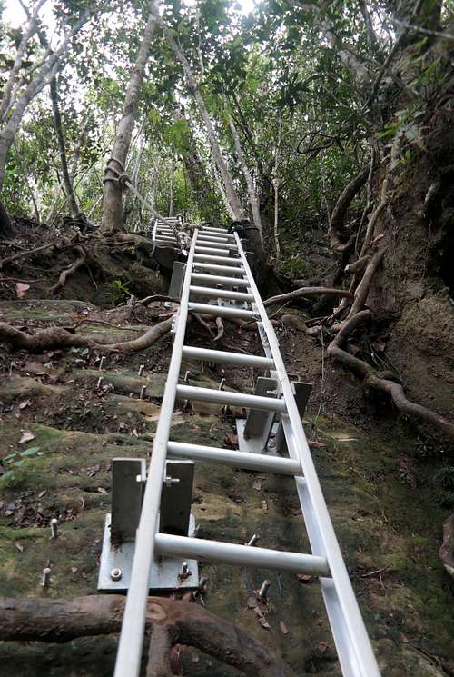
Ladders near the Summit.
Two trails leave from the park entry station. The one to the summit has red marks, while a second one with blue marks makes a short loop near the entry station and gives access to a popular waterfall and swimming hole. Many of these marks are fairly obtrusive and are splashed liberally across rocks as the trail wends its way up and across a stream bed. Keep on the red trail when one arm of the blue trail separates off to the left. The trail crosses the stream and enters primary forest where the second branch of the blue trail branches off to the right. Keep on the red trail to climb the mountain. When I did the hike, the trail was in poor condition with a number of downed trees and spots in which herd paths left the former trail and worked around obstacles before returning to the established path. Eventually, a waterfall is reached and after a steep stretch, the trail becomes more gradual until it arrives at an older trail (the Putri Trail) that heads directly up the western ridge of the mountain to the summit.
Once on this more established trail, the going gets rockier and much steeper for the remainder of the climb. Along the way, a couple of false summits are passed and one ascends a steadily increasing number of ladders. The final portion below the summit even has a place with two consecutive ladders working up a steep rock face. This is not an easy trail and many people take hours getting to the summit despite the rather short horizontal distance involved (2 miles from entry station to summit). There is a shelter at the summit of the mountain as well as nice views along the coast and back in the direction of Kuching.
According to a sign at the entry station, the Putri Trail is officially closed below where the red trail meets it. With that said, most of the people that I met climbing the mountain used this route from the base of the mountain to this point. It begins on the main road about a mile before the entry station at a small parking area. Were this to officially open, it would be a much easier and more direct way to the summit.
Although it is a bit out of the way, a short detour on the upper arm of the blue trail to the waterfall and swimming hole is worthy both for the beauty of the falls and for a swim if you are so inclined.
Red Tape
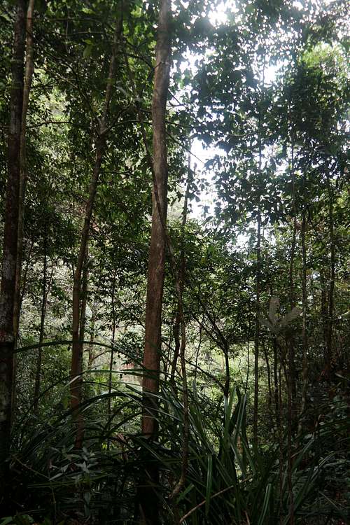
Primary Forest on Gunung Santubong slopes.
Santubong National Park is open daily from 8:00 AM until 5:00 PM. There is no fee for the climb but registration is required at the park entry station. Unlike a number of other mountains in Malaysia, It is not necessary to hire a guide for the walk. There is, however, a stipulation that you turn around at 3:00 PM if you have not reached the summit so as not to be benighted. Since there is also a reasonable chance for rain in the afternoon, a morning hike is probably better anyways…
When to Climb
Gunung Santubong can be climbed year round. The months of June through September tend to be drier than other times of the year.Animals and Plants
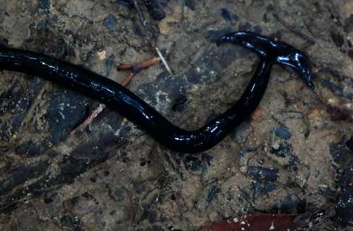
Hammerhead Worm
Other things to do in the area.
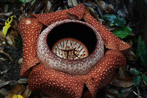
Rafflesia blossom
The following are other possible activities in the region:
- Close to the entry station, one can frolic at Damai Beach or visit the Cultural Village (for a fee). I did not do either so cannot give a review. - There are evening river cruises to see the endemic river dolphins and fireflies. Sadly, as a single traveler, I was unable to get this to work.
- Many people that I talked to raved about the nearby Bako National Park with its diverse habitats, wildlife, and views. If I had a second day in the Kuching area I would have visited…
- If you have not seen the amazing Rafflesia flower, one might check out Gunung Gading National Park, which is a few hours’ drive from Kuching. The blooming of this flower is fairly random through the year. However, the park maintains a Facebook page which alerts people when the blossoms occur.
- The city of Kuching is the Capital of Sarawak and is a thriving, pedestrian friendly place with a mix of the historical and modern. There is delicious, inexpensive street food.
Cable Car
Proposals have been made over the years to build a cable car to the summit of the mountain. According to reports from 2014, approval for the project was given in 2014. I cannot find reference to further progress on the project since that date. There are signs on the mountain urging people to resist the building of this project.External Links
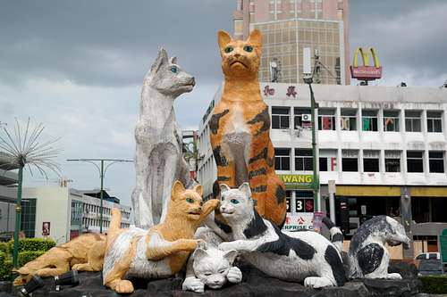
Cat Statue; Downtown Kuchin
The legend of the princesses as written by Catohrinner Joyce Guri can be seen here.
A article describing some of the wildlife found on the peak can be read here.
The cable car project is described here.