
-
 19711 Hits
-
 80.49% Score
-
 12 Votes
|
|
Mountain/Rock |
|---|---|
|
|
69.56211°N / 19.36016°E |
|
|
Hiking, Mountaineering, Scrambling, Skiing |
|
|
4606 ft / 1404 m |
|
|
![Southwest Spur detail]()
Overview
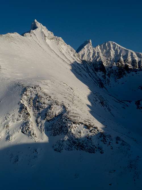
Taken in early March. The almost entire Middagsaksle route is visible in this photo. Simply the skyline.
Hamperokken is a peak of regional importance. It is the highest peak in the area, and its pleasing spire beckons the climber. The views from the summit are exceptional, as all other local peaks are lower, and fjords are visible in 3 different directions. This is one of the most visible and popular climbs in the Troms area. It offers a long varied ridge climb (middagsaksle) as well as a steeper more direct ski route (southwest spur).
Getting There
From Tromsø, take E8 South out of town. After about 25 kilometers, a sign for Breivikeidet appears. This is highway 91. Turn left on 91, and follow it until reaching the EISCAT research facility. There is a large radio telescope as well as other research structures. Continue driving for about 4 kilometers. There is a small parking area with a sign on fishing regulations, next to a small stream. Park here, and follow the clear path through a dense spruce tree thicket. Hamperokken was recently (2015) featured in the 10 på topp (10 summits) program, so it has recently had improved trail access. While the summit was visible during the drive in, now all you see is a big rounded ridge. This is the start. See route information for Middagsaksle or Southwest Spur route to know where to go from here. |  |  |  |
Red Tape
Ask permission before parking if it looks like you are on a private way. No permit fees or rules really. Just leave it as you found it.When To Climb
The Middagsaksle route is attempted almost year round. The two months of no sunlight in the arctic winter add an extra challenge however. February to October works better. The Southwest Spur is best done in winter as it is a long slog loose talus in the summer.Routes.
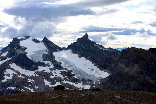
Seldom seen north face of Hamperokken. New routes anyone?
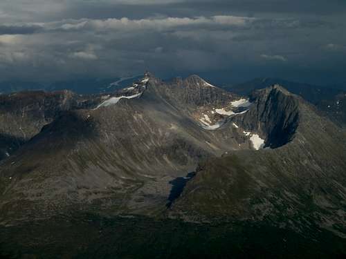
From L to R: Gabriellfjellet, Hamperokken, Bjørnskardalstind, Sautind or Stortind.
Middagsaksle: A summer hike\scramble, and the lower slope is a great ski descent.
Southwest Spur: Preferable as a ski ascent, variations lead directly to the summit.
Gabrielfjellet: A massive subsummit to Hamperokken, the best ski route, though there is no easy connection to Hamperokken. Link to Gabrielfjellet: Gabrielfjellet skitrip
This website: Hamperokken has a great series of photos with route overlays and description in english.
The Jambo - Feb 11, 2007 11:55 am - Hasn't voted
Guidebook to HamperokkenThe new guidebook "Walks and Scrambles in Norway" includes Hamperokken and other routes in the far north.
darinchadwick - Feb 12, 2007 8:19 am - Hasn't voted
Re: Guidebook to HamperokkenYeah, found it on your website, will include it soon (and probably buy the book just cause I'm curious what outsiders describe in our area). :) Cheers. Darin.