
Viewing: 1-3 of 3

Klenke - Jan 14, 2004 4:22 pm - Voted 10/10
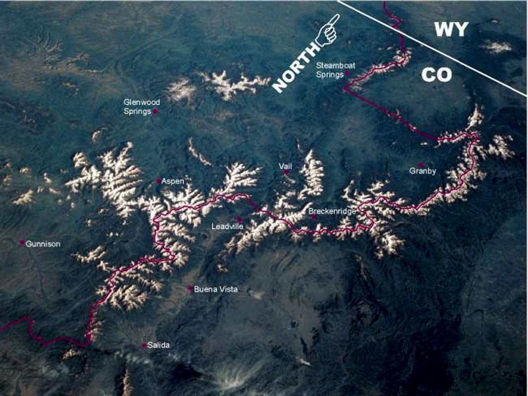
Elbert's locationVery nicely done, Bill.
So where's Waldo, I mean Elbo?
If you were to draw a straight line between the "A" in Aspen and the "L" in Leadville, near where that line would intersect the Continental Divide is the approximate location of Mt. Elbert. I say approximate because Elbert doesn't reside exactly on the divide but slightly to the east in that detached group of snowy peaks.

billokc - Jan 14, 2004 4:53 pm - Hasn't voted
Re: Elbert's locationYes, Elbert is the first snowy peak to the left of the "L" in Leadville..........and thanks for the comment. These annotations can be fun to do and they do help you learn the areas.
billokc - Jan 14, 2004 4:57 pm - Hasn't voted
Other shotsif you want to see some other shots from space look at my user page. You'll see some duplication because I've posted some shots on more than one mountain page.
Viewing: 1-3 of 3


Comments
Post a Comment