
|
|
Mountain/Rock |
|---|---|
|
|
48.05513°N / 121.76734°W |
|
|
Snohomish |
|
|
5139 ft / 1566 m |
|
|
Overview
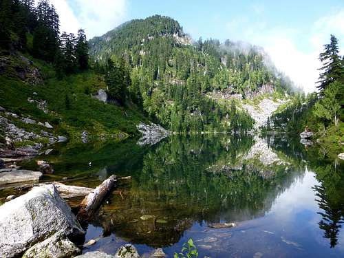
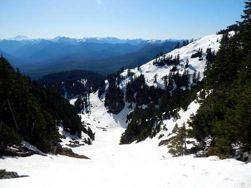
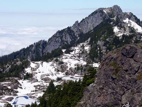
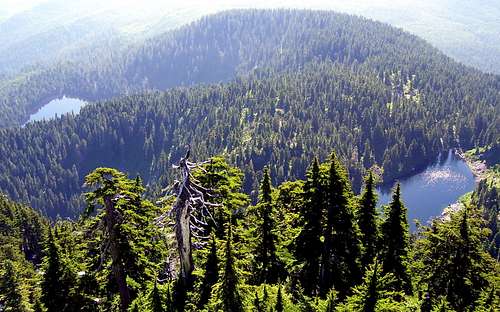
Hermans Peak from Lake 22
The following comments are credited to Harry Majors, from the book "Monte Cristo Area":
"Hermans Peak commemorates the pioneer land surveyor Emery J. Hermans who, during June and July 1895, made the first survey of Township 30 North, Range 8 East, about present Verlot. Hermans discovered and named Bear Lake and Pinnacle Lake in 1895. The peak was first climbed by Louis C. Fletcher of the U. S. Geological Survey."
Update: I have begun to realize lately that only old-timers like myself use the Cascade Alpine Guide. For this reason, I have dropped the "East Knob" designation from the title for this page.
The easiest and shortest approach to Hermans Peak is via the Bear/Pinnacle Lakes trail and "Iodine Gulch", and that will be the approach described here. There are other approach variations that come from the Mt. Pilchuck trail to the west, and more information on these routes to the "Bathtub Lakes" can be found in trip reports on the main Mt. Pilchuck page. One popular option is to arrange a car shuttle with another party, which allows two groups to do a full mountain traverse in opposite directions.
Drive the mountain Loop Highway east from Granite Falls for 15.5 miles to the Schweitzer Creek Road, FR4020 (4.5 miles from the Verlot RS). Turn right on this road, and follow it 2.3 miles to Bear Lake Road, FR4021. Turn right on Bear Lake Road and continue 3.4 miles to the Bear Lake trailhead. Take FS trail #703 0.2 miles to a junction (0.1 miles on the right fork leads to Bear Lake). Take the left fork (trail #703.1) 1.8 miles to Pinnacle Lake (do not confuse with the large pond 500' before Pinnacle Lake - it has been done!).
Hermans Peak from Pinnacle Lake
Cross Pinnacle Lake's outlet, and follow the shoreline clockwise for 0.2 miles to the obvious inlet creek. This creek originates in "Iodine Gulch", which will be your route to the Bathtub Lakes and summit. There is a fairly well defined path (assuming it is not snow covered) paralleling the inlet creek at this point. At an elevation of about 4100', veer slightly to the right and into Iodine Gulch. Going left would take you to a lower saddle in the ridge ahead, but it is steeper and more difficult. Iodine Gulch will get steep at this point, but rich rewards lay ahead as soon as you top out on the ridge at 4700'. At this point you have reached the east end of the Bathtub Lakes, also known as "Twenty Lakes Basin".
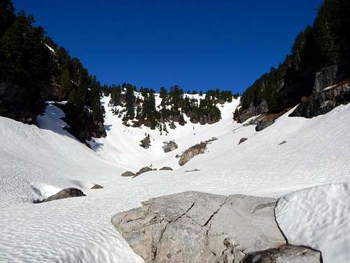
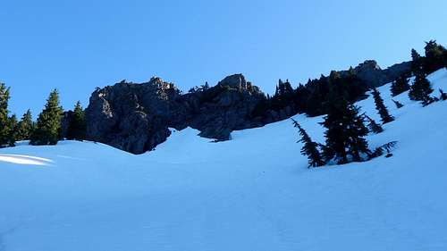
Iodine Gulch on Hermans Peak from 4100'. For the Bathtub Lakes and Hermans Peak, stay right. For Summit Lake, stay left.
Looking down on Iodine Gulch on Hermans Peak from 4700'. Pinnacle Lake in center-left portion of photo.

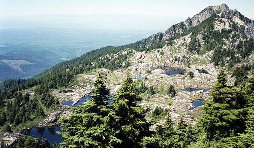
Bathtub Lakes - Mt. Pilchuck west summit in the distance
You will certainly want to make some time to explore these hidden gems before leaving the area, but for now, you have a peak to climb. Upon reaching the ridge crest at 4700', you will notice a short cliff band on your right. Traverse along the base of these cliffs (heading west) for about 200'. Here, the cliff band will end, and you will be in a small drainage that flows into a small pond (perhaps, the easternmost Bathtup Lake?). Turn right, and head up or abeam this drainage - after a short distance, Hermans Peak's summit block will come into view.
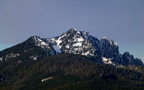
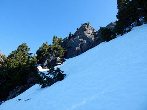
Hermans Peak summit block from 4900'
At first view, you may ask yourself 'Do I have to climb up THAT?!'. Well, actually, you don't. The true summit of Hermans Peak is the point on the far right, and not the class 4 bumps directly in front of you. Make an oblique traverse to the right - at about 5000', you will have a view similar to the photo below.
Hermans Peak summit block from 5000'. While there are several variations for scrambling the summit block, my personal preference is a dirt ramp just left of photo center. It starts out as a squeeze between rock and shrubs, followed by about 50' of low-exposure class 3.
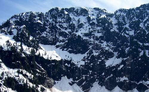
There are a number of variations possible in the final scramble to the top, and if you choose your route carefully, none should be more difficult than class 3. Upon arrival at the top, looking straight down at Lake 22 (2800' below you!) will take your breath away. This is certainly no place to hang out if you are afraid of heights.
Lake 22 from Hermans Peak
Looking to the west, you can plan your Bathtub Lakes excursion, and watch the throngs of people scrambling around on the west summit. Just one half mile to the W/NW, you will notice another minor summit called the "Eagles Nest" (elev. 5118'). If you have not had enough peak bagging, you can combine this with your Bathtub Lakes explorations. I have seen mountain goats on a few occasions in this area, so have your camera ready.
Bathtub Lakes from Hermans Peak (spring)
Bathtub Lakes from Hermans Peak (summer)
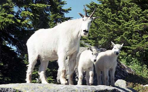
Mountain Goats in the Bathtub Lakes area
Looking below the Bathtub Lakes to the south, you will see Summit Lake. For those with way too much extra energy, a scramble is possible from the ridge separating Pinnacle Lake and Summit Lake. There is some brush to deal with, and it will add 800' of extra elevation gain to your trip. Do not attempt to go straight down to Summit Lake from the Bathtub Lakes - you will get cliffed out. From looking at the maps, it appears that one could approach Summit Lake from the west side, but this route has not been tested by yours truly.
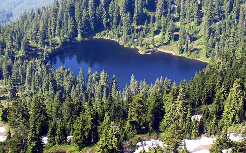
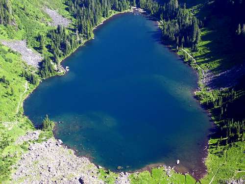
Summit Lake from Hermans Peak
A short scramble to the east side of the summit will give you a look at the lakes you passed on the way up, Bear and Pinnacle.
Bear and Pinnacle Lakes from Hermans Peak
I don't have any good summit panoramas from the East Knob, as it seemed a little redundant after my west summit Pilchuck trips. If you would like an idea of the mountain views from Hermans Peak, please refer to the image gallery on the main Mt. Pilchuck page.
Getting There
Follow the Mountain Loop Highway east from Granite Falls for 15.5 miles to the Schweitzer Creek Road (FR4020). Follow Schweitzer Creek Road 2.3 miles to Bear Lake Road (FR4021). Follow Bear Lake Road 3.4 miles to the Bear Lake trailhead.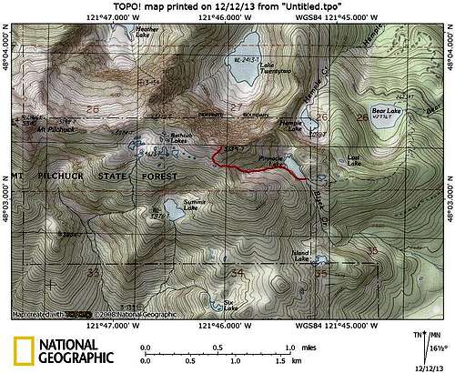
Hermans Peak route map
Red Tape
A Northwest Forest Pass is required to park at the Bear Lake trailhead.Update (5-2-16): At this time, a Northwest Forest Pass is not required at the Bear Lake Trailhead. Please check with the Verlot Ranger Station for the most current status.