
|
|
Route |
|---|---|
|
|
47.01732°N / 10.46844°E |
|
|
Hiking |
|
|
Spring, Summer, Fall |
|
|
One to two days |
|
|
T4- (UIAA I) |
|
|
I |
|
|
Overview
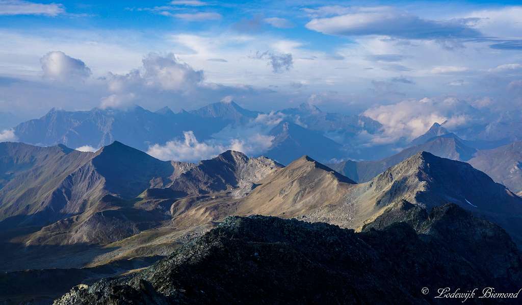
Hexenkopf Summit view
Climbing Hexenkopf is not for the impatient. Whether coming from Serfaus or See im Paznauntal, all approach routes are long. Climbing Hexenkopf requires a long day of hiking but of course there is also the possibility to spend a night in the Hexenseehütte. The Hexenseehütte is the base for climbing Hexenkopf and can be reached from the Serfaus or See im Paznauntal.
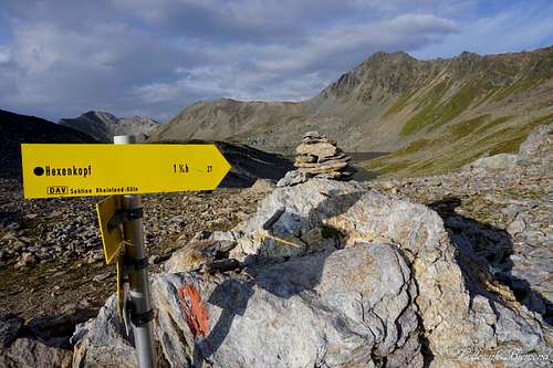
The route from the Hexenseehütte over the Hexensattel and south ridge to the summit of Hexenkopf is regarded as the normal route on the mountain. The route along the east ridge is slightly more difficult and therefore not the main or normal route. The hexensattel- south ridge route (from now on Normal Route) is graded T4-. This means the route can be considered a ''difficult mountain hike'' with some parts of scrambling in the first grade (UIAA I). However, these difficulties are limited to the upper parts of the route and to be more precise: the last 100 meters before reaching the summit. Apart from this, the south ridge is mostly graded T3 and belwo the Hexensattel T3 and T2. Route finding isn't an issue on the normal route. The painted red-white-red markers are abundant and therefore always in sight, making it easy to find your way up and downs the mountain.
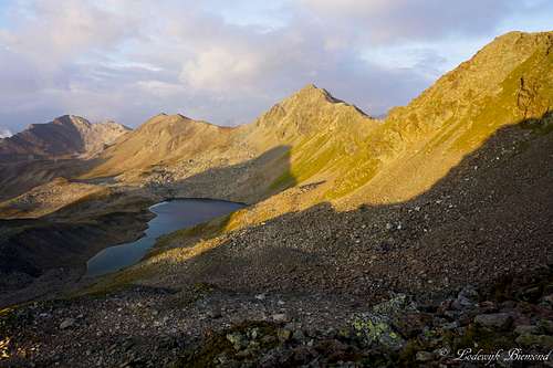
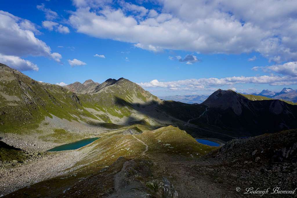 Hexensee and the lower part of the trail | 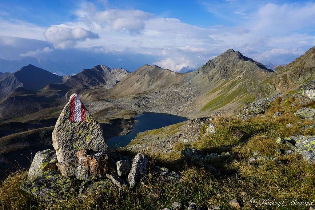 Gmaiersee and a route marker on the S-ridge |
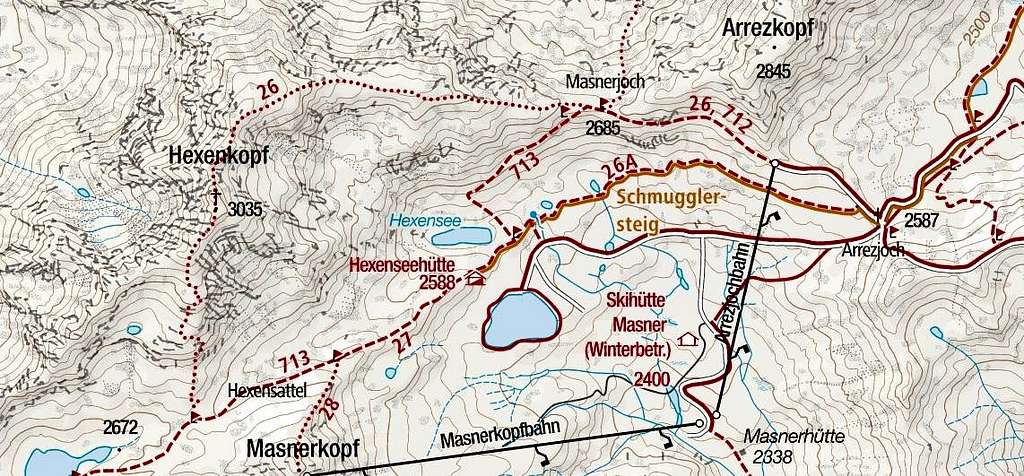
I Approach Route: Serfaus
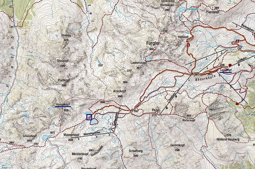
The base for Climbing Hexenkopf along the normal route is the Hexenseehütte. This section describes how to get to the Hut from ether Serfaus (Inntal) or See (Paznauntal).
Take the cableway system from Serfaus up to the Komperdell and continue all the way up to Lazid (2346m). Start your hike in a Southern direction. Follow the broad ‘’Kamm’’ in the direction of the Scheid saddlepoint (2429m). Scheid can be reckognized by the top station of a chairlift carrying the same name: Scheid. At the Scheid there are 2 trails/paths, both of them leading towards the Arrezjoch (2587m). Follow the hiking trail or the broad path to the Arrezjoch. The hiking trail is more scenic though. The broad path is more or less a dirt road used by cars and other vehicles to get to all the ski facilities of the Serfaus-Fiss-Ladis ski resort. Not the prettiest sight to say the least. I would advise to take the hiking trail. After about an hour of hiking you will reach the Arrezjoch. The Arrezjoch offers the first views of Hexenkopf and at this point you can try to imagine the shape of a witch’s head in the summit pyramid. Also you can spot the Hexenseehütte in front. Follow the trail to the Hexenseehütte (Yellow signpost at the Arrezjoch; trail 26A).
II Approach Route: See
Alternatively, coming from See in Paznauntal, take trail 713 up all the way to the Masnerjoch at 2685 meters. From the saddle, follow route 713 and eventually route 26 to the Hexenseehütte.
Route Description
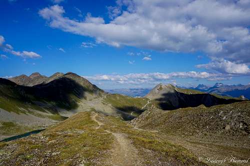
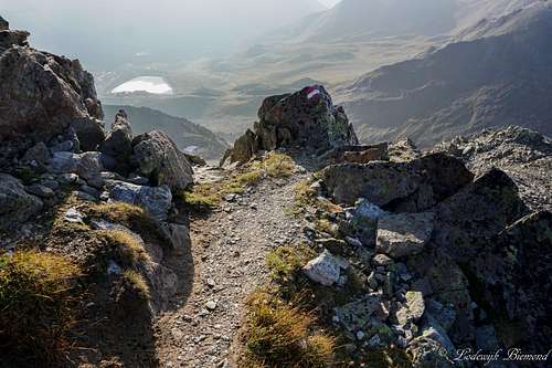
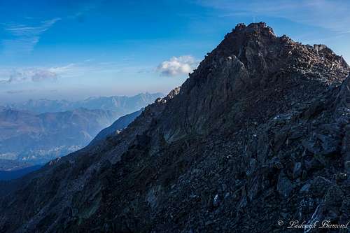
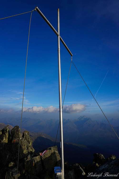
From the Hexenseehütte head towards the west along trail 713. This trail goes over easy terrain to the Hexensattel (2715m), marked by a yellow signpost. If you look down this saddlepoint you can see the beautiful Gmaiersee, a small mountain lake. At the Hexensattel the real climb begins. Follow the yellow signpost which says ‘’Hexenkopf’’ towards the north, you are now entering the south ridge of the mountain. The trail is well marked and therefore route finding is unproblematic. he route starts to steepen a little at this point (T3). Keep following the marked trail along the south ridge. Eventually you can spot the summit cross of Hexenkopf. This is also the point the crux of the route begins: The final 100 meters involve some light scrambling (UIAA I). The rock is solid though and the climbing is not too exposed. After covering these last 100 vertical meters you will find yourself on the summit of Herenkopf at 3035 meters. Descent is the same way back , but it is also a possibility to traverse Hexenkopf by using the east ridge route down the mountain. This route is more difficult though. It also involves Climbing in the first grade (UIAA I), but the climbing part is longer and more exposed in comparison with the normal route.
Hiking Times
| Route Section | Time required |
Lazid - Scheid | 20 to 30 minutes |
Scheid - Arrezjoch | 1 to 1,5 hours |
| Arrezjoch - Hexenseehütte | 45 minutes to 1 hour |
| Hexenseehütte - Hexensattel | 30 minutes |
| Hexensattel - Hexenkopf | 1 hour 15 min |
The times mentioned above are averages. My experience is that the hiking times on the singposts in Austria are ''slower'' compared to the ones in Switzerland. In Switzerland I am usually a bit faster compared to the signpost times, but in Austria I ocasionally use only half of the time mentioned on the signposts. The return time from Hexenkopf back to Lazid is about 3 hours. Make sure to check the lift operating times in order to use the Lazidbahn back to Serfaus. Otherwise it will cost you another 2 to 2,5 hours to get down.
Route Photos
 1. The trail just above the Hexensee Hut | 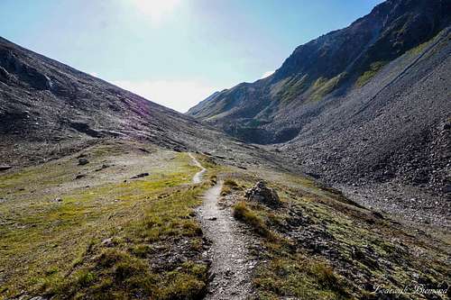 2. The path to Hexensattel |
 3. Hexensattel (2715m) | 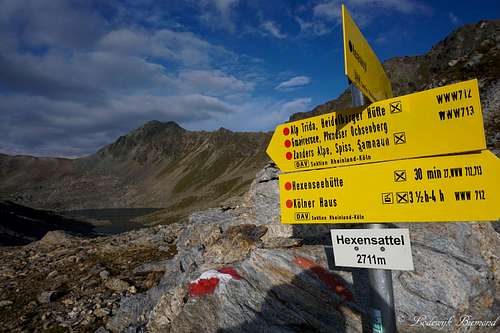 4. Hexensattel Signpost (2710m) |
 5. Entering the South Ridge | 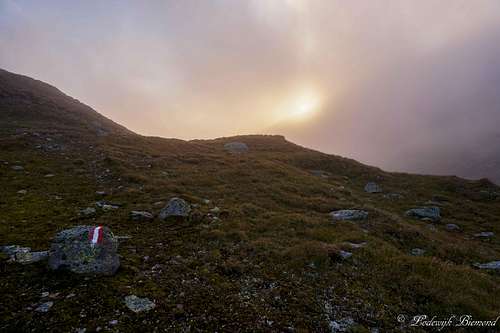 6. Sunrise; first part of the S-ridge |
 7. Hexensee from halfway up the South Ridge | 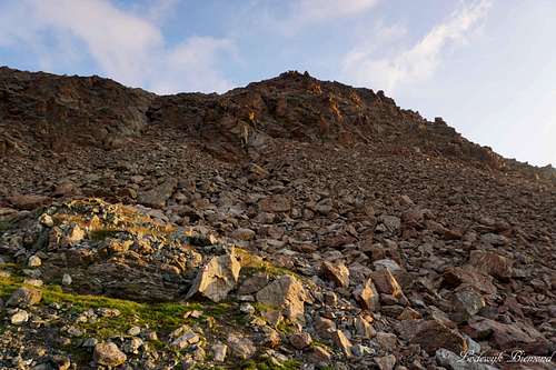 8. Start of the steeper part (T3) |
 9. Gmaiersee Alpenglow from S-ridge | 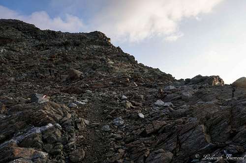 10. The Upper south ridge |
 11. The summit from the S-ridge | 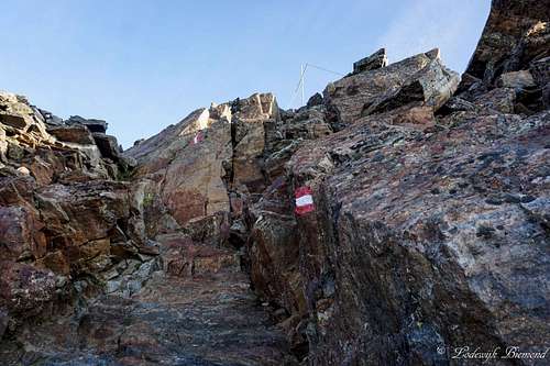 12. The Crux below the summit |
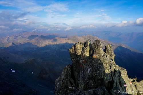 13. Summit view West | 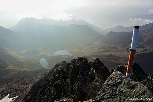 14. Summit view East |
When to Climb
Hexenkopf can be climbed best during the summer months (june / September) when there is no snow present on the mountain.
Essential Gear
When climbing Hexenkopf good hiking shoes are a must. Also take warm clothing since it can be cold at 3000+ meters. Climbing equipment like a rope etc are not neccessary for climbing this route. Poles can be useful.
External Links
Summit Cross
Hexenkopf Webcam
Bergfex Weather Serfaus
Accomodation in Serfaus
Interactive Map with the route to Hexenkopf
Also see the main page of Hexenkopf for information about -Maps & Books, -How to get to Serfaus or See, -the Hexenseehütte