


lcarreau - Sep 3, 2009 12:43 am - Voted 10/10
It's been way too longsince I've visited Wyoming. I wasn't aware of
the fact they were harnessing the wind to
make power.
More power to you, Zee !!!

ZeeJay - Sep 3, 2009 10:50 am - Hasn't voted
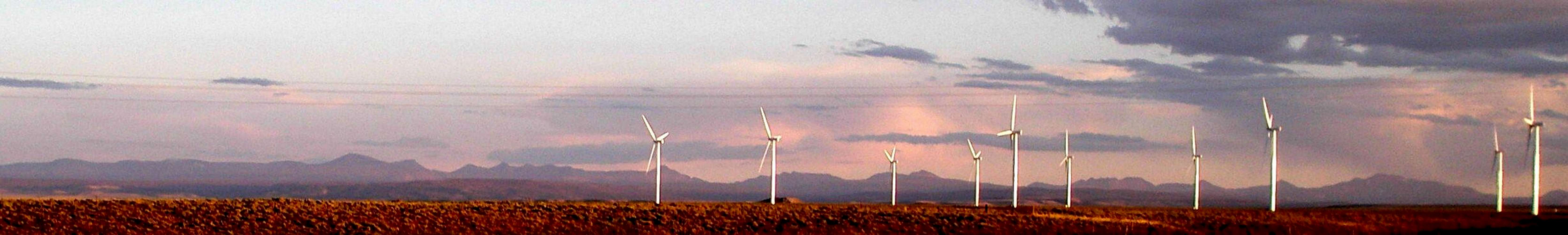
Re: It's been way too longThere are tons of windmills in Wyoming. For instance, there's a spot on I80 where you crest a hill and over 60 of them suddenly come in to view on the horizon in front of you.
lcarreau - Sep 3, 2009 12:54 pm - Voted 10/10
Re: It's been way too long...Incredible use of the wind!
I'm "assuming" all of the 'sheeple'
wandering past on I-80 north of the Uintas
are thrilled by this innovative concept ???
ZeeJay - Sep 8, 2009 8:54 pm - Hasn't voted
Re: sweet photo ZeeJayI wish!

rmac10 - Jun 13, 2010 9:08 pm - Hasn't voted
I.DsTell me if I'm correct for the peaks from the left of the panorama: highest on left, Mt. Gilbert; then Gunsight; followed by Dome, Kings, So. Kings; Lovinia (behind the windmill); between 3rd and 4th windmill from left, Tokewanna?
ZeeJay - Jun 14, 2010 2:00 pm - Hasn't voted
Re: I.DsWow! You're gooood! But, not perfect and I might not be either. Here's what I think.
You're right about Gilbert, Gunsight, Dome, Kings, and South Kings. After S Kings, the 3 distinct steps down to a flatish ridge is Henrys Fork Peak.
Mount Powell is directly behind the first windmill (from left).
Wilson is to the right of the second windmill.
For sure, no doubt in my mind, between the 3rd and 4th windmill is Moose Peak (12780). To see this, compare with this picture.
West Oweep Peak (12507) is between windmills 5 and 6.
The Blacks Fork Ridge is between windmills 6 and 7.
Barely to the right of 7 (almost directly behind it) is E Lovenia.
Barely to the right of 8 (almost directly behind it) is Lovenia.
The big hunk left of 9 is Tokewanna, but I think there is just a speck of Wasatch Benchmark poking up on the left of it. Also, I think a piece of NW Wasatch is glommed on to the right, but with the cloud and the fuzziness of the picture it's hard to tell.
I'm hoping to retake that picture this summer with a better camera. Did you used to live in Utah?
rmac10 - Jul 19, 2010 6:20 pm - Hasn't voted
Thanks!No, I've never lived in Utah, but I love the State... particularly the Uintas. I love David Rose's name for Henrys Fork Pk. ... "Fortress Peak". I certainly need more "identifying 101" instruction! Thanks for the clarification. I used to love this activity in the Sierras and San Gabriels in California.


Comments
Post a Comment