

Viewing: 1-6 of 6

andre hangaard - Oct 20, 2011 4:55 am - Voted 10/10
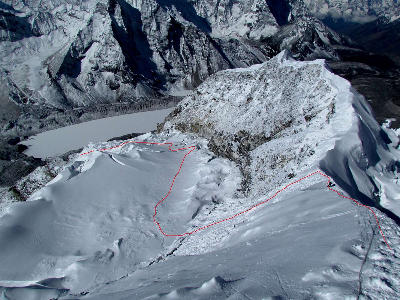
Excellent overview!!Excellent overview over the climbing route!!

Bruno - Oct 20, 2011 9:14 pm - Hasn't voted
Re: Excellent overview!!Thanks Andre!

radson - Oct 20, 2011 2:08 pm - Hasn't voted
coolGreat pics Bruno, very informative.
Bruno - Oct 20, 2011 9:15 pm - Hasn't voted
Re: coolThanks Rason! Imja Tse makes an excellent warm up run...
andre hangaard - Oct 23, 2011 4:10 pm - Voted 10/10
SW ridge?Do you know if the SW ridge is done frequently? Looks like a nice traverse.
Bruno - Oct 28, 2011 12:27 pm - Hasn't voted
Re: SW ridge?I guess very rarely, but I don't have any reference on it, except the fact that virtually everybody climbs Imja Tse via the normal route...
Interestingly, the first two quasi-ascent of Imja Tse in 1953 and 1955 reached the SW summit (the highest point at the end of the ridge), which is approx. 100m lower than the main summit. None of these two teams reached the main summit (I don't what was the reason for not continuing to the main summit)
Viewing: 1-6 of 6


Comments
Post a Comment