
-
 15729 Hits
-
 73.06% Score
-
 3 Votes
|
|
Area/Range |
|---|---|
|
|
35.33714°N / 127.72898°E |
|
|
Hiking, Mountaineering, Scrambling |
|
|
Spring, Summer, Fall, Winter |
|
|
Overview
Designated as the first national park in 1967, Jirisan spreads across 1 city and 4 counties in three-provinces – Hadong, Hamyang, Sancheong of Gyeongnam province, Gurye of Jeonnam province, and Namwon of Jeonbuk. The total area of Jirisan National park is 471.758㎢, which makes it the largest mountainous national park in Korea. The name of Jirisan means “the mountain of the odd and wise people.
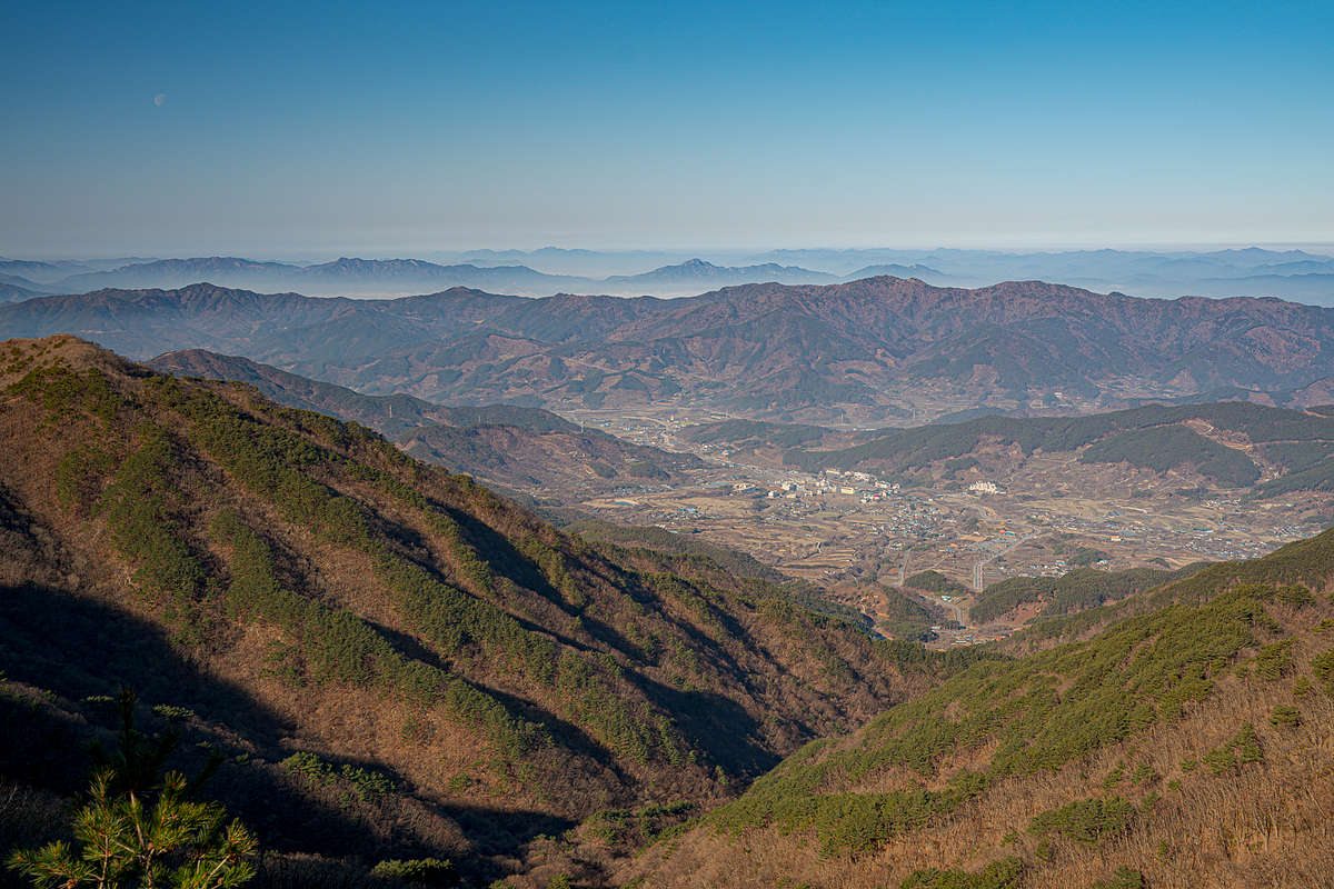
Since the ancient times, together with Geumgangsan and Hallasan, Jirisan has been known as one of the three legendary mountains in Korea, and a hallowed ground of the nation’s faith. The circumference of Jirisan is over 320km, and numerous peaks are spread out like a folding screen in the center of Cheonwangbong(1,915m), Banyabong(1,732m), and nogodan(1,507m) peaks. Many valleys are situated over 20 ridges. Jirisan is the cause for the cultural differences and varieties between regions to its east and west
With 4,989 flora and fauna inhabiting it’s grounds, Jirisan is a treasure chest of nature. Various vegetation from warm-temperate forests, temperate central forests and cold sub-alpine forests populate jirisan. Natural treasures such as the Higan cherry tree at Hwaeomsa (Temple) and the Waun Cheonyeongsong (Millennium Pine Tree) are in Jirisan

Hiking Opportunities
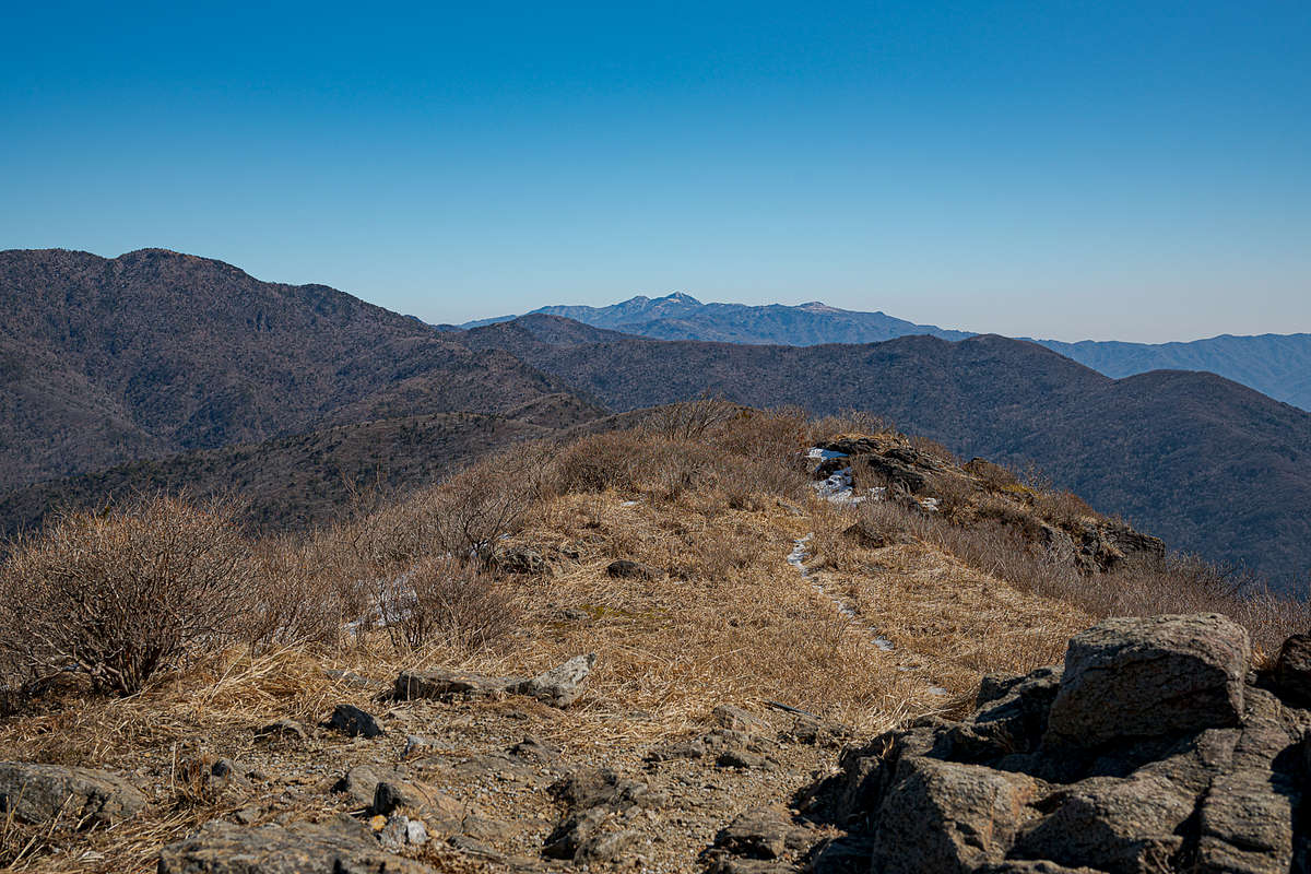
Jirisan is primarily a hiking destination, with some elements of mountaineering in the winter. The park orients itself along two primary ridgelines, one north-south ridge in the far western part of the park, and one east-west ridgeline through the center. The high point, Cheonwangbong, is along this east-west central ridge.
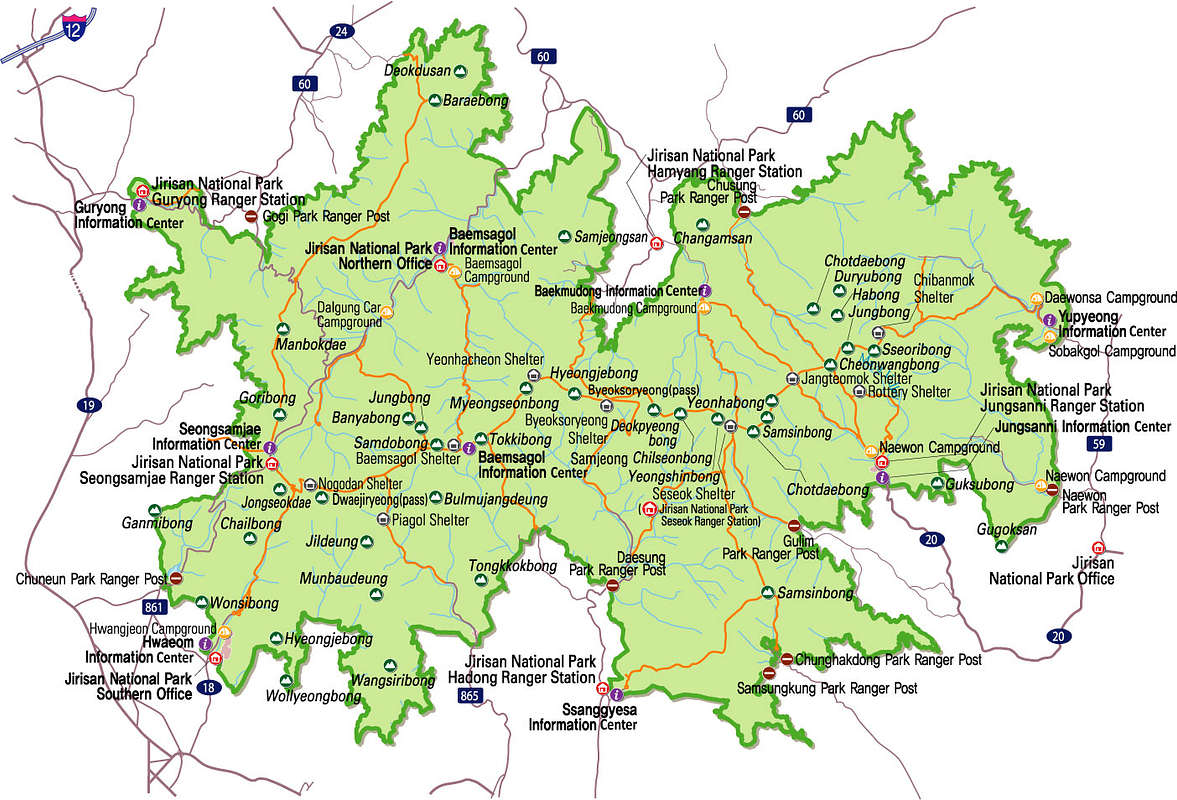
There are numerous ways to get up the main trails along the ridges, and the trails are generally well marked.
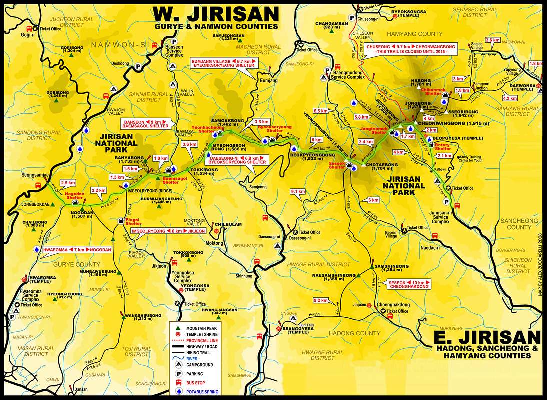
The "big" attraction at Jirisan National Park is the 'traverse route'. This is to backpack across the east-west ridgeline between Nagodan peak and Cheonwangbong, starting from either direction. There is a decent description of this route on hiking project. The allure of this route is the magnitude, it is the longest overnight hiking route through any of the national parks, and it also happens to go over the highest peak on the mainland. Along the way there are mountain shelters to stay in, and the suggested method is to take about 4 days and 3 nights to complete the traverse in one direction. For those with a fast-and-light mentality, the route could be completed in 2 days and 1 night. The scenery is not very diverse. Once on top of the ridge, you are on top of a high ridgeline looking at the mild rolling mountains of Korea in all directions, and that is the view for basically the entire journey. I noticed signs regarding attempts to reintroduce the Korean black bear into the park, so if you are lucky maybe you'll see one! It is a shame that tigers, once native to the peninsula, have been pushed out for ages, that certainly would have made wilderness hiking a bit more exciting :)
In the map below, the "easy" traverse is shown. It starts in the west at a high-pass parking lot, already putting you near ridgeline elevation. The "traditional traverse" is harder, and starts at Hwaeomsa Temple in the bottom left, ending at Daewonsa Temple in the far right.
Getting There
I had a car my entire time in Korea, so I just drive using Kakao Maps app. There are ample public transportation oppotunities however.
Red Tape
Nothing in addition to Korean national parks in general, as per the Korea parent page. This is one of, if not the most-likely-to-close park in dry fire-risk conditions. Always check at a park office in fall/winter (dry season) before heading out.
Camping
Like other National Parks, no wilderness camping allowed. The usual mountain shelters are available, and like the other parks, they fill up very fast! See the main Korea page for more information on reserving the shelters
