Jungfrau, via the Kranzbergegg

Jungfrau, via the Kranzbergegg

Jungfrau from the summit of the Mönch. The route via the Kranzbergegg is shown in red. The dotted portion is on the south side of the rock. The dashed portion follows rocks of the SE Ridge not visible in the photo The "old" normal route went directly up the glacier to the right of the Kranzbergegg and up the steep headwall to the Rottalsattle. (Now rarely done due to crevasse and ice fall problems.)
Photo by Monica Spicker, graphics by Fred Spicker.
Fred Spicker
on Oct 23, 2003 4:03 pm
Image Type(s): Alpine Climbing,  Topo/Diagram,  Informational
Image ID: 31406

Comments

Post a Comment
Viewing: 1-3 of 3
Velebit

Velebit - Oct 23, 2003 5:17 pm - Hasn't voted

When..

..was this shot taken Fred? Also, is that the Spinx at the bottom of the photo or just a rock shaped like structure? Useful graphics, thanks for adding.

Fred Spicker

Fred Spicker - Oct 23, 2003 5:25 pm - Hasn't voted

Re: When..

1977 & yes, the Spinx

eza

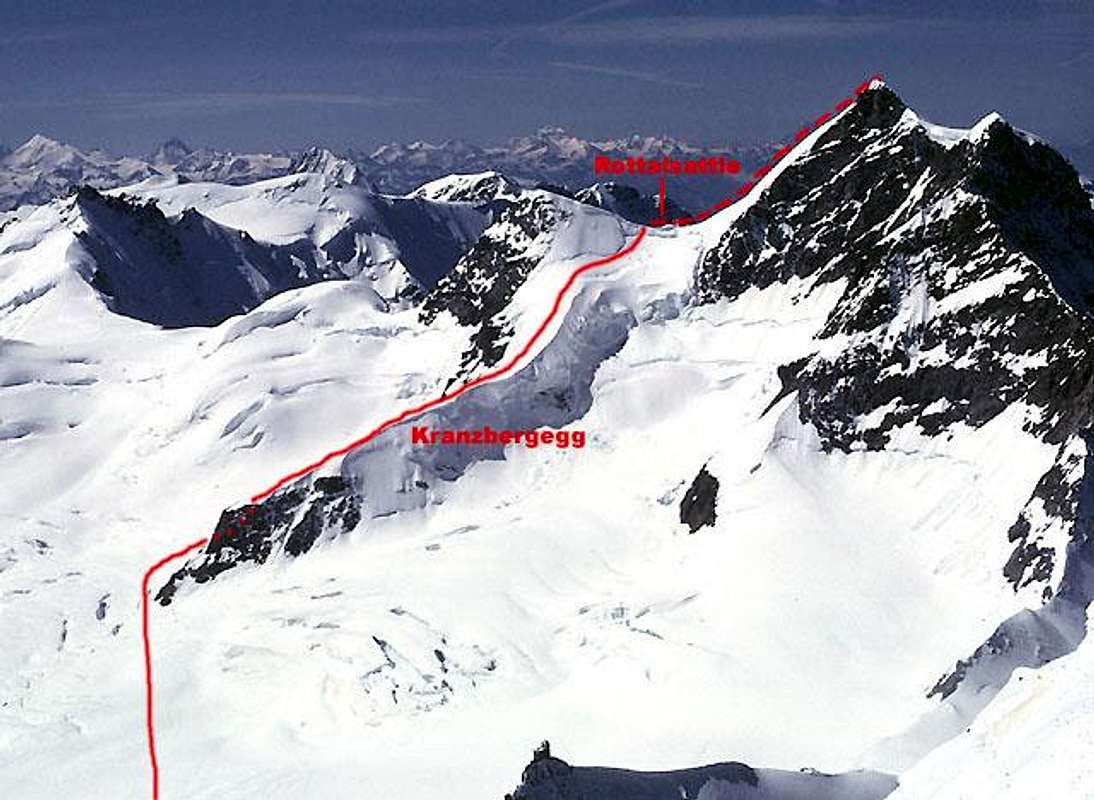
eza - Jun 3, 2008 10:24 am - Voted 10/10

Nice information

In fact, I had read about the normal route was still the one to the right of the Kranzbergegg. This alternative looks much more logical, I don't like the look of those hanging séracs

Viewing: 1-3 of 3