
-
 5145 Hits
-
 85.87% Score
-
 21 Votes
|
|
Mountain/Rock |
|---|---|
|
|
46.78337°N / 14.97870°E |
|
|
Hiking |
|
|
Spring, Summer, Fall, Winter |
|
|
6946 ft / 2117 m |
|
|
Overview
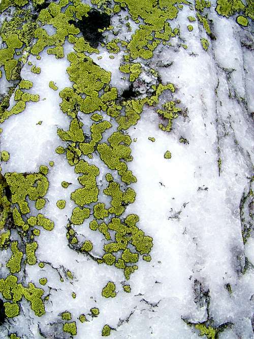
Lichen on quartzstone
Koralpe has 5 summits that are higher than 2000 meter. The highest peak is Grosser Speikkogel (2141 m). The other 4 summits are in the four cardinal points. All of them nearby Grosser Speikkogel. Seespitz is to north, Steinschneider to west, Krakaberg to south and Kleiner Speikkogel to east. Kleiner Speikkogel is the highest among the “four”.
Actually there are two summits in east, south-east direction to Grosser Speikkogel. It’s interesting that according to the maps the lower (and farther) is called Kleiner Speikkogel, while the higher has no name. The distance of the lower summit from Grosser Speikkogel is 900 meter, and its altitude is 2117 m. Though I have a map that indicates it with altitude of 2107 m.
For those who don’t speak any German: Grosser means big/high, while Kleiner means small.
As already mentioned: the western neighbour of our summit is Grosser Speikkogel. The eastern one is Ochsenstein (1987 m), in 1 km distance.
Kleiner Speikkogel, Ochsenstein and Glitzfelsen actually form a ridge that is the watershed of the Mur and Drava rivers. Water falling to the 2 sides of Kleiner Speikkogel meets again only in 160 km distance.
Kleiner Speikkogel is also on the border on the provinces Styria and Carinthia. The nearby Grosser Speikkogel is not on the border: that’s already completely in Carinthia.
We know that Kleinner Speikkogel is smaller than Grosser Speikkogel. Still, what is good in Kleiner Speikkogel compared to Grosser Speikkogel?
- Grosser Speikkogel has some black features: radar and TV stations at the top and a ski center northwest to it. On Kleiner Speikkogel you “miss” all these
- As no marked way goes to Kleiner Speikkogel, very likely you can better enjoy the nature there than on the nearby summit that is the highpoint of Koralpe
- Kleiner Speikkogel is a a protected Natura 2000 area. Grosser Speikkogel isn’t
- Kleiner Speikkogel – similarly to Grosser Speikkogel – is built mainly of schist. But on Kleiner Speikkogel there is a much higher ratio of white quartz stones. These are beautiful stones.
Getting There
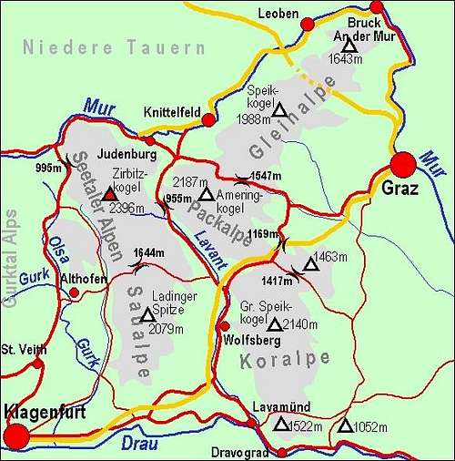
Map of Lavanttal Alps created by Vid
You can hike to Kleiner Speikkogel for in the same way as to Grosser Speikkogel. Only the last few hundred meters will be different.
Grosser Speikkogel can be most easilly reached from the end of the road that ascends from the town called Wolfsberg up to the altitude of 1630 meter. As there is a ski resort, the road is toll-free. From the end of the road up to the top you need 1h 30 minutes.
From north you can start your walk from the mountain pass called Weinebene (1668 m). From there you can reach the summit in 2h 30min.
With a long walk from south east you can walk up from the village of St. Oswald or from the hut Jägerwirt. Details of this route are described on the Glitzfelsen page.
You can approach Grosser Speikkogel on many other marked routes, too.
Routes
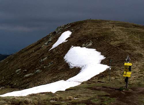
The saddle between Kleiner and Grosser Speikkogel
From south and from east it’s hiking/easy scrambling going up to the summit. From north climbing skills would be needed.
Red Tape
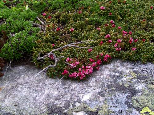
Stonecrop on the eastern slope of Kleiner Speikkogel, in 2000 m altitude
Accomodation
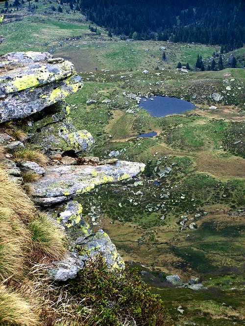
Speiksee below the summit
No camping on the Styrian side. On the Carinthian side the nearest camping is the Stausee Camping at Völkermarkt.
Tourist huts
Koralpenhaus, 1966 m
The Koralpenhaus inn is situated in the federal province of Carinthia and has 50 beds. Open from mid December till end March and from beginning of June till end September. In the main hiking season, you are advised to book on phone.
Contact: +43 664/4536313
Weinebene
45 beds, with possible catering. Whole year open
Contact: Knapp Barbara, +43 4352 71471

Schwanberger-Brendlhütte, 1566 m.
63 beds, with possible breakfast, lunch or supper. Open from June to September
Contact: Miss Maria Raunjak, +43 699/12196213
Literature
Useful topographic mapsFraytag & Berndt, WK 237 Koralpe, Lavanttal, Saualpe, 1 : 50,000
Kompass, Nr. 218 Koralpe, Pack, Soboth, 1 : 50,000
Bundesamt für Eich- und Vermessungswesen, ÖK 50 188, 189, 1 : 50,000
Online map: www.austrianmap.at
Useful guidebooks
Österreichischer Weitwanderweg 05 "Nord-Süd-Weitwanderweg", ISBN 3-222-12571-6
Lavanttaler Höhenweg
Kärntner Grenzweg, ISBN 3-7084-0129-8