Kupunkamint by any other name is still Kupunkamint
Kupunkamint Mountain
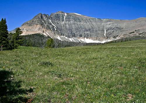
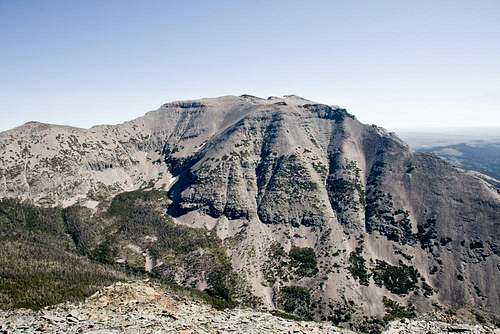
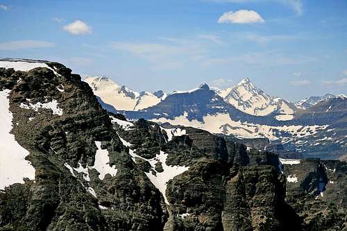
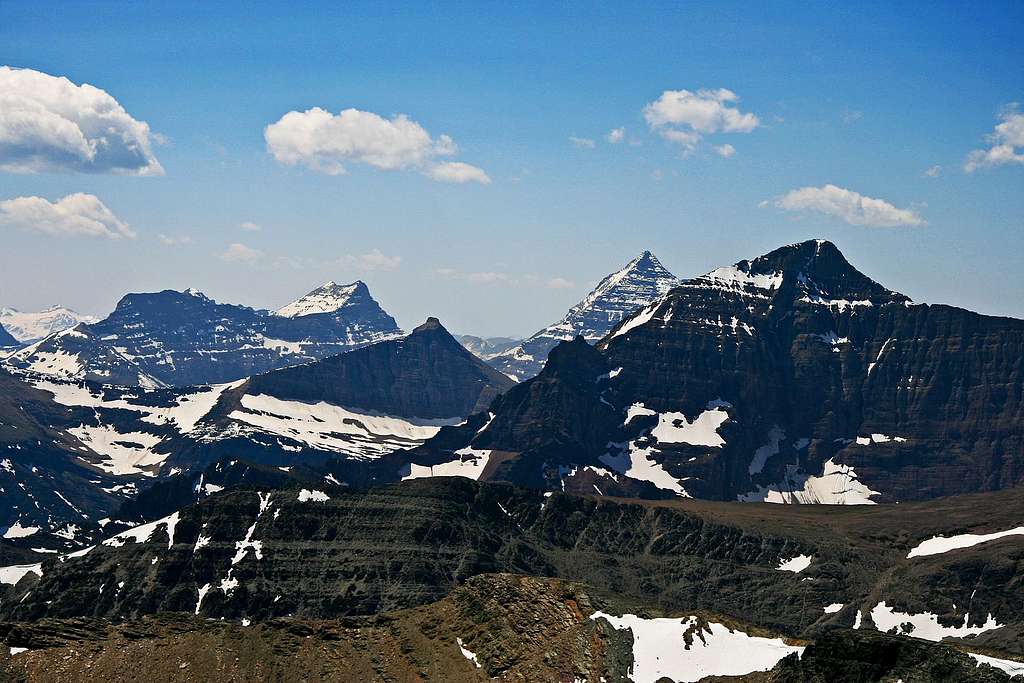
The summit is visible at the start
The name rolls off the tongue. "Kupunkamint." Now there's a word to say quickly several times in a row! Well okay, maybe the syllables don't exactly trip lightly, but it's a catchy tune nontheless. "Kupunkamint." Memorable, to say the least; stays in the mind...and the specific origin and meaning of this nicely-named peak has become uncertain over the years. Tracking down exact sources of Native names for mountains is often difficult; tribes relocated and intermingled over time, often resulting in variant identifications to geographical features of an area, and then the Europeans entered the scene, having naming ideas of their own. In this case, I think a couple hints may be gleaned from Jack Holterman's book, Place Names of Glacier National Park.
Kupunkamint's west face, as seen from Amphitheater Mountain
It seems the appellation in use today is a corruption of the original spelling, "Kupumqamik," which was the original name given a relatively obscure mountain—a peak now known as Double Mountain—in the southeast portion of GNP. Here is how Holterman puts it: "The Kootenai name [of Double Mountain] is Kupumqamik, which has now been transferred and misspelled to another mountain still called Kupunkamint, said to mean 'He shakes himself'." Then, a final tidbit of information about "He shakes himself" declares, "It normally refers to an animal but here it is said to be the name of a man." And that's it; no elucidation of the possibilities inherent in "Double Mountain," or "He shakes himself." So while all this is interesting, and the name is certainly colorful, it seems we're missing enough historical ties that we'll just have to enjoy the current name sans any definitive etymological origin. Or we can simply experience the mountain, and not bother ourselves with the mysteries of what gets called what, and why, and when.
(But still...it is indeed a nice name.)
And now....
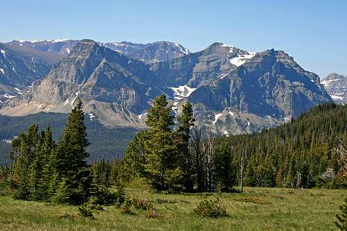
Kupunkamint, high mountain meadow
...the Peak—and Company
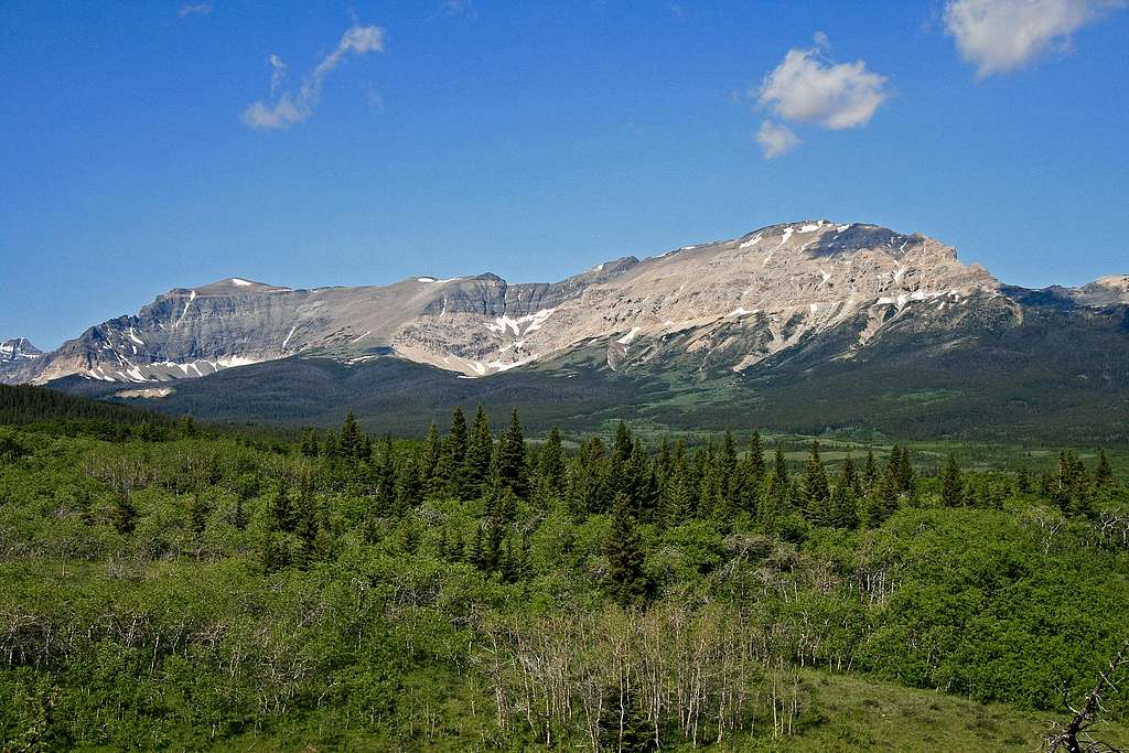
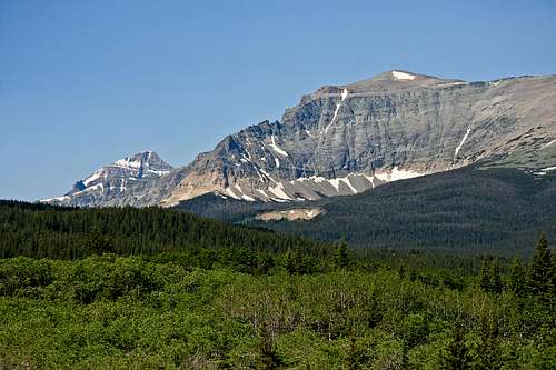
Kupunkamint and White Calf, rising as one from the plains
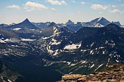
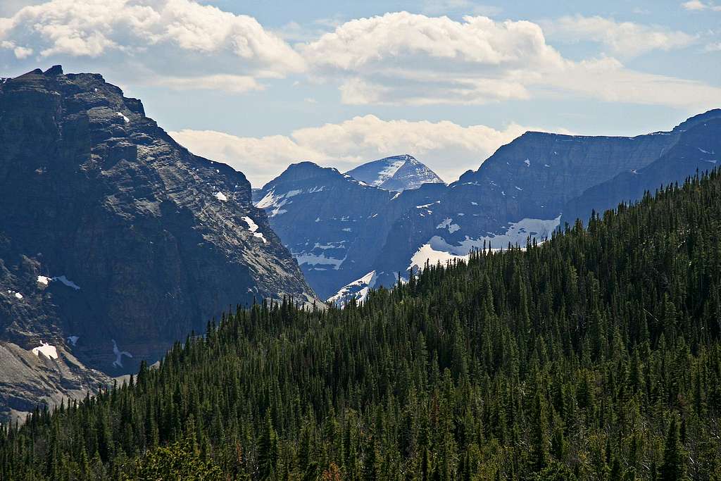
Three mountains
If viewing towards the west, it is as though three closely joined peaks rise out of nowhere to displace the calm perspective of the plains. Two of them, Kupunkamint and White Calf, easily pass as one long mountain separated only by a gash in the ridge ("Double Mountain"?—makes me wonder if some of the past naming-intent went
White Calf & northern neighbor Divide Mtn.
astray), while the third, Divide Mountain, is more easily distinguishable as something apart, the northern anchor of a nice trio.
Coming from the south, these three are big enough to dominate much of the drive the last fifteen or so miles into St. Mary. They are not unduly glacially carved, or have the substantial elevation gain present in so many of this area's peaks, but the plains illusion of sameness is greatly and easily shattered; these members of the Rocky Mountain Front will most assuredly capture your attention! And if heading east, they'll have help, but these are the ones reaching out to your back.
Two of close neighbor White Calf Mountain
Kupunkamint and James
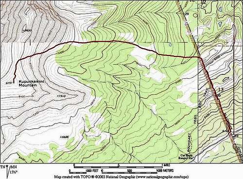
Three harbingers of a towering interior are met, and one of them, Divide Mountain, is among the easier climbs in the park; Kupunkamint and White Calf, still not "difficult," are nowhere near as easy, but are good and well worth the effort. In its own way Kupunkamint is the least stand-outish of the three, and for a long while I was never sure of its exact summit location, assuming only that it was somewhere along a quite lengthy, picturesque ridge. Actually, much of that memorable ridge is property of White Calf (which is quite a large thing), with Kupunkamint's summit being a relatively unassuming round point near the south end, and overlooking entry into the Cut Bank Valley.
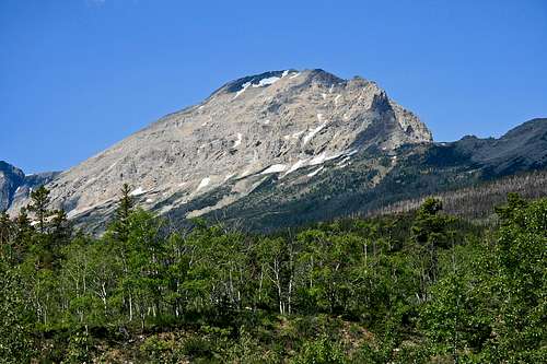
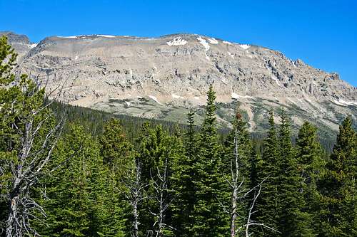
White Calf Mountain
Whether the plains end here, or you're going in a different direction and the mountains end here, it is at least a nice confluence. The operative words in this place are "green" and "forest," and early in the summer the area around Kupunkamint is spellbinding. Further north, the landscape around Divide Mountain changes, becomes an intense difference courtesy of the monster Red Eagle fire of 2005 (there are links to unusually dramatic USFS photos of this event on the Divide Mountain page). But no matter, the subject at hand is in the forest, so there is no burned-over terrain with which to deal. And besides, it has the memorable name.
Summit Views
This mountain has nice summit views. Enjoy them here....
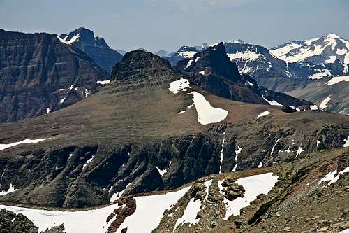
View looking almost directly southwest, through to Great Northern Mountain
Sometimes it is nice to photographically bring things in a bit...
...but then, back the lens off and the scene opens, becomes quite special...
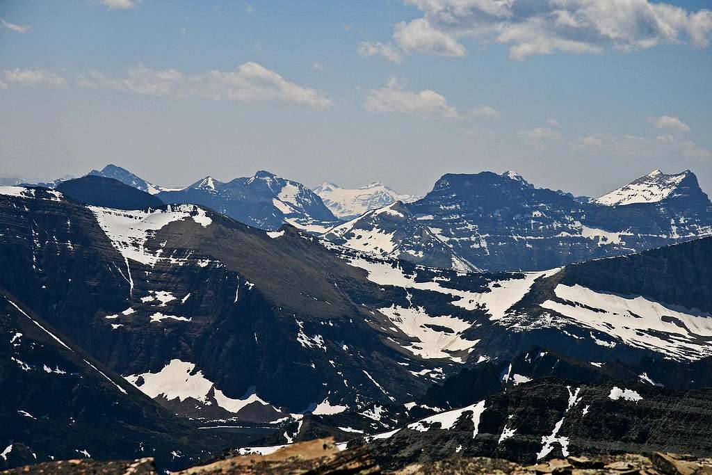
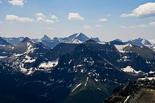
Summit view South and Southwest
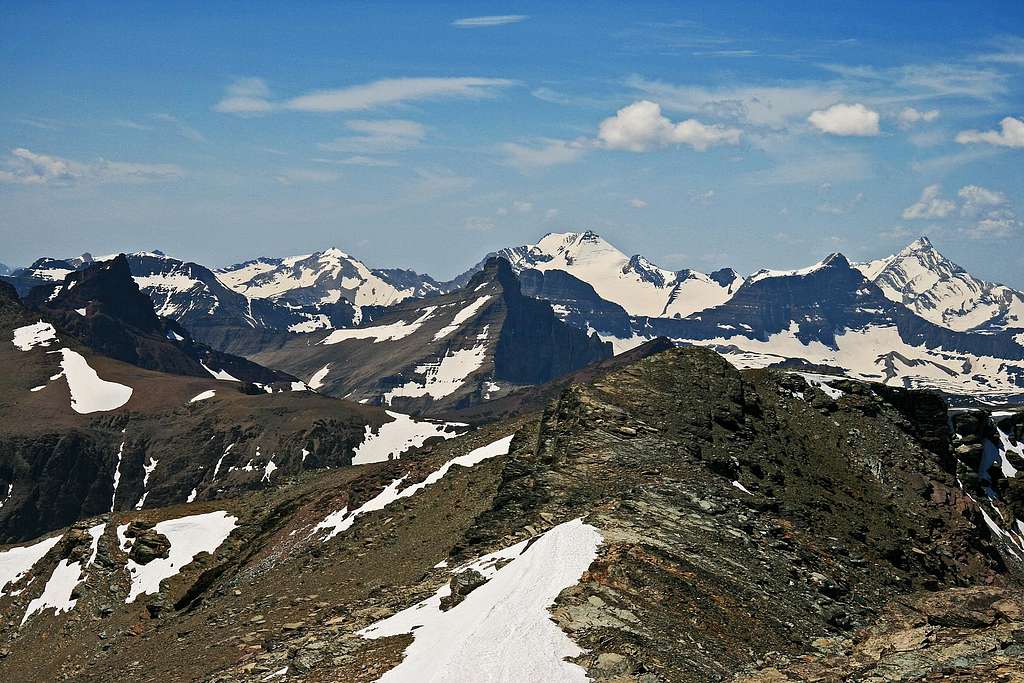
Five nice peaks, west and southwest
To Climb—Getting There
Not too far along, the Cut Bank Valley begins impressing...
...then opens up even more
Looking north from the Kupunkamint summit along the ridge to White Calf
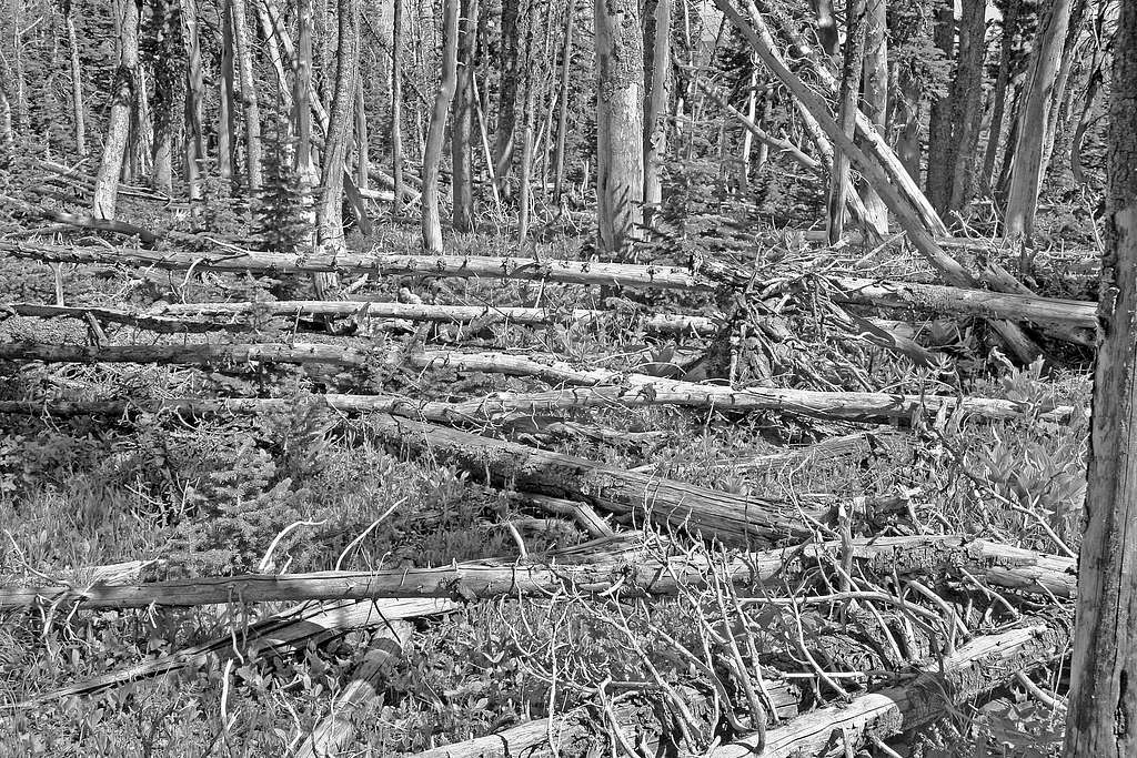
It doesn't take very many GNP climbs to realize that while the network of maintained trails is extensive, those trails usually get you only to the vicinity of your destination; many (maybe even most) climbs are completed courtesy varying degrees of bushwhacking difficulty, and game trails, or no trails. Especially while working through the lower slopes, forest and undergrowth are often dense enough to create slow progress, confusing directions (usually worse on the descent), and injured dispositions (also worse during descent). So the choice is either work through the obstacles (which, naturally enough, vary greatly from mountain to mountain), or stay home. Kupunkamint is an interesting mix of all the above, has one unusual man-made feature of which to take advantage, but is by and large not at all bad.
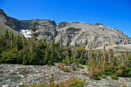
The "Gap" between Kupunkamint and White Calf
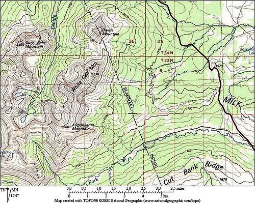
There is no trail head or official marking, but a definite place to begin exists, and it is quite easy to reach. Approximately half way between East Glacier Park and St. Mary on Hwy 89, take the gravel road to the Cut Bank Campground. The turnoff is well marked, and the road, while not "first class," is fine for passenger cars. Entry to GNP is about four miles; it, too, is well marked with a "Glacier National Park" sign that is hard to miss, along with a cattle guard and fence. This is your starting point for the climb. There isn't a whole lot of space in which to pull off the road, so most people drive the additional half mile to the Ranger Station, where there is ample room to park, then walk back to the starting point. (As a side note, the campground is an additional half mile beyond the Ranger Station—see below for specific information regarding this quiet backwater of a GNP camping area. Also, a major trail leading to Triple Divide Pass and points beyond, and intersecting other trails, takes off from the campground—if you wish, you're off and running into some (really) nice days of mountain experience! But now, back to the issue at hand, involving a singular and particular nice day of...mountain experience.)
During the afternoon descent, an unusual perspective of Mount Phillips
To Climb—A Route
[Overview of area, and the route]
The circumstance is that this climb begins via a man-made trail which doesn't appear on maps. The eastern Glacier National Park boundary is the western Blackfeet Indian Reservation boundary; at lower elevations there is a fence where the two come together, and more to the point for this climb, a trail runs along the fence, on the Reservation side. It is much easier following the trail than walking on the GNP side, where you'll be dealing with...no trail, and undergrowth. A Reservation Conservation Permit is required if you do this; it costs $10, is good from the first of April through the end of March each year, and may be easily purchased in East Glacier Park (Bear Track Mini-Mart/Gas Station, on the right heading out of town towards Browning), the Trail & Creek Sporting Goods store in St. Mary, or Browning (Tribal Headquarters, or any hardware/sporting goods store).
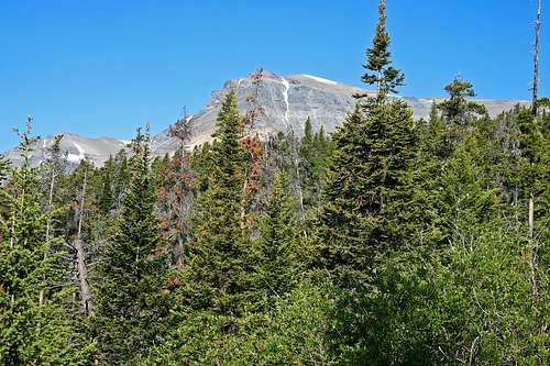
Any climb is enjoyable when it works through open forest...
So...the climb starts at the entrance to GNP, marked by the ubiquitous "Glacier National Park" sign prevalent at entrances throughout the park. There is also, as stated above, a cattle guard, and the just-mentioned fence. Follow the trail as it climbs for about a mile (possibly a bit less), until reaching a relatively level area mostly clear of undergrowth and trees. The view west to Kupunkamint and White Calf dominates the horizon, and this is where you cross the fence (assuming you were on the trail; if you were in the GNP side, simply turn left/west). There is no trail the rest of the climb, but the route—excepting some forest bushwhacking, which doesn't last long—is relatively easy, and intuitive. Much of this approach to the mountain proper is through huge windswept meadows of flowers. Enjoy!!!
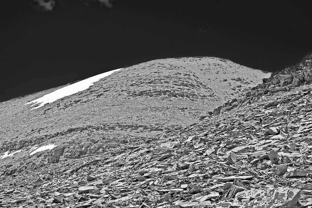
High on the mountain proper...final ascent
From here on what you do, basically, is work your way through forest (no way to completely avoid some bushwhacking) and meadows, always keeping the mountains in front of you, which is not at all difficult, because they're relatively close. There is a large gap in the ridge between the two mountains, and you will head for an area to the left of this break. I know it sounds simplistic, but from this point on, simply head towards Kupunkamint, accessing and climbing the mountain so as to reach a saddle not far to the right (north) of the actual summit. Total elevation gain is about 3600', and the route (about 3.5 miles) is not difficult.
...but...it can't be avoided...there is forest bushwhacking on Kupunkamint Mountain
The best descent if doing just Kupunkamint (see next paragraph) is to retrace your ascent. We thought we'd take a shortcut by heading more directly downhill, got lost in some relatively dense undergrowth, and added at least an hour to the day. There is a trail on the map, marked "Boundary Trail," which we eventually found, but it is not an easy search (although it does come out at the Ranger Station, and—presumably—your vehicle). Gotta love that bushwhacking....
[img:537126:aligncenter:medium:High on the mountain proper...final ascent]
It is only being accurate to point out that Kupunkamint and White Calf are often done as a pair, sometimes climbing White Calf from the large break—to the north—between Divide and White Calf, or sometimes climbing Kupunkamint first, then taking the long ridge between the two. The "gap" separating Kupunkamint and White Calf does not require technical work. (We were going to do both peaks, but 50 mph winds—with stronger gusts—forced us to retreat after Kupunkamint.) It is not possible to go between Divide and White Calf without substantial technical work on severe cliffs, thereby eliminating the possibility of doing all three in a day.
Home stretch, and now merely a short walk to the summit....
The Red Tape, Wildlife, & Cautions Section
In case you need it: A couple reminders that this GNP/Northern Rockies area has a LOT of wildlife.
No permits required, but you must pay a park entry fee, which is $25 for one week, or $35 for an annual pass. Registration for day climbs in Glacier National Park is recommended, but not mandatory. Probably anyone prone to climbing in this part of the country already knows this, but the Northern Rockies are full of wildlife. Always be aware, and don't do anything stupid, like—for example—feed the bears, think that a mountain lion is even remotely related to your pet cat, or run up to a moose (moose are quite unpredictable, irritable, and very dangerous). And never, ever, EVER forget you're in grizzly country; they insist on being left alone—disagreement on that point is not an argument you'll win! Bear spray and noise should be part of every GNP foray you make into the back country. Black bears will be found in the forests, grizzlies commonly venture onto the above-timberline tundra, sometimes, when in pursuit of such delicacies as ladybugs or cutworm moth larva, even to the summits! Also note that improperly stored food in park campgrounds (i.e., scraps left around the table or campfire, or edibles in your tent rather than your car) will subject you to a $50 fine. If you wander off, leaving your pack unattended, and there is food in it which attracts the attention of, for example, a bear, it is also a fine. Folks, the Park Service is serious about not providing human food access to the critters!
Lastly, check "To Climb—A Route" section above for information as to the particulars concerning the need to obtain a Blackfeet Indian Reservation Conservation Permit for this particular climb. I found it easier to work the necessary info into the text in that section, and so won't repeat myself here.
GNP Road Information
Standard Precautionary Note: All GNP roads are closed in winter, with Going-to-the-Sun Road (the major route through the park; its eastern terminus is at Saint Mary) sometimes not opening until July (average opening is second week in June; earliest opening ever is May 16, 1987, with the second earliest being May 22, 2005). Don't head out early in the year (i.e., June/early July) without checking the status of these roads—it is not unusual to have repeated, sometimes lengthy, road closures due to storms, avalanches, rock slides, or all three! The same holds true for late in the year; weather changes dramatically in Glacier, beginning usually around the end of August, with road closures normally becoming more and more frequent throughout the month of September (although don't shy away from going, there can also be very nice—albeit cool or cold—days of Indian Summer throughout this time frame; plus the park is relatively free of people after Labor Day). The following links are relatively self-explanatory, and provide all sorts of useful information:
And finally, click here for current information, as well as easy access to some interesting photos showing the Plowing of Going-to-the-Sun Road.
When to Climb, & Climbing Considerations
From late June/early July (during this time frame expect LOTS of snow in the high elevations) to early fall, depending on snow conditions. Traditional climbing season in the Northern Rockies is July, August, and September—with September weather becoming progressively colder and more unstable (sometimes dramatically so: PAY ATTENTION!) as the month progresses—but does of course vary from year to year. There are occasional winter climbs in the park, but not often, and then only by well-equipped, area-wise, extremely competent individuals. Basically, most of GNP is inaccessable through the winter, and avalanche danger, to put it mildly, is extreme almost everywhere.
CLIMBING CONSIDERATIONS
Because of the nature of the rock, there are special considerations regarding climbing in Glacier National Park, and grading systems unique to the Park have been developed by both J. Gordon Edwards and the Glacier Mountaineering Society. Anyone doing more than just "trail" hiking in this part of the Rockies should read the excellent and important information put together by Fred and Moni Spicker. Much—if not most—of the rock in GNP is sedimentary and rotten, and you need to know about it: Glacier National Park Rock & Grading Systems.
Camping
There are numerous campgrounds available within Glacier National Park, of which only Fish Creek and Saint Mary take reservations (not required, but probably a good idea during the peak summer tourist period, especially on weekends). There are also many campgrounds as well as motels just outside the park on both the west and east sides. Lodging, whether camping or indoors, should be no problem. Specifically, Kupunkamint Mountain is in the Cut Bank area, and there is a small campground (turn-off to which is approximately half way between St. Mary and East Glacier); the NPS designates this campground as "primitive," with the only facilities being pit toilets. Cost here is $10 per night, or half the normal rate. [NOTE: As of summer, 2009, the only water source—and it's a good one—is from Cut Bank Creek, which flows mere yards from the campground. Water quality in GNP is normally quite good post run-off, but it's still a good idea to filter this far downstream.] See link below for current campground information throughout the park, including fees. There are also several restaurants in the three closest communities—Saint Mary, East Glacier Park, Browning—to the Cut Bank Campground.
The communities of East Glacier Park, Browning, and Saint Mary, are all on the Blackfeet Indian Reservation, where there a great many additional services available.
Also, for those so inclined...GNP does have Backcountry Campsites throughout the park. Some of these sites can be reserved; others are on a first come basis. Anyone doing extensive, multi-day, remote hiking/climbing would be well advised to check this out.
Current Conditions/Web Cams
Weather page—an overview, plus current conditions and forecast
Glacier National Park Chat—a great source for friendly conversation and information concerning all things GNP related!
In Tribute
On March 1, 2011, Vernon Garner, Saintgrizzly, left us after losing a bold, inspiring fight against pancreatic cancer. Or maybe he won, for he is at last free of his pain and has "shuffle[d] off this mortal coil."
Vernon was an important contributor on SummitPost, but beyond merely making good, informative pages, he actually inspired many who read his work. No one put more work into his or her pages than Vernon did, and many of those pages, especially those related to Glacier National Park, the place he loved above all others, are works of art in both the writing and layout. More than one person has wanted to visit Glacier or go back to Glacier largely due to what he shared about that magnificent place.
Many people on SP counted Vernon among their friends, and many more saw him as one of the best, one of those who exemplified the spirit of this site. He was one of the best of us, he will be missed, and he will not be forgotten.
As a tribute to him, Vernon's pages will remain in his name. Any member who sees a need for an addition or correction should please contact site management via the "Send PM to the Elves" feature.
Thanks for the info! I'll add it immediately onto the page....
Interesting: I tried getting a permit in Columbia Falls, and the clerk did indeed think I wanted the fishing permit; they didn't sell the actual Conservation Permit, so I continued on to East Glacier Park, where it may be easily purchased at the Bear Track gas station/mini-mart on the way out of town (towards Browning).
distressbark - Jun 29, 2011 10:23 pm - Voted 10/10
route variation - old trail!
On the way down from the summit ridge of Kupunkamint, we noticed a patchy series of meadows that appeared to lead towards the Cut Bank entrance road. We followed the meadows down, and to our surprise, eventually encontered the remnants of an old trail! It led directly out the Cut Bank Ranger Station. Not sure how far it can be followed or where it leads to, but it very well may provide a significantly shorter approach than the primitive reservation trail. I hope to return later this summer to investigate!
Children refers to the set of objects that logically fall under a given object. For example, the
Aconcagua mountain page is a child of the 'Aconcagua Group' and the 'Seven Summits.' The
Aconcagua mountain itself has many routes, photos, and trip reports as children.
Parents refers to a larger category under which an object falls. For example, theAconcagua mountain page has the 'Aconcagua Group' and the 'Seven Summits' asparents and is a parent itself to many routes, photos, and Trip Reports.

 11132 Hits
 92.85% Score
 40 Votes
 Kupunkamint, high mountain meadow
 Three mountains
 White Calf & northern neighbor Divide Mtn.
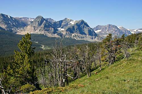 ...then opens up even more
 Looking north from the Kupunkamint summit along the ridge to White Calf
 The "Gap" between Kupunkamint and White Calf
 Any climb is enjoyable when it works through open forest...
 High on the mountain proper...final ascent
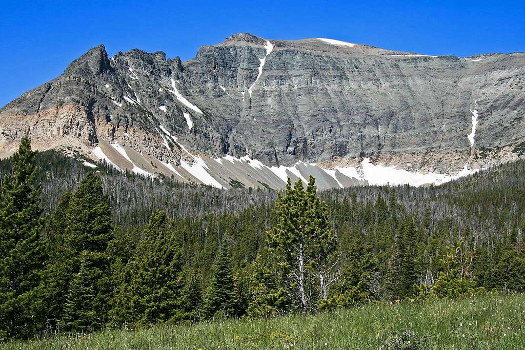
Saintgrizzly - Aug 5, 2009 6:45 pm - Hasn't voted
Re: Blackfeet PermitThanks for the info! I'll add it immediately onto the page.... Interesting: I tried getting a permit in Columbia Falls, and the clerk did indeed think I wanted the fishing permit; they didn't sell the actual Conservation Permit, so I continued on to East Glacier Park, where it may be easily purchased at the Bear Track gas station/mini-mart on the way out of town (towards Browning).
FlatheadNative - Aug 12, 2009 10:22 am - Voted 10/10
Re: Blackfeet PermitIs the permit good for the entire year (like the Tribal fishing license)?
Saintgrizzly - Aug 12, 2009 12:10 pm - Hasn't voted
Re: Blackfeet PermitYup. The permit runs from April 1st through the last day of March. (I've put that on the main page.)
FlatheadNative - Aug 12, 2009 3:11 pm - Voted 10/10
Re: Blackfeet PermitThanks Vernon!
distressbark - Jun 29, 2011 10:23 pm - Voted 10/10
route variation - old trail!On the way down from the summit ridge of Kupunkamint, we noticed a patchy series of meadows that appeared to lead towards the Cut Bank entrance road. We followed the meadows down, and to our surprise, eventually encontered the remnants of an old trail! It led directly out the Cut Bank Ranger Station. Not sure how far it can be followed or where it leads to, but it very well may provide a significantly shorter approach than the primitive reservation trail. I hope to return later this summer to investigate!
FlatheadNative - Jun 30, 2011 11:12 pm - Voted 10/10
Re: route variation - old trail!There was an old horse trail that was used. It traveled from 2 med as well.