


-
 3998 Hits
-
 83.1% Score
-
 16 Votes
|
|
Mountain/Rock |
|---|---|
|
|
45.70150°N / 7.48828°E |
|
|
Aosta Valley Fénis and Saint Marcel Municipalities |
|
|
Hiking |
|
|
Spring, Summer, Fall, Winter |
|
|
6512 ft / 1985 m |
|
|
Note
La montagna chiama i suoi figli, ed essi rispondono fedelmente al suo appello… Osvaldo Cardellina, Diario alpinistico, 1964-65 Page texts: @ OsvaldoCardellina "Osva", passed away on May 2, 2022. Page owners: Christian Cardellina e Osvaldo Cardellina. Any updates from September 12, 2022: Antonio Giani, page administrator, friend and climbing companion. Testi della pagina: @ OsvaldoCardellina "Osva", scomparso il 2 maggio 2022. Proprietari pagina: Christian Cardellina e Osvaldo Cardellina. Eventuali aggiornamenti dal 12 settembre 2022: Antonio Giani, amministratore della pagina, amico e compagno di salite. |
Overview
 |
We continue the search for mountains that that are not well known and even less busy. Although this certainly appears to be a mountain little popular and even less frequented. This mountain, but not excessive height from the forms clearly in evidence, is placed at the end of the very long ridge, starting from Punta Tersiva (3.515m) arrives to the Central Valley of the River Dora Baltea, above the little Town of Fénis (very famous and splendid Medieval Castle) at the entrance of the vallon with same placename. It serves as the watershed between this and the adjacent (to the West), Valley of Saint Marcel, this splits after Mount Corquet (2.527m): a branch facing North-northeast gets up in Torrasse also Tower and then finally down to the Mount Saint Julien, while the second goes more towards the North-northwest to Mount Roux and the Mines of Servette, near, from East to West, Villages of Petit and Les Hautes Druges and the Alps and Pouria Vargney on the private road, which alleges the Reserve Grand Avert, by the Marquis Turati. Between these two short watershed lies small the Vallon of the Pieiller, divided by the Municipality of Saint Marcel from Torrent Morgnet(t)z, while the portion to the East of this is the real Pieiller leaning against the Mount Saint Julien and fades into the end and wooded against Mount The Torrasse (1.854m), also clearly visible from the central valley. Finally, the two parties shall meet up at Alpage Prapremier (2.011m) at the base of Corquet where, shortly afterwards, ending the boundaries between the two municipalities. The sector of the Mont Saint Julien is therefore to further East-northeast, where the mountain is presented with great forest covering it laterally until almost the Summit, interspersed with bands with steep rocky cliffs. From the Eastern side of Mont-de-la-Touriasse takes on a more impressive with ribs rocky which are inserted steeply in the forest and then into the wood, while to the North, or on the underlying plateau near the Plan des Meyes and Meyes Pasture, falls covered by forest and then in the lower and dense woods, which then declines on the Torrent de Bioley at La Morgnettaz Hamlet inside the small Vallon of Pieiller behind the Municipality of Fènis.
![]()
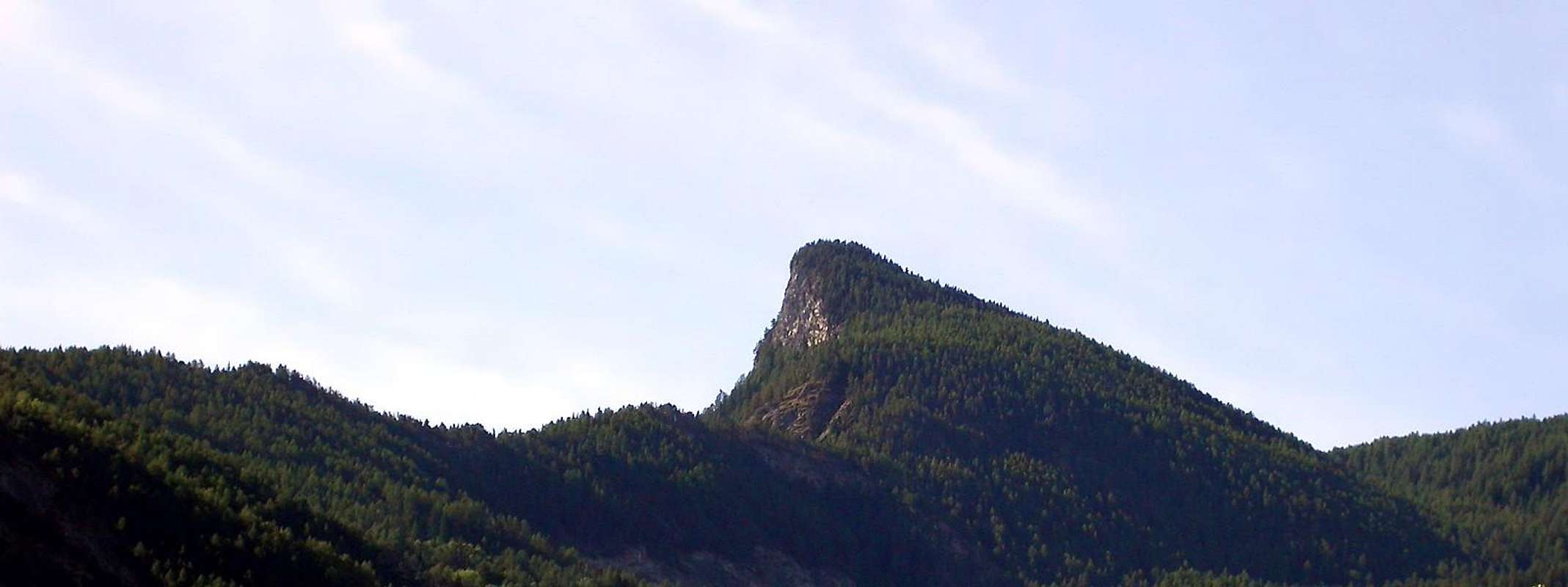
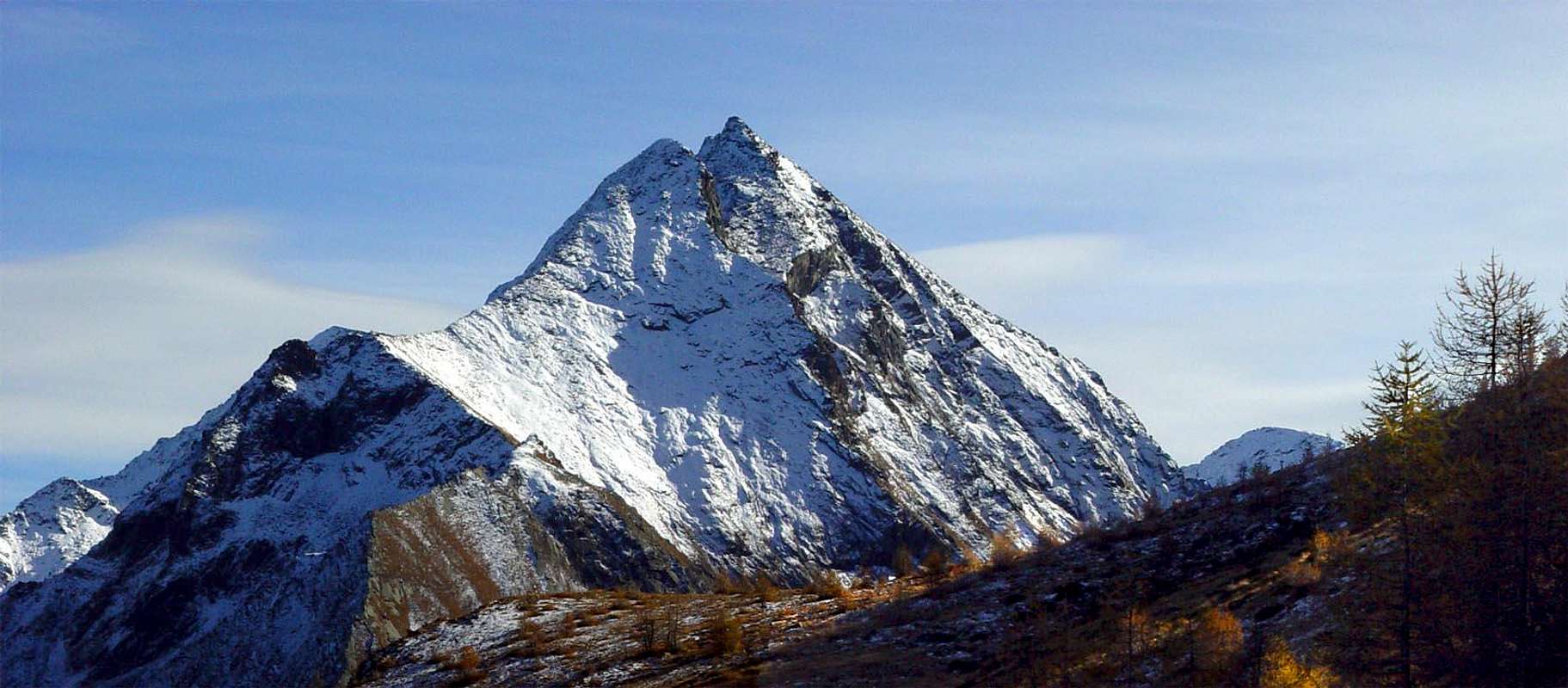
La Torrassa also Mont Touriasse above the Mont Saint Julien, by SalVal
![]()
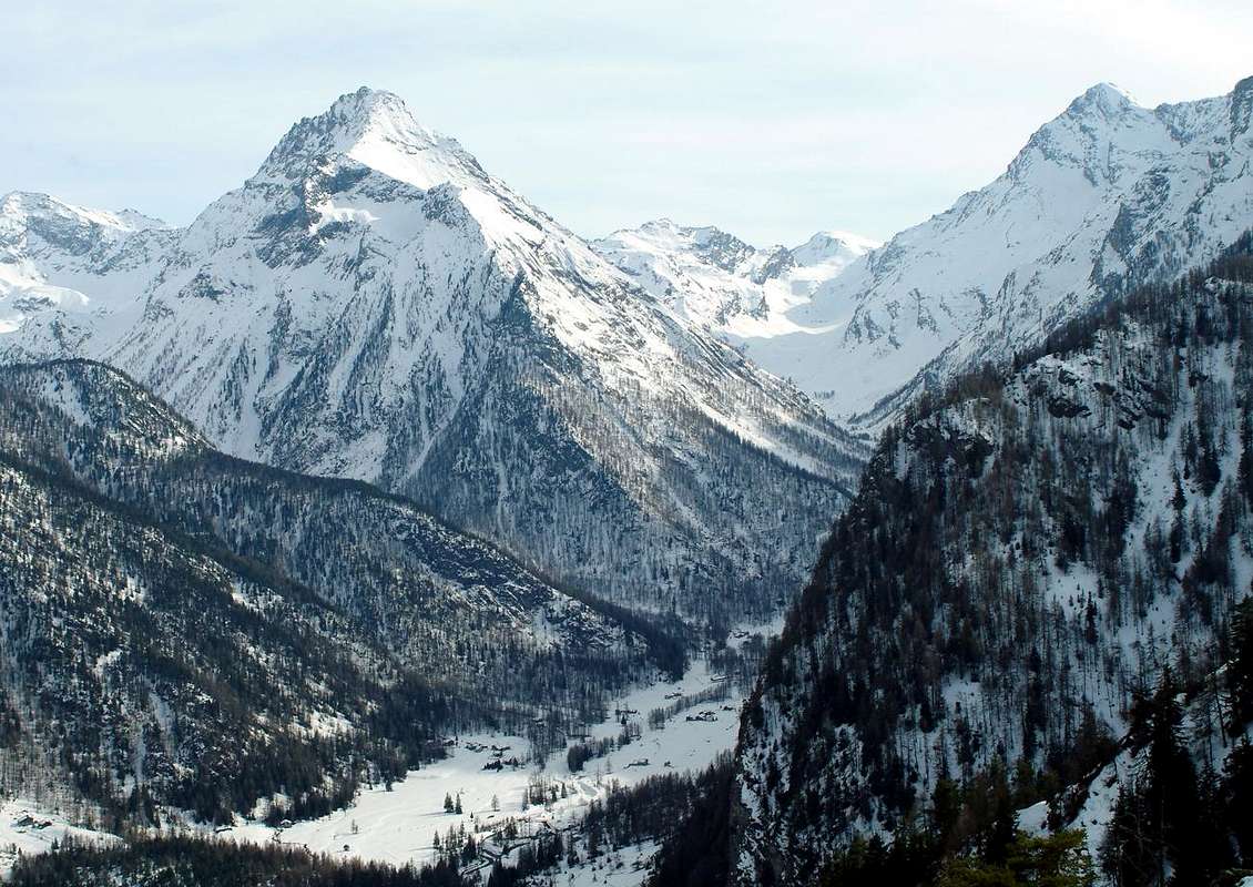
Ascending from Les Druges Alte towards Southeast, by emilius
![]()
Meyes Alpages just at the Western Slope of Touriasse, by emilius
![]()
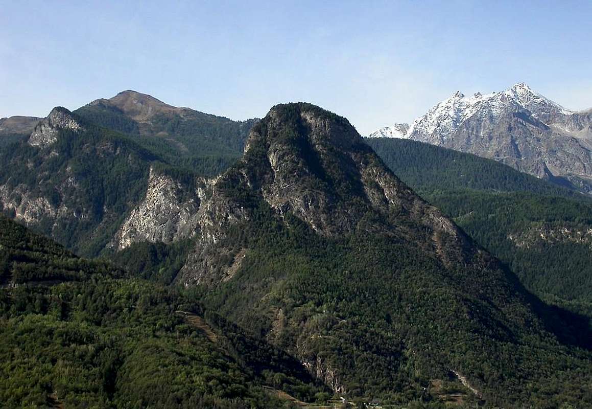
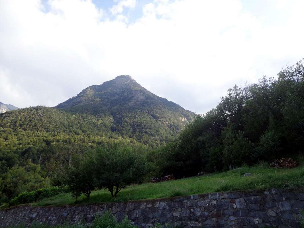
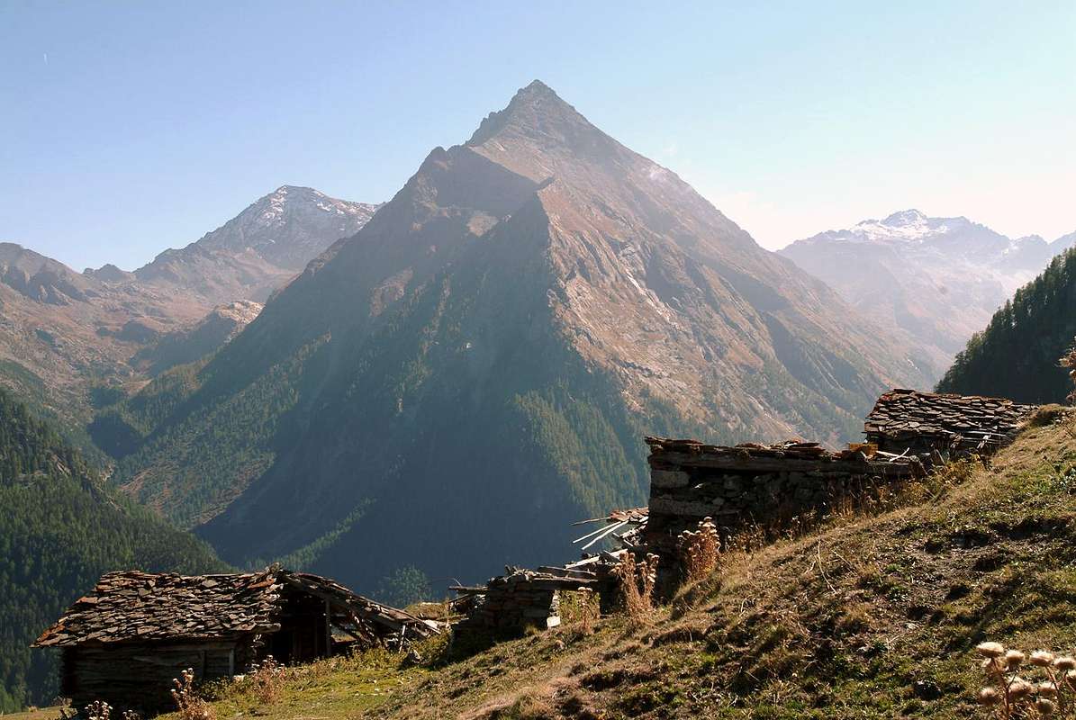
Left or South: Mont Corquet, La Torrasse & St. Julien, by SalVal
From the Municipal Road in Pieiller's Vallon to fork of Le Coteau, by Osw
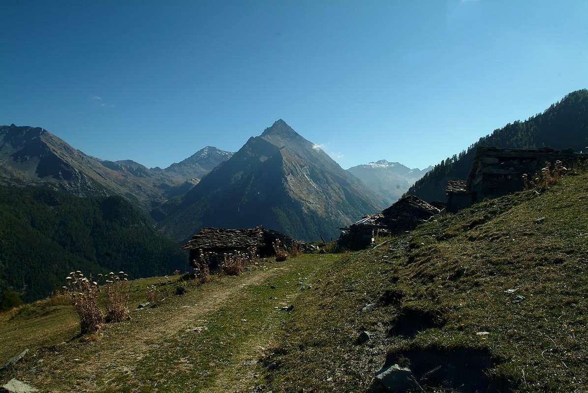
The Upper Alpage of Prapremier (2.011m), between Fénis/Saint Marcel Municipalities, by emilius
Continuiamo la ricerca di montagne sconosciute e raramente frequentate. Anche questa sicuramente risulta esserne una poco popolare ed ancora di meno visitata. Montagna, di non eccessiva altezza ma dalle forme nettamente evidenti, é collocata al termine della lunghissima cresta che, partendo dalla Punta Tersiva (3.515 m) arriva insino alla Valle Centrale del Fiume Dora Baltea, sopra la Cittadina di Fénis all'imbocco dell'omonima valle (famosissimo e splendido Castello Medioevale). Funge da spartiacque tra questa e l'attiguo (ad Ovest) Vallone di Saint Marcel; questo si sdoppia dopo il Mont Corquet (2.527 m): un ramo rivolto a Nord-nordest si rialza nella Torrasse per poi definitivamente scendere al Mont Saint Julien, mentre un secondo scende più verso Nord-nordovest fino al Mont Roux ed alle Miniere di Servette, nei pressi dei, da Est ad Ovest, Villaggi di Petit e Les Hautes Druges e delle Alpi Pouria e Vargney sulla strada poderale, adducente alla Riserva del Grand Avert del Marchese Turati. Tra questi due brevi spartiacque s'adagia il Vallone del Pieiller, diviso dal Comune di Saint Marcel dal Torrent La Morgnet(t)az; la parte ad Oriente di questi costituisce il vero e proprio Vallone del Pieiller che s'appoggia contro il Mont Saint Julien e si smorza nella parte terminale e boschiva contro il Mont La Torrasse (1.854 m), anche questo ben in vista dalla valle centrale. Infine le due parti si riuniscono in alto presso l'Alpe Prapremier (2.011 m), alla base del Corquet ove, poc'oltre, terminano i confini tra i due comuni. Il settore del Mont Saint Julien risulta quindi quello più ad Est-nordest, ove il monte si presenta con grande foresta ricoprentelo lateralmente fin quasi alla Cima, inframmezzato da ripide fasce rocciose con una grande parete sommitale che sprofonda fino alla Clavalitè. Dal lato Orientale anche il Mont de la Touriasse assume una dimensione più imponente con costoloni rocciosi, inserentisi frammisti ripidamente nella foresta e poi nel bosco, mentre a Settentrione, ovvero sul sottostante pianoro nei pressi di Plan des Meyes ed omonima alpe, scende ricoperto da fitte estese boschive poi declinanti sul Torrent de Bioley presso il Villaggetto La Morgnettaz ed all'interno del Valloncello del Pieiller alle spalle del Comune di Fènis.
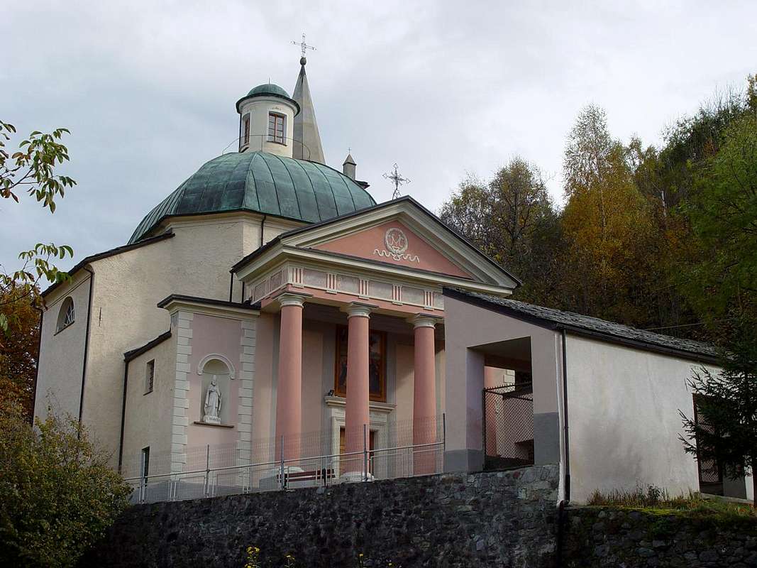
Short description Topographic As mentioned in the Overview, this mountain is located in the partition between the Walloons of Saint Marcel (West) and Fènis-Clavalité-High Comba Tersiva (East-southeast). More precisely, the long watershed that got out of Punta Tersiva (3.515m), divides at Punta del Tessonet (3.264m); this branch goes more to the Northwest, and after Gianni Vert and Laval Summits, reaches the Saint Marcel Hill or Coronas (2916m). In addition, this branching is split further by forming the Chain of Rouèses and the Group of Mount Emilius (3.559m), now already both on the Central Valley of Dora Baltea. A second branch proceeds from Tessonet decidedly towards the North, and after Lavòdilèc Hill (2.870m) gets up in the two Avert, Petit (2.946m), Grand (2.991m); themselves are divided by an unnamed hill on the Maps, but known by local visitors, due to the bluish color of the rocks and soil that cover it, as Col de Terre Bleue (2.820m). After the Grand Avert the crest form of the same name Col (2.832m), immediately followed by a crest that advances more and more jagged ridge called the Gran or Great-Crete and someone known as "Crest of the Devil" (2.908m; the highest. There an Inn with such a name just before Les Druges Petite ed Haute at the entrance of the Walloon of St. Marcel); this stands up with some gendarmes and three jumps to the next Punta of Plan Rué (2.877m). Two other carvings, the first of which is told by the Hunters of deer "Belfrond Collar" (2.598m), anticipate Col de Crotey (2.460m), net and deep carving before long, flat grassy ridge that reaches Mount Corquet (+ 2.530m). A final subdivision sends a short ridge to Mont Roux (2.280m) with the its Coppermines of Servette-Chuc, while on the opposite side of the partition with the Common Fénis leads to the Torasse or Mont-de-la-Touriasse (1.903m) end with the rocky-wooded promontory of Saint-Julien (1.377m), which houses on the Top the Shrine of St. Grat and includes "perched" on a high wall, which falls above the Vallon of the Fènis-Clavalité the famous Hermitage with the same name. This area, however, belongs to the Group of Monte Emilius (3.559m), which remains the highest mountain of this broad sector, limited to the West and to the Southeast by the course of Torrents Grand'Eyvia and Urtier (Cogne Valley), is the Northeast offshoot of the Gran Paradiso Group extending up to the Po Plain. More specifically, the group membership is that of Punta Tersiva (3.515m), from which descends towards the North "crest mother" that reaches the Punta del Tessonet where, as mentioned above, the ridges are separated definitively addressing Northwest to the Emilius and Range Rouèses and North to the Group of Gr. Avert ending on Mont Corquet with its appendanges.

Breve descrizione Topografica Come già detto in Overview, questa montagna é collocata nello spartiacque tra i Valloni di Saint Marcel (Ovest) e di Fénis-Clavalité-Alta Comba Tersiva (Est-sudest). Più precisamente sul lungo divisorio che, scendendo dalla Punta Tersiva (3.515 m), si divide alla Punta del Tessonet (3.264 m). Da questa un ramo procede maggiormente a Nordovest e, dopo le Punte Gianni Vert e di Laval, raggiunge il Colle di Saint Marcel o Coronas (2916 m). Oltre, questa ramificazione si sdoppia ulteriormente formando la Catena delle Rouèses ed il Gruppo dell'Emilius (3.559 m), di già ormai entrambi sulla Valle Centrale della Dora Baltea. Una seconda ramificazione procede dalla Punta del Tessonet decisamente verso Settentrione e, dopo il Colle di Lavòdilèc (2.870 m) si rialza nei due Avert, Petit (2.946 m) e Grand (2.991 m). Questi son separati da un colle innominato sulle Carte, ma conosciuto da parte dei frequentatori locali, causa il colore bluastro delle rocce e del terriccio che lo ricoprono, come Col di Terre Bleue (2.820 m). Dopo il Grand Avert, la cresta spartiacque forma l'omonimo Colle (2.832 m), subito seguito da una cresta che avanza sempre più frastagliata chiamata la Gran Cresta o Grande-Crete e da qualcuno conosciuta come "Cresta del Diavolo" (2.908 m; la massima elevazione. In loco esiste una Locanda con siffatto nome appena prima di Les Druges Petite ed Haute, all'ingresso del Vallone di St. Marcel). Questa si rialza con alcuni gendarmi e tre salti verso la successiva Punta di Plan Rué (2.877 m). Altri due colletti, il primo dei quali é conosciuto dai Cacciatori di camosci come "Colletto Belfrond" (2.598 m), anticipano il Col de Crotey (2.460 m), netto e profondo intaglio prima della lunga e piatta dorsale erbosa che raggiunge il Mont Corquet (+ 2.530 m). Un'ultima suddivisione invia una breve cresta al Mont Roux (2.280 m) con le sue Miniere di rame di Chuc-Servette, mentre sul lato opposto il divisorio con il Comune di Fénis conduce a La Torasse o Mont-de-la-Touriasse (1.903 m) per terminare con il promontorio roccioso-boschivo del Saint Julien (1.377 m), ospitante quasi sul colmo il Santuario di San Grato ed include "abbarbicato" su d'un'alta parete, precipitante sopra il Vallone della Clavalité, il famoso nonché omonimo Eremitaggio. Quest'area però appartiene al Gruppo del Monte Emilius (3.559 m), che rimane la montagna più elevata di tutto questo ampio settore che, limitato ad Ovest ed ad Sudest dal corso dei Torrenti Grand'Eyvia ed Urtier (Valle di Cogne), costituisce la propaggine Nordest del Gruppo del Gran Paradiso estendendosi fino alla Pianura Padana. Più specificamente il Gruppo d'appartenenza risulta quello della Tersiva (3.515 m), dalla quale scende verso Nord la "cresta madre" raggiungente la Punta del Tessonet da ove, come già detto, le creste si separano definitivamente indirizzandosi a Nordovest verso il Monte Emilius e la Catena delle Rouèses ed a Nord verso il Gruppo del Grand Avert-Mont Corquet.
First Ascents
- In the Summit: unknown.
- In Winter: unknown.
Getting There Road Itineraries from Fénis & by Saint Marcel
 |
From the Village of Fénis, accessible from Highway n° 26 crossing the bridge over the Dora Baltea Stream, just after the Country of Nus (output Motorways A7), arriving at the junction 539 meters, and immediately after the field of Football, leave the roundabout to the left on the same (large signals), and go up to the Chief Lieu. Following the signs in color marron "Saint Julien" and, still leaving the Municipal Road to the East to Barche Hamlet and towards Fénis-Clavalité Valley satisfy the signs for the "Vallon of Pieiller", a tarmac road dates back to the South, starting between the Villages of Le Perron (582m) and Pommier (614m), and through road bends that door, through the woods, to the small Village of Le Boit-du Chat (695m) and the subsequent of Champlan. After four more through the hairpin road nearby the Torrent Bioley and goes West towards the basin left its course, always with tight bends reaches The Pieiller-de-Sermaz (1.075m) and then Maison Longue (1.112m) and The Plany (1.174m) little Villages, with a last bend to the East toward the La Morgettaz Hamlet reach the junction, with small parking lot on the floor, for the little semi-abandoned Village of Le Coteau (1.234m). VARIOUS REMARKS
 |
The carriage, which then continues over and again crosses the Torrent de Bioley reaching the other side, with a wide circle first and then North-northwest to West-southwest, reach a fork just beyond the Village Champremier (1.383m), connecting to the Municipal Road leading up to Saint Marcel to the Les Druges thus combining the "viability" in the upper area between these two commons. Please note that the path is formed by a narrow road with many hairpin bends, for which reason it is good thing to pay attention. This Road Connection also allows power to vary the same trip, and after the climb to Saint Julien, such as going to Area Pic Nic Les Druges with the Various Opportunities:
a) - Stay with the same modest sum payment (fountain, benches and tables in wood, stone barbecue inside the dense forest; toilets just at the entrance);
b) - visit the Sites of the Mines of Copper and Iron Servette (from the nearby location of Furnace, now in ruins, the tops of which are accessed through marked trails and a General Map departure (Various entrances, Houses and the remains almost in ruins of the Miners of large Ropeways wood for the transport of Ore towards "Factory");
c) - from Les Druges High (1.567m) ascending with the route n° 14 starting at the fountain with adjoining gorgeous little "Rascard" wood and lift the near Chapel St. Bernard, from this, depending on your choice, you can continue up to the summer Alps of Fontanafreida (1.829m), Bren (1.961m; fountain) and finally the last of Prapremier or Praz-Premier (2.011m), right on the border with the Common Fénis, by this means crossing to the right (West) you can reach the Alp Corquet Dèsott (2.146m), now at the foot of Corquet (2.530m). The easy climb of this, via the North Slope and the Northeast Crest in the final, can be combined with that of Mont Touriasse or Torrasse in returning. Regarding the descent, in case of extension of the excursion to the Area of Druges, it is convenient from the junction of the road on the right Champremier abandon climbed and get off at Saint Marcel through the Regional Road, in such a way passing from the "Inn of the Hell" and subsewuent small Villages of Viplana, Ronc, Sazailland and Seissogne (1066m; beautiful wooden mill) you will reach the Village Plout with its very famous Sanctuary of 1640, but existing as a niche, since 1200, dedicated to "Notre Dame des Hermites" (968 m; beautiful "Via Crucis" outside on the arcade, which depicts the "Fifteen Mysteries of the Rosary" by Painter of Asti in 1854). From Plout also Plou continue towards the underlying Villages of Réan, Mezéin (793m, 300m before, turn right for Fénis), Jayer, Moulin and Saint Marcel (Castle Location Paquier; 609m), and finally, passing under the Motorway and crossing the bridge over the Dora Baltea near the ancient Foundry Copper (547m) you get to Highway N°26. Combining it with the ascent of Saint Julien from Fénis through Pieiller Walloon, is Fantastic Hiking Tour, scenic, cultural and quite instructive for boys.
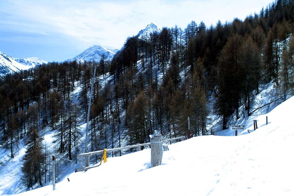
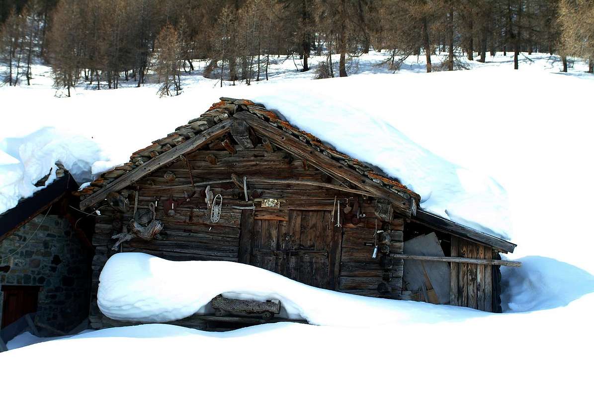
Alpage of Bren (1.961m), by emilius
Le Coteau ancient Village, by Osw
 |
Dal Paese di Fénis, raggiungibile dalla Strada Statale n°26 attraversando il ponte sulla Dora Baltea, subito dopo il Paese di Nus (uscita Autostrada A7), arrivando al bivio 539 metri; subito dopo il campo di Calcio, lasciare a sinistra la rotonda sulla medesima (ampie segnalazioni), e salire verso il Capoluogo. Seguendo i cartelli in color marron "Saint Julien" e, lasciando ancora ad Est la strada Comunale per la Frazione Barche e la Clavalité, assecondare le indicazioni per il "Vallone del Pieiller". Una bella ma non troppo larga strada in asfalto attraverso il bosco risale verso Mezzogiorno, partendo tra le Frazioni di Le Perron (582 m) e Pommier (614 m), e tramite stretti tornanti si porta, in mezzo al bosco, al piccolo Villaggio di Le-Boit du Chat (695 m) ed al successivo di Champlan. Dopo altri quattro tornanti attraversa il Torrent Bioley portandosi ad Ovest verso il suo corso idrografico sinistro; sempre con tornantini raggiunge i piccoli insediamenti di Le Pieiller-de-Sermaz (1.075 m) e successivamente Maison Longue (1.112 m) e Le Plany (1.174 m); con un ultimo tornante ad Est verso La Morgettaz raggiunge il bivio, con ridotto parcheggio in terra, per il Villaggetto semiabbandonato di Le Coteau (1.234 m). ANNOTAZIONI VARIE
 |
La carrozzabile, poi continuante oltre e attraversante nuovamente il Torrent de Bioley portandosi sull'altra sponda, con un largo giro dapprima a Nord-nordovest e quindi ad Ovest-sudovest, raggiunge un bivio appena oltre il Villaggio di Champremier (1.383 m), collegandosi alla Strada Comunale risalente da Saint Marcel verso la Conca delle Druges Basse ed Alte, unendo così la "viabilità" nella zona collinare più elevata tra questi due comuni. Da segnalare che il percorso é formato da una strada alquanto ristretta e formata da molti tornanti a gomito, per il qual motivo é cosa buona prestar molta attenzione. Questa Strada di Collegamento permette, inoltre, di poter variar la gita e, volendo, dopo la salita al Mont Saint Julien, ad esempio salire All'Area Pic Nic di Les Druges, quasi all'ingresso del Vallone di St. Marcel e della Riserva del Grand Avert, con Varie Possibilità:
a) - sostare alla medesima con modica cifra di pagamento (fontana, panche e tavoli in legno, barbecue in pietra tra la fitta foresta; servizi igienici appena all'ingresso);
b) - visitare i Siti delle Miniere di Rame e Ferro di Servette (dalla vicina Località di Fornace, ormai in rovina, alle parti superiori alle quali s'accede tramite sentieri segnalati ed una Mappa Generale alla partenza (Vari imbocchi, Case dei Minatori nonché resti ormai in rovina delle grandi Teleferiche in legno per il trasporto del Minerale verso la "Fabbrica");
c) - da Les Druges Alte (1.567 m) salire con il sentiero n° 14 partendo alla fontana con attiguo splendido e piccolo "Rascard" in legno e risalita alla vicina Cappelletta di San Bernardo; da questa, a secondo della vostra scelta, potete continuare fin agli Alpeggi di Fontanafreida (1.829 m), Bren (1.961 m) ed infine all'ultimo di Prapremier o Praz-Premier (2.011 m), proprio al confine col Comune di Fénis; da questo tramite traversata a destra (Ovest) si può raggiungere l'Alpe Corquet Dèsott (2.146 m), ormai ai piedi del Mont Corquet (2.530m). La facile salita di questo, tramite il Versante Nord e la Cresta Nordest nel finale, può essere combinata al ritorno con quella del Mont Touriasse. Per quanto concerne la discesa, in caso di prolungamento della gita insino l'Area delle Druges, conviene dal bivio di Champremier abbandonare sulla destra la strada percorsa in salita e discendere in Saint Marcel con la Strada Regionale; in siffatta maniera passando dalla "Locanda del Diavolo ed i Villaggetti di Viplana, Ronc, Sazailland e Seissogne (1.066m; bel mulino in legno) si raggiunge il Villaggio di Plout con il suo famosissimo Santuario del 1640, ma esistente, come nicchia, già dal 1200, dedicato a "Notre Dame des Hermites" (968 m; splendida "Via Crucis" all'esterno nel porticato, che raffigura i "Quindici Misteri del Rosario" ad opera di Pittore Astigiano nel 1854). Da Plout o Plou continuare per i sottostanti Villaggi di Réan, Mezéin (793 m; 300 metri prima, bivio a destra per Fénis), Jayer, Moulin e Saint Marcel (Castello in Località Paquier; 609 m); infine, passando al di sotto dell'Autostrada ed attraversando il ponte sulla Dora Baltea nei pressi dell'antica Fonderia del Rame (547 m) s'arriva alla Strada Statale n° 26. Abbinandola alla salita del Saint Julien da Fénis pel Vallone del Pieiller, risulta Fantastica Gita Escursionistica, paesaggistica, culturale, nonché alquanto istruttiva per i ragazzi.
The renowned Plout Sanctuary (968m), by emilius
 |
Approach & Route
La Torrasse or Mont La Tourriasse(1.985m) from Les Druges Alte, through the dirt road concomitant with the path n° 14, just at the Chapel of St. Bernard, towards Fontanafredda isolated Alpage (1.829m); from Fontaine Froide three possibilities:
1) - leaving the same, from the following alternative 1.885 meters turn briefly before Northeast with short dirt road, after through the path n° 9 towards Plan des Meyes (1.887m) and Meyes (1.893m) Pastures. From this last, pathless, to the altitude 1.901 meters and, through the forest with sparce rocks, in North-northeast to the Summit (E/F; 1h'15/1h'30 from Les Druges Alte small Village or by the subsequent nearby Picnic Area).
Fontanafredda Alpage, below Mont Corquet, by emilius
 |
La Torrasse o Mont La Tourriasse (1.985 m) da Les Druges Alte, attraverso la strada sterrata concomitante con il sentiero n° 14, che parte subito dietro il fontanile del "Rascard" squadrato nonchè appresso alla Cappellina di San Bernardo, verso l'isolata Alpe di Fontanafredda (1.829m). Da Fontaine Froide sussistono tre possibilità:
1) - lasciando la stessa e dalla successiva ramificazione a quota 1.885 metri girare brevemente prima verso Nordest, con breve strada sterrata, e subito dopo per mezzo del sentiero n° 9 in direzione delle Alpi di Plan des Meyes (1.887 m) e Meyes (1.893 m). Da quest'ultima, senza sentieri, verso la quota 1.901 metri e, attraverso la foresta con roccette sparse di nessuna difficoltà, donde a Nord-nordest alla Sommità (E/F; 1h'15/1h'30 dal Villaggio di Les Druges Alte oppure dalla viciniora Area Pic Nic di Les Druges).
Going towards Bren Alp, at the foot of Mont Corquet, by emilius
 |
Also 2) - from Fontanafreide Pasture continue up to the preceding alternative reaching Bren Alp (1.965m; last still used for the high mountain pasture and with beautiful fountain in front); a short descent amongst the wide prairies with the small path n° 9C lead to Meye Pasture and previous route.
3) - Even continuing up to the last Prapremier Alp (2.010m; semi ruined and abandoned) and with traverse throuhg the hemicircular trail n° 9B connecting with the route from La Rossa Tramouail (Fénis Valley). Beautiful excursion by snowshes or skis with various diversified departures, as above described; in this case, we recommend the tour starting downhill from Prapremier old Alp.
Prapremier Alpage, between Fénis/Saint Marcel, by emilius
 |
Anche 2) - dall'Alpeggio di Fontanafreide si può continuare fino al bivio precedente raggiungendo l'Alpe di Bren (1.965 m; ancora utilizzata per il pascolo d'alta montagna e con una bella fontana nel piazzale in terra battuta proprio davanti); una breve discesa tra le le estese praterie con il sentierino n° 9C conduce a Meye, donde al percorso precedente.
3) - Oppure continuando fino all'ultima Alpe di Prapremier (2.010 m, ormai semi distrutta ed abbandonata) e con attraversata tramite il sentiero semicircolare n° 9B ci si collega con il percorso dall'Alpe o Tramouail de La Rossa (con provenienza dal fondovalle del Vallone di Fénis-Clavalitè). Bell'escursione in racchette da neve oppure di Sci-Alpinismo con varie diversificate partenze, come sopra descritto; in questo caso, si consiglia la visita a partire in discesa dalla vecchia di Alpe di Prapremier.
![]()
From the Summit above Fénis-Clavalité Tableland, by emilius
Difficulty & Equipment
This route can be considered E or EE (Experts Hikers) in winter.L'itinerario è classificato E oppure EE in inverno.
Hiking gear with snowshoes in winter.
Da Escursionismo od in inverno con racchette da neve.
Mountain Condition
- Meteo: you can find all the needed informations at the official site of the Valle d'Aosta Region:
- Valle d'Aosta Meteo
Important Information
- REGIONE AUTONOMA VALLE D'AOSTA the official site.
- FONDAZIONE MONTAGNA SICURA Villa Cameron, località Villard de la Palud n° 1 Courmayeur (AO) Tel: 39 0165 897602 - Fax: 39 0165 897647.
- SOCIETA' DELLE GUIDE DELLA VALPELLINE Etroubles-Strada Nazionale, n° 13 - Tel +39 0165 78559 - Valpelline-Loc Capoluogo, n° 1 - Tel +39 0165 713502 (AO) Italia.
- A.I.NE.VA. (Associazione Interregionale Neve e Valanghe).
Useful numbers
- Protezione Civile Valdostana località Aeroporto n° 7/A Saint Christophe (Ao) Tel. 0165-238222.
- Bollettino Valanghe Tel. 0165-776300.
- Bollettino Meteo Tel. 0165-44113.
- Unità Operativa di Soccorso Sanitario Tel. 118.