
-
 2371 Hits
-
 78.27% Score
-
 9 Votes
|
|
Trailhead |
|---|---|
|
|
46.43228°N / 14.26012°E |
|
|
Spring, Summer, Fall, Winter |
|
|
3471 ft / 1058 m |
Overview
Ljubelj is a transit place. Before building the Karawanks tunnel (near Jesenice) the road over Ljubelj was the main connection between Austria and Slovenia over the Karawanks, so connecting the Central Europe with the Adriatic. The road is still very popular, so you can reach the trailheads described here from both sides, The Austrian and the Slovenian.
Ljubelj Pass refers to the ex road pass over the main streak of Karawanks. Its altitude is 1367 m. Then through the mountain ridge a tunnel was dug and customs offices were placed on it northern (Austrian) side and southern (Slovenian) side. With the Ljubelj toponym now often the southern portal of the tunnel is meant. Strictly speaking, that's Santa Anna locality. And further southwards there's the Podljubelj locality - the village, located "under the Ljubelj".
The trailheads described here are around the southern tunnel entry.
Short History
A trade route over Ljubelj must had existed even in prehistoric times, as the influence of Celtic Noricum Kingdom on the southern lands is well proven. In antiquity the roman towns of Virunum and Emona were connected also via the Ljubelj. Lively trade continued in the middle ages, after 1560 the new road became the main connection. In the valley around Podljubelj there were a few mines of quick silver, copper and manganese. The tunnel was built during the WW2 (by the prisonners of Nazi concentration camp) and officially put in use in 1963.
Geography
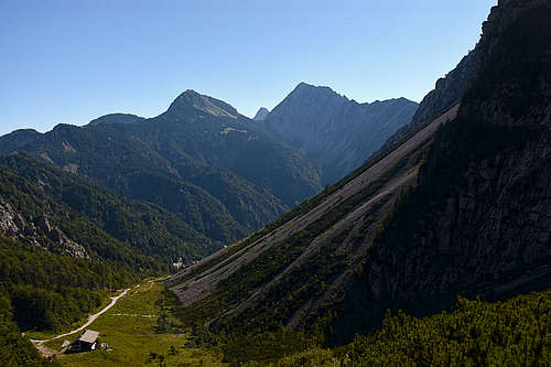
The valley of Mošenik creek (also the valley of Santa Anna) is approaching the main ridge of Karawanks from the south. The valley end is nothing spectacular. There, the Karawanks ridge descends on the altitude of 1367 m, also the nearby summits to the E and W don't reach 2000 m. A little too the south, there's a higher, parallel ridge of Begunjščica and Košuta, but it's cut by the Mošenik valley. So, our trail head is quite a closed place with many summits all around. After the valley reaches the main ridge of Karawanks, it branches into two side valleys. Towards the W rises the valley on the popular Zelenica high meadow. Towards the E rises a similar valley on the much less frequented Hajnž saddle, lying on the state border.
What To Do There?
The area is first of all a hiking and tour skiing destination. Hikes can be done by many marked and unmarked trails. For skiing is very popular the valley towards Zelenica meadow, especially nice because the ordinary ski resort which was once there, has been for many years already a history. The ski tours from that valley on Begunjščica are much more demanding, but very popular as well. The Ljubelj valley is also a trail head for rock climbers, but some climbs worth mentioning are only in Veliki vrh (Košuta). Begunjščica is very popular for winter base climbs. Finally, the old road on the ex Ljubelj road pass is in winter often arranged as a very popular sledge piste.
Getting There
The reason for popularity of the Ljubelj trail heads is the good road, reaching it from both states. By that road also a regular bus connection goes (Ljubljana - Klagenfurt).
The Interactive Map
Explore the below interactive map to find all the features mentioned in the text further below! You'll find trailheads (parkings), summits, some normal ascent routes, pictures and other interesing features to visit. Easier (up to the Swiss T3) and well beaten trails are depicted as solid lines, weak and more dem anding trails and ferratas are dotted. Unmarked trails are brown. All hiking routes difficultiy grades are on the Swiss Hiking Scale. Many routes are missing - for more details see the relevant SP mountain pages and routes pages! Use also other trails, shown on the base map - the big majority of them is drawn correctly.
To zoom in/out, you can also use mouse wheel and the mini map on the corner right-below
See full screen
Routes and Summits
Koča na Zelenici (hut), 1536 m
- Ljubelj (1058 m) - Zelenica, T2/T1, 1 h 30 min.
This hut can itself be the trail head for many summit tours, see them listed below.
Koča na Ljubelju (hut), 1360 m
- Ljubelj (1058 m) - Koča na Ljubelju, T1, 55 min. (Also a sledge piste in winter.)
Korošica hut, 1554 m
- Ljubelj (910 m) - Korošica (S route), T2, 1 h 45 min.
- Ljubelj (1058 m) - Korošica (N route), T2, 1 h 45 min.
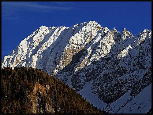
Begunjščica, 2060 m
Veliki vrh (Begunjščica), its highest summit, can be ascended from many sides. Also all routes from the Ljubelj side are not drawn on the above map. There are many north face routes and it can also be hiked up from the Zelenica hut, via the Roblek hut. More direct routes are:
- Ljubelj - Prevala (via Born's trail) - Veliki vrh (Begunjščica). T3, 3 h 30 min.
- Descent option: By Šentanski palz (ravine), maximum 1 h 30 min.
- Ljubelj - Šentanski plaz (ravine) - Veliki vrh (Begunjščica). Demanding ski tour, 3 h for ascent.
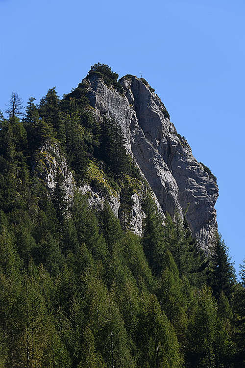
Vrh Ljubeljščice, 1705 m
- Koča na Zelenici - Vrh Ljubeljščice, T2, 25 min.
Spodnji Plot, 1682 m
- Koča na Zelenici - Spodnji Plot (normal route), T3, 20 min.
- Koča na Zelenici - Spodnji Plot (ferrata), D/E, 30 min. Also an easy ferrata variant exists.
Na Možeh, 1784 m
- Koča na Zelenici - Na Možeh, UIAA II, 1 h.
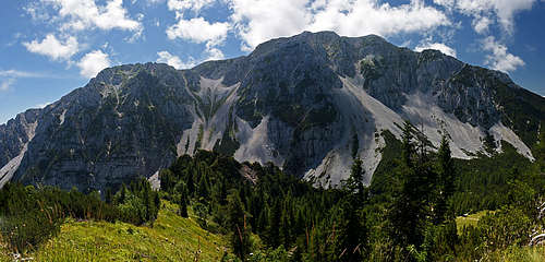
Vrtača / Wertatscha, 2180 m
- Koča na Zelenici - Vrtača (normal route), T3, 2 h.
See many other routes (summer, winter, ski) descriptions on the page of Vrtača!
Zelenjak, 2024 m
- Koča na Zelenici - Zelenjak (normal route), UIAA II, 2 h.
Palec / Selenitza, 2026 m
- Koča na Zelenici - Palec (normal route), T5 (UIAA I), 1 h 50 min.
Polna peč, 1503 m
- Ljubelj - Koča na Ljubelju - Polna peč, T2, 1 h 15 min.
From Polna peč along the main ridge of Karawanks (towards the W-SW) also a trail goes. It's not marked, on some places eroded and quite demanding. It brings you on the summit of Ljubeljščica, which is a little gain, because that summit can be easily ascended from Zelenica.
Veliki vrh (Košuta) / Hochturm, 2088 m
- Ljubelj (910 m) - Hajnž saddle - Veliki vrh (Košuta), T4 (ferrata), 3 h.
Košutica / Loibler Baba, 1968 m
- Ljubelj (910 m) - Hajnž saddle - Košutica, T4, 3 h.
- Ljubelj (910 m) - Korošica meadow - Košutica, T3, 3 h (1 h 15 min from Korošica).
- Ljubelj - ex Ljubelj road pass - Grunt - Košutica, T3, 3 h 20 min.
Normal Ski Tours
- Vrh Ljubeljščice - Zelenica - Ljubelj. Easy, nice and popular ski tour.
- Žleb notch (below Palec) - Zelenica - Ljubelj. Easy, nice and popular ski tour.
- Vrtača - Zelenica - Ljubelj. Very steep/demanding, but nice ski tour.
- Veliki vrh (Begunjščica) - Šentanski plaz (ravine) - Ljubelj. Very steep/demanding, but nice ski tour.
- Hajnž saddle - Ljubelj. Medium demanding, nice ski tour.
- Košutica W ridge - Korošica meadow - Ljubelj. Medium demanding, nice ski tour.
Alpinistic Skiing
Many tours in the N face of Begunjščica and a few ravines in the E face of Vrtača.
Official Mountain Huts
Koča na Zelenici, 1536 m.