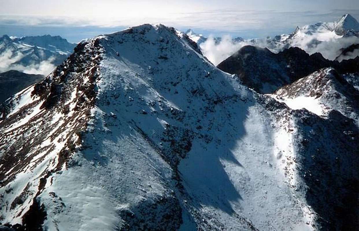
But to give some hint of color to this lonely mountain one must say that when they reached the first in September 1898, the famous Mountaineer-Writer Agostino Ferrari with his Cogne Mountain Carrier not "saw" not even, even passing over or near, they were so committed to rise the West Ridge of Leppe then cross the entire Chain of Roises or Rouèses at the Salé or of Brissogne Pass. A great undertaking worthy of the best mountaineering exploration of a
, unfortunately no longer repeatable. We, too, with the friends Marco Cossard said "Crevassino" and "Peppino" Lamazzi, which we reached after 75 years (I think that we were the seconds!) June 29th, 1973, in the "Day of Fire" of the St. Peter and Paul at Emilius we got "accidentally" being certainly not this the goal: in fact, we carried out the great crossing, starting from Les Druges High in the Valley of Saint Marcel (Idea of Marco, a true mountain mule and camel desert and lover of codest Marathons, such as the long stroncar mates!), we saw the eponymous hill climb, climb over the two Summits of Laval, the Punta Gianni Vert up to Collar Tessonet, renounce Punta Tersiva, return back, the same via, to cross Mont Vallonet and below the hill, climb the Punta di Leppe, descend his Northwest Side of the collar and the Tip Lussert or Quote
(then unnamed), get off his South Wall to the Lower Lake Lussert, go back to that Middle and the Upper, cross the Col des Laures entering the homonymous walloon, crossing under the East Wall of the Eastern Summit of Tips Red Emilius reaching the Col d'Arbolle and entering the fourth walloon of the day, go back to Three Capuchins Pass use it to direct up to the Emilius; but the dark (we did not have batteries) and, perhaps even more, the effort stopped us in the middle ridge and descended to camp "rich" for only one blanket at Lake Gelato. So neglected that in the book
, 1978 even remembered to include the descent through the great rocky couloir of his South Wall; indeed signaled as yet to climb and unexplored. I just wanted to forget the drudgery and the thrilling downhill on rocky ribs covered with grass and with the constant fear of falling rocks, so that you descended more with the head facing upstream and not downstream, fearful of the event. Then until July of 1988, I forgot this adventure and I went to explore this ridge, strarting from Laures Hill, just to vary between the routes of the Emilius Group; was a revelation to: it was long but fun and so I started to become familiar with the Lussert, almost always wandering lonely, because they have all the snobbish and prefer Leppe or Lakes Lussert and the Col des Laures, perhaps because view from under a little bit of fear it inspires ...
Ma per dar qualche nota di colore a questa montagna solitaria si deve dire che quando la raggiunsero per primi nel Settembre 1898 il famoso Agostino Ferrari col suo Portatore di Montagna di Cogne B. Glarey non la "videro" neppure passandole sopra od accanto, tant'erano impegnati a salire la Cresta Ovest della Punta di Leppe per poi attraversare tutta la Catena delle Roises o Rouèses fino al Col di Salé o di Brissogne. Una bell'impresa degna del migliore alpinismo d'esplorazione di un'
Epoca d'Oro, purtroppo non più ripetibile. Anche noi, con Marco Cossard detto "Crevassino" e "Peppino" Lamazzi, che la raggiungemmo 75 anni dopo (penso proprio che siam stati i secondi!) il 29 Giugno del 1973 nel "Giorno dei Fuochi" di San Pietro e Paolo all'Emilius ci arrivammo "per sbaglio" non essendo certamente questa la meta: effettuammo infatti la grande traversata, partendo da Les Druges Alte nel Vallone di Saint Marcel (Idea di Marco, vero e proprio mulo di montagna e cammello del deserto nonché amante di codeste Maratone, tali da stroncar alla lunga i compagni!), che ci vide salir all'omonimo colle, scavalcare le due Punte di Laval, la Punta Gianni Vert insino al Colletto Tessonet, rinunciare alla Punta Tersiva, ritornare all'indietro, stessa via, per attraversare al Mont Vallonet ed al sottostante colle, risalire la Punta di Leppe, discenderne il suo Versante Nordovest al Colletto ed alla Punta di Lussert o Quota
3221 metri (allora innominata), calare nella sua Parete Sud verso il Lago Inferiore di Lussert, risalire a quello Medio ed a quello Superiore, superare il Colle des Laures entrando nell'omonimo vallone, attraversare sotto la Parete Est della Punta Orientale delle Punte Rosse dell'Emilius raggiungendo il Colle d'Arbolle ed entrando nel quarto vallone della giornata, risalire al Passo dei Tre Cappuccini indirizzandoci all'Emilius; ma il buio (non avevam pile) e, forse ancora di più, la fatica ci fermarono a metà cresta e scendemmo a bivaccare "ricchi" d'una sola coperta presso il Lago Gelato. Talmente trascurata che nel libro
"Guida del Monte Emilius", 1978 neppur ricordai d' inserire la discesa tramite il gran canale della sua Parete Sud; anzi la segnalai come ancora da salire ed inesplorata. Volevo proprio dimenticare quella sfacchinata e quella discesa da brivido su costoloni rocciosi ricoperti d'erba e con la continua paura di scariche di sassi, tanto che scendevi più con la testa rivolta a monte che non verso valle, timorosi dell'evento. Poi fino al Luglio del 1988 dimenticai sta'avventura e questa cresta che andai ad esplorare partendo dal Col des Laures, tanto per variar tra gli itinerari del Gruppo dell'Emilius; fu un a rivelazione: era lunga ma divertente e così iniziai a prendere confidenza con la Lussert gironzolandola da solo in lungo e largo, quasi sempre vagabondando solitario, perché hanno tutti la puzza sotto il naso e preferiscono la Leppe oppure i Laghi di Lussert ed il Colle des Laures. Forse anche perché buttando uno sguardo dal sotto un pochettin di timor l'incute...
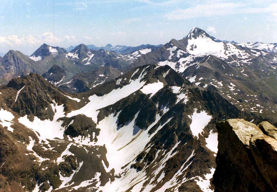
Con vedute in basso dall'Emilius e dalla Leppe
![]()
Any suggestions and recommendations
![]()
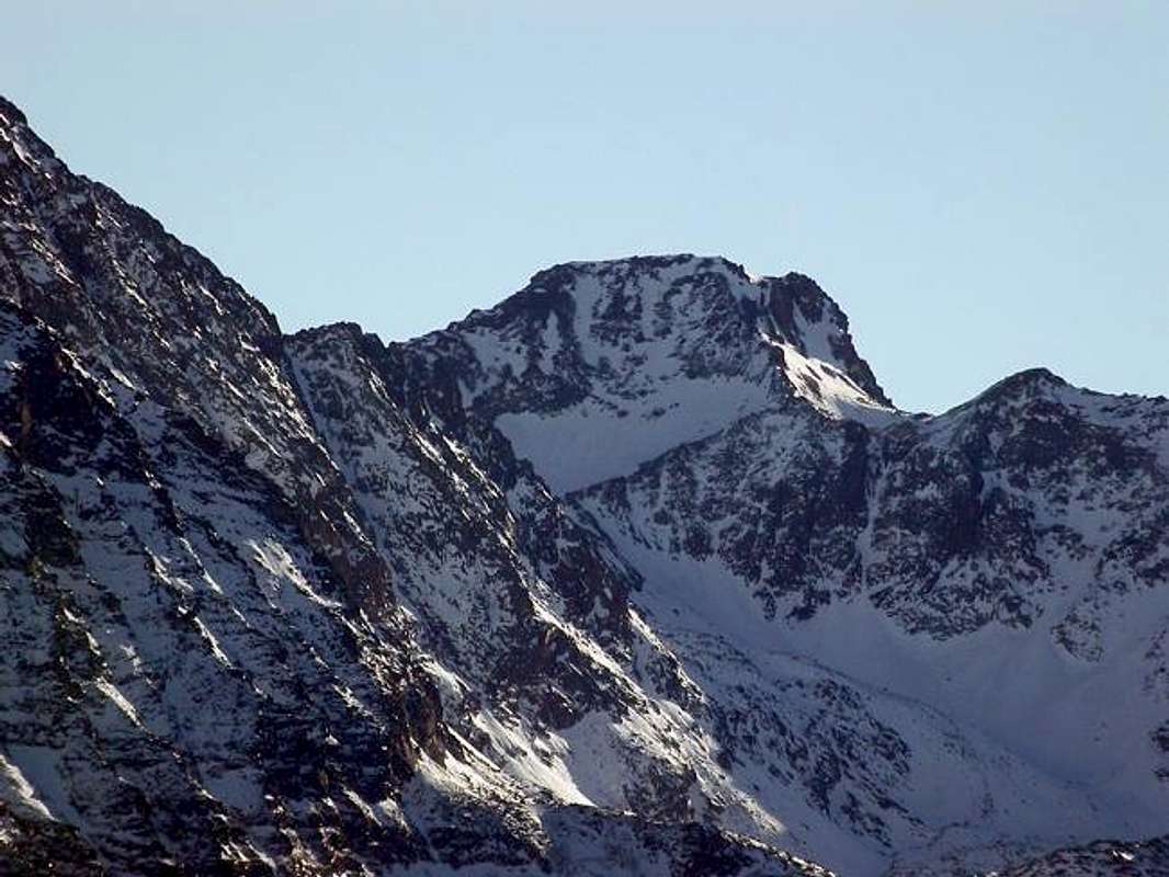
We want to give some indication of the slope suggesting routes safer and more spectacular, as are held mainly on the ridges; at the same time we list some recommendation, which is never too much. The ascent of this mountain can occur through two walloons or to Grauson, branch of Lussert, and the opposite Les Laures that can become three using one of Saint Marcel Eastward through a longer route departing from Les Hautes Druges to Mulac, Grande Chaux Hunting Houses. In the latter case requires a descent from the Top of the Leppe
(3305/6m), or a short descent from the homonym Hill
(3105m) with subsequent crossing in the Southwest at the base of the North Slope of the same:
1)- from the South departing from Gimillan
(1787m) easily reach the Leppe Summit through South-southeast Crest with two different possibilities:
a)- from Tsesère Alp moving more to the West and reaching the Vallonet Pass;
b)- passing further East towards the Lakes of the Frogs, Corona and the Saint Marcel Hill
(2913m). In any case, this side is preferable to avoid the direct ascent to the South side of the Hill Lusssert by rocky couloir or the adjacent Southern Wall, since both steep and exposed to falling of stones.
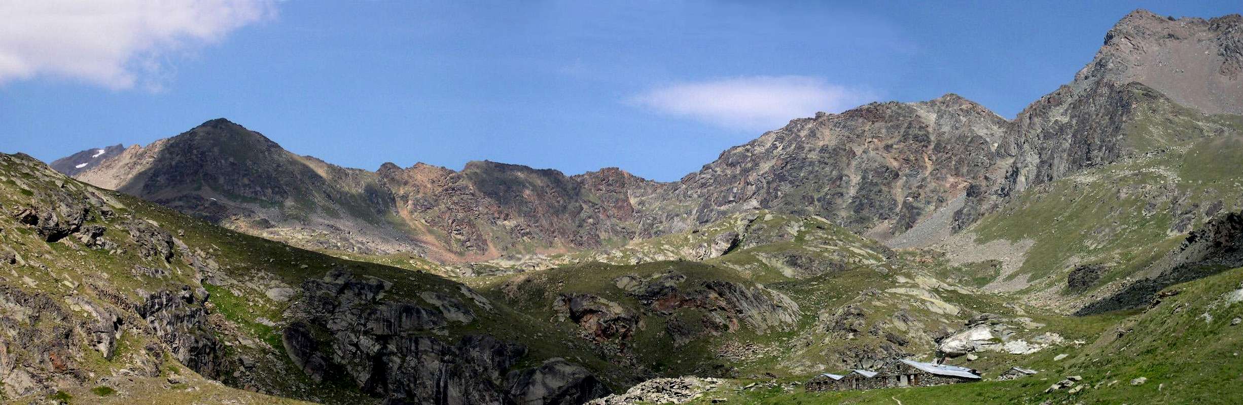
2)- From North departing from Grand-Brissogne Municipality, Fraction Primaz
(894m), go to Rifugio Ernesto Menabreaz
(2546m) at Lower Lake Laures; from this and continue to the Long Lake
(2630m), reached a crossroads:
c)- divert to the East towards the small Walloon of Leppe up almost to the summit; reached
about 100 metres from the hill to the right, reaching the large terrace or Lussert Collar
(3181m) and short top. This route is almost always safe and easy path.
d)- From the fork to continue toward the Southwest Col des Laures but not reach it; instead climb the ridge, as they did in September 1898, and go all the same to the East with an easy, safe and scenic journey. In doing so we will have fun making likeably an
"historic" via. Are to avoid the climbs through the rocky North ribs or by the snowy gullies, because dangerously exposed to falls.
3)-: from the Northeast departing from Saint Marcel Municipality to the Hamlet Les Druges High
(about 1600 metres) going up the whole walloon up to the Great Chaux Hunting House
(2365m); and from this
e)- go up to the Leppe Hill through the "Little Vallone" and, after a short descent, renewing with the way Les Laures. Otherwise, continue to the South through the "Great Vallone
f)- reach the Col Vallonet or go further South with the "Vallon Fenêtre"
g)- reach the Corona Hill or of Saint Marcel. In the latter two cases you end up with the itineraries that climbs from Gimillan; all these routes are simple but longer. In any case, all the approaches are long and require a high degree of training and early morning departures, given the length of the indentation. In my opinion, the routes are preferable from Les Laures and, among them, the one in the small Walloon of Leppe.
![]()
Vogliamo dar qualche indicazione per la salita suggerendo gli itinerari più sicuri e spettacolari, poiché svolgentisi prevalentemente sulle creste; allo stesso tempo elenchiamo qualche raccomandazione, cosa che non é mai di troppo. L'ascensione di questa montagna può avvenire tramite due valloni ovvero quello di Grauson-Lussert e l'opposto delle Laures, che posson diventare tre utilizzando quello viciniore di Saint Marcel più ad Oriente tramite un percorso più lungo con partenza dal Villaggetto di Les Druges Alte; in questo ultimo caso necessita d'una discesa dall'alto dalla Leppe, oppure una breve dall'omonimo colle (3105 m) con susseguente traversata a Sudovest alla base del Versante Nord:
1)-: da Sud con partenza da Gimillan (1787 m) raggiungere facilmente la Punta di Leppe tramite la Cresta Sud-sudest con due diverse possibilità: a)- passando più ad Ovest e raggiungendo il Col Vallonet dall'Alpe Tesesère; oppure b)- transitando più ad Est verso i Laghi delle Rane, Corona ed il Colle di Saint Marcel. In ogni caso da questo lato é preferibile evitare la salita diretta per il versante Sud del Colle di Lusssert od il canalone roccioso ed attiguo della Parete Sud, poiché entrambi ripidi ed esposti a cadute di pietre.
2)-: da Nord con partenza da Grand-Brissogne Frazione Primaz (894 m) salire al Rifugio Ernesto Menabreaz (2546 m) presso il Lago Inferiore delle Laures; da questo continuare verso il Lago Lungo e, giunti ad un bivio: c)- deviare ad Est verso il Valloncello di Leppe fino quasi al suo sommo; giunti a circa 100 metri dal colle attraversare a destra raggiungendo il largo terrazzo del Colletto Lussert ed in breve in vetta. Questo itinerario quasi mai percorso é sicuro e facile. d)- Dal bivio continuare a Sudovest verso il Colle des Laures ma non raggiungerlo; salire invece in cresta, come fecero nel 1898, e percorrere tutta la medesima verso Est con una facile, sicura e panoramica traversata. Così facendo ci si divertirà ad effettuare un percorso "storico". Sono da evitarsi le salite tramite le costole rocciose Settentrionali, perché pericolosamente esposte a caduta di sassi.
3)-: da Nordest con partenza da Saint Marcel Frazione Les Druges Alte (1600 m circa) salendo l'intero vallone fino a Grande Chaux (2365 m); da questa e)- salire al Colle di Leppe tramite il Piccolo Vallone e, dopo breve discesa, riallacciarsi allo via da Les Laures. Altrimenti continuare più a Sud tramite il Gran Vallone e f)- raggiungere il Col Vallonet oppure ancora più a Sud con il Vallon Fenêtre e g)- pervenire al Col Corona o di Saint Marcel. In questi due ultimi si finisce con la via da Gimillan; tutti questi itinerari son semplici ma più lunghi. In ogni caso tutti gli avvicinamenti risultano estenuanti e richiedono un buon grado di allenamento e partenze di primo mattino, vista la lunghezza dei rientri.
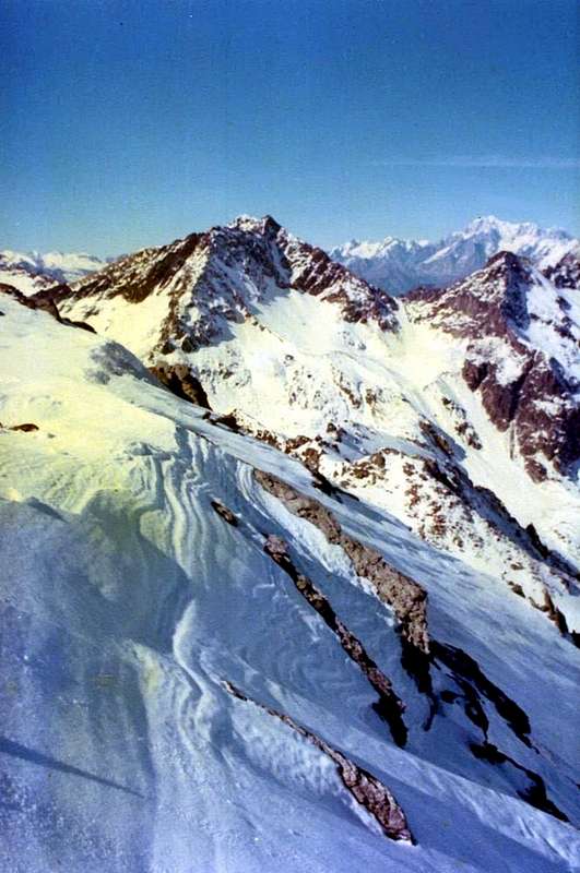
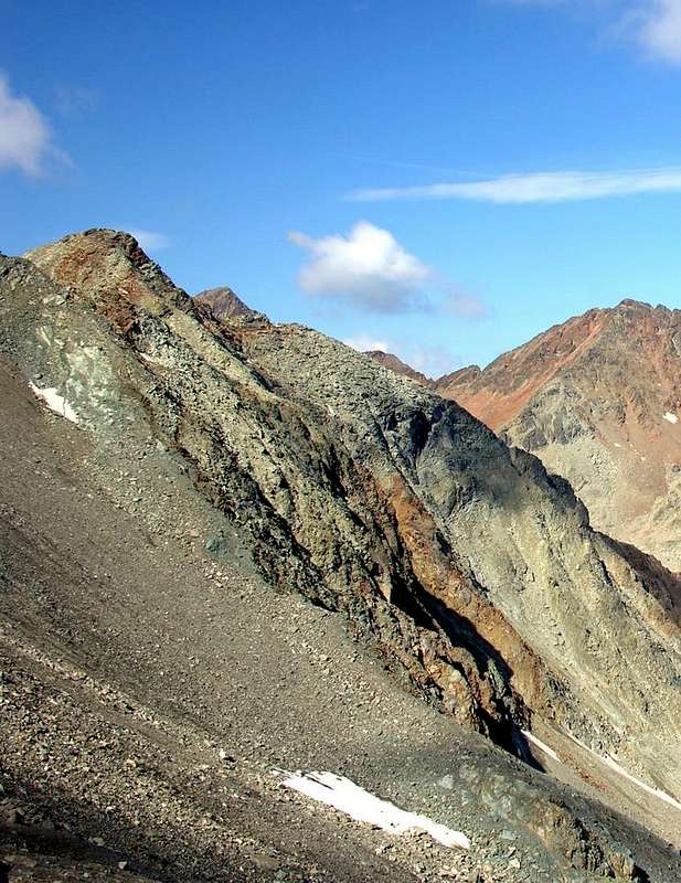
![]() Il Versante Nord dall'alto del Col di Leppe o Nordest
Il Versante Nord dall'alto del Col di Leppe o Nordest
Comments
No comments posted yet.