
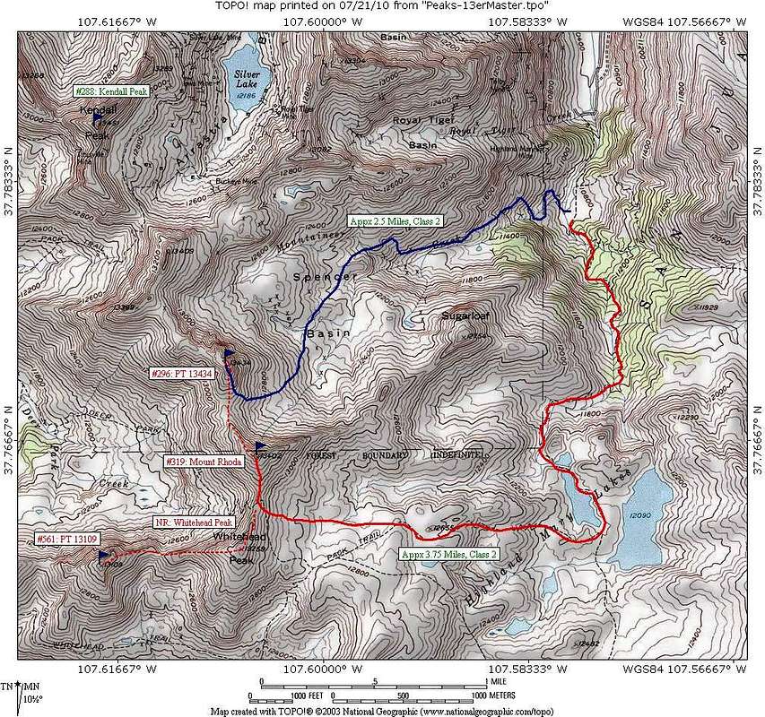
Map for Rhoda and PT 13434 Routes
This map shows the approximate routes that provide access to Mt Rhoda and PT 13434. The roads in the area are not correctly indicated on the map (hence why the trailhead seems to "float". The road to the trailhead goes to appx 10,800' beyond which an old mining road switchbacks up to a higher trailhead (4WD) and parking for about 2 vehicles before it turns into a hiking trail to Spencer Basin. Also note the trail from Highland Mary Lakes to Whitehead-Rhoda saddle was no existent when we were there. It is cross country on tundra at this point. Hope this helps!


