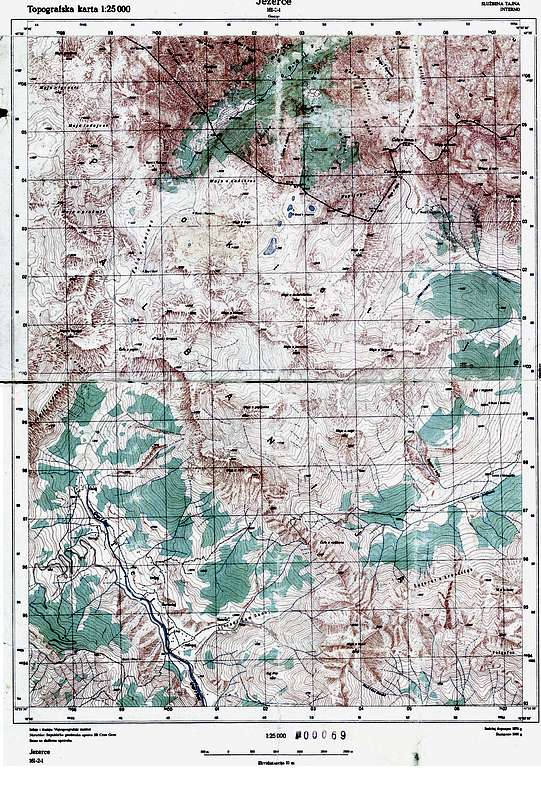
An old Yugoslavian military map 1:25000. Shows the area from Ropojana valley in the north to Thethi in the south, Maja Shkurts group in the west to Maja Rosit in the east.
It's been in action a few times and is a bit worn out, so the scan is not of high quality :)


