Toggle navigation
Mountains
Routes
Images
Trip Reports
Forum
What's New
People
Areas & Ranges
Articles
Trailheads
Canyons
Huts & Campgrounds
Albums
Logistical Centers
Fact Sheets
Lists
Custom Objects
Gear
Plans & Partners
WELCOME TO SUMMITPOST
SIGN IN
REGISTER
Maps of South America
Additional Parents
Image
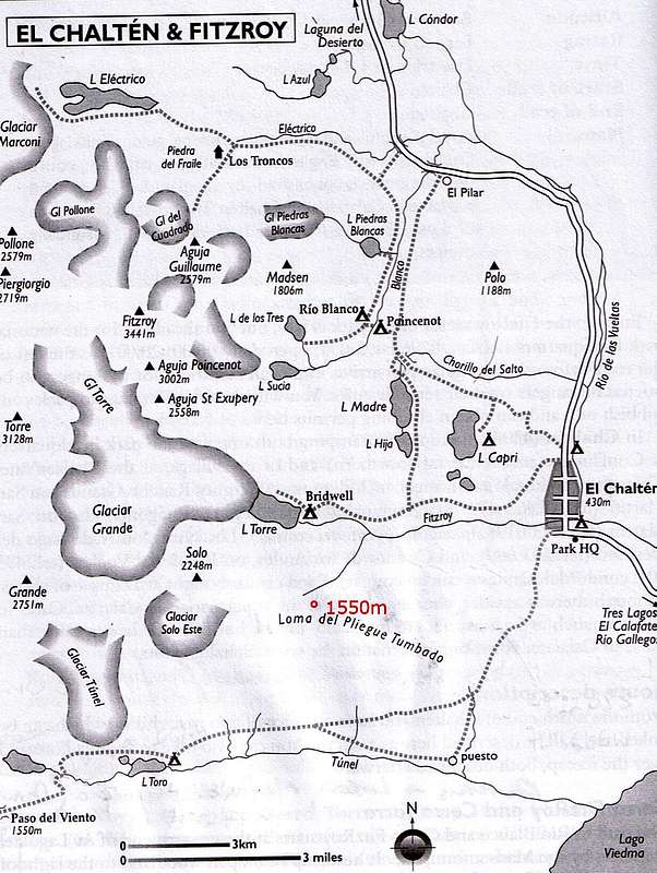
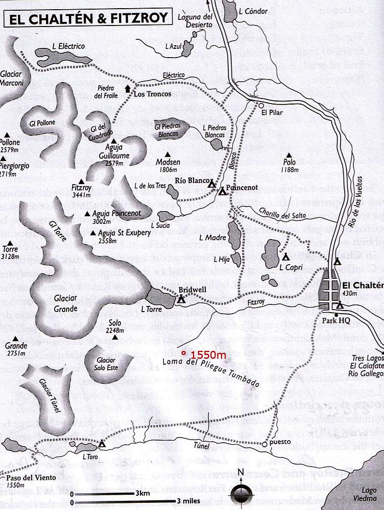
Map of El Chalten
View High-Resolution Image
Map of El Chalten
The summit of Loma del Pliengue Tumbado is indicated in red, at 1550m.
Aguja Poincenot
and
Aguja St-Exupery
are directly South of Fitz Roy. Extract from the Bradt guidebook :
Chile & Argentina : Backpacking & Hiking Guide
« PREV
NEXT »
Andino
on
Sep 24, 2007 11:12 am
Comments & voting
Other parents
Lat/Lon:
49.35331°S / 72.98149°W
Image Type(s):
Informational
Image ID:
340254
15342 Hits
76.66
% Score
7
Votes
Log in to vote
Comments
No comments posted yet.
to post!
Don't have an account?
Maps of South America
(Album)
« PREV
Viewing
#9 of 30
GALLERY
NEXT »
Andino's Image Gallery
« PREV
Viewing
#399 of 597
GALLERY
NEXT »
Aguja Poincenot (Patagonia)
(Mountain/Rock)
Loading....
Agujas St-Exupery, Raphael & de la S (Patagonia)
(Mountain/Rock)
Loading....
Loma del Pliegue Tumbado (Patagonia)
(Mountain/Rock)
Loading....
×
You need to login in order to vote!
User Name
Password
Remember me
Forgot your password?
Log me out when I close my browser.
Keep me logged in all the time.
sign in as a user
Don't have an account?
Register now for FREE
Rating available
Suggested routes for you
People who climb the same things as you
Comments Available
Create Albums
Register Here


