Map of way to get from...

Map of way to get from...

Map of way to get from parking area to the obscure trail up to Gunn Peak. Follow the red line. Edited 8/21/06 for correct distances. For additional instruction, see this satellite image where A is the parking point and B is the end of the old spur where the trail cuts off into the woods.
Klenke
on May 7, 2004 4:03 pm
Image ID: 52254

Comments

Post a Comment
Viewing: 1-1 of 1
gimpilator

gimpilator - Sep 22, 2012 12:11 pm - Voted 10/10
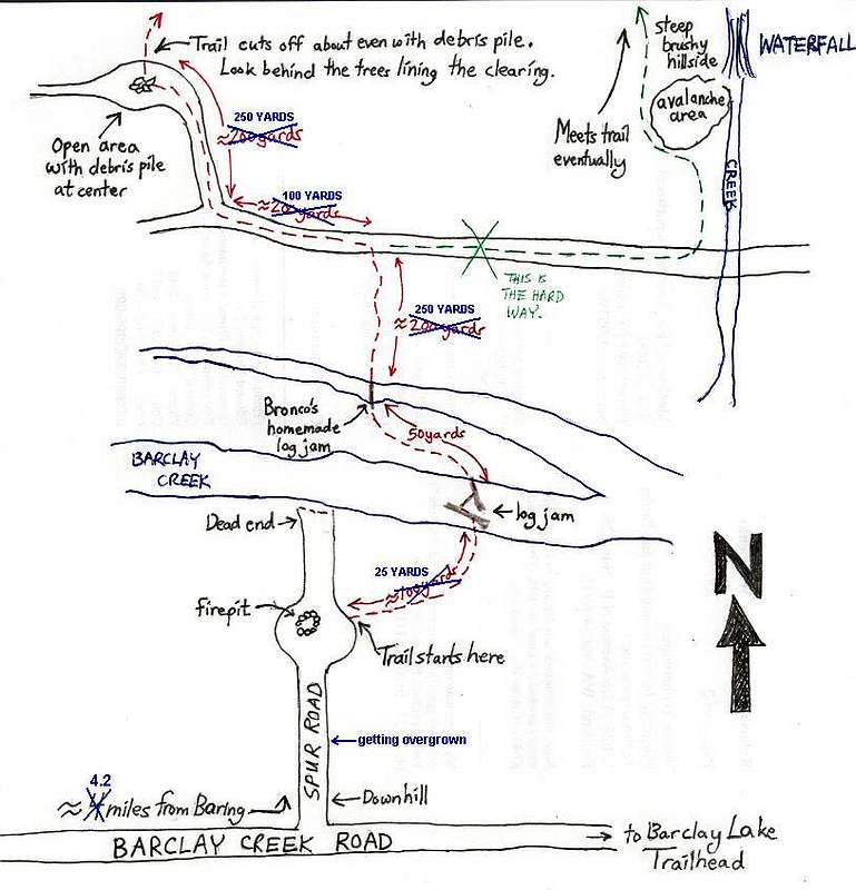
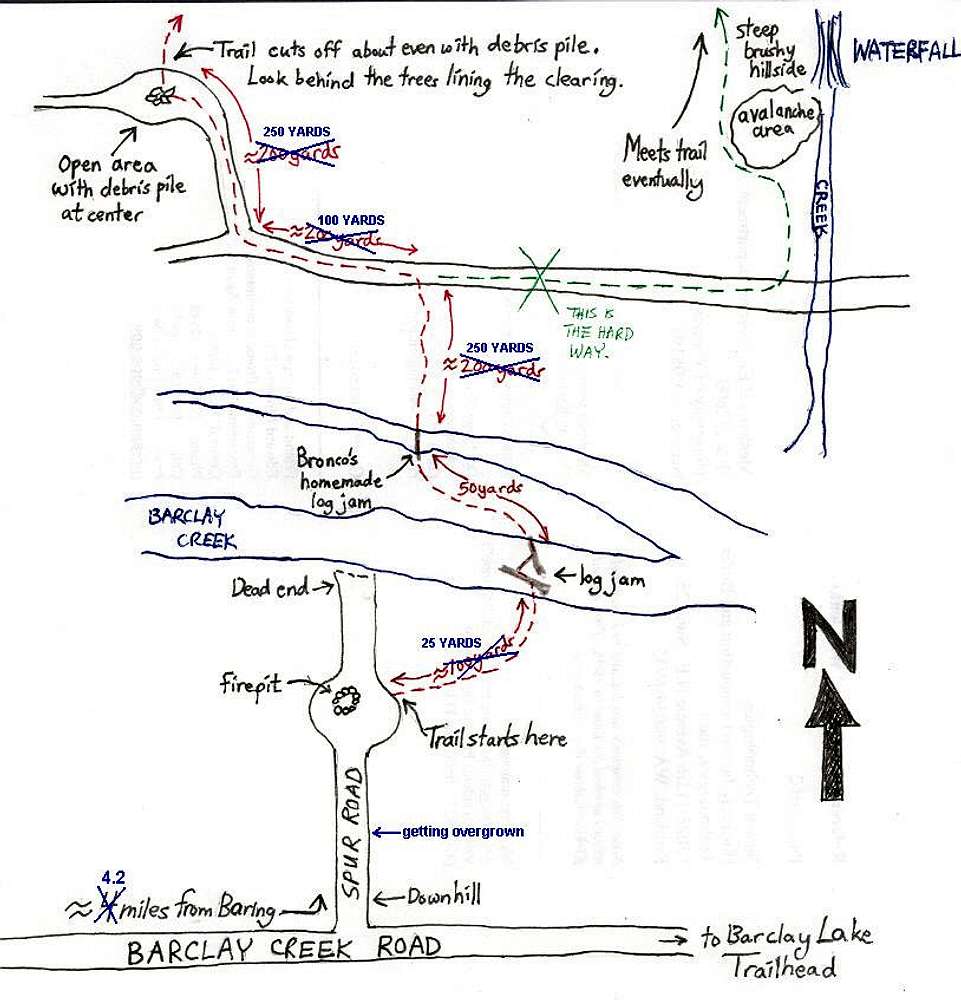
Very Helpful

Gunn turned out to be easier to navigate than all the complex directions would imply, but I did print this page out and I was glad to have it.

Viewing: 1-1 of 1