


Comments
No comments posted yet.
|
|
Trip Report |
|---|---|
|
|
33.73464°S / 69.86977°W |
|
|
Download GPX » View Route on Map |
|
|
Feb 1, 2022 |
|
|
Mountaineering |
|
|
Summer |
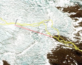
Marmolejo.The Argentinian route. |
||||||||||||||||||||||||||||||||||||||||||||||||||||||||||||||||||||||||||||||||
|
Marmolejo is the southernmost summit of the Andes with the altitude higher than 6000m and it’s the southernmost 6000-summit in the world. The most popular, easy and safe route goes from the west side, Chile. The Argentinian route from the east is rarely visited and more complicated. This is a description of the route from the Argentinian side. All data is in metric system. All left and right directions and sides are specified by the orographic rule.
Our initial plan was to reach this range from Maipo volcano by the autonomous foot trek. According to the rules of the national reserve Maipo, you must return to the same point where you enter. We didn't know that before. So we refused to visit Maipo and changed our plan to a round track through the old military base Refugio Real de la Cruz (refuge). The modified plan was the following:
The main problem of this plan was an extremely high weight per person on the way through the Portillo pass. It was the result of a forced distortion of the plan. We needed to transport food and gas supplies for two parts of the mountain trek (Marmolejo and Tupungato).
If I had known of this problem before I would have arranged a carriage by horse. But we didn't have enough time to plan and organize it on the go. It was possible to access 4000m altitude by the 4WD car to the end of the route to the east side of the Portillo pass, so we did it. We reached the 4000m point by car around 4 p.m. and set up our camp directly in the road flat. The night was sleepless and it was a predictable result of spending the first night at this altitude without acclimatization. Next day we started to go with a payload over 40kg per man up to the Portillo pass saddle and then we had a long descent to the refuge. We saw a lot of local people who did their lightweight foot and horse treks to the refuge without physical suffering as we did. “Strong in spirit, weak in mind” - was our sarcastic slogan ;-)
As an additional trouble I got sick and had a fever over 39C by the end of the day, which was the result of rejecting acclimatization and perhaps a viral infection. My great cough frightened my friends during the trek.
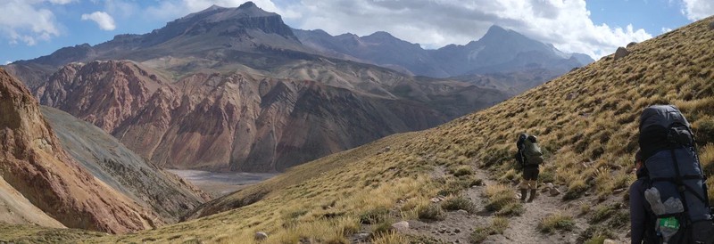
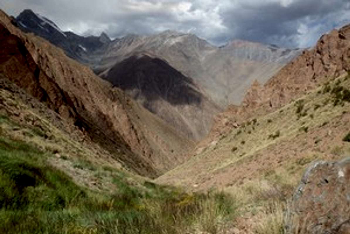
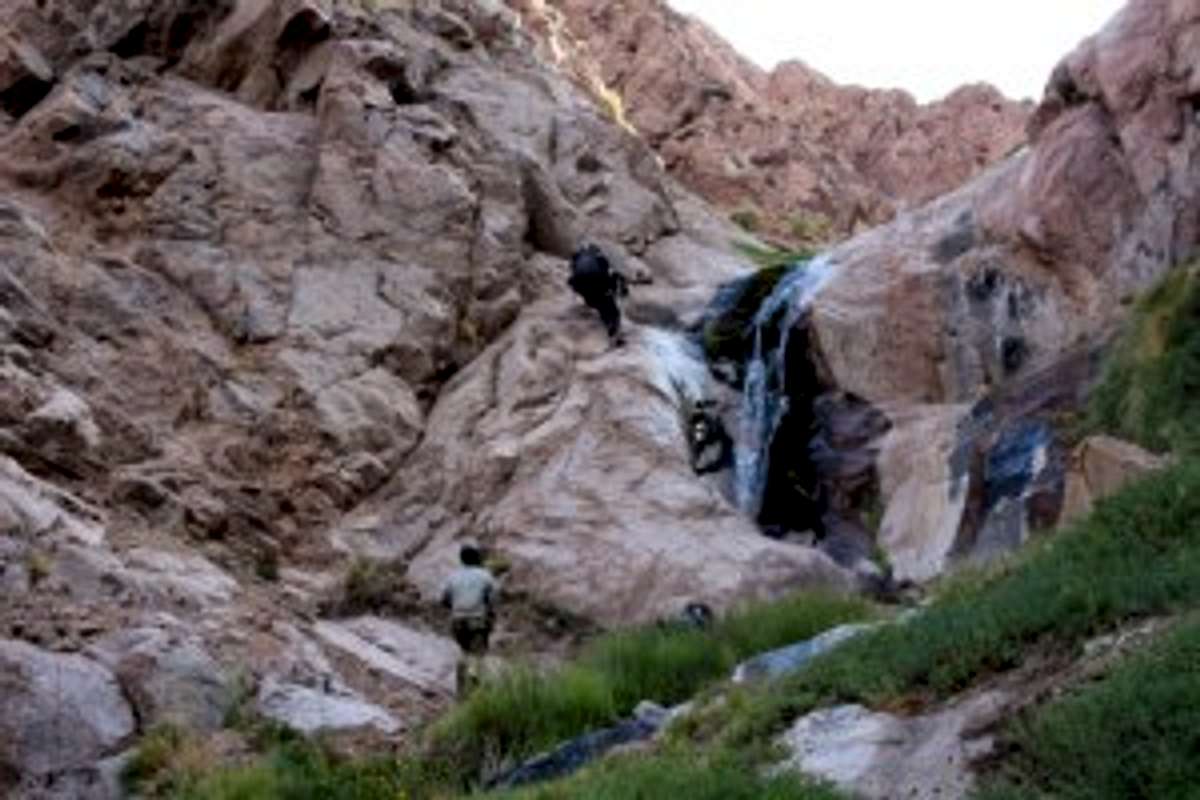
In the late afternoon we reached the refuge concrete building and camped at the tent site. There were mountain rangers (maybe they were army border guards) who helped us to leave a bag with food and gasoline. They were very friendly and helpful. Next day we stayed at the same place, because I had a high fever with cough. Because our first part plan didn’t contain extra spare days it was necessary to start the following day. There was no time to wait for recovering. On the third day in the morning we left rangers a note describing our plan with the dates and started to climb Passo del Contrabandista. I found Passo del Contrabandista in an old USSR military map and checked its location by satellite image, as I was working on this route. Passo del Contrabandista is located in the side ridge, not in the main Andes ridge. So it's a strange name because this mountain pass didn't help smuggling between Chile and Argentina in the past. We crossed the Tunuyan river early in the morning without any trouble and went by the trail towards Paso Piuquenes (that was not our goal) about 2.5 km. Paso Piuquenes is famous for having been passed by Charles Darwin in March 1835!
From this point we left the trail and started to rise up the Marmolejo river. That day we climbed from 2800m to 3300m and reached a glacial terrace beside the final ascending of the canyon in the evening. The next morning (day 4) the weather was bad and the temperature was very low. It was snowing and the famous wind of the Andes was quite strong. We walked several kilometers and set up a tent at 3800m in an uncomfortable place with no water.
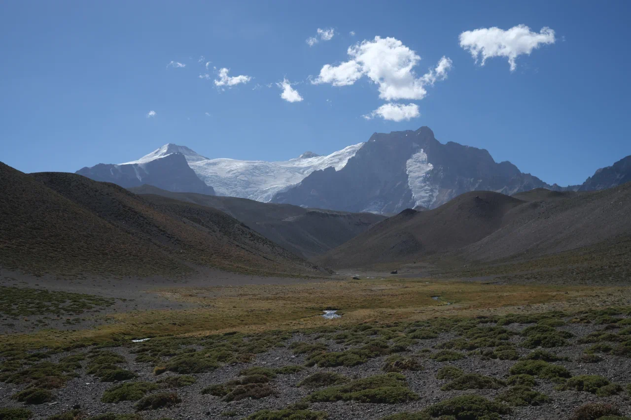
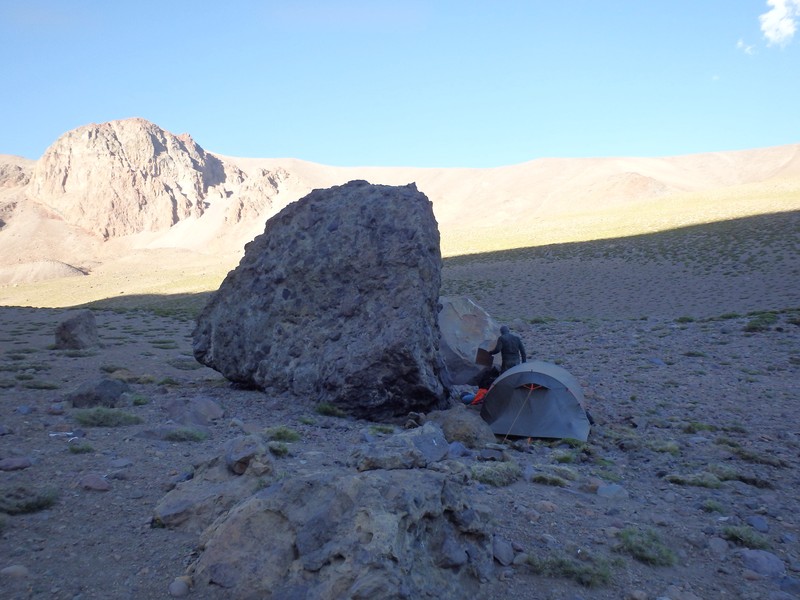
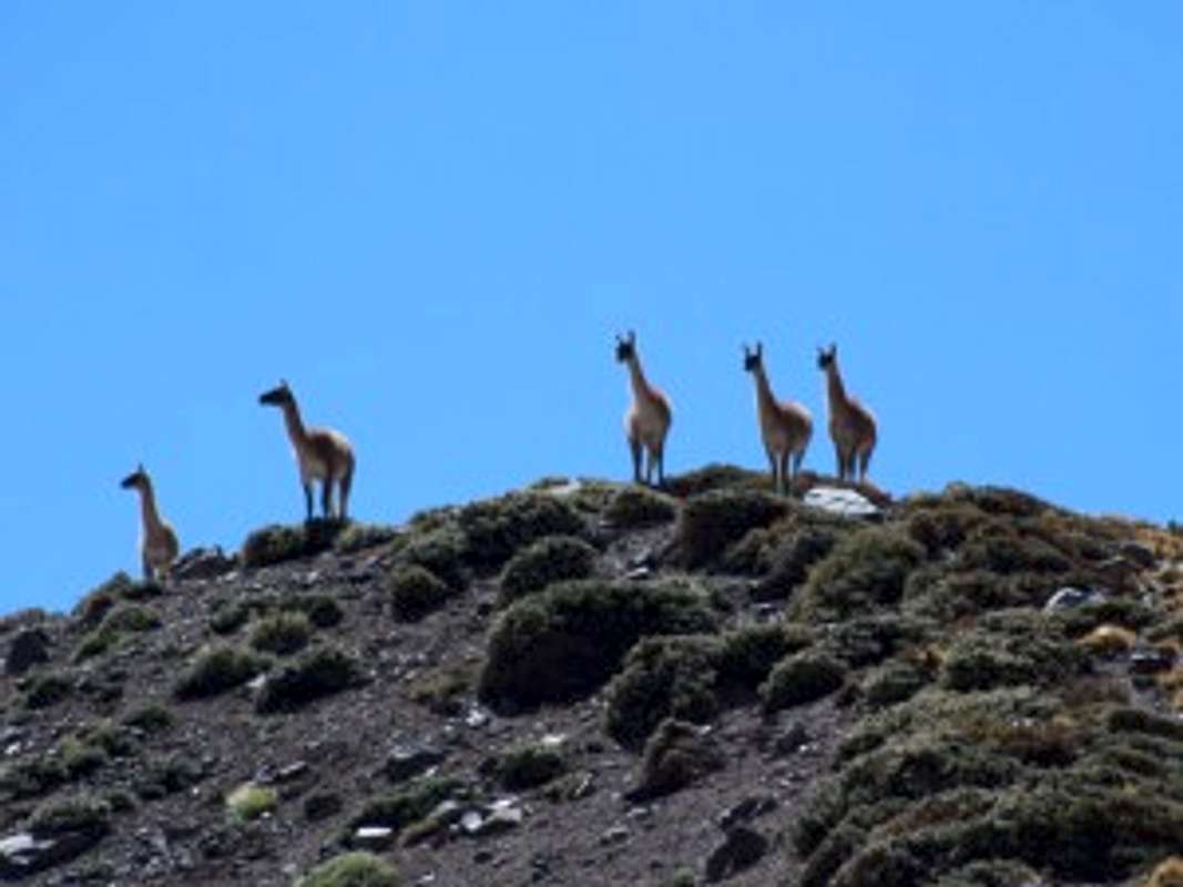
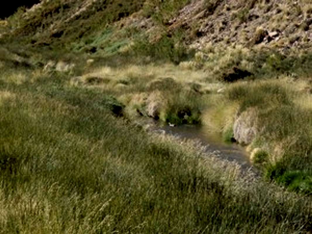
Next day (5) we climbed Passo del Contrabandista and crossed it over to the south side. The route from the north side passed through the bed of the stream. Sometimes the river bed looked like an easy canyon. Before the final climb to the saddle of the pass there was a small flat place near the remaining part of the disappearing glacier. It's a good place for camping at 4550m, but we only had lunch there. Going down the south side was easy. There were a few guanaco trails that were usually very helpful and suitable for human walking. Apart from the strong wind, the weather was good and we went down to the south side of the pass and crossed the south glacier to the right side. After the short rest we went for the additional 5 km and reached a 3700m camp point in the valley with grass and a clean transparent river.
It was a good place for a green, comfortable camping. We hid the tent from the wind behind a huge stone.
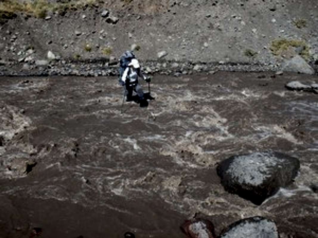
Next day (6) we crossed over a local ridge towards Marmolejo and crossed another parallel valley with a black dirty river. It was a bit difficult to cross it in the middle of the day because of the high water level. We had lunch near this river, using dirty water ((. And all the second part of the day there was no water and it was impossible to make a camp. Forced to search for water we went the extra 10 km and reached a place with water only near the low-lying branch of the east Marmolejo glacier. I t was a very tough day because we were forced to exceed our daily target distance by more than 50%. The main cause of this hard walking day was my error in determining the presence of water on a satellite image. There was only a dry stream bed. Andes require you to always think about water if you are not a Guanaco!
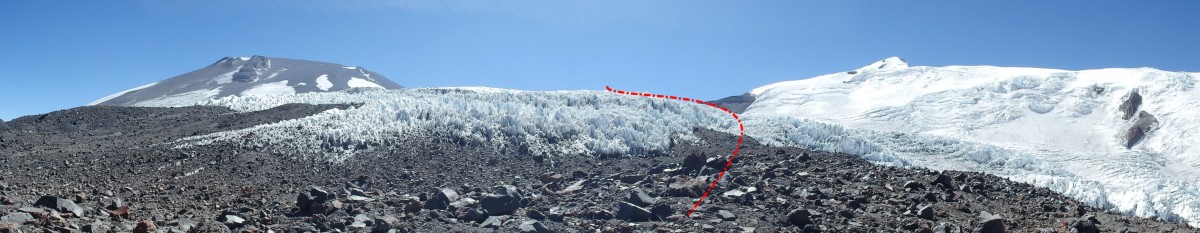
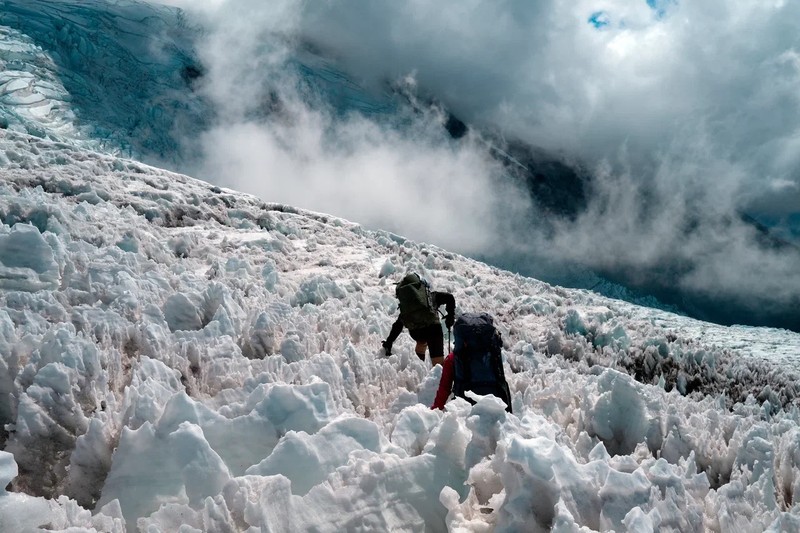
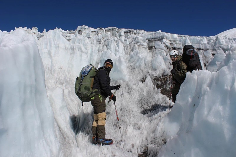
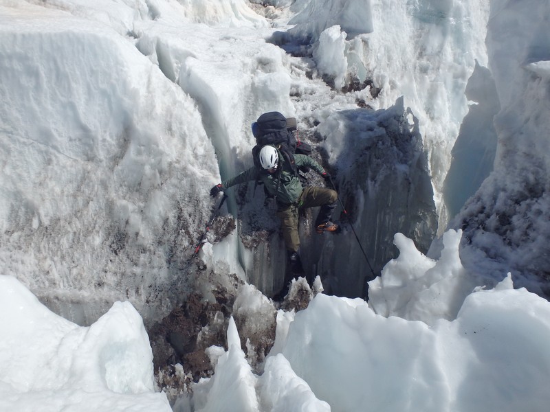
In the flat place before ascending to the edge of the East Marmolejo glacier we left part of the food and gas for the way back. On day 6 we reached the edge of the penitente glacier East Marmolejo. The “Penitente” type of a glacier is very common in the central part of the Andes. Usually this type of a glacier is extremely difficult and unwalkable. It is a good practice to avoid crossing or moving on a penitente glacier, while normal glaciers are sometimes even more comfortable to walk over. But in this route it was necessary to cross it.
The main danger of penitent glaciers is that it is easy to get injured, while in regular glaciers the main danger is a risk of falling into the crack. It will be extremely difficult to pull out a traumatized climber with broken limbs from penitente glaciers if it happens. Due to the absence of cracks you do not need to move roped together on a penitente glacier. But you must move extremely slowly and with an extra special personal care. Of course you must have a helmet, an ice axe and crampons. Expected speed usually is not higher than 300-500 meters per hour. We climbed up to the edge of the glacier in the midday and set up a camp. After lunch we made a short walk to explore the penitente glacier without backpacks. So the next day we crossed this part successfully without injuries. Оnly one bracket of the crampon was broken. It was repaired by the portable drill and stainless steel wire on the go. I always have 3-5 meters of stainless steel wire with a diameter of about 0.7 mm in my mountain repair kit.
East Marmolejo glacier also has a small icefall. It is a final obstacle before the upper flat part. We spent 1-2 hours trying to find the best route through the icefall. As a result, we found a good passage in the icefall that does not require fixing a rope.
Upper side of the glacier icefall has a few safe camp places sheltered from the wind.
After a short stay we reached an upper horizontal flat on the East Marmolejo glacier over 5000m. A strong wind constantly blows from west to east across the Andes range. So we faced this wind and it was hard to go and impossible to have a rest. Only in the late evening we reached the Marmolejo pass 5150m between Chile and Argentina and found a good place for a camp sheltered from the wind. There was a frozen lake with clear water on the pass saddle. It was the end of the day 7.
The climbing route from the saddle of the Marmolejo pass to the top of the Marmolejo peak goes on the south ridge. This final part of the route is easy. The route contains parts of the slope with open volcanic pebbles sometimes covered by snow or firn fields. The steepness of the slope is less than 30 degrees. For experienced climbers it is usually safe to move on it without a rope. Only personal mountain equipment is necessary on this part of the route (crampons, ice axe, helmet, suitable boots and wear). It is necessary to consider that a strong west wind always blows here faster than 10m/s. It decreases your walking speed by half. The wind chill index should be considered as well. Look at any type of wind chill chart. At the actual air temperature of -10 C it feels like -20 C, so you should wear proper boots and clothes. Next morning (day 8) we started to climb Marmolejo at 9 a.m. and reached the summit approximately at 3 p.m. The climbing took us 6 hours up and 3 hours down.
At the top there was a small stone pyramid and snow tracks of previous climbers who ascended from the Chile side. There was a good visibility and we saw the Aconcagua massive, Tupungato volcano and valley Lo Valdes.
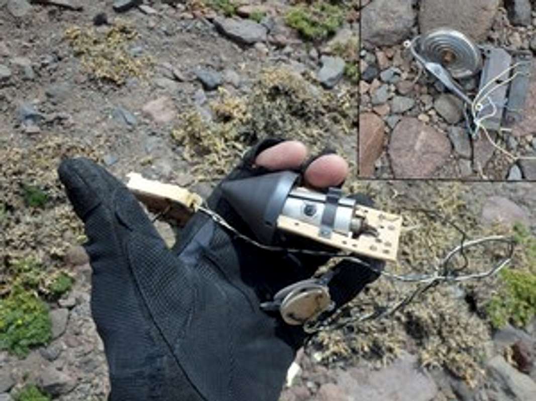
The way back to the green camp took us 2 days. We picked up our food stash and took a half day rest at the green camp. Next day (11) we started a way back to the refuge Real de la Cruz by a different path. In the satellite image the main valley leading to the Tunuyan river looks like a canyon. If we had gone there, we would have met polished stone walls with local waterfalls in the canyon as an obstacle. I found the nearest left downside valley that looked better on sat image. I use an android smartphone with preloaded free offline satellite maps. It is a good tool to find the way in the mountains. I use mixed free data from google, bing and ESRI satellite image maps and height data sources. We hiked on the top local low ridge. There was a flat place on the top of the ridge with scattered parts of the crashed UFO. Is it old style barometric altitude control system? I suggested that it was a part of a crashed old unmanned stratosphere helium balloon probe. But who knows….(the X-files theme is playing)
Next we crossed one more local ridge and reached the target point, the upper entrance to the side valley. The valley looked green and easy to go but contained very painful prickly burdock. The seed balls were very sharp and pierced clothing. Also this valley had a hidden obstacle in the lower part. It was a steep stone wall about 15 meters. So we used a loop around the stone and a rappel rope, folded in half 50m (2x25m).
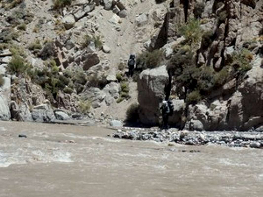
In the later evening of day 11 we reached the Tunyan river and made a camp near an old meteorological rainfall gauge. Day 13. The Tunuyan river is quite deep and crossing it can be dangerous at this point. So the next day we went up 5 km along the right side of the river. It was a hard way along the steep river bank slope. We found a good place to cross the river only at noon. The water level had risen and we crossed the Tunuyan to the left side with great difficulty. The mountain valley Tunuyan is the place where waterfowl breed their chicks in mountain streams in summer. We saw a lot of various kinds of ducks and ducklings that hunted for fish in the mountain streams. On the left bank of the river there was a horse trail which leads to the refuge. After lunch it took us a half of a day to reach the refuge Real de la Cruz. We finished our 13 days Marmolejo trek in the late evening.
|