
-
 6318 Hits
-
 77.3% Score
-
 8 Votes
|
|
Canyon |
|---|---|
|
|
37.96310°N / 110.482°W |
|
|
Hiking, Canyoneering |
|
|
Spring, Summer, Fall, Winter |
|
|
Overview
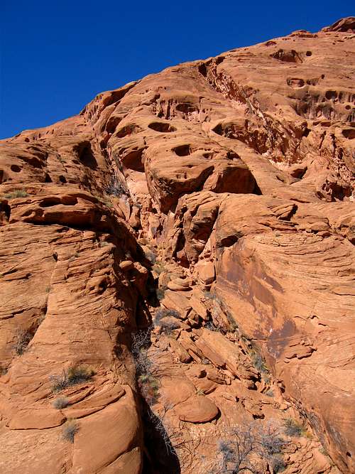
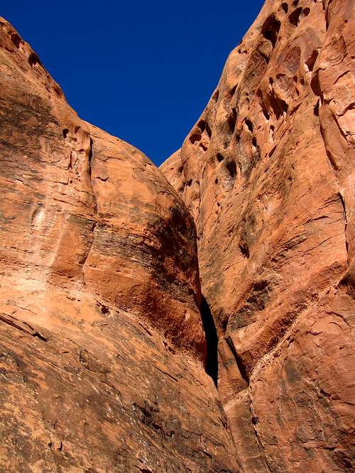
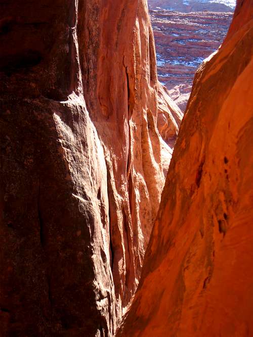
Merry Piglet is a short slot canyon in the North Wash area of southern Utah. This canyon is characterized by a few awkward rappels and some very nice narrows with a very short approach. The North Wash area is a large group of side canyons that drain into North Wash which then drains into Lake Powell. The area sits in the southern end of Robbers Roost Country and Utah Highway 95 heads south out of Hanksville to the east of the Henry Mountains and follows North Wash all the way to Lake Powell so many of the slots in the area dump right out onto the highway. Longer canyons in the area can be approached by the Cedar Point Dirt Road which heads east off the highway just to the north of the junction with Utah Highway 276. Merry Piglet slot is a short slot in this area. The map below shows the location of this canyon. Just across the highway is Hogwarts Canyon which is another short and sweet slot that dumps right out to the highway.
Getting There/Route
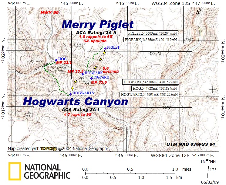
To get to this canyon, drive south on Highway 95 out of the small town of Hanksville, Utah. The highway starts here at mile zero and the mile markers are important to finding the correct place to pull out and park. Continue south on the highway as you begin descending and following North Wash. Once you reach mile marker 33.6 which is only a quarter mile past the Hog Springs Picnic area, you will see a pull out just big enough for one car on the left (north) side of the highway and the boulderfield just above marks the approach. From your parking spot, hike up the boulderfield staying to the left side for easier hiking. After a few minutes you will reach a dryfall which you will need to climb over. From the center of the dryfall, locate a 12 foot slab to the left (looking up-canyon) where you will be able to climb up with 4th class climbing. It really isn't that hard and if needed the first person up can set up a handline for others.
 Talus field to hike up by the road Talus field to hike up by the road | 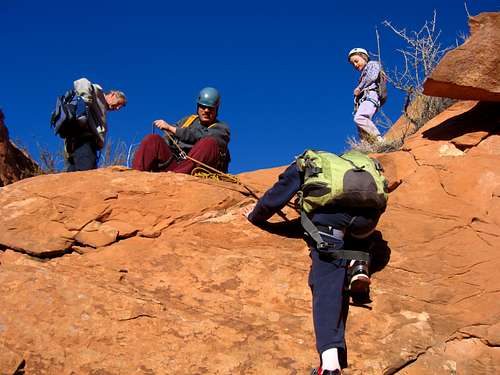 Climbing up the 12 foot slab Climbing up the 12 foot slab |
 Walking the white ledge to the top of the slot
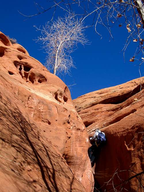
Once above this short climb you'll be at an elevation of 4,160 feet. Cross back to the left side of the drainage and ascend the obvious rock gully heading up and to the west. Be sure you don't head towards the ominous looking slot upstream. Continue up the gully and up slickrock veering right and mount a nice white ledge at 4,400 feet in elevation. Follow this ledge around to the north where you will be able to see the canyon below you to the right. After a quarter mile you can descend to a tree growing out of the canyon bottom. This tree can be used to descend into the slot canyon or you can take Rappel 1 off a sling anchor into the canyon. However, using the tree can save you a wade through cold water at the very start of the slot.
 The ascent gully on the approach The ascent gully on the approach | 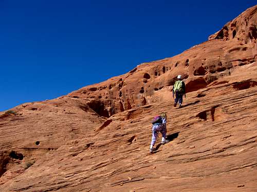 Climbing the slabs to the white ledge Climbing the slabs to the white ledge |
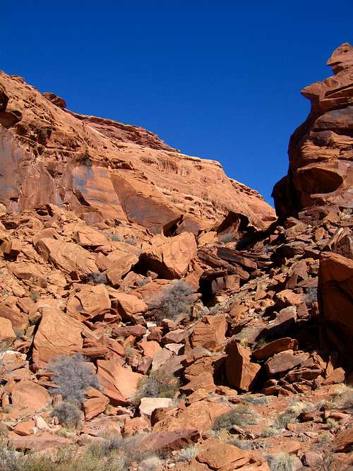
Once inside the canyon begin heading down. The canyon starts out easy but a drop is quickly reached which marks Rappel 2 (unless you down-climbed the tree). This short drop can be down-climbed but most will want to rappel. There is a nice anchor here to use. Beyond this rappel the canyon opens up where you pass by a small grove of cottonwood trees. This section has some really nice and photogenic spots and during the fall the trees will display a bright yellow color.
 Russel on Rappel 2 Russel on Rappel 2 | 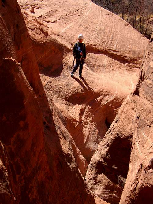 Kessler waits for the rest of us to make Rappel 2 Kessler waits for the rest of us to make Rappel 2 |
After you pass through the open area the canyon slots up again and you quickly get to Rappel 3. Here it is off a deadman anchor that we added rocks to. I went first and had Scott back it up for me but it was solid. This short rappel dropped into a pothole but it was dry and filled with quite a bit of sand. This might be filled with water at times so keep that in mind. Only a short walk past Rappel 3 is where we ran into a pothole drop with water in it. A 10 foot down-climb led into a pothole that likely has water most of the time. If you dropped right into the water after descending it will come up to your waist however there is a small ledge on the left side (looking down canyon) about a foot above the pothole you can use to avoid part of the wade (or avoid it altogether if you're really good...the final part of this ledge disappears). Using the ledge and sliding into the water halfway across makes the water only knee deep. Either way just about everyone will have to wade. Once everyone is across take a few minutes to dry off.
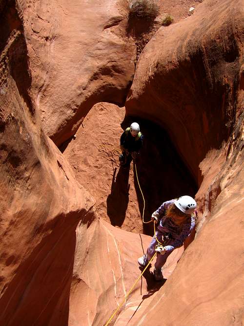 Shaylee on Rappel 3 Shaylee on Rappel 3 | 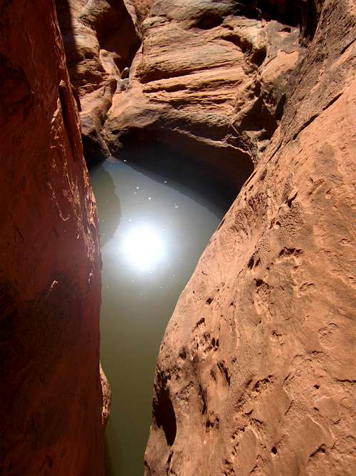 Looking down to the water filled pothole Looking down to the water filled pothole | 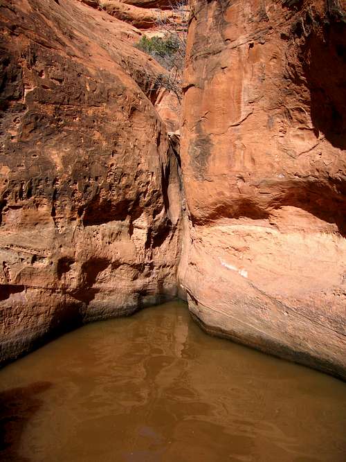 Water filled pool with the ledge at right Water filled pool with the ledge at right |
Just beyond the pool of water you will come to Rappel 4 which was another deadman of poor quality when we arrived so we added quite a bit of rocks to it and Scott backed it up while I rapped. This anchor should be solid now barring any flash floods. Continue through some nice narrows working your way through until you get to another anchor off a large chalkstone marking Rappel 5. We added a secondary sling to this anchor to back it up however the white webbing wrapped around the chalkstone was showing some intense fraying. When you start this awkward rappel, don't pull up on the anchor as it looked as if it could pull up off the chalkstone (which was why we backed it up using another rock behind). Rappel 5 was longer than the first four but a surprise was waiting for us. Literally a few feet down the canyon after Rappel 5 was another drop which was the biggest of them all. A green piece of webbing was wrapped around a chalkstone and this final drop (Rappel 6) was about an 18 meter drop making a single 30 meter rope insufficient. The start to this rappel was also awkward since the slot was slanted and narrow here. Once everyone finishes this last rappel, walk down out of the canyon where it quickly opens up and you walk back to the 12 foot dryfall you started on. Descend this and hike down the talus field to your car.
 Looking back after Rappel 6 Looking back after Rappel 6 | 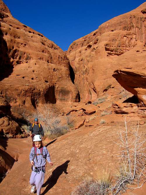 Exiting the slot canyon Exiting the slot canyon | 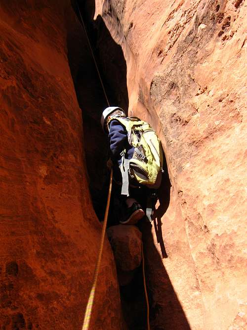 Kessler on the final rappel Kessler on the final rappel |
Red Tape/Camping
No red tape here! This is the Utah desert in Robbers Roost Country which lies on BLM lands where there are no permits and no private property. Please leave no trace and avoid walking on the crypto-biotic soil. There are many great places to camp just off Highway 95 at the mouth of Blarney Canyon, Leprechaun Canyon, Sandthrax Canyon, and Stair Canyon. Each have dirt road pull offs looping around to various open camping areas where many people set up a camper or tents and have nice camp fires. Please try and bring your own firewood as the surrounding cottonwood trees take a long time to grow. Camping at these places can get quite crowded in the spring and fall when many parties come for a weekend of canyoneering so be prepared to share the area. Other camping opportunities can be found alongside the Cedar Point Road but up here the country is open and more exposed to wind.
 Rappel 5
Gear:
Take a single 40+ meter rope. This will be long enough for all the rappels in the canyon, the longest of which is 60 feet (~18 meters). Also make sure you have harnesses, belay devices, extra webbing and rap rings and helmets. Know how to construct or improve deadman anchors as flash floods in these canyons can destroy or compromise existing anchors. Gloves are also nice for rappelling. Plan on 2-4 hours for this canyon depending on your group size and how fast everyone can rappel.